|
Port Jackson, New Zealand
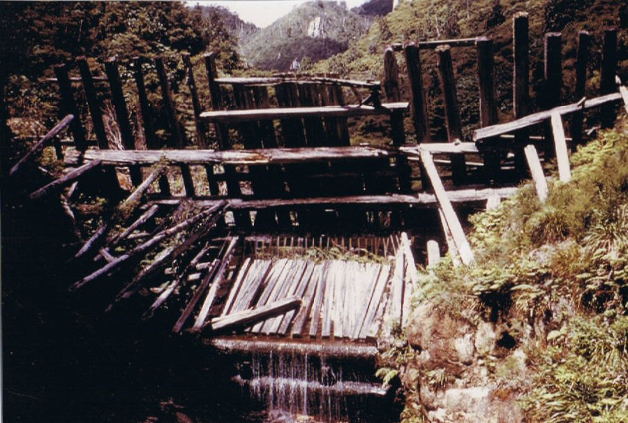
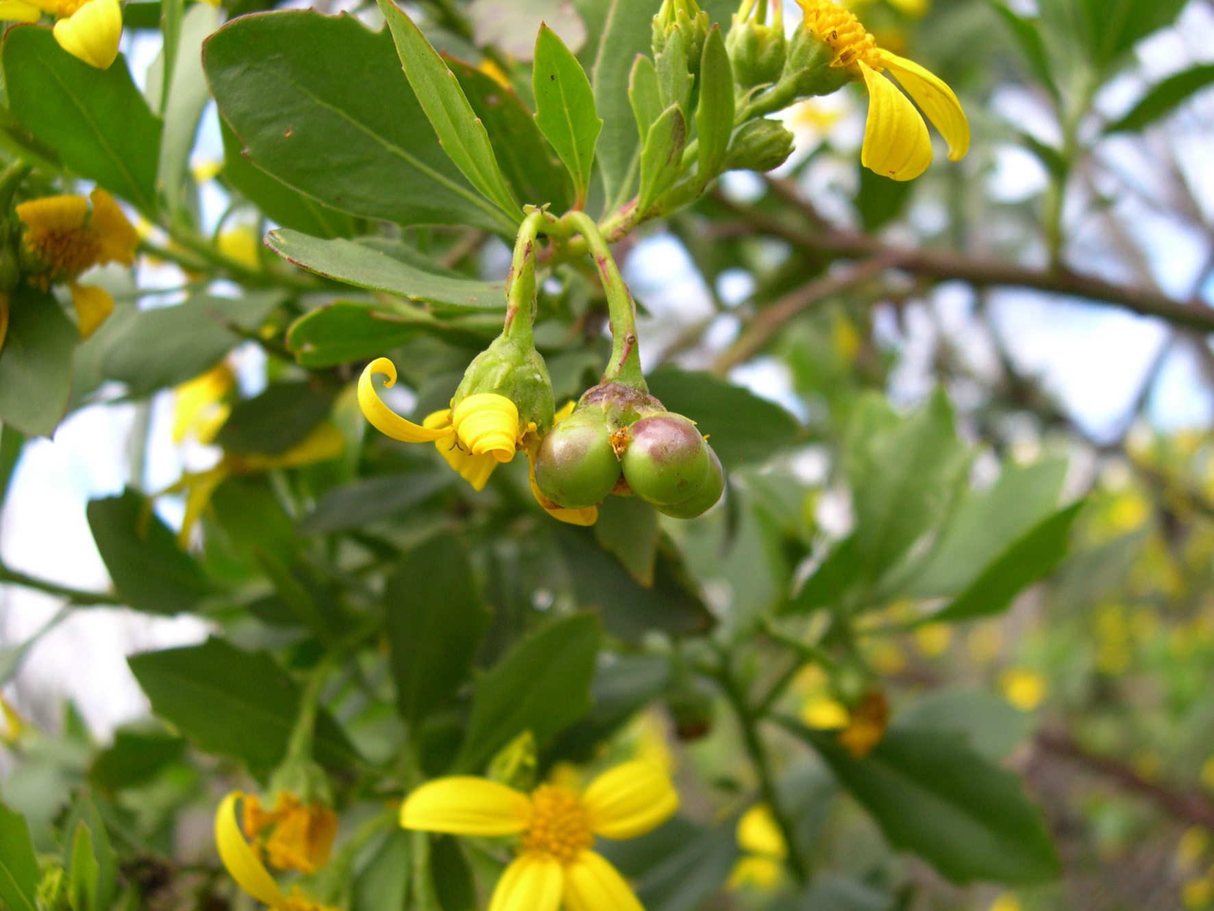
Cape Colville is the northernmost point of the Coromandel Peninsula in New Zealand's North Island. It lies 85 kilometres north of Thames, and 70 kilometres northeast of the city of Auckland, on the other side of the Hauraki Gulf. The small settlements of Port Jackson and Fletcher Bay lie immediately to the west and east respectively of the cape. Great Barrier Island lies to the north of Cape Colville, separated from it by 20 kilometre width of the Colville Channel. The tiny Channel Island lies between the two. Port Jackson Port Jackson Bay, just to the south of the Cape, has been inhabited since at least the fifteenth century. At the south end of the Bay, at Port Jackson, a water-powered flax mill existed in 1901, when the population was 12. There is a camp site. New Zealand dotterel breed locally. Boneseed is a local weed. Dune restoration with spinifex was done from 2009 to 2011. There was much flooding in 2014. See also * Moehau Range References Colville Col ... [...More Info...] [...Related Items...] OR: [Wikipedia] [Google] [Baidu] |
Coromandel Peninsula
The Coromandel Peninsula ( mi, Te Tara-O-Te-Ika-A-Māui) on the North Island of New Zealand extends north from the western end of the Bay of Plenty, forming a natural barrier protecting the Hauraki Gulf and the Firth of Thames in the west from the Pacific Ocean to the east. It is wide at its broadest point. Almost its entire population lives on the narrow coastal strips fronting the Hauraki Gulf and the Bay of Plenty. In clear weather the peninsula is clearly visible from Auckland, the country's biggest city, which lies on the far shore of the Hauraki Gulf, to the west. The peninsula is part of the Thames-Coromandel District of the Waikato region. Origin of the name The Māori name for the Coromandel comes from the Māori legend of Māui and the Fish, in which the demigod uses his hook to catch a great fish from the depths of te Moana-Nui-a-Kiwa (The Pacific Ocean). ''Te Tara-O-Te-Ika-A-Māui'' means 'The spine of Māui's fish'. The spine can be understood to be the C ... [...More Info...] [...Related Items...] OR: [Wikipedia] [Google] [Baidu] |
New Zealand
New Zealand ( mi, Aotearoa ) is an island country in the southwestern Pacific Ocean. It consists of two main landmasses—the North Island () and the South Island ()—and over 700 smaller islands. It is the sixth-largest island country by area, covering . New Zealand is about east of Australia across the Tasman Sea and south of the islands of New Caledonia, Fiji, and Tonga. The country's varied topography and sharp mountain peaks, including the Southern Alps, owe much to tectonic uplift and volcanic eruptions. New Zealand's capital city is Wellington, and its most populous city is Auckland. The islands of New Zealand were the last large habitable land to be settled by humans. Between about 1280 and 1350, Polynesians began to settle in the islands and then developed a distinctive Māori culture. In 1642, the Dutch explorer Abel Tasman became the first European to sight and record New Zealand. In 1840, representatives of the United Kingdom and Māori chiefs ... [...More Info...] [...Related Items...] OR: [Wikipedia] [Google] [Baidu] |
North Island
The North Island, also officially named Te Ika-a-Māui, is one of the two main islands of New Zealand, separated from the larger but much less populous South Island by the Cook Strait. The island's area is , making it the world's 14th-largest island. The world's 28th-most-populous island, Te Ika-a-Māui has a population of accounting for approximately % of the total residents of New Zealand. Twelve main urban areas (half of them officially cities) are in the North Island. From north to south, they are Whangārei, Auckland, Hamilton, Tauranga, Rotorua, Gisborne, New Plymouth, Napier, Hastings, Whanganui, Palmerston North, and New Zealand's capital city Wellington, which is located at the south-west tip of the island. Naming and usage Although the island has been known as the North Island for many years, in 2009 the New Zealand Geographic Board found that, along with the South Island, the North Island had no official name. After a public consultation, the board officially ... [...More Info...] [...Related Items...] OR: [Wikipedia] [Google] [Baidu] |
Thames, New Zealand
Thames () ( mi, Pārāwai) is a town at the southwestern end of the Coromandel Peninsula in New Zealand's North Island. It is located on the Firth of Thames close to the mouth of the Waihou River. The town is the seat of the Thames-Coromandel (district), New Zealand, Thames-Coromandel District Council. The Māori people, Māori iwi are Ngāti Maru (Hauraki), Ngāti Maru, who are descendants of Marutuahu's son Te Ngako. Ngāti Maru is part of the Ngati Marutuahu confederation of tribes or better known as Hauraki Iwi. Thames had an estimated population of 15,000 in 1870, but this declined to 4,500 in 1881, and it has increased modestly since. It is still the biggest town on the Coromandel. Until 2016, a historical Oak, oak tree that was planted by Governor George Grey stood on the corner of Grey and Rolleston streets. Demographics Thames covers and had an estimated population of as of with a population density of people per km2. Thames had a population of 7,293 at the 2018 Ne ... [...More Info...] [...Related Items...] OR: [Wikipedia] [Google] [Baidu] |
Auckland
Auckland (pronounced ) ( mi, Tāmaki Makaurau) is a large metropolitan city in the North Island of New Zealand. The List of New Zealand urban areas by population, most populous urban area in the country and the List of cities in Oceania by population, fifth largest city in Oceania, Auckland has an urban population of about It is located in the greater Auckland Region—the area governed by Auckland Council—which includes outlying rural areas and the islands of the Hauraki Gulf, and which has a total population of . While European New Zealanders, Europeans continue to make up the plurality of Auckland's population, the city became multicultural and Cosmopolitanism, cosmopolitan in the late-20th century, with Asian New Zealanders, Asians accounting for 31% of the city's population in 2018. Auckland has the fourth largest Foreign born, foreign-born population in the world, with 39% of its residents born overseas. With its large population of Pasifika New Zealanders, the city is ... [...More Info...] [...Related Items...] OR: [Wikipedia] [Google] [Baidu] |
Hauraki Gulf
The Hauraki Gulf / Tīkapa Moana is a coastal feature of the North Island of New Zealand. It has an area of 4000 km2, Zeldisl, J. R. et al. (1995) Salp grazing: effects on phytoplankton abundance, vertical distribution and taxonomic composition in a coastal habitat. Marine Ecology Progress Series, Vol. 126, p 267-283 and lies between, in anticlockwise order, the , the Hauraki Plains, the , and [...More Info...] [...Related Items...] OR: [Wikipedia] [Google] [Baidu] |
Great Barrier Island
Great Barrier Island ( mi, Aotea) lies in the outer Hauraki Gulf, New Zealand, north-east of central Auckland. With an area of it is the sixth-largest island of New Zealand and fourth-largest in the main chain. Its highest point, Mount Hobson, is above sea level.Great Barrier Island Aotea page on the DOC website (from the . Accessed 2008-06-04.) The is the [...More Info...] [...Related Items...] OR: [Wikipedia] [Google] [Baidu] |
Colville Channel
The Colville Channel is one of three channels connecting the Hauraki Gulf with the Pacific Ocean to the northeast of Auckland, New Zealand. It is the easternmost channel, lying between the southern end of Great Barrier Island and Cape Colville at the northern tip of the Coromandel Peninsula. The tiny Channel Island lies in the centre of the channel. The other two channels are the Cradock Channel and the Jellicoe Channel The Jellicoe Channel is one of three channels connecting the Hauraki Gulf with the Pacific Ocean to the northeast of Auckland, New Zealand. It is the westernmost channel, lying between Cape Rodney on the North Auckland Peninsula and Little Barri .... References Hauraki Gulf Straits of New Zealand Great Barrier Island Thames-Coromandel District Landforms of the Auckland Region {{Auckland-geo-stub ... [...More Info...] [...Related Items...] OR: [Wikipedia] [Google] [Baidu] |
Channel Island (New Zealand)
The Colville Channel is one of three channels connecting the Hauraki Gulf with the Pacific Ocean to the northeast of Auckland, New Zealand. It is the easternmost channel, lying between the southern end of Great Barrier Island and Cape Colville at the northern tip of the Coromandel Peninsula. The tiny Channel Island lies in the centre of the channel. The other two channels are the Cradock Channel and the Jellicoe Channel The Jellicoe Channel is one of three channels connecting the Hauraki Gulf with the Pacific Ocean to the northeast of Auckland, New Zealand. It is the westernmost channel, lying between Cape Rodney on the North Auckland Peninsula and Little Barri .... References Hauraki Gulf Straits of New Zealand Great Barrier Island Thames-Coromandel District Landforms of the Auckland Region {{Auckland-geo-stub ... [...More Info...] [...Related Items...] OR: [Wikipedia] [Google] [Baidu] |
Flax In New Zealand
New Zealand flax describes the common New Zealand perennial plants ''Phormium tenax'' and ''Phormium colensoi'', known by the Māori names ''harakeke'' and ''wharariki'' respectively. Although given the common name 'flax' they are quite distinct from the Northern Hemisphere plant known as flax (''Linum usitatissimum''). ''P. tenax'' occurs naturally in New Zealand and Norfolk Island, while ''P. colensoi'' is endemic to New Zealand. They have played an important part in the cultural and economic history of New Zealand for both the Māori people and the later European settlers. Both species and their cultivars have now been widely distributed to temperate regions of the world as ornamental garden plants – and to lesser extent for fibre production. __TOC__ Traditional Māori uses Textiles Although the Māori made textiles from a number of other plants, including tī kōuka, tōī, pingao, kiekie, toetoe and the paper mulberry, the use of harakeke and wharariki was pre ... [...More Info...] [...Related Items...] OR: [Wikipedia] [Google] [Baidu] |
New Zealand Plover
The New Zealand dotterel (''Charadrius obscurus'') is a species of shorebird found only in certain areas of New Zealand. It is also called the New Zealand plover or red-breasted dotterel, and its Māori language, Māori names include , , and . The southern subspecies of the New Zealand plover is considered Critically Endangered, critically endangered and was nearing extinction with about 75 individuals remaining in 1990. Conservation measures increased this to 250 by 2005, but a further decline has occurred since 2012 to an estimated 60–80 mature individuals in 2017. Taxonomy and systematics The New Zealand dotterel was Species description, formally described in 1789 by the German naturalist Johann Friedrich Gmelin in his revised and expanded edition of Carl Linnaeus's ''Systema Naturae''. He placed it with the plovers in the genus ''Charadrius'' and coined the binomial nomenclature, binomial name ''Charadrius obscurus''. Gmelin's description was based on the "Dusky plover ... [...More Info...] [...Related Items...] OR: [Wikipedia] [Google] [Baidu] |
Chrysanthemoides Monilifera
''Osteospermum moniliferum'' ''(Chrysanthemoides monilifera)'' is an evergreen flowering shrub or small tree of the Asteraceae (daisy) family that is native to South Africa, such as the Cape Flats Dune Strandveld habitat. Most subspecies have woolly, dull, serrate, oval leaves, but the subspecies ''rotundata'' has glossy round leaves. Subspecies are known as boneseed and bitou bush in Australasia, or bietou, tick berry, bosluisbessie, or weskusbietou in South Africa. (Archived by ) The plant has become a major environmental weed and invasive species in Australia and New Zealand. Taxonomy ''Chrysanthemoides monilifera'' is one of two members of the genus ''Chrysanthemoides'', the other being ''Chrysanthemoides incana''. ''Chrysanthemoides monilifera'' has six recognized subspecies: *''Chrysanthemoides monilifera'' subsp. ''canescens'' *''Chrysanthemoides monilifera'' subsp. ''monilifera'' *''Chrysanthemoides monilifera'' subsp. ''pisifera'' *''Chrysanthemoides monilifera'' subsp. ... [...More Info...] [...Related Items...] OR: [Wikipedia] [Google] [Baidu] |


_p225_AUCKLAND%2C_NEW_ZEALAND.jpg)


