|
Port Glasgow
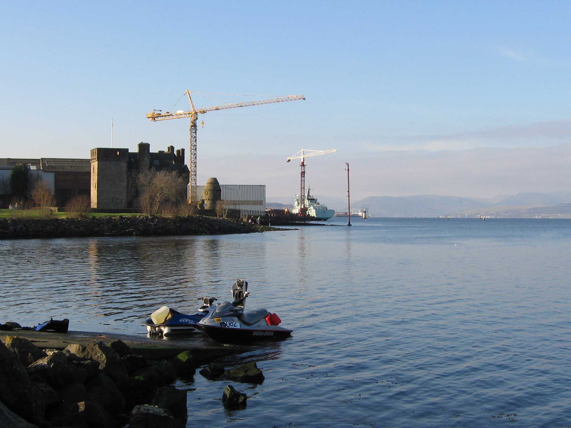
Port Glasgow ( gd, Port Ghlaschu, ) is the second-largest town in the Inverclyde council area of Scotland. The population according to the 1991 census for Port Glasgow was 19,426 persons and in the 2001 census was 16,617 persons. The most recent census in 2011 states that the population has declined to 15,414. It is located immediately to the east of Greenock and was previously a burgh in the county of Renfrewshire. Originally a fishing hamlet named Newark, Port Glasgow came about as a result of large ships being unable to navigate the shallow and meandering River Clyde to the centre of the city of Glasgow. As a result, it was formed as a remote port for Glasgow in 1668, and became known as 'New Port Glasgow', which was shortened to 'Port Glasgow' in 1775. Port Glasgow was home to dry docks and shipbuilding beginning in 1780. The town grew from the central area of the present town and thus many of the town's historic buildings and people are found here. Port Glasgow expanded up ... [...More Info...] [...Related Items...] OR: [Wikipedia] [Google] [Baidu] |
Inverclyde (UK Parliament Constituency)
Inverclyde is a parliamentary constituency of the House of Commons of the Parliament of the United Kingdom. It replaced Greenock and Inverclyde and the Port Glasgow and Kilmacolm areas from West Renfrewshire for the 2005 general election. Iain McKenzie of the Labour Party won the ensuing Inverclyde by-election following the death of the previous Labour MP, David Cairns. At the 2015 general election, the seat was gained by Ronnie Cowan of the Scottish National Party, with a majority of 11,063 votes. At the 2017 snap election, Cowan was re-elected, but with a greatly reduced majority of just 384 votes. However, at the 2019 general election he was re-elected with a significantly increased majority of 7,512 votes, making this a safe seat for the SNP. Constituency profile Most of the population live along the Clyde in the north of the seat, and there is a more rural area to the south in Clyde Muirshiel Regional Park. Residents are slightly less affluent than the Scottish ... [...More Info...] [...Related Items...] OR: [Wikipedia] [Google] [Baidu] |
Barony Of Cartsburn
The barony of Cartsburn in the Baronage of Scotland was created for Thomas Crawfurd of Cartsburn in 1669, when the lands of Cartsburn in the Parish of Easter Greenock in the Shire of Renfrew were erected , as a free barony held of the Prince and Great Steward of Scotland. The estate of Cartsburn, also known as Crawfurdsburn, incorporated the lands of Cartsdyke and part of the lands of Easter Greenock Castle. The Barony of Cartsburn is a feudal Barony of Scotland. The seat of the Barony was the House of Cartsburn, built in the 17th century near Greenock, Renfrewshire. The most notable Barons of Cartsburn are Thomas Crawfurd of Cartsburn, 4th Baron of Cartsburn, Thomas Macknight Crawfurd of Cartsburn and Lauriston Castle, 8th Baron of Cartsburn, and Mark Lindley-Highfield of Ballumbie Castle, 14th Baron of Cartsburn. The current Baron is the 15th Baron of Cartsburn. Other people associated with the Barony include George Crawfurd, the compiler of ''The Peerage of Scotland'', the ... [...More Info...] [...Related Items...] OR: [Wikipedia] [Google] [Baidu] |
Town Buildings, Port Glasgow
The Town Buildings, also known as the Municipal Buildings, are in Fore Street, Port Glasgow, Scotland. The structure, which served as the meeting place of Port Glasgow Burgh Council, is a Category A listed building. History The first municipal building in the town, which was originally known as Newark, was a tolbooth, which was completed in the late 17th century. Following significant population growth, largely associated with the status of Port Glasgow as a seaport, the area became a police burgh in 1803. By that time, the tolbooth had become dilapidated and the burgh commissioners decided to raise money, by public subscription, to erect a new structure. The new building was designed by David Hamilton in the neoclassical style, built in ashlar stone at a cost of £12,000 and was completed in December 1816. The design involved a symmetrical main frontage with five bays facing northwest along Fore Street; the central section of three bays featured a full-height tetrastyle portic ... [...More Info...] [...Related Items...] OR: [Wikipedia] [Google] [Baidu] |
Commemorative Plaque
A commemorative plaque, or simply plaque, or in other places referred to as a historical marker, historic marker, or historic plaque, is a plate of metal, ceramic, stone, wood, or other material, typically attached to a wall, stone, or other vertical surface, and bearing text or an image in relief, or both, to commemorate one or more persons, an event, a former use of the place, or some other thing. Many modern plaques and markers are used to associate the location where the plaque or marker is installed with the person, event, or item commemorated as a place worthy of visit. A monumental plaque or tablet commemorating a deceased person or persons, can be a simple form of church monument. Most modern plaques affixed in this way are commemorative of something, but this is not always the case, and there are purely religious plaques, or those signifying ownership or affiliation of some sort. A plaquette is a small plaque, but in English, unlike many European languages, the term is ... [...More Info...] [...Related Items...] OR: [Wikipedia] [Google] [Baidu] |
Steam
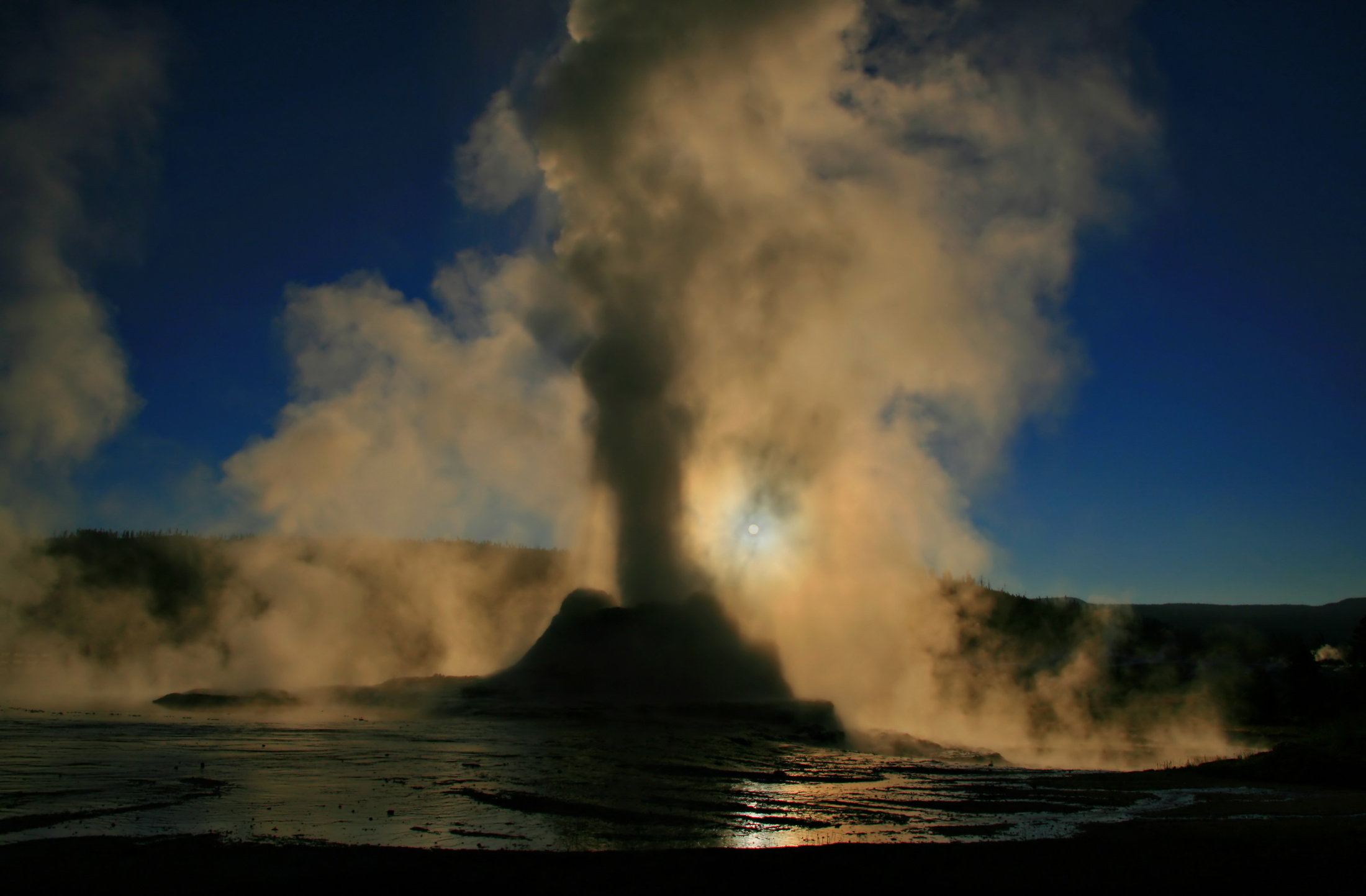
Steam is a substance containing water in the gas phase, and sometimes also an aerosol of liquid water droplets, or air. This may occur due to evaporation or due to boiling, where heat is applied until water reaches the enthalpy of vaporization. Steam that is saturated or superheated is invisible; however, "steam" often refers to wet steam, the visible mist or aerosol of water droplets formed as water vapor condenses. Water increases in volume by 1,700 times at standard temperature and pressure; this change in volume can be converted into mechanical work by steam engines such as reciprocating piston type engines and steam turbines, which are a sub-group of steam engines. Piston type steam engines played a central role in the Industrial Revolution and modern steam turbines are used to generate more than 80% of the world's electricity. If liquid water comes in contact with a very hot surface or depressurizes quickly below its vapor pressure, it can create a steam explosion. ... [...More Info...] [...Related Items...] OR: [Wikipedia] [Google] [Baidu] |
PS Comet
The PS (paddle steamer ) ''Comet'' was built in 1812 for Henry Bell, hotel and baths owner in Helensburgh, and began a passenger service on 15 August 1812 on the River Clyde between Glasgow and Greenock, the first commercially successful steamboat service in Europe. History Henry Bell had become interested in steam-propelled boats, and corresponded with Robert Fulton to learn from the '' Charlotte Dundas'' venture. In the winter of 1811/1812 he got John and Charles Wood of John Wood and Company, shipbuilders of Port Glasgow, to build a paddle steamer which was named ''Comet'', named after the "Great Comet" of 1811. The 28 ton burthen craft had a deck long with a beam of . It had two paddle wheels on each side, driven by a single-cylinder engine rated at . The engine was made by John Robertson of Glasgow, and the boiler by David Napier, Camlachie, Glasgow (a story has it that they were evolved from an experimental little steam engine which Bell installed to pump sea wat ... [...More Info...] [...Related Items...] OR: [Wikipedia] [Google] [Baidu] |
Grid Plan
In urban planning, the grid plan, grid street plan, or gridiron plan is a type of city plan in which streets run at right angles to each other, forming a grid. Two inherent characteristics of the grid plan, frequent intersections and orthogonal geometry, facilitate movement. The geometry helps with orientation and wayfinding and its frequent intersections with the choice and directness of route to desired destinations. In ancient Rome, the grid plan method of land measurement was called centuriation. The grid plan dates from antiquity and originated in multiple cultures; some of the earliest planned cities were built using grid plans in Indian subcontinent. History Ancient grid plans By 2600 BC, Mohenjo-daro and Harappa, major cities of the Indus Valley civilization, were built with blocks divided by a grid of straight streets, running north–south and east–west. Each block was subdivided by small lanes. The cities and monasteries of Sirkap, Taxila and Thimi (in the Ind ... [...More Info...] [...Related Items...] OR: [Wikipedia] [Google] [Baidu] |
Baltic Sea
The Baltic Sea is an arm of the Atlantic Ocean that is enclosed by Denmark, Estonia, Finland, Germany, Latvia, Lithuania, Poland, Russia, Sweden and the North and Central European Plain. The sea stretches from 53°N to 66°N latitude and from 10°E to 30°E longitude. A marginal sea of the Atlantic, with limited water exchange between the two water bodies, the Baltic Sea drains through the Danish Straits into the Kattegat by way of the Øresund, Great Belt and Little Belt. It includes the Gulf of Bothnia, the Bay of Bothnia, the Gulf of Finland, the Gulf of Riga and the Bay of Gdańsk. The " Baltic Proper" is bordered on its northern edge, at latitude 60°N, by Åland and the Gulf of Bothnia, on its northeastern edge by the Gulf of Finland, on its eastern edge by the Gulf of Riga, and in the west by the Swedish part of the southern Scandinavian Peninsula. The Baltic Sea is connected by artificial waterways to the White Sea via the White Sea–Baltic Canal and to the German ... [...More Info...] [...Related Items...] OR: [Wikipedia] [Google] [Baidu] |
Americas
The Americas, which are sometimes collectively called America, are a landmass comprising the totality of North and South America. The Americas make up most of the land in Earth's Western Hemisphere and comprise the New World. Along with their associated islands, the Americas cover 8% of Earth's total surface area and 28.4% of its land area. The topography is dominated by the American Cordillera, a long chain of mountains that runs the length of the west coast. The flatter eastern side of the Americas is dominated by large river basins, such as the Amazon, St. Lawrence River–Great Lakes basin, Mississippi, and La Plata. Since the Americas extend from north to south, the climate and ecology vary widely, from the arctic tundra of Northern Canada, Greenland, and Alaska, to the tropical rain forests in Central America and South America. Humans first settled the Americas from Asia between 42,000 and 17,000 years ago. A second migration of Na-Dene speakers followed later ... [...More Info...] [...Related Items...] OR: [Wikipedia] [Google] [Baidu] |
Custom House
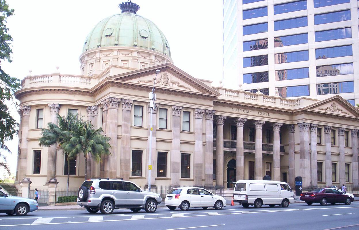
A custom house or customs house was traditionally a building housing the offices for a jurisdictional government whose officials oversaw the functions associated with importing and exporting goods into and out of a country, such as collecting customs duty on imported goods. A custom house was typically located in a seaport or in a city on a major river, with access to an ocean. These cities acted as ports of entry into a country. Due to advances in electronic information systems, the increased volume of international trade, and the introduction of air travel, the term "custom house" became a historical anachronism. There are many examples of buildings around the world that were formerly used as custom houses but have since been converted for other uses, such as museums or civic buildings. As examples, the former Alexander Hamilton U.S. Custom House in Manhattan, New York, (now the George Gustav Heye Center) presently houses a branch of the National Museum of the American Indi ... [...More Info...] [...Related Items...] OR: [Wikipedia] [Google] [Baidu] |
Harbour
A harbor (American English), harbour (British English; see spelling differences), or haven is a sheltered body of water where ships, boats, and barges can be docked. The term ''harbor'' is often used interchangeably with ''port'', which is a man-made facility built for loading and unloading vessels and dropping off and picking up passengers. Ports usually include one or more harbors. Alexandria Port in Egypt is an example of a port with two harbors. Harbors may be natural or artificial. An artificial harbor can have deliberately constructed breakwaters, sea walls, or jettys or they can be constructed by dredging, which requires maintenance by further periodic dredging. An example of an artificial harbor is Long Beach Harbor, California, United States, which was an array of salt marshes and tidal flats too shallow for modern merchant ships before it was first dredged in the early 20th century. In contrast, a natural harbor is surrounded on several sides of land. Examples ... [...More Info...] [...Related Items...] OR: [Wikipedia] [Google] [Baidu] |


.jpg)


