|
Port Chicago Disaster
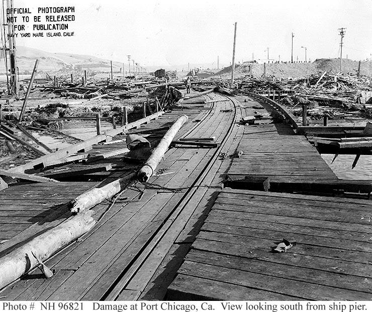
The Port Chicago disaster was a deadly munitions explosion of the ship SS ''E. A. Bryan'' that occurred on July 17, 1944, at the Port Chicago Naval Magazine in Port Chicago, California, United States. Munitions detonated while being loaded onto a cargo vessel bound for the Pacific Theater of Operations, killing 320 sailors and civilians and injuring 390 others. Approximately two-thirds of the dead and injured were enlisted African American sailors. A month later, unsafe conditions inspired hundreds of servicemen to refuse to load munitions, an act known as the Port Chicago Mutiny. Fifty mencalled the "Port Chicago 50"were convicted of mutiny and sentenced to 15 years of prison and hard labor, as well as a dishonorable discharge. Forty-seven of the 50 were released in January 1946; the remaining three served additional months in prison. During and after the trial, questions were raised about the fairness and legality of the court-martial proceedings. Owing to public pressure, ... [...More Info...] [...Related Items...] OR: [Wikipedia] [Google] [Baidu] |
Port Chicago, California
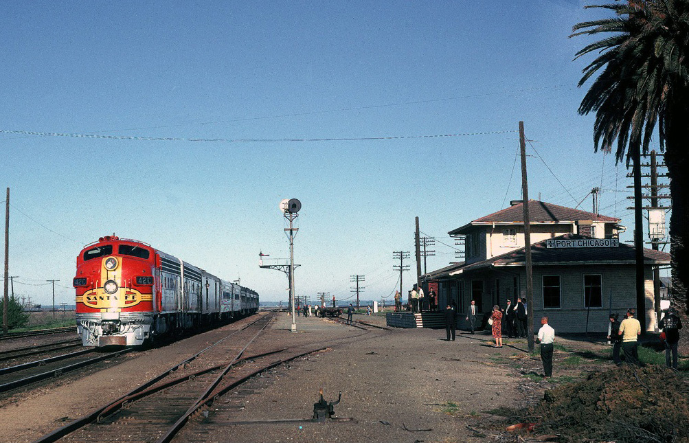
Port Chicago was a town on the southern banks of Suisun Bay, in Contra Costa County, California. It was located east-northeast of Martinez, at an elevation of 13 feet (4 m). It is best known as the site of a devastating explosion at its Naval Munitions Depot during World War II. History The area was first settled by Anglo-Americans between 1850 and 1851, including Josiah Knight and Samuel E. Strode. The first permanent settler was Daniel Cunningham. Port Chicago was originally called Bay Point. The town was created when the Bay Point Land Company, with offices in San Francisco, filed an official plat map at the Contra Costa County Recorder’s Office. The Southern Pacific Railroad ran through the town. In 1931, as the Great Depression worsened, Walter Van Winkle, a business leader, proposed and succeeded in getting the name of the town changed from Bay Point to Port Chicago (after the Illinois city). The Bay Point post office operated from 1897 to 1931, when it became the P ... [...More Info...] [...Related Items...] OR: [Wikipedia] [Google] [Baidu] |
Port Chicago Naval Magazine National Memorial
The Port Chicago Naval Magazine National Memorial is a memorial dedicated in 1994 recognizing the dead of the Port Chicago disaster, and the critical role played by Port Chicago, California during World War II, in serving as the main facility for the Pacific Theater of Operations. The national memorial is located at the Concord Naval Weapons Station near Concord, California, in the United States. The 1944 Port Chicago disaster occurred at the naval magazine and resulted in the largest domestic loss of life during World War II. 320 sailors and civilians were instantly killed on July 17, 1944, when the ships they were loading with ammunition and bombs exploded. The majority of the deaths were African American sailors working for the racially segregated military. The explosion and its aftermath led to the largest Naval mutiny in US history, and it and the subsequent trial became major catalysts for the United States Navy to desegregate following the war. History The national m ... [...More Info...] [...Related Items...] OR: [Wikipedia] [Google] [Baidu] |
Bomb
A bomb is an explosive weapon that uses the Exothermic process, exothermic reaction of an explosive material to provide an extremely sudden and violent release of energy. Detonations inflict damage principally through ground- and atmosphere-transmitted mechanical stress (mechanics), stress, the impact and penetration of pressure-driven projectiles, pressure damage, and explosion-generated effects. Bombs have been utilized since the 11th century starting in East Asia. The term bomb is not usually applied to explosive devices used for civilian purposes such as construction or mining, although the people using the devices may sometimes refer to them as a "bomb". The military use of the term "bomb", or more specifically aerial bomb action, typically refers to airdropped, unpowered explosive weapons most commonly used by air forces and naval aviation. Other military explosive weapons not classified as "bombs" include shell (projectile), shells, depth charges (used in water), or lan ... [...More Info...] [...Related Items...] OR: [Wikipedia] [Google] [Baidu] |
Attack On Pearl Harbor
The attack on Pearl HarborAlso known as the Battle of Pearl Harbor was a surprise military strike by the Imperial Japanese Navy Air Service upon the United States against the naval base at Pearl Harbor in Honolulu, Territory of Hawaii, just before 8:00a.m. (local time) on Sunday, December 7, 1941. The United States was a neutral country at the time; the attack led to its formal entry into World War II the next day. The Japanese military leadership referred to the attack as the Hawaii Operation and Operation AI, and as Operation Z during its planning. Japan intended the attack as a preventive action. Its aim was to prevent the United States Pacific Fleet from interfering with its planned military actions in Southeast Asia against overseas territories of the United Kingdom, the Netherlands, and those of the United States. Over the course of seven hours there were coordinated Japanese attacks on the US-held Philippines, Guam, and Wake Island and on the British Empire ... [...More Info...] [...Related Items...] OR: [Wikipedia] [Google] [Baidu] |
Concord Naval Weapons Station
Concord Naval Weapons Station was a military base established in 1942 north of the city of Concord, California at the shore of the Sacramento River where it widens into Suisun Bay. The station functioned as a World War II armament storage depot, supplying ships at Port Chicago. During World War II it also had a Naval Outlying Field at the southern edge of the base. It ceased being an operating airfield after World War II. During the Korean War, the Vietnam War and the Gulf War, Concord NWS processed and shipped thousands of tons of materiel out across the Pacific Ocean. The station consisted of two areas: the Inland Area (), which is within the Concord city limits, and the Tidal Area ().About the City of Concord Community Reuse Project , official city web site'. Retrieved 2007-08-13 Because ... [...More Info...] [...Related Items...] OR: [Wikipedia] [Google] [Baidu] |
San Francisco Bay
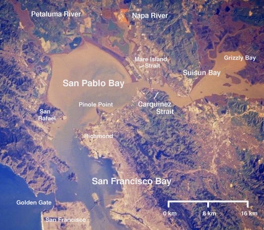
San Francisco Bay is a large tidal estuary in the U.S. state of California, and gives its name to the San Francisco Bay Area. It is dominated by the big cities of San Francisco, San Jose, and Oakland. San Francisco Bay drains water from approximately 40 percent of California. Water from the Sacramento and San Joaquin rivers, and from the Sierra Nevada mountains, flow into Suisun Bay, which then travels through the Carquinez Strait to meet with the Napa River at the entrance to San Pablo Bay, which connects at its south end to San Francisco Bay. It then connects to the Pacific Ocean via the Golden Gate strait. However, this entire group of interconnected bays is often called the ''San Francisco Bay''. The bay was designated a Ramsar Wetland of International Importance on February 2, 2017. Size The bay covers somewhere between , depending on which sub-bays (such as San Pablo Bay), estuaries, wetlands, and so on are included in the measurement. The main part of the bay meas ... [...More Info...] [...Related Items...] OR: [Wikipedia] [Google] [Baidu] |
Pacific Ocean
The Pacific Ocean is the largest and deepest of Earth's five oceanic divisions. It extends from the Arctic Ocean in the north to the Southern Ocean (or, depending on definition, to Antarctica) in the south, and is bounded by the continents of Asia and Oceania in the west and the Americas in the east. At in area (as defined with a southern Antarctic border), this largest division of the World Ocean—and, in turn, the hydrosphere—covers about 46% of Earth's water surface and about 32% of its total surface area, larger than Earth's entire land area combined .Pacific Ocean . '' Britannica Concise.'' 2008: Encyclopædia Britannica, Inc. The centers of both the |
San Joaquin River
The San Joaquin River (; es, Río San Joaquín) is the longest river of Central California. The long river starts in the high Sierra Nevada, and flows through the rich agricultural region of the northern San Joaquin Valley before reaching Suisun Bay, San Francisco Bay, and the Pacific Ocean. An important source of irrigation water as well as a wildlife corridor, the San Joaquin is among the most heavily dammed and diverted of California's rivers. People have inhabited the San Joaquin Valley for more than 8,000 years, and it was long one of the major population centers of pre-Columbian California. Starting in the late 18th century, successive waves of explorers then settlers, mainly Spanish and American, emigrated to the San Joaquin basin. When Spain colonized the area, they sent soldiers from Mexico, who were usually of mixed native Mexican and Spanish birth, led by Spanish officers. Franciscan missionaries from Spain came with the expeditions to evangelize the natives by teac ... [...More Info...] [...Related Items...] OR: [Wikipedia] [Google] [Baidu] |
Sacramento River
The Sacramento River ( es, Río Sacramento) is the principal river of Northern California in the United States and is the largest river in California. Rising in the Klamath Mountains, the river flows south for before reaching the Sacramento–San Joaquin River Delta and San Francisco Bay. The river drains about in 19 California counties, mostly within the fertile agricultural region bounded by the California Coast Ranges, Coast Ranges and Sierra Nevada (U.S.), Sierra Nevada known as the Sacramento Valley, but also extending as far as the volcanic plateaus of Northeastern California. Historically, its watershed has reached as far north as south-central Oregon where the now, primarily, endorheic basin, endorheic (closed) Goose Lake (Oregon-California), Goose Lake rarely experiences southerly outflow into the Pit River, the most northerly tributary of the Sacramento. The Sacramento and its wide natural floodplain were once abundant in fish and other aquatic creatures, notably one ... [...More Info...] [...Related Items...] OR: [Wikipedia] [Google] [Baidu] |
Estuary
An estuary is a partially enclosed coastal body of brackish water with one or more rivers or streams flowing into it, and with a free connection to the open sea. Estuaries form a transition zone between river environments and maritime environments and are an example of an ecotone. Estuaries are subject both to marine influences such as tides, waves, and the influx of saline water, and to fluvial influences such as flows of freshwater and sediment. The mixing of seawater and freshwater provides high levels of nutrients both in the water column and in sediment, making estuaries among the most productive natural habitats in the world. Most existing estuaries formed during the Holocene epoch with the flooding of river-eroded or glacially scoured valleys when the sea level began to rise about 10,000–12,000 years ago. Estuaries are typically classified according to their geomorphological features or to water-circulation patterns. They can have many different names, such as bays, ... [...More Info...] [...Related Items...] OR: [Wikipedia] [Google] [Baidu] |
Suisun Bay
Suisun Bay ( ; Wintun for "where the west wind blows") is a shallow tidal estuary (a northeastern extension of the San Francisco Bay) in Northern California. It lies at the confluence of the Sacramento River and San Joaquin River, forming the entrance to the Sacramento–San Joaquin River Delta, an inverted river delta. To the west, Suisun Bay is drained by the Carquinez Strait, which connects to San Pablo Bay, a northern extension of San Francisco Bay. Suisun Marsh, the tidal marsh land to the north, is the largest marsh in California. Grizzly Bay forms a northern extension of Suisun Bay. Suisun Bay is directly north of Contra Costa County. The bay was named in 1811, after the Suisunes, a Patwin tribe of Wintun Indians. The Central Pacific Railroad built a train ferry that operated between Benicia and Port Costa, California, from 1879 to 1930. The ferry boats ''Solano'' and ''Contra Costa'' were removed from service when the nearby Martinez railroad bridge was completed in ... [...More Info...] [...Related Items...] OR: [Wikipedia] [Google] [Baidu] |


.jpg)


