|
Ponneri
Ponneri is a town located in Chennai Metropolitan Region, Thiruvallur district in the Indian state of Tamil Nadu. It is located in Ponneri taluk. Ponneri is major destination for Andhra Pradesh people to buy goods. Geography Ponneri is located at . It has an average elevation of 16 metres (52 feet). Demographics India census, Ponneri had a population of 24,205. Males constitute 50% of the population and females 50% and with Minjur population, with postal code 601204, considered it could be of 50,000 as ponneri state offices governs most of state implementations on all blocks under ponneri taluk. Neighbouring towns are Minjur, Redhills, Gummidipoondi and Athipattu with development underway on NCTPS power plant project. Ponneri is on the banks of the Arani river. Ponneri is located 33 km north of Chennai and 52 km Northwest of Thiruvallur. Ponneri has an average literacy rate of 73%, higher than the national average of 59.5%. Approximately 81% of ... [...More Info...] [...Related Items...] OR: [Wikipedia] [Google] [Baidu] |
Minjur
Minjur is a town located in the outskirts of North Chennai, India. It is located in the Thiruvallur district in the Indian state of Tamil Nadu. Minjur is called 'Vada Kanchi' meaning North Kanchipuram. The town has two famous temples for Shiva and Vishnu, similar to Kanchipuram. The neighbourhood is served by Minjur railway station Minjur railway station is one of the railway stations of the Chennai Central–Gummidipoondi section of the Chennai Suburban Railway Network. It serves the neighbourhood of Minjur, a suburb of Chennai, and is located 26 km north of Chennai ... of the Chennai Suburban Railway Network. Geography Minjur is located at . It has an average elevation of 11 metres (36 foot (length), feet). With Ponneri as its north, Cholavaram as its west, Manali New Town, Manali, Chennai, Manali and Thiruvottiyur as its south, it is situated about 25 km from north of Chennai and well connected to that city with roadways and railways. Minjur is a we ... [...More Info...] [...Related Items...] OR: [Wikipedia] [Google] [Baidu] |
Ponneri Railway Station
Ponneri railway station is one of the railway stations of the Chennai Central–Gummidipoondi section of the Chennai Suburban Railway Network. It serves the neighbourhood of Ponneri, a suburb of Chennai, and is located 34 km north of Chennai Central railway station. It has an elevation of 15 m above sea level. History The lines at the station were electrified on 13 April 1979, with the electrification of the Chennai Central–Gummidipoondi section. See also * Chennai Suburban Railway The Chennai Suburban Railway is a commuter rail system in the city of Chennai, Tamil Nadu, India, operated by the Southern Railways branch of Indian Railways. It is the second largest suburban rail network in terms of route length and the third ... References External links Ponneri railway station on IndiaRailInfo.com Stations of Chennai Suburban Railway Railway stations in Tiruvallur district {{TamilNadu-railstation-stub ... [...More Info...] [...Related Items...] OR: [Wikipedia] [Google] [Baidu] |
Thiruvallur (Lok Sabha Constituency)
Thiruvallur Lok Sabha constituency is a newly formed Lok Sabha (Parliament of India) constituency after the 2008 delimitation. Its Tamil Nadu Parliamentary Constituency number is 1 of 39. It was formed after merging the assembly segments of Gummidipoondi, Ponneri (SC), Tiruvallur, and Poonamallee Poonamallee is suburb of Chennai, India under the Chennai Metropolitan Area. It was historically called ''Pushpagirimangalam'', later renamed in Tamil as ''Poovirundhavalli'' (), and now colloquially called as ''Poondhamalli''. It is a town in ... (SC), which were earlier parts of Sriperumbudur constituency and the newly formed Avadi. The constituency had previously existed for three elections from 1951 till 1962. It is reserved for Scheduled Castes (SC). Assembly segments Members of the Parliament Election results General Elections 2019 General Elections 2014 General Elections 2009 References External linksThiruvallur lok sabha consti ... [...More Info...] [...Related Items...] OR: [Wikipedia] [Google] [Baidu] |
Chennai Suburban Railway Network
The Chennai Suburban Railway is a commuter rail system in the city of Chennai, Tamil Nadu, India, operated by the Southern Railways branch of Indian Railways. It is the second largest suburban rail network in terms of route length and the third largest in terms of commuters in India. Around 1,000 services are operated daily between 4:00 a.m. and midnight. It is the longest suburban circular route in India covering of . Chennai has a complex railway network. It is the third busiest suburban rail system in India after Mumbai and Kolkata. It has separate tracks for local and express trains. The system uses electrical multiple units (EMUs) operating on alternating current (AC) drawn from overhead wires through the catenary system. The total system spans around of which only have dedicated dual tracks for suburban EMUs, the rest share tracks with other trains and are called mainline EMUs (MEMUs). As of 2013, the suburban sector has 1,000 services, including 250 in the Beach� ... [...More Info...] [...Related Items...] OR: [Wikipedia] [Google] [Baidu] |
Ponneri Taluk
ponneri is a taluk of Tiruvallur district of the Indian state of Tamil Nadu. The headquarters of the taluk is the town of Ponneri. Demographics According to the 2011 census, the taluk of Ponneri had a population of 385,620 with 193,043 males and 192,577 females. There were 998 women for every 1000 men. The taluk had a literacy rate of 70.81. Child population in the age group below 6 was 19,639 Males and 18,808 Females. See also *Seemapuram *Madhavaram Madhavaram may refer to: Places in South India Andhra Pradesh * Madhavaram, Kukkunoor, a village in Kukkunoor Taluk, Eluru district * Madhavaram, Tadepalligudem, a village in Tadepalligudem mandal Tadepalligudem mandal is one of the 19 mand ... References Taluks of Tiruvallur district {{Tiruvallur-geo-stub ... [...More Info...] [...Related Items...] OR: [Wikipedia] [Google] [Baidu] |
Madhavaram, Ponneri
Madhavaram is a village in Ponneri Taluk, Thiruvallur district in the state of Tamil Nadu in India India, officially the Republic of India (Hindi: ), is a country in South Asia. It is the seventh-largest country by area, the second-most populous country, and the most populous democracy in the world. Bounded by the Indian Ocean on the so .... Census of India (2011) Demographics References {{reflist Cities and towns in Tiruvallur district ...[...More Info...] [...Related Items...] OR: [Wikipedia] [Google] [Baidu] |
Red Hills, Chennai
Sengundram, known in English as Red Hills, is a neighbourhood in the northwestern part of Chennai, Tamil Nadu, India. The name was derived from the red hills (Semman Kuviyal) that was formerly present in the area. History The first railway proposals for India were made in Madras in 1832. The country's first transport train, ''Red Hill Railway'' (built by Arthur Cotton to transport granite for road-building), ran from Red Hills to the Chintadripet bridge in Madras in 1836-1837. A town named Sholavaram has a unused airstrip build by British for World War II. It was originally operated by the Royal Air Force as an airbase during World War II. After the war, it was abandoned until the airstrip was turned into a venue for drag racing. Most notably, the Malayalam actor Jayan was killed in a helicopter accident here during the shooting of his film Kolilakkam on 16 November 1980. After the Madras Motor Sports Club was formed in mid-1950s, Sholavaram was selected to conduct its racing ... [...More Info...] [...Related Items...] OR: [Wikipedia] [Google] [Baidu] |
Census
A census is the procedure of systematically acquiring, recording and calculating information about the members of a given population. This term is used mostly in connection with national population and housing censuses; other common censuses include censuses of agriculture, traditional culture, business, supplies, and traffic censuses. The United Nations (UN) defines the essential features of population and housing censuses as "individual enumeration, universality within a defined territory, simultaneity and defined periodicity", and recommends that population censuses be taken at least every ten years. UN recommendations also cover census topics to be collected, official definitions, classifications and other useful information to co-ordinate international practices. The UN's Food and Agriculture Organization (FAO), in turn, defines the census of agriculture as "a statistical operation for collecting, processing and disseminating data on the structure of agriculture, covering th ... [...More Info...] [...Related Items...] OR: [Wikipedia] [Google] [Baidu] |
Bay Of Bengal
The Bay of Bengal is the northeastern part of the Indian Ocean, bounded on the west and northwest by India, on the north by Bangladesh, and on the east by Myanmar and the Andaman and Nicobar Islands of India. Its southern limit is a line between Sangaman Kanda, Sri Lanka, and the north westernmost point of Sumatra, Indonesia. It is the largest water region called a bay in the world. There are countries dependent on the Bay of Bengal in South Asia and Southeast Asia. During the existence of British India, it was named as the Bay of Bengal after the historic Bengal region. At the time, the Port of Kolkata served as the gateway to the Crown rule in India. Cox's Bazar, the longest sea beach in the world and Sundarbans, the largest mangrove forest and the natural habitat of the Bengal tiger, are located along the bay. The Bay of Bengal occupies an area of . A number of large rivers flow into the Bay of Bengal: the Ganges– Hooghly, the Padma, the Brahmaputra–Yamuna, the Barak� ... [...More Info...] [...Related Items...] OR: [Wikipedia] [Google] [Baidu] |
Pulicat
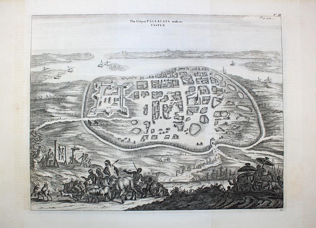
Pulicat or Pazhaverkadu is a historic seashore town in Chennai Metropolitan Area at Thiruvallur District, of Tamil Nadu state, India. It is about north of Chennai and from Elavur, on the southern periphery of the Pulicat Lake. Pulicat lake is a shallow salt water lagoon which stretches about along the coast. With lakeside and seashore development as well as several Special Economic Zones (SEZs) including a US$1 billion Medical SEZ, coming up in nearby Elavur, land prices in the area are rising. History The Portuguese established a trading post in Pulicat in 1502 with the help of the Vijayanagar rulers. They built a fort there and held this fort until 1609 when they were defeated by the Dutch. The Dutch occupied Pulicat fort in 1609. Between 1621 and 1665, 131 slave ships were deployed by the Dutch to export 38,441 Indians captured on the Coromandel coast and transported from Pulicat to be sold as slaves to Dutch plantations in Batavia. Pulicat was till 1690 the capital ... [...More Info...] [...Related Items...] OR: [Wikipedia] [Google] [Baidu] |
Poonamallee
Poonamallee is suburb of Chennai, India under the Chennai Metropolitan Area. It was historically called ''Pushpagirimangalam'', later renamed in Tamil as ''Poovirundhavalli'' (), and now colloquially called as ''Poondhamalli''. It is a town in the Poonamallee taluk of the Tiruvallur district in the Indian state of Tamil Nadu. The nearest Railway station is at Avadi. It acts as the gateway to the city from its western side. It is a town with rich cultural heritage and also a fast-growing areas in the city. As of 2011, the town had a population of 57,224. There are plans to merge the areas under Poonamallee Municipality with Avadi Municipal Corporation. Location The town of Poonamallee is situated at a distance of 23 km from Fort St George and 21 km from Sriperumbudur on the Chennai-Bangalore highway and 12 km from Thiruninravur on Chennai Outer Ring Road. It is located at the end of the Mount-Poonamallee Road, Poonamalle High Road and Pallavaram-Kundrathur-Poo ... [...More Info...] [...Related Items...] OR: [Wikipedia] [Google] [Baidu] |


