|
Pong Dam
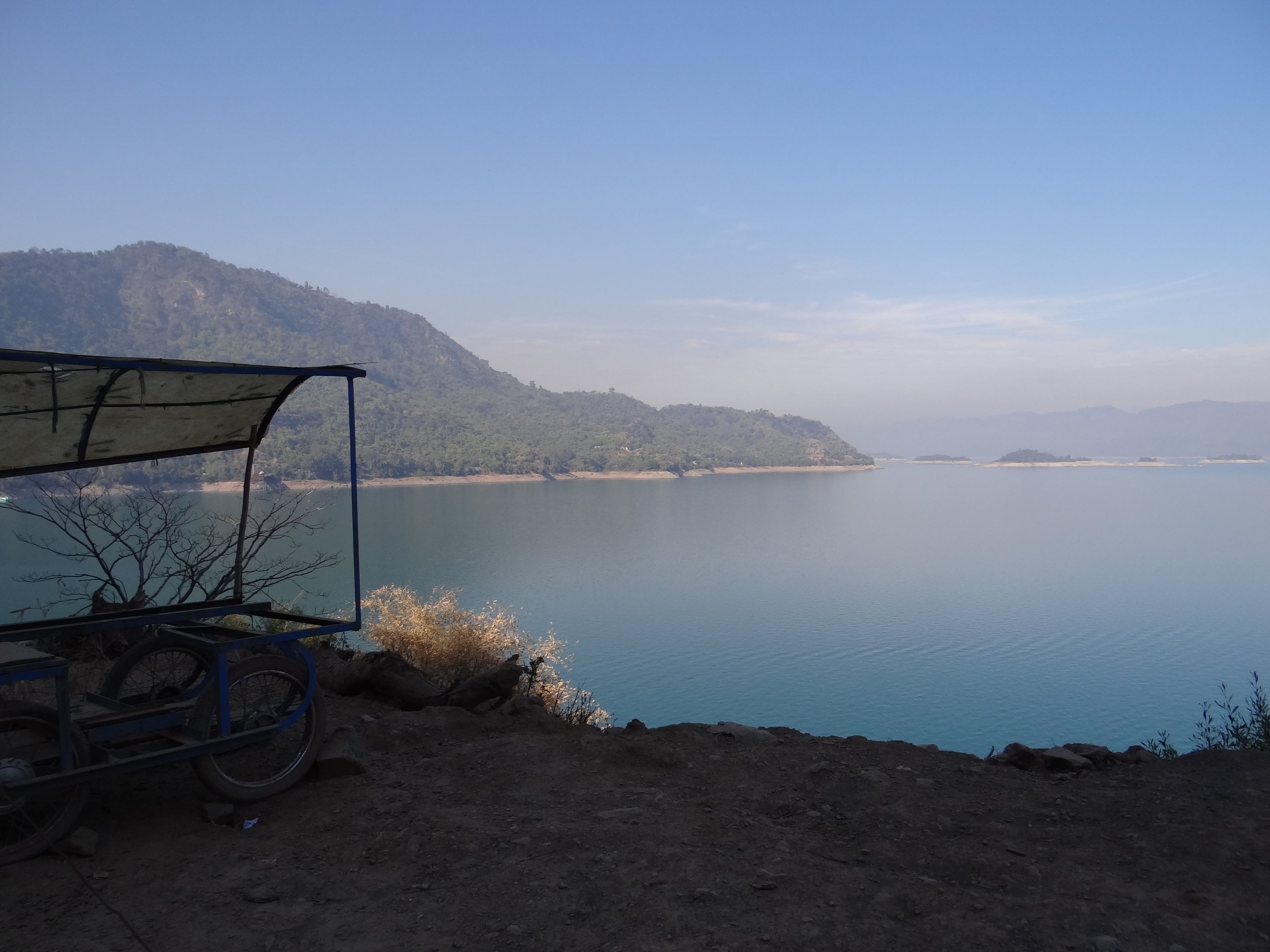
The Pong Dam, also known as the Beas Dam, is an earth-fill embankment dam on the Beas River in the state of Himachal Pradesh, India, just upstream of Talwara. The purpose of the dam is water storage for irrigation and hydroelectric power generation. As the second phase of the Beas Project, construction on the dam began in 1961 and was completed in 1974. At the time of its completion, the Pong Dam was the tallest of its type in India. The lake created by the dam, Maharana Pratap Sagar, became a renowned bird sanctuary. Background The idea for a dam on the Beas at the Pong site was first proposed in 1926 and subsequent surveys of the Indus River and its tributaries were ordered by the Punjab Government in 1927. Interest in the dam declined after the report deemed the project difficult because of flood waters. In 1955, geological and hydrological studies were carried out on the Pong site and an embankment design was recommended. In 1959, extensive studies were carried out and recomme ... [...More Info...] [...Related Items...] OR: [Wikipedia] [Google] [Baidu] |
Talwara
Talwara is a census town in Hoshiarpur district in the Indian state of Punjab. It is near to the border of the state of Himachal Pradesh.This place is known for proximity to Pong Dam and was mainly populated during the construction of the same. It is situated on the banks of Pong Left Main Canal. locally known as Shah Neher. It consists of 4 sectors and a main market, where people can get there day to day needs. Prominent personalities include Mrs. Ankita Jamwal of Datarpur. Geography Talwara is located at . It has an average elevation of 326 metres (1069 ft). Talwara Township generally known as Talwara is named after a small nearby village name Talwara. It is approximately 75 KM from district headquarter Hoshiarpur City and 28 Km from the Mukerian City. It is situated about 22 Km from the Hindu temple of Mata Chinta-Poorni darbar (in Himanchal Pradesh). It is a town located at the fringes of Shivalik range of mountains. The Pong Dam (the Beas Dam) is also known as TA ... [...More Info...] [...Related Items...] OR: [Wikipedia] [Google] [Baidu] |
Drainage Basin
A drainage basin is an area of land where all flowing surface water converges to a single point, such as a river mouth, or flows into another body of water, such as a lake or ocean. A basin is separated from adjacent basins by a perimeter, the '' drainage divide'', made up of a succession of elevated features, such as ridges and hills. A basin may consist of smaller basins that merge at river confluences, forming a hierarchical pattern. Other terms for a drainage basin are catchment area, catchment basin, drainage area, river basin, water basin, and impluvium. In North America, they are commonly called a watershed, though in other English-speaking places, "watershed" is used only in its original sense, that of a drainage divide. In a closed drainage basin, or endorheic basin, the water converges to a single point inside the basin, known as a sink, which may be a permanent lake, a dry lake, or a point where surface water is lost underground. Drainage basins are similar ... [...More Info...] [...Related Items...] OR: [Wikipedia] [Google] [Baidu] |
Embankment Dams
Embankment may refer to: Geology and geography * A levee, an artificial bank raised above the immediately surrounding land to redirect or prevent flooding by a river, lake or sea * Embankment (earthworks), a raised bank to carry a road, railway, or canal across a low-lying or wet area * Embankment dam, a dam made of mounded earth and rock * Land reclamation along river banks, usually marked by roads and walkways running along it, parallel to the river, as in: ** The Thames Embankment along the north side of the Thames River in London, England *** The Victoria Embankment contained within the Thames Embankments *** The Chelsea Embankment contained within the Thames Embankment ** The Albert Embankment along the south side of the Thames River in London, England ** The Neva embankments along the Neva River in Saint Petersburg, Russia * Embankment tube station, a station on the London Underground Arts * "Embankment", a work by artist Rachel Whiteread Dame Rachel Whiteread ( ... [...More Info...] [...Related Items...] OR: [Wikipedia] [Google] [Baidu] |
Dams On The Beas River
A dam is a barrier that stops or restricts the flow of surface water or underground streams. Reservoirs created by dams not only suppress floods but also provide water for activities such as irrigation, human consumption, industrial use, aquaculture, and navigability. Hydropower is often used in conjunction with dams to generate electricity. A dam can also be used to collect or store water which can be evenly distributed between locations. Dams generally serve the primary purpose of retaining water, while other structures such as floodgates or levees (also known as dikes) are used to manage or prevent water flow into specific land regions. The earliest known dam is the Jawa Dam in Jordan, dating to 3,000 BC. The word ''dam'' can be traced back to Middle English, and before that, from Middle Dutch, as seen in the names of many old cities, such as Amsterdam and Rotterdam. History Ancient dams Early dam building took place in Mesopotamia and the Middle East. Dams were used ... [...More Info...] [...Related Items...] OR: [Wikipedia] [Google] [Baidu] |
Dams Completed In 1974
A dam is a barrier that stops or restricts the flow of surface water or underground streams. Reservoirs created by dams not only suppress floods but also provide water for activities such as irrigation, human consumption, industrial use, aquaculture, and navigability. Hydropower is often used in conjunction with dams to generate electricity. A dam can also be used to collect or store water which can be evenly distributed between locations. Dams generally serve the primary purpose of retaining water, while other structures such as floodgates or levees (also known as dikes) are used to manage or prevent water flow into specific land regions. The earliest known dam is the Jawa Dam in Jordan, dating to 3,000 BC. The word ''dam'' can be traced back to Middle English, and before that, from Middle Dutch, as seen in the names of many old cities, such as Amsterdam and Rotterdam. History Ancient dams Early dam building took place in Mesopotamia and the Middle East. Dams were us ... [...More Info...] [...Related Items...] OR: [Wikipedia] [Google] [Baidu] |
Hydroelectric Power Stations In Himachal Pradesh
Hydroelectricity, or hydroelectric power, is electricity generated from hydropower (water power). Hydropower supplies one sixth of the world's electricity, almost 4500 TWh in 2020, which is more than all other renewable sources combined and also more than nuclear power. Hydropower can provide large amounts of low-carbon electricity on demand, making it a key element for creating secure and clean electricity supply systems. A hydroelectric power station that has a dam and reservoir is a flexible source, since the amount of electricity produced can be increased or decreased in seconds or minutes in response to varying electricity demand. Once a hydroelectric complex is constructed, it produces no direct waste, and almost always emits considerably less greenhouse gas than fossil fuel-powered energy plants. [...More Info...] [...Related Items...] OR: [Wikipedia] [Google] [Baidu] |
Dams In Himachal Pradesh
A dam is a barrier that stops or restricts the flow of surface water or underground streams. Reservoirs created by dams not only suppress floods but also provide water for activities such as irrigation, human consumption, industrial use, aquaculture, and navigability. Hydropower is often used in conjunction with dams to generate electricity. A dam can also be used to collect or store water which can be evenly distributed between locations. Dams generally serve the primary purpose of retaining water, while other structures such as floodgates or levees (also known as dikes) are used to manage or prevent water flow into specific land regions. The earliest known dam is the Jawa Dam in Jordan, dating to 3,000 BC. The word ''dam'' can be traced back to Middle English, and before that, from Middle Dutch, as seen in the names of many old cities, such as Amsterdam and Rotterdam. History Ancient dams Early dam building took place in Mesopotamia and the Middle East. Dams were used ... [...More Info...] [...Related Items...] OR: [Wikipedia] [Google] [Baidu] |
Bhakra Dam
Bhakra Dam is a concrete gravity dam on the Sutlej River in Bhakra Village near Bilaspur in Bilaspur district, Himachal Pradesh in northern India. The dam forms the Gobind Sagar reservoir. The dam, located at a gorge near the (now submerged) upstream Bhakra village in Bilaspur district of Himachal Pradesh of height 226 m. The length of the dam (measured from the road above it) is 518.25 m and the width is 9.1 m. Its reservoir known as "Gobind Sagar" stores up to 9.34 billion cubic metres of water. The 90 km long reservoir created by the Bhakra Dam is spread over an area of 168.35 km2. In terms of quantity of water, it is the third largest reservoir in India, the first being Indira Sagar dam in Madhya Pradesh with capacity of 12.22 billion cu m and second Nagarjunasagar Dam. Described as "New Temple of Resurgent India" by Jawaharlal Nehru, the first prime minister of India, the dam attracts tourists from all over India. Bhakra dam is 15 km f ... [...More Info...] [...Related Items...] OR: [Wikipedia] [Google] [Baidu] |
Hydraulic Head
Hydraulic head or piezometric head is a specific measurement of liquid pressure above a vertical datum., 410 pages. See pp. 43–44., 650 pages. See p. 22. It is usually measured as a liquid surface elevation, expressed in units of length, at the entrance (or bottom) of a piezometer. In an aquifer, it can be calculated from the depth to water in a piezometric well (a specialized water well), and given information of the piezometer's elevation and screen depth. Hydraulic head can similarly be measured in a column of water using a standpipe piezometer by measuring the height of the water surface in the tube relative to a common datum. The hydraulic head can be used to determine a ''hydraulic gradient'' between two or more points. "Head" in fluid dynamics In fluid dynamics, ''head'' is a concept that relates the energy in an incompressible fluid to the height of an equivalent static column of that fluid. From Bernoulli's principle, the total energy at a given point in a fluid i ... [...More Info...] [...Related Items...] OR: [Wikipedia] [Google] [Baidu] |
Francis Turbine
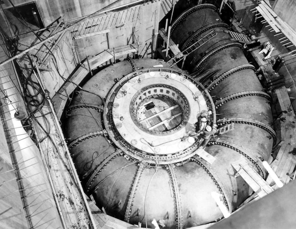
The Francis turbine is a type of water turbine. It is an inward-flow reaction turbine that combines radial and axial flow concepts. Francis turbines are the most common water turbine in use today, and can achieve over 95% efficiency. The process of arriving at the modern Francis runner design took from 1848 to approximately 1920. It became known as the Francis turbine around 1920, being named after British-American engineer James B. Francis who in 1848 created a new turbine design. Francis turbines are primarily used for producing electricity. The power output of the electric generators generally ranges from just a few kilowatts up to 1000 MW, though mini-hydro installations may be lower. The best performance is seen when the head height is between . Penstock diameters are between . The speeds of different turbine units range from 70 to 1000 rpm. A wicket gate around the outside of the turbine's rotating runner controls the rate of water flow through the turbine for d ... [...More Info...] [...Related Items...] OR: [Wikipedia] [Google] [Baidu] |
Penstock
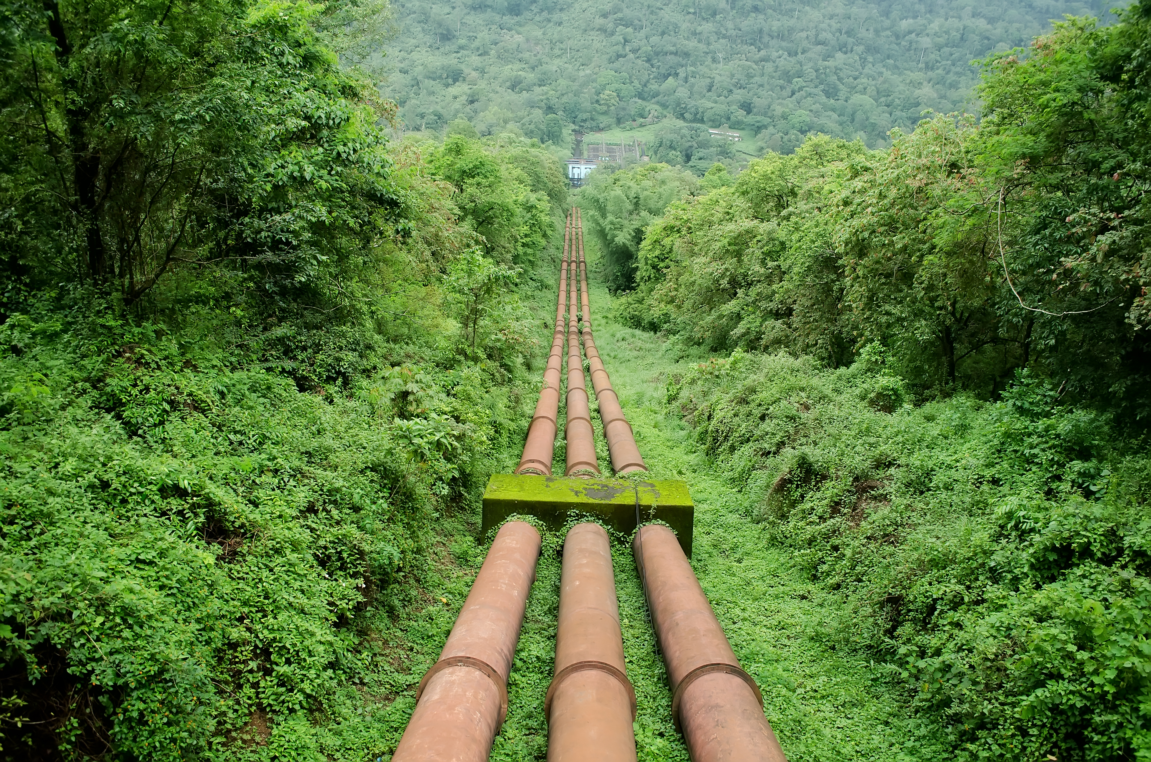
A penstock is a sluice or gate or intake structure that controls water flow, or an enclosed pipe that delivers water to hydro turbines and sewerage systems. The term is inherited from the earlier technology of mill ponds and watermills. Hydroelectric systems and dams Penstocks for hydroelectric installations are normally equipped with a gate system and a surge tank. They can be a combination of many components such as anchor block, drain valve, air bleed valve, and support piers depending on the application. Flow is regulated by turbine operation and is nil when turbines are not in service. Penstocks, particularly where used in polluted water systems, need to be maintained by hot water washing, manual cleaning, antifouling coatings, and desiccation. The term is also used in irrigation dams to refer to the channels leading to and from high-pressure sluice gates. Penstocks are also used in mine tailings dam construction. The penstock is usually situated fairly close to the ... [...More Info...] [...Related Items...] OR: [Wikipedia] [Google] [Baidu] |


