|
Pomanda Island
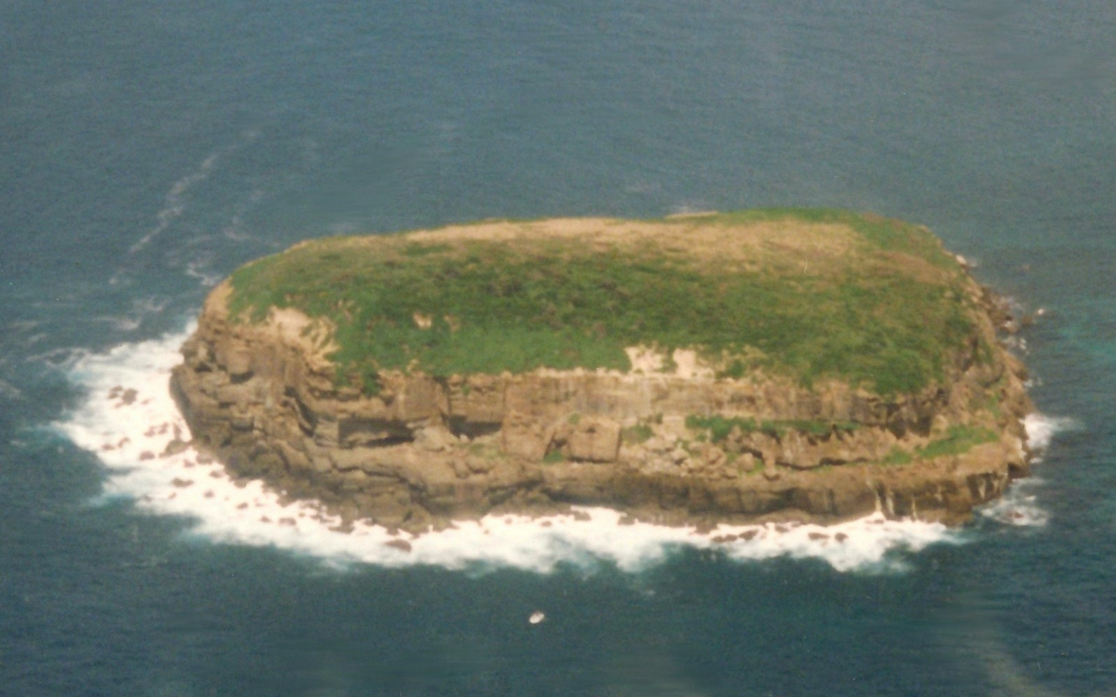
Pomanda Island is an island in the Australian state of South Australia, located in within Lake Alexandrina about southeast of the Adelaide city centre and south of the town of Wellington. It has an area of . It was the proposed site of a temporary weir A weir or low head dam is a barrier across the width of a river that alters the flow characteristics of water and usually results in a change in the height of the river level. Weirs are also used to control the flow of water for outlets of l ... of length which was intended to protect River Murray water supplies, should it become necessary to let seawater into Lake Alexandrina. References [...More Info...] [...Related Items...] OR: [Wikipedia] [Google] [Baidu] |
Adelaide City Centre
Adelaide city centre (Kaurna: Tarndanya) is the inner city locality of Greater Adelaide, the capital city of South Australia. It is known by locals simply as "the City" or "Town" to distinguish it from Greater Adelaide and from the City of Adelaide local government area (which also includes North Adelaide and from the Park Lands around the whole city centre). The population was 15,115 in the . Adelaide city centre was planned in 1837 on a greenfield site following a grid layout, with streets running at right angles to each other. It covers an area of and is surrounded by of park lands.The area of the park lands quoted is based, in the absence of an official boundary between the City and North Adelaide, on an east–west line past the front entrance of Adelaide Oval. Within the city are five parks: Victoria Square in the exact centre and four other, smaller parks. Names for elements of the city centre are as follows: *The "city square mile" (in reality 1.67 square miles ... [...More Info...] [...Related Items...] OR: [Wikipedia] [Google] [Baidu] |
Wellington, South Australia
Wellington is a township in South Australia, Australia on the Murray River (River Murray in South Australia) just upstream of where it empties into Lake Alexandrina. Its postcode is 5259. Wellington is in the Rural City of Murray Bridge. At the , Wellington had a population of 295. History Because of its geographical similarities, the first European colonists likened the development potential of the site of Wellington to that of New Orleans. In 1839 the London-based Secondary Towns Association, represented in Adelaide by John Morphett and John Hill, authorised expenditure on the special survey a proposed town to be named Wellington, with prior consent of the Duke of Wellington himself. Despite never having seen the land except on a map, the directors of the Association had great hopes for Wellington becoming an important town. The survey eventually provided for 700 lots in Wellington (west side of the Murray) and 300 lots in Wellington East (east side of the Murray), as well as ... [...More Info...] [...Related Items...] OR: [Wikipedia] [Google] [Baidu] |
South Australia
South Australia (commonly abbreviated as SA) is a state in the southern central part of Australia. It covers some of the most arid parts of the country. With a total land area of , it is the fourth-largest of Australia's states and territories by area, and second smallest state by population. It has a total of 1.8 million people. Its population is the second most highly centralised in Australia, after Western Australia, with more than 77 percent of South Australians living in the capital Adelaide, or its environs. Other population centres in the state are relatively small; Mount Gambier, the second-largest centre, has a population of 33,233. South Australia shares borders with all of the other mainland states, as well as the Northern Territory; it is bordered to the west by Western Australia, to the north by the Northern Territory, to the north-east by Queensland, to the east by New South Wales, to the south-east by Victoria, and to the south by the Great Australian Bight.M ... [...More Info...] [...Related Items...] OR: [Wikipedia] [Google] [Baidu] |
Lake Alexandrina (South Australia)
Lake Alexandrina is a coastal freshwater lake located between the Fleurieu and Kangaroo Island and Murray and Mallee regions of South Australia, about south-east of Adelaide. The lake adjoins the smaller Lake Albert (together known as the Lower Lakes) and a coastal lagoon called The Coorong to its southeast, before draining into the Great Australian Bight via a short, narrow opening known as Murray Mouth. Nomenclature Aboriginal naming Aboriginal people having an association with the lake were reported as knowing it by such names as ''Mungkuli,'' ''Parnka'' and ''Kayinga.'' European naming English settlers named the lake after Princess Alexandrina, niece and successor of King William IV of Great Britain and Ireland. When the princess ascended the throne and took the name Queen Victoria, there was some talk of changing the name of the lake to Lake Victoria, but the idea was dropped. Description Lake Alexandrina is located north of Encounter Bay and east of Fleurieu Peninsu ... [...More Info...] [...Related Items...] OR: [Wikipedia] [Google] [Baidu] |
Weir
A weir or low head dam is a barrier across the width of a river that alters the flow characteristics of water and usually results in a change in the height of the river level. Weirs are also used to control the flow of water for outlets of lakes, ponds, and reservoirs. There are many weir designs, but commonly water flows freely over the top of the weir crest before cascading down to a lower level. Etymology There is no single definition as to what constitutes a weir and one English dictionary simply defines a weir as a small dam, likely originating from Middle English ''were'', Old English ''wer'', derivative of root of ''werian,'' meaning "to defend, dam". Function Commonly, weirs are used to prevent flooding, measure water discharge, and help render rivers more navigable by boat. In some locations, the terms dam and weir are synonymous, but normally there is a clear distinction made between the structures. Usually, a dam is designed specifically to impound water behind ... [...More Info...] [...Related Items...] OR: [Wikipedia] [Google] [Baidu] |
River Murray
The Murray River (in South Australia: River Murray) (Ngarrindjeri: ''Millewa'', Yorta Yorta: ''Tongala'') is a river in Southeastern Australia. It is Australia's longest river at extent. Its tributaries include five of the next six longest rivers of Australia (the Murrumbidgee, Darling, Lachlan, Warrego and Paroo Rivers). Together with that of the Murray, the catchments of these rivers form the Murray–Darling basin, which covers about one-seventh the area of Australia. It is widely considered Australia's most important irrigated region. The Murray rises in the Australian Alps, draining the western side of Australia's highest mountains, then meanders northwest across Australia's inland plains, forming the border between the states of New South Wales and Victoria as it flows into South Australia. From an east–west direction it turns south at Morgan for its final , reaching the eastern edge of Lake Alexandrina, which fluctuates in salinity. The water then flows thro ... [...More Info...] [...Related Items...] OR: [Wikipedia] [Google] [Baidu] |
South Australian Government
The Government of South Australia, also referred to as the South Australian Government, SA Government or more formally, His Majesty’s Government, is the Australian state democratic administrative authority of South Australia. It is modelled on the Westminster system of government, which is governed by an elected parliament. History Until 1857, the Province of South Australia was ruled by a Governor responsible to the British Crown. The Government of South Australia was formed in 1857, as prescribed in its Constitution created by the Constitution Act 1856 (an act of parliament of the then United Kingdom of Great Britain and Ireland under Queen Victoria), which created South Australia as a self-governing colony rather than being a province governed from Britain. Since the federation of Australia in 1901, South Australia has been a state of the Commonwealth of Australia, which is a constitutional monarchy, and the Constitution of Australia regulates the state of South Aust ... [...More Info...] [...Related Items...] OR: [Wikipedia] [Google] [Baidu] |
Islands Of South Australia
This is a list of selected Australian islands grouped by State or Territory. Australia has 8,222 islands within its maritime borders. Largest islands The islands larger than are: * Tasmania (Tas) ; * Melville Island, Northern Territory (NT), ; * Kangaroo Island, South Australia (SA), ; * Groote Eylandt (NT), ; * Bathurst Island (NT), ; * Fraser Island, Queensland (Qld), ; * Flinders Island (Tas), ; * King Island (Tas), ; and * Mornington Island (Qld), . New South Wales * Amherst Island, in Lake Mummuga * Bare Island, near the north headland of Botany Bay * Belowla Island, off Kioloa Beach * Bird Island, located near Budgewoi, east of the Central Coast * Boondelbah Island, at the mouth of Port Stephens * Brisbane Water: ** Pelican Island ** Riley's Island ** St Hubert's Island (largely artificial, created by raising an inter-tidal wetland above high water level) * Broughton Island, located north of Port Stephens * Broulee Island, located off the coast at Broulee ... [...More Info...] [...Related Items...] OR: [Wikipedia] [Google] [Baidu] |
River Islands Of Australia
A river is a natural flowing watercourse, usually freshwater, flowing towards an ocean, sea, lake or another river. In some cases, a river flows into the ground and becomes dry at the end of its course without reaching another body of water. Small rivers can be referred to using names such as Stream#Creek, creek, Stream#Brook, brook, rivulet, and rill. There are no official definitions for the generic term river as applied to Geographical feature, geographic features, although in some countries or communities a stream is defined by its size. Many names for small rivers are specific to geographic location; examples are "run" in some parts of the United States, "Burn (landform), burn" in Scotland and northeast England, and "beck" in northern England. Sometimes a river is defined as being larger than a creek, but not always: the language is vague. Rivers are part of the water cycle. Water generally collects in a river from Precipitation (meteorology), precipitation through a ... [...More Info...] [...Related Items...] OR: [Wikipedia] [Google] [Baidu] |


.png)

