|
Polkerris
Polkerris ( kw, Pollkerys, meaning ''fortified pool'') is a small village on the south coast of Cornwall, United Kingdom. It forms part of the civil parish of Fowey. The village is part of the Rashleigh estate which is commemorated in the name of the pub, 'Rashleigh Inn'. The village essentially consists of a single steeply sloping road down to the harbour and beach. Parking is limited. There is a small sandy beach, with a curved harbour wall. Etymology The original translation of the place name is obscure. However, the presence of a number of Napoleonic era cannons embedded in the harbour wall, muzzle first, does lend credence to one possible meaning 'Fortified Cove'. Geography Polkerris is on the west side of the Gribbin promontory and on the east side of St Austell Bay. It is two miles west of Fowey and three miles east of St Austell. Polkerris is situated on the South West Coast Path, which follows the coast of south west England from Somerset to Dorset. The path follows ... [...More Info...] [...Related Items...] OR: [Wikipedia] [Google] [Baidu] |
Polkerris - Geograph
Polkerris ( kw, Pollkerys, meaning ''fortified pool'') is a small village on the south coast of Cornwall, United Kingdom. It forms part of the civil parish of Fowey. The village is part of the Rashleigh estate which is commemorated in the name of the pub, 'Rashleigh Inn'. The village essentially consists of a single steeply sloping road down to the harbour and beach. Parking is limited. There is a small sandy beach, with a curved harbour wall. Etymology The original translation of the place name is obscure. However, the presence of a number of Napoleonic era cannons embedded in the harbour wall, muzzle first, does lend credence to one possible meaning 'Fortified Cove'. Geography Polkerris is on the west side of the Gribbin Head, Gribbin promontory and on the east side of St Austell Bay. It is two miles west of Fowey and three miles east of St Austell. Polkerris is situated on the South West Coast Path, which follows the coast of south west England from Somerset to Dorset. The ... [...More Info...] [...Related Items...] OR: [Wikipedia] [Google] [Baidu] |
Fowey Lifeboat Station
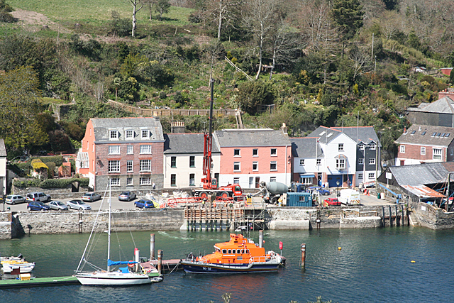
Fowey Lifeboat Station is the base for Royal National Lifeboat Institution (RNLI) search and rescue operations at Fowey on the south coast of Cornwall in the United Kingdom. The first lifeboat was stationed in the area in 1859 and the present station was opened in 1997. It operates a Trent Class all weather boat (AWB) and a D class (IB1) inshore lifeboat (ILB). History Fowey stands at the mouth of the River Fowey where it forms a natural deep water harbour. The town has a long history of fishing and merchant shipping, although the present quays busy with ships loading china clay were only developed in the 1860s. To the west lies St Austell Bay which includes Par Docks built in the 1840s to handle the mineral traffic from Joseph Treffry's mines and quarries, and Charlestown which had been established about fifty years earlier by Charles Rashleigh. A fatal ship wreck on the Gribben Head between Fowey and St Austell Bay on 6 May 1856 prompted William Rashleigh, a local landowner ... [...More Info...] [...Related Items...] OR: [Wikipedia] [Google] [Baidu] |
Fowey
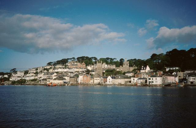
Fowey ( ; kw, Fowydh, meaning 'Beech Trees') is a port town and civil parish at the mouth of the River Fowey in south Cornwall, England, United Kingdom. The town has been in existence since well before the Norman invasion, with the local church first established some time in the 7th century; the estuary of the River Fowey forms a natural harbour which enabled the town to become an important trading centre. Privateers also made use of the sheltered harbourage. The Lostwithiel and Fowey Railway brought China clay here for export. History Early history The Domesday Book survey at the end of the 11th century records manors at Penventinue and Trenant, and a priory was soon established nearby at Tywardreath. the prior granted a charter to people living in Fowey itself. This medieval town ran from a north gate near Boddinick Passage to a south gate at what is now Lostwithiel Street; the town extended a little way up the hillside and was bounded on the other side by the river where ... [...More Info...] [...Related Items...] OR: [Wikipedia] [Google] [Baidu] |
Polmear, Cornwall
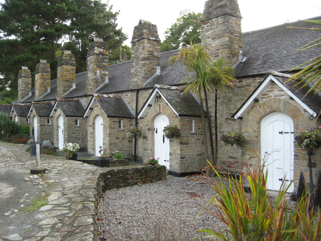
Polmear ( kw, Porth Meur, meaning ''great cove'') is a hamlet in Cornwall, England, UK. It is located on the A3082 road close to Par Sands and the village of Par. Part is in the civil parish of Fowey and part in Par and Tywardreath parish. The centre of Fowey is some distant, whilst Par railway station is less than away. Polmear used to be known as East Polmear and West Polmear is now known as Charlestown, and has been since Charles Rashleigh built the harbour there (1791 to 1798). The first four Rashleigh Almshouses in Polmear were originally built c. 1653 when Jonathan Rashleigh was granted leave to build housing for four poor persons from Tywardreath. Each cottage had one room with a large fireplace and a platform reached by ladder to sleep on, and they shared a water pump and a privy out the back. There are records accounting for the food and clothing given to the widows between 1745 and 1850, records of an "abstract of deeds" in the 18th century, information of the r ... [...More Info...] [...Related Items...] OR: [Wikipedia] [Google] [Baidu] |
Gribbin Head
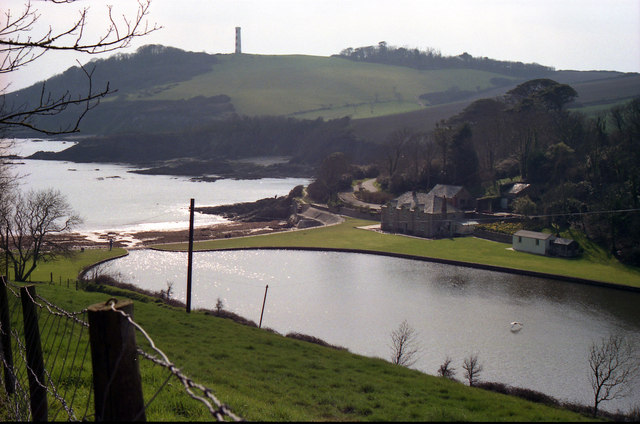
Gribbin Head ( kw, an Gribyn) is a promontory on the south coast of Cornwall, England, UK, owned and managed by the National Trust. It separates St Austell Bay from the estuary of the River Fowey and is marked by a large tower used to aid navigation of ships approaching the local harbours. The nearest town is Fowey. The western point of the headland is called Little Gribbin. Gribbin Head is the most southerly part of the parish of Fowey. To the north, and facing west across St Austell Bay is the small village of Polkerris, beyond which is the harbour at Par. To the east is Polridmouth cove and the Fowey estuary, where the town of Fowey itself is situated. Inland, to the north, is the Menabilly estate,Ordnance Survey 1:25000 Explorer Map 107 built for the Rashleigh family but later home to author Daphne du Maurier. The high promontory forms a part of the South Coast (eastern) section of the Cornwall Area of Outstanding Natural Beauty. The South West Coast Path passes aroun ... [...More Info...] [...Related Items...] OR: [Wikipedia] [Google] [Baidu] |
Doomwatch (film)
''Doomwatch'' is a 1972 British science fiction film directed by Peter Sasdy and starring Ian Bannen, Judy Geeson and John Paul. Described as both a thriller and a horror film, it is based on the BBC's science fiction television series ''Doomwatch'' which ran between 1970 and 1972. The screenplay was written by Clive Exton. In the United States it was released by Embassy Pictures with the alternative title ''Island of the Ghouls''. In the film, the waters surrounding an island become contaminated by chemical dumping, and people who eat fish caught in those waters become deformed and violent. Plot An outsider visits a remote isolated village that has seemingly shunned the modern life. Doctor Del Shaw, an investigator from the British ecological watchdog group nicknamed Doomwatch, is sent to the island of Balfe, to file a report on the effects of a recent oil tanker spill. He becomes fascinated with the mysterious behavioural disorders of the locals who display rudeness and r ... [...More Info...] [...Related Items...] OR: [Wikipedia] [Google] [Baidu] |
South West Coast Path
The South West Coast Path is England's longest waymarked long-distance footpath and a National Trail. It stretches for , running from Minehead in Somerset, along the coasts of Devon and Cornwall, to Poole Harbour in Dorset. Because it rises and falls with every river mouth, it is also one of the more challenging trails. The total height climbed has been calculated to be 114,931 ft (35,031 m), almost four times the height of Mount Everest. It has been voted 'Britain's Best Walking route' twice in a row by readers of The Ramblers' ''Walk'' magazine, and regularly features in lists of the world's best walks. The final section of the path was designated as a National Trail in 1978. Many of the landscapes which the South West Coast Path crosses have special status, either as a national park or one of the heritage coasts. The path passes through two World Heritage Sites: the Dorset and East Devon Coast, known as the Jurassic Coast, was designated in 2001, and the Cornwall ... [...More Info...] [...Related Items...] OR: [Wikipedia] [Google] [Baidu] |
Populated Coastal Places In Cornwall
Population typically refers to the number of people in a single area, whether it be a city or town, region, country, continent, or the world. Governments typically quantify the size of the resident population within their jurisdiction using a census, a process of collecting, analysing, compiling, and publishing data regarding a population. Perspectives of various disciplines Social sciences In sociology and population geography, population refers to a group of human beings with some predefined criterion in common, such as location, race, ethnicity, nationality, or religion. Demography is a social science which entails the statistical study of populations. Ecology In ecology, a population is a group of organisms of the same species who inhabit the same particular geographical area and are capable of interbreeding. The area of a sexual population is the area where inter-breeding is possible between any pair within the area and more probable than cross-breeding with ind ... [...More Info...] [...Related Items...] OR: [Wikipedia] [Google] [Baidu] |
Villages In Cornwall
A village is a clustered human settlement or community, larger than a hamlet but smaller than a town (although the word is often used to describe both hamlets and smaller towns), with a population typically ranging from a few hundred to a few thousand. Though villages are often located in rural areas, the term urban village is also applied to certain urban neighborhoods. Villages are normally permanent, with fixed dwellings; however, transient villages can occur. Further, the dwellings of a village are fairly close to one another, not scattered broadly over the landscape, as a dispersed settlement. In the past, villages were a usual form of community for societies that practice subsistence agriculture, and also for some non-agricultural societies. In Great Britain, a hamlet earned the right to be called a village when it built a church. [...More Info...] [...Related Items...] OR: [Wikipedia] [Google] [Baidu] |
Doomwatch
''Doomwatch'' is a British science fiction television programme produced by the BBC, which ran on BBC1 between 1970 and 1972. The series was set in the then present day, and dealt with a scientific government agency led by Doctor Spencer Quist (played by John Paul), responsible for investigating and combating various ecological and technological dangers. The series was followed by a film adaptation produced by Tigon British Film Productions and released in 1972, and a revival TV film was broadcast on Channel 5 in 1999. Background The programme was created by Gerry Davis and Kit Pedler, who had previously collaborated on scripts for ''Doctor Who'', a programme on which, for a time during the late 1960s, Davis had been the story editor and Pedler the unofficial scientific adviser. Their interest in the problems of science changing and endangering human life had led them to create the popular cyborg villains the Cybermen for that program. Similar interests led them to create ''D ... [...More Info...] [...Related Items...] OR: [Wikipedia] [Google] [Baidu] |
Menabilly
Menabilly ( kw, Men Ebeli, meaning ''stone of Colt (horse), colts'') is a historic estate on the south coast of Cornwall, England, situated within the parish of Tywardreath on the Gribben Head, Gribben peninsula about west of Fowey. It has been the seat of the Rashleigh, Rashleigh family from the 16th century to the present day. The mansion house, which received a Listed building, Grade II* listing on 13 March 1951, is early Georgian in style, having been re-built on the site of an earlier Elizabethan house, parts of which were possibly incorporated into the present structure. The house is surrounded by woodland and nearby is the farmhouse Menabilly Barton (demesne), Barton. In the Return of Owners of Land, 1873 Jonathan Rashleigh of Menabilly, Par, Cornwall, Par, was listed as the largest landowner in Cornwall with an estate of or almost 4% of the total area of Cornwall. Rashleigh family seat The Rashleigh family of Menabilly originated as powerful merchants in the 16 ... [...More Info...] [...Related Items...] OR: [Wikipedia] [Google] [Baidu] |
Sardina Pilchardus
The European pilchard (''Sardina pilchardus'') is a species of ray-finned fish in the monotypic genus ''Sardina''. The young of the species are among the many fish that are sometimes called sardines. This common species is found in the northeast Atlantic, the Mediterranean, and the Black Sea at depths of . It reaches up to in length and mostly feeds on planktonic crustaceans. This Shoaling and schooling, schooling species is a batch Spawn (biology), spawner where each female lays 50,000–60,000 eggs. Description The European pilchard is a small to medium-sized, somewhat elongated, herring-like fish. The origin of the pelvic fins is well behind that of the dorsal fin, and the last two soft rays on the anal fin are larger than the remainder. The upper parts are green or olive, the flanks are golden and the belly is silvery. Distribution and habitat The European pilchard occurs in the northeastern Atlantic Ocean, the Mediterranean Sea and the Black Sea. Its range extends from Ice ... [...More Info...] [...Related Items...] OR: [Wikipedia] [Google] [Baidu] |


