|
Plumb Beach, Brooklyn
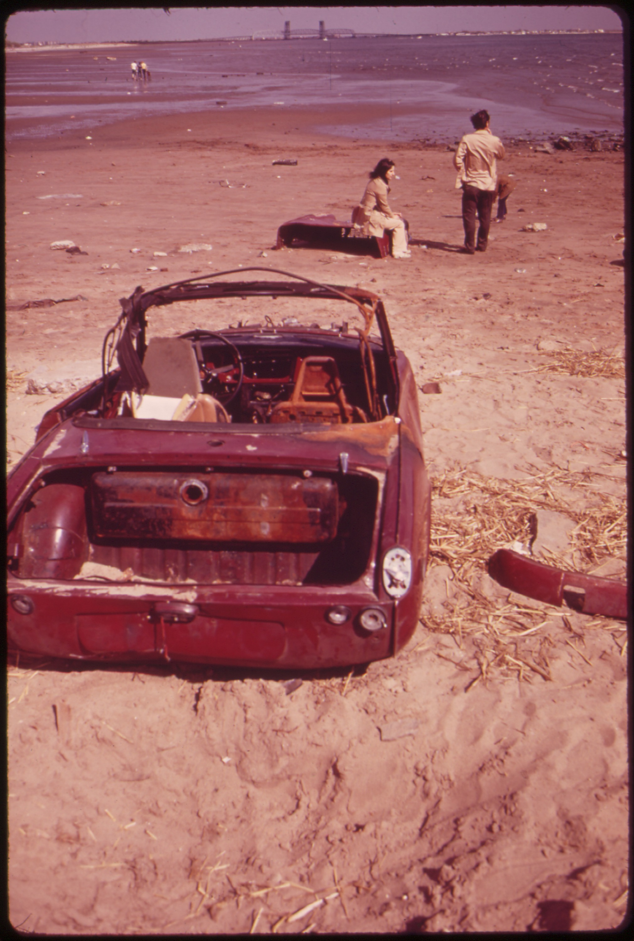
Plumb Beach (sometimes spelled "Plum") is a beach and surrounding neighborhood along the north shore of Rockaway Inlet, in the New York City borough of Brooklyn. It is located near the neighborhoods of Sheepshead Bay and Gerritsen Beach, just off the Belt Parkway. Plumb Beach was originally part of a small island until Hog Creek was filled in during the late 1930s, connecting the beach to the rest of Brooklyn. Since 1972 it has been a part of Gateway National Recreation Area, though the parking lot and greenway that provide primary access to the shore are the responsibility of the New York City Department of Parks and Recreation and the New York City Department of Transportation. The neighborhood is part of Brooklyn Community District 15, although a section of the beach is not part of a Community District. In May and June, horseshoe crabs climb onto the beach to mate. That beach is often subjected to heavy beach erosion, as incoming storms often blow large amounts of water u ... [...More Info...] [...Related Items...] OR: [Wikipedia] [Google] [Baidu] |
Neighborhoods Of Brooklyn
This is a list of neighbourhood, neighborhoods in Brooklyn, one of the five boroughs of New York City, boroughs of New York City. By geographical region Central Brooklyn *Crown Heights, Brooklyn, Crown Heights **Weeksville, Brooklyn, Weeksville *Flatbush, Brooklyn, Flatbush **Beverley Squares: Beverley Square East, Beverley Square West **Ditmas Park, Brooklyn, Ditmas Park **East Flatbush, Brooklyn, East Flatbush ***Farragut, Brooklyn, Farragut ***Remsen Village, Brooklyn, Remsen Village **Fiske Terrace, Brooklyn, Fiske Terrace **Pigtown, Brooklyn, Pigtown **Wingate, Brooklyn, Wingate *Prospect Park (Brooklyn), Prospect Park area **Prospect Lefferts Gardens **Prospect Park South, Brooklyn, Prospect Park South **Windsor Terrace, Brooklyn, Windsor Terrace *Kensington, Brooklyn, Kensington **Ocean Parkway (Brooklyn), Ocean Parkway **Parkville Eastern Brooklyn *Brownsville, Brooklyn, Brownsville *Canarsie, Brooklyn, Canarsie *East New York, Brooklyn, East New York **City ... [...More Info...] [...Related Items...] OR: [Wikipedia] [Google] [Baidu] |
Belt Parkway
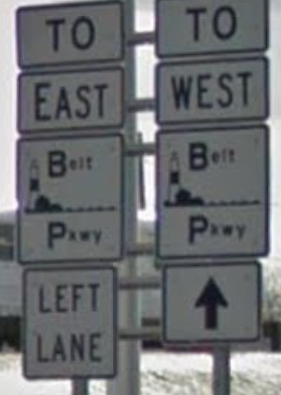
The Belt Parkway is the name given to a series of connected limited-access highways that form a belt-like circle around the New York City boroughs of Brooklyn and Queens. The Belt Parkway comprises three of the four parkways in what is known as the Belt System: the Shore Parkway, the Southern Parkway (not to be confused with the Southern State Parkway), and the Laurelton Parkway. The three parkways in the Belt Parkway are a combined in length. The Cross Island Parkway makes up the fourth parkway in the system, but is signed separately. Route description The Shore Parkway, Southern Parkway, Laurelton Parkway, and Cross Island Parkway are collectively known as the "Belt System". The four components of the Belt System are designated as New York State Route 907C (NY 907C), NY 907D, NY 907B, and NY 907A, respectively, by the New York State Department of Transportation. All four numbers are reference route designations and are not signed. Excluding the Cros ... [...More Info...] [...Related Items...] OR: [Wikipedia] [Google] [Baidu] |
1938 New England Hurricane
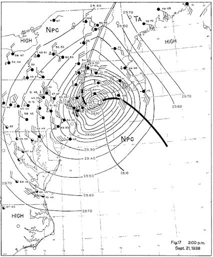
The 1938 New England Hurricane (also referred to as the Great New England Hurricane and the Long Island Express Hurricane) was one of the deadliest and most destructive tropical cyclones to strike Long Island, New York, and New England. The storm formed near the coast of Africa on September 9, becoming a Category 5 hurricane on the Saffir–Simpson hurricane scale, before making landfall as a Category 3 hurricane on Long Island on Wednesday, September 21. It is estimated that the hurricane killed 682 people, damaged or destroyed more than 57,000 homes, and caused property losses estimated at $306 million ($4.7 billion in 2017). Multiple other sources, however, mention that the 1938 hurricane might have really been a more powerful Category 4, having winds similar to Hurricanes Hugo, Harvey, Frederic and Gracie when it ran through Long Island and New England. Also, numerous others estimate the real damage between $347 million and almost $410 million. Damaged trees and buildings ... [...More Info...] [...Related Items...] OR: [Wikipedia] [Google] [Baidu] |
Squatters
Squatting is the action of occupying an abandoned or unoccupied area of land or a building, usually residential, that the squatter does not own, rent or otherwise have lawful permission to use. The United Nations estimated in 2003 that there were one billion slum residents and squatters globally. Squatting occurs worldwide and tends to occur when people who are poor and homeless find empty buildings or land to occupy for housing. It has a long history, broken down by country below. In developing countries and least developed countries, shanty towns often begin as squatted settlements. In African cities such as Lagos much of the population lives in slums. There are pavement dwellers in India and in Hong Kong as well as rooftop slums. Informal settlements in Latin America are known by names such as villa miseria (Argentina), pueblos jóvenes (Peru) and asentamientos irregulares (Guatemala, Uruguay). In Brazil, there are favelas in the major cities and land-based movements. I ... [...More Info...] [...Related Items...] OR: [Wikipedia] [Google] [Baidu] |
World War I
World War I (28 July 1914 11 November 1918), often abbreviated as WWI, was one of the deadliest global conflicts in history. Belligerents included much of Europe, the Russian Empire, the United States, and the Ottoman Empire, with fighting occurring throughout Europe, the Middle East, Africa, the Pacific, and parts of Asia. An estimated 9 million soldiers were killed in combat, plus another 23 million wounded, while 5 million civilians died as a result of military action, hunger, and disease. Millions more died in genocides within the Ottoman Empire and in the 1918 influenza pandemic, which was exacerbated by the movement of combatants during the war. Prior to 1914, the European great powers were divided between the Triple Entente (comprising France, Russia, and Britain) and the Triple Alliance (containing Germany, Austria-Hungary, and Italy). Tensions in the Balkans came to a head on 28 June 1914, following the assassination of Archduke Franz Ferdin ... [...More Info...] [...Related Items...] OR: [Wikipedia] [Google] [Baidu] |
Breezy Point, Queens
Breezy Point is a neighborhood in the New York City borough of Queens, located on the western end of the Rockaway peninsula, between Rockaway Inlet and Jamaica Bay to the north and the Atlantic Ocean to the west and south. The community is run by the Breezy Point Cooperative, in which all residents pay the maintenance, security, and community-oriented costs involved with keeping the community private. The cooperative owns the entire community; residents own their homes and hold shares in the cooperative.Sciolino, Elaine"A Cooperative on the Beach Loves Privacy" ''The New York Times'', September 10, 1984. Accessed November 21, 2007. ''The New York Times'' described Breezy Point as consisting of "three small neighborhoods:" Rockaway Point, Roxbury, and namesake Breezy Point, and that ''Rockaway Point Boulevard'' "runs between the sections." It is less urbanized than most of the rest of New York City, and it is part of Queens Community District 14. Breezy Point is patrolled by the ... [...More Info...] [...Related Items...] OR: [Wikipedia] [Google] [Baidu] |
Barren Island, Brooklyn
Barren Island is a peninsula and former island on the southeast shore of Brooklyn in New York City New York, often called New York City or NYC, is the List of United States cities by population, most populous city in the United States. With a 2020 population of 8,804,190 distributed over , New York City is also the L .... Located on Jamaica Bay, it was geographically part of the Outer Barrier island group on the South Shore (Long Island), South Shore of Long Island. The island was occupied by the Lenape Native Americans prior to the arrival of Dutch settlers in the 17th century. Its name is a Language change, corruption of , the Dutch language, Dutch-language term for "Bears' Island". Barren Island remained sparsely inhabited before the 19th century, mainly because of its relative isolation from the rest of the city. Starting in the 1850s, the island was developed as an industrial complex with fish rendering (industrial), rendering plants and other ... [...More Info...] [...Related Items...] OR: [Wikipedia] [Google] [Baidu] |
Prunus Maritima
''Prunus maritima'', the beach plum, is a species of plum native to the East Coast of the United States. It is a choice wild edible and its few pests and salt tolerance make it a resilient fruit crop for degraded lands and urban soils. Description ''Prunus maritima'' is a deciduous shrub, in its natural sand dune habitat growing tall, although it can grow larger, up to tall, when cultivated in gardens. The leaves are alternate, elliptical, long and broad, with a sharply toothed margin. They are green on top and pale below, becoming showy red or orange in the autumn. The flowers are in diameter, with five white petals and large yellow anthers. The fruit is an edible drupe in diameter in the wild plant, red, yellow, blue, or nearly black.Maine Department of Conservation Natural Areas Program: Huxley, A., ed. (1992). ''New RHS Dictionary of Gardening''. Macmillan . The plant is salt-tolerant and cold-hardy. It prefers the full sun and well-drained soil. It spreads roots by p ... [...More Info...] [...Related Items...] OR: [Wikipedia] [Google] [Baidu] |
Coastal Erosion
Coastal erosion is the loss or displacement of land, or the long-term removal of sediment and rocks along the coastline due to the action of waves, currents, tides, wind-driven water, waterborne ice, or other impacts of storms. The landward retreat of the shoreline can be measured and described over a temporal scale of tides, seasons, and other short-term cyclic processes. Coastal erosion may be caused by hydraulic action, abrasion, impact and corrosion by wind and water, and other forces, natural or unnatural. On non-rocky coasts, coastal erosion results in rock formations in areas where the coastline contains rock layers or fracture zones with varying resistance to erosion. Softer areas become eroded much faster than harder ones, which typically result in landforms such as tunnels, bridges, columns, and pillars. Over time the coast generally evens out. The softer areas fill up with sediment eroded from hard areas, and rock formations are eroded away. Also erosion commonly ... [...More Info...] [...Related Items...] OR: [Wikipedia] [Google] [Baidu] |
Atlantic Horseshoe Crab
The Atlantic horseshoe crab (''Limulus polyphemus''), also known as the American horseshoe crab, is a species of marine and brackish chelicerate arthropod. Despite their name, horseshoe crabs are more closely related to spiders, ticks, and scorpions than to crabs. It is found in the Gulf of Mexico and along the Atlantic coast of North America. The main area of annual migration is Delaware Bay along the South Jersey Delaware Bayshore. Their eggs were eaten by Native Americans, but today Atlantic horseshoe crabs are caught for use as fishing bait, in biomedicine (especially for ''Limulus'' amebocyte lysate) and science. They play a major role in the local ecosystems, with their eggs providing an important food source for shorebirds, and the juveniles and adults being eaten by sea turtles. The other three extant (living) species in the family Limulidae are also called horseshoe crabs, but they are restricted to Asia. Names and classification This group of animals is also known ... [...More Info...] [...Related Items...] OR: [Wikipedia] [Google] [Baidu] |
Brooklyn Community Board 15
Brooklyn Community Board 15 is a New York City community board that encompasses the Brooklyn neighborhoods of Gravesend, Sheepshead Bay, Manhattan Beach, Gerritsen Beach, Madison, Homecrest, and Plum Beach. , . Accessed December 31, 2007. It is delimited by Corbin Place, Coney Island Avenue, Avenue Y, 86th street, Avenue U and McDonald Avenue, Avenue P and Kings Highway on the north, Nostrand avenue and Marine Park on the east, as well as by the |
New York City Department Of Transportation
The New York City Department of Transportation (NYCDOT) is the agency of the government of New York City responsible for the management of much of New York City's transportation infrastructure. Ydanis Rodriguez is the Commissioner of the Department of Transportation, and was appointed by Mayor Eric Adams on January 1, 2022. Former Commissioners have included Polly Trottenberg, Janette Sadik-Khan, and Iris Weinshall Responsibilities The Department of Transportation's responsibilities include day-to-day maintenance of the city's streets, highways, bridges, sidewalks, street signs, traffic signals, and street lights. DOT supervises street resurfacing, pothole repair, parking meter installation and maintenance, and municipal parking facility management. DOT also operates the Staten Island Ferry. DOT is the exclusive provider of day-to-day operations and maintenance on state-maintained roads and highways in city limits, while major repairs and capital improvements on state-owned road ... [...More Info...] [...Related Items...] OR: [Wikipedia] [Google] [Baidu] |


