|
Plevna, Missouri
Plevna is an unincorporated area, unincorporated community and census-designated place in southeastern Knox County, Missouri, Knox County, Missouri, United States. It is located approximately southeast of Edina, Missouri, Edina on Missouri Route 15. As of the 2020 United States Census, 2020 census, its population was 7. Plevna was platted in 1877. According to author and name historian Robert L. Ramsay (academic), Robert Ramsay, the community is named after Pleven, Plevna, Bulgaria, site of a Russian victory at the Siege of Plevna during the Russo-Turkish War, 1877–1878, Russo-Turkish War. A post office was established at Plevna in 1877. Demographics References Unincorporated communities in Knox County, Missouri Unincorporated communities in Missouri Census-designated places in Missouri {{KnoxCountyMO-geo-stub ... [...More Info...] [...Related Items...] OR: [Wikipedia] [Google] [Baidu] |
Census-designated Place
A census-designated place (CDP) is a Place (United States Census Bureau), concentration of population defined by the United States Census Bureau for statistical purposes only. CDPs have been used in each decennial census since 1980 as the counterparts of incorporated places, such as self-governing city (United States), cities, town (United States), towns, and village (United States), villages, for the purposes of gathering and correlating statistical data. CDPs are populated areas that generally include one officially designated but currently unincorporated area, unincorporated community, for which the CDP is named, plus surrounding inhabited countryside of varying dimensions and, occasionally, other, smaller unincorporated communities as well. CDPs include small rural communities, Edge city, edge cities, colonia (United States), colonias located along the Mexico–United States border, and unincorporated resort and retirement community, retirement communities and their environs. ... [...More Info...] [...Related Items...] OR: [Wikipedia] [Google] [Baidu] |
Edina, Missouri
Edina is a city in Knox County, Missouri, United States, between the North and South Forks of the South Fabius River. As of the 2020 census, its population was 1,012. It is the county seat of Knox County. Geography Edina is located in central Knox County at the intersection of Missouri routes 6 and 15. Hurdland is 6.5 miles to the west, Knox City is 8.5 miles to the east and the community of Baring is about 5.5 miles to the north. The North and South Forks of the South Fabius River pass approximately one-half mile to the northeast and southwest of the city. According to the United States Census Bureau, the city has a total area of , of which is land and is water. Weather According to weather data tallied between July 1, 1985 and June 30, 2015 for every location in the National Oceanic and Atmospheric Administration's official climate database, Edina, Missouri, is the snowiest place in the state of Missouri with an average of of snow per year. History Edina was pl ... [...More Info...] [...Related Items...] OR: [Wikipedia] [Google] [Baidu] |
Unincorporated Communities In Knox County, Missouri
Unincorporated may refer to: * Unincorporated area, land not governed by a local municipality * Unincorporated entity, a type of organization * Unincorporated territories of the United States, territories under U.S. jurisdiction, to which Congress has determined that only select parts of the U.S. Constitution apply * Unincorporated association Unincorporated associations are one vehicle for people to cooperate towards a common goal. The range of possible unincorporated associations is nearly limitless, but typical examples are: :* An amateur football team who agree to hire a pitch onc ..., also known as voluntary association, groups organized to accomplish a purpose * ''Unincorporated'' (album), a 2001 album by Earl Harvin Trio {{disambig ... [...More Info...] [...Related Items...] OR: [Wikipedia] [Google] [Baidu] |
Post Office
A post office is a public facility and a retailer that provides mail services, such as accepting letters and parcels, providing post office boxes, and selling postage stamps, packaging, and stationery. Post offices may offer additional services, which vary by country. These include providing and accepting government forms (such as passport applications), and processing government services and fees (such as road tax, postal savings, or bank fees). The chief administrator of a post office is called a postmaster. Before the advent of postal codes and the post office, postal systems would route items to a specific post office for receipt or delivery. During the 19th century in the United States, this often led to smaller communities being renamed after their post offices, particularly after the Post Office Department began to require that post office names not be duplicated within a state. Name The term "post-office" has been in use since the 1650s, shortly after the ... [...More Info...] [...Related Items...] OR: [Wikipedia] [Google] [Baidu] |
Siege Of Plevna
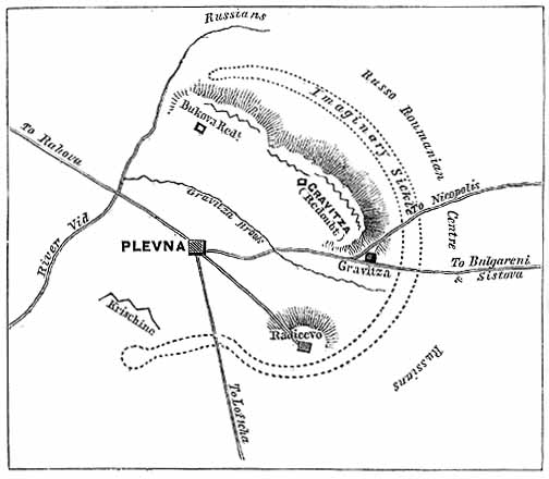
The siege of Pleven, was a major battle of the Russo-Turkish War of 1877–1878, fought by the joint army of Russia and Romania against the Ottoman Empire. After the Russian army crossed the Danube at Svishtov, it began advancing towards the centre of modern Bulgaria, with the aim of crossing the Balkan Mountains to Constantinople, avoiding the fortified Turkish fortresses on the Black Sea coast. The Ottoman army led by Osman Pasha, returning from Serbia after a conflict with that country, was massed in the fortified city of Pleven, a city surrounded by numerous redoubts, located at an important road intersection. After two unsuccessful assaults, in which he lost valuable troops, the commander of the Russian troops on the Balkan front, Grand Duke Nicholas of Russia insisted by telegram the help of his Romanian ally King Carol I. King Carol I crossed the Danube with the Romanian Army and was placed in command of the Russian-Romanian troops. He decided not to make any mor ... [...More Info...] [...Related Items...] OR: [Wikipedia] [Google] [Baidu] |
Bulgaria
Bulgaria (; bg, България, Bǎlgariya), officially the Republic of Bulgaria,, ) is a country in Southeast Europe. It is situated on the eastern flank of the Balkans, and is bordered by Romania to the north, Serbia and North Macedonia to the west, Greece and Turkey to the south, and the Black Sea to the east. Bulgaria covers a territory of , and is the sixteenth-largest country in Europe. Sofia is the nation's capital and largest city; other major cities are Plovdiv, Varna and Burgas. One of the earliest societies in the lands of modern-day Bulgaria was the Neolithic Karanovo culture, which dates back to 6,500 BC. In the 6th to 3rd century BC the region was a battleground for ancient Thracians, Persians, Celts and Macedonians; stability came when the Roman Empire conquered the region in AD 45. After the Roman state splintered, tribal invasions in the region resumed. Around the 6th century, these territories were settled by the early Slavs. The Bulgars, led ... [...More Info...] [...Related Items...] OR: [Wikipedia] [Google] [Baidu] |
Pleven
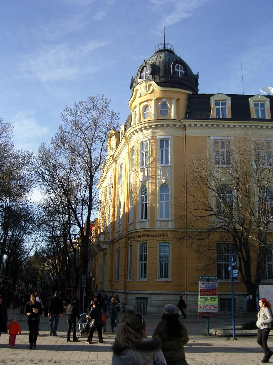
Pleven ( bg, Плèвен ) is the seventh most populous city in Bulgaria. Located in the northern part of the country, it is the administrative centre of Pleven Province, as well as of the subordinate Pleven municipality. It is the biggest economic center in Northwestern Bulgaria. At the 2021 census its population was 89,823. Internationally known for the siege of Plevna of 1877, it is today a major economic centre of the Bulgarian Northwest and Central North and the third largest city of Northern Bulgaria after Varna and Ruse. Name The name comes from the Slavic word ''plevnya'' ("barn") or from ''plevel'', meaning "weed", sharing the same root, and the Slavic suffix ''-en''. Geography Pleven is in an agricultural region in the middle of the Danubian Plain, the historical region of Moesia, surrounded by low limestone hills, the Pleven Heights. The city's central location in Northern Bulgaria defines its importance as a big administrative, economic, political, cultu ... [...More Info...] [...Related Items...] OR: [Wikipedia] [Google] [Baidu] |
Robert L
The name Robert is an ancient Germanic given name, from Proto-Germanic "fame" and "bright" (''Hrōþiberhtaz''). Compare Old Dutch ''Robrecht'' and Old High German ''Hrodebert'' (a compound of '' Hruod'' ( non, Hróðr) "fame, glory, honour, praise, renown" and ''berht'' "bright, light, shining"). It is the second most frequently used given name of ancient Germanic origin. It is also in use as a surname. Another commonly used form of the name is Rupert. After becoming widely used in Continental Europe it entered England in its Old French form ''Robert'', where an Old English cognate form (''Hrēodbēorht'', ''Hrodberht'', ''Hrēodbēorð'', ''Hrœdbœrð'', ''Hrœdberð'', ''Hrōðberχtŕ'') had existed before the Norman Conquest. The feminine version is Roberta. The Italian, Portuguese, and Spanish form is Roberto. Robert is also a common name in many Germanic languages, including English, German, Dutch, Norwegian, Swedish, Scots, Danish, and Icelandic. It can be ... [...More Info...] [...Related Items...] OR: [Wikipedia] [Google] [Baidu] |
Plat
In the United States, a plat ( or ) (plan) is a cadastral map, drawn to scale, showing the divisions of a piece of land. United States General Land Office surveyors drafted township plats of Public Lands Surveys to show the distance and bearing between section corners, sometimes including topographic or vegetation information. City, town or village plats show subdivisions broken into blocks with streets and alleys. Further refinement often splits blocks into individual lots, usually for the purpose of selling the described lots; this has become known as subdivision. After the filing of a plat, legal descriptions can refer to block and lot-numbers rather than portions of sections. In order for plats to become legally valid, a local governing body, such as a public works department, urban planning commission, or zoning board must normally review and approve them. In gardening history, in both varieties of English (and in French etc), a "plat" means a section of a forma ... [...More Info...] [...Related Items...] OR: [Wikipedia] [Google] [Baidu] |
United States Census Bureau
The United States Census Bureau (USCB), officially the Bureau of the Census, is a principal agency of the U.S. Federal Statistical System, responsible for producing data about the American people and economy. The Census Bureau is part of the U.S. Department of Commerce and its director is appointed by the President of the United States. The Census Bureau's primary mission is conducting the U.S. census every ten years, which allocates the seats of the U.S. House of Representatives to the states based on their population. The bureau's various censuses and surveys help allocate over $675 billion in federal funds every year and it assists states, local communities, and businesses make informed decisions. The information provided by the census informs decisions on where to build and maintain schools, hospitals, transportation infrastructure, and police and fire departments. In addition to the decennial census, the Census Bureau continually conducts over 130 surveys and p ... [...More Info...] [...Related Items...] OR: [Wikipedia] [Google] [Baidu] |
Missouri Route 15
Route 15 is a highway in northeast Missouri. Its northern terminus is at the Iowa state line about thirteen miles (19 km) north of Memphis; its southern terminus is at U.S. Route 54 in Mexico. Route 15 is one of the original 1922 Missouri highways, though its southern terminus was significantly farther at Route 71 (now U.S. Route 65) at Buffalo. It was replaced by U.S. Route 54 from Mexico to southwest of Macks Creek and by Route 73 from that point to Buffalo. Major intersections References External Links 015 Fifteen or 15 may refer to: *15 (number), the natural number following 14 and preceding 16 *one of the years 15 BC, AD 15, 1915, 2015 Music *Fifteen (band), a punk rock band Albums * ''15'' (Buckcherry album), 2005 * ''15'' (Ani Lorak albu ... Transportation in Audrain County, Missouri Transportation in Monroe County, Missouri Transportation in Shelby County, Missouri Transportation in Knox County, Missouri Transporta ... [...More Info...] [...Related Items...] OR: [Wikipedia] [Google] [Baidu] |


