|
Plaza De Mayo
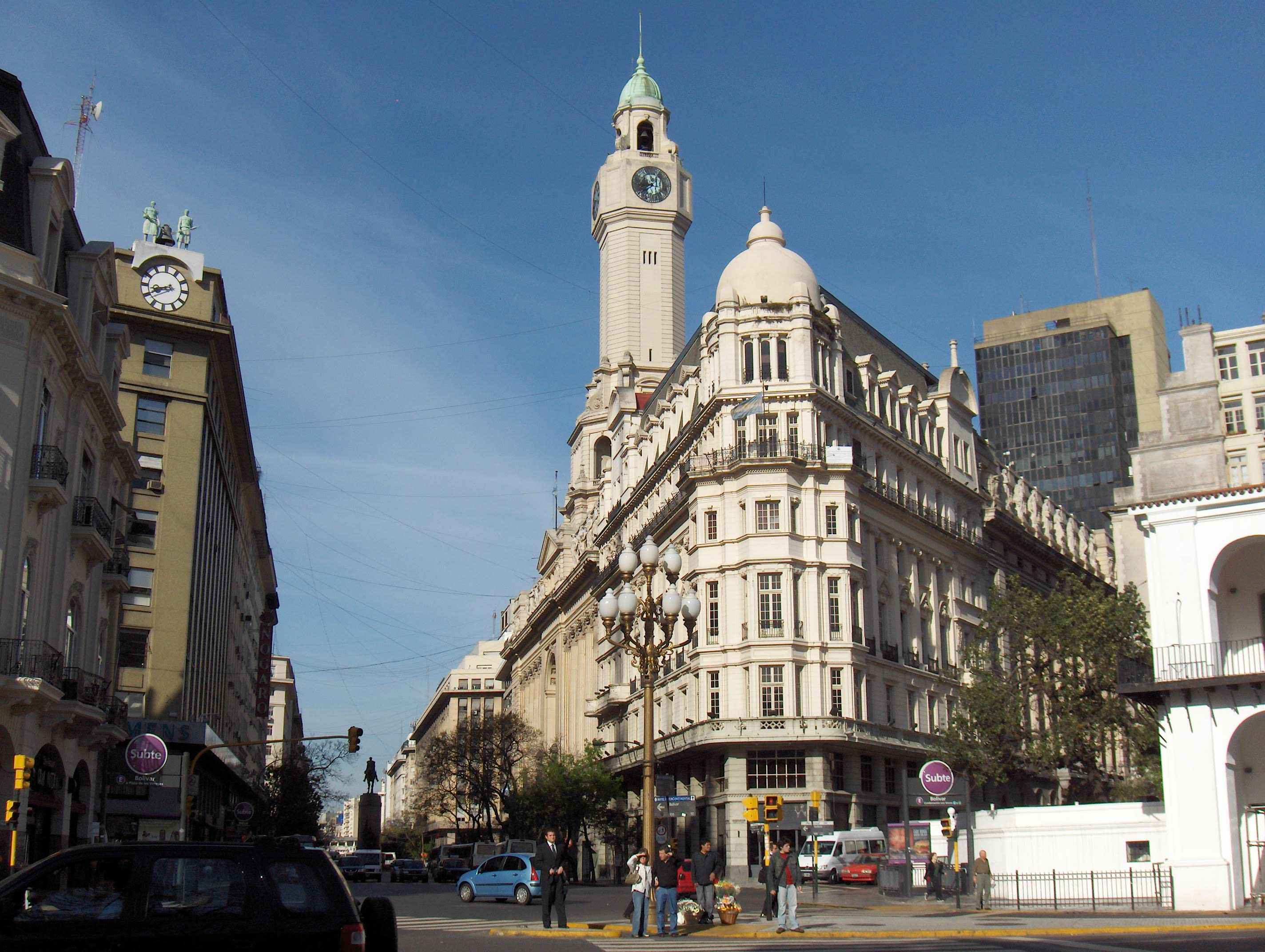
The Plaza de Mayo (; en, May Square) is a city square and main foundational site of Buenos Aires, Argentina. It was formed in 1884 after the demolition of the Recova building, unifying the city's Plaza Mayor and Plaza de Armas, by that time known as ''Plaza de la Victoria'' and ''Plaza 25 de Mayo,'' respectively. The city centre of Buenos Aires, Plaza de Mayo has been the scene of the most momentous events in Argentine history, as well as the largest popular demonstrations in the country. On the occasion of the first anniversary of the May Revolution in 1811, the Pirámide de Mayo ( en, May Pyramid) was inaugurated in the square's hub, becoming Buenos Aires' first national monument. It is located in the financial district known as '' microcentro'', within the ''barrio'' ( en, neighborhood) of Monserrat. It is bounded by Bolívar, Hipólito Yrigoyen, Balcarce and Avenida Rivadavia streets; and from its west side three important avenues are born: Avenida Presidente Julio Argenti ... [...More Info...] [...Related Items...] OR: [Wikipedia] [Google] [Baidu] |
Monserrat, Buenos Aires
Monserrat or Montserrat () is a neighbourhood in the east of the Buenos Aires CBD. The district features some of the most important public buildings in Buenos Aires, including city hall, the city legislature, Casa Rosada, the Colegio Nacional de Buenos Aires and the Libertador Building (Ministry of Defense), among others. Avenida de Mayo runs through the Monserrat district, connecting Plaza de Mayo and the Plaza de los Dos Congresos (Congressional Plaza). A block, or two, south of the Plaza de Mayo, the older section of Monserrat begins. This is Buenos Aires' oldest neighborhood and even today, very little of the cityscape there is less than a hundred years old (except along Belgrano Avenue), thereby making a nearly seamless transition to the likewise historic San Telmo district, to the south. History The Monserrat area traces its origins to the foundation of Buenos Aires itself, when, in 1580, Spanish Adelantado Juan de Garay disembarked on the area's shores. The Fort ... [...More Info...] [...Related Items...] OR: [Wikipedia] [Google] [Baidu] |
Buenos Aires CBD
The Buenos Aires Central Business District is the main commercial centre of Buenos Aires, Argentina, though not an official city ward. While the '' barrios'' of Puerto Madero and Retiro house important business complexes and modern high-rise architecture, the area traditionally known as ''Microcentro'' (Spanish: Microcenter) is located within San Nicolás and Monserrat, roughly coinciding with the area around the historic center of the Plaza de Mayo. The ''Microcentro'' has a wide concentration of offices, service companies and banks, and a large circulation of pedestrians on working days. Another name given to this unofficial ''barrio'' is ''La City'', which refers more precisely to an even smaller sector within the ''Microcentro'', where almost all the banking headquarters of the country are concentrated. Overview The area was the site of the first European settlement in what later became Buenos Aires. Its south–north axis runs along Leandro Alem Avenue, from Belgrano A ... [...More Info...] [...Related Items...] OR: [Wikipedia] [Google] [Baidu] |
Line E (Buenos Aires Underground)
Line E of the Buenos Aires Underground runs from Retiro to Plaza de los Virreyes, a total distance of 12 km. Opened in 1944, the Line E was the last completely new line to be added to the Buenos Aires Underground, until 2007 when Line H was opened. The line has a history of being re-routed and extended due to having been historically the line with the lowest passenger numbers on the network. History Line E was opened on 20 June 1944, after construction began in 1938, with an original route that ran from Constitución railway station to General Urquiza. Soon after, it was decided to abandon the terminus at Constitución (which also served as the connection with Line C) and instead reroute the line towards the Plaza de Mayo. Work began in 1957, and in 1966 the San José, Independencia, Belgrano and Plaza de Mayo (now Bolívar) stations were opened to the public by president Arturo Umberto Illia. For many years, the two stations that had been closed as a result of th ... [...More Info...] [...Related Items...] OR: [Wikipedia] [Google] [Baidu] |
Bolívar (Buenos Aires Underground)
Bolívar is a station on Line E of the Buenos Aires Underground at is located on the Diagonal Sur avenue by the Plaza de Mayo The Plaza de Mayo (; en, May Square) is a city square and main foundational site of Buenos Aires, Argentina. It was formed in 1884 after the demolition of the Recova building, unifying the city's Plaza Mayor and Plaza de Armas, by that time know .... Subterráneos de Buenos Aires S.E. From here, passengers may transfer to the Perú Station on Line A and the [...More Info...] [...Related Items...] OR: [Wikipedia] [Google] [Baidu] |
Line D (Buenos Aires Underground)
Line D of the Buenos Aires Underground runs from Catedral to Congreso de Tucumán. The line opened on 3 June 1937 and has been expanded to the north several times. The line is currently 11 km long and has 16 stations, while running approximately parallel to the city's coastline. History Line D was the second line to be built by the Compañía Hispano Argentina de Obras Públicas y Finanzas (CHADOPyF, Hispanic-Argentine Company for Public Works and Finances), following the construction of Line C in 1934. Construction began in 1935 and the first part of the line was inaugurated in 1937 and ran 1.7 km from Catedral (still the current terminus) to Tribunales. Three years later, the section which brought the line to Plaza Italia in Palermo was completed, bringing the length of the line to 6.5 km. The line was not properly extended until 1993 when it was extended to Ministro Caranza, a station named after the Radical politician. Further extensions occurred in t ... [...More Info...] [...Related Items...] OR: [Wikipedia] [Google] [Baidu] |
Catedral (Buenos Aires Underground)
Catedral is a terminal station of the Line D of the Buenos Aires Underground. From here, passengers may transfer to the Perú station on Line A and the Bolívar station on Line E. Overview It is located at the intersection of Roque Sáenz Peña Avenue and Florida Street, which gave the original name of the station. Its current name comes from the Buenos Aires Metropolitan Cathedral, located in the vicinity of the station. This station had the name ''Florida'', as recorded on maps of the network of 1955. The station was inaugurated on 3 June 1937 as part of the inaugural section of Line D, between Catedral and Tribunales. In 1997 it was declared a national historic monument. (Spanish) Retrieved 8 November 2010 The station was used as a set in the 1996 Argentine science fiction film [...More Info...] [...Related Items...] OR: [Wikipedia] [Google] [Baidu] |
Line A (Buenos Aires Underground)
Line A is the oldest line of the Buenos Aires Underground. Opened to the public on 1 December 1913, it was the first underground line in South America, the Southern Hemisphere and the Spanish-speaking world. It made Buenos Aires the 13th city in the world to have an underground transport service. The line stretches 9.8 km from Plaza de Mayo and San Pedrito and runs under the full length of the Avenida de Mayo and part of the Avenida Rivadavia, and is used by 258,000 people per day. On the first day of public service (18 December 1913), it carried 220,000 passengers.Subterráneos de Buenos Aires (Official Page) History of Line A – Retrieved 2010-11-04 Line A used the |
Plaza De Mayo (Buenos Aires Underground)
Plaza de Mayo is a station on Line A of the Buenos Aires Underground. This station belonged to the first section of line opened on 1 December 1913, linking the station with the station of Plaza Miserere. Overview It lies at the intersection of Hipólito Yrigoyen and Defensa, in the neighborhood of Montserrat. It's a busy station because it is the head of the line A and is in the historic centre of Buenos Aires. Nearby are some of the most important public buildings in the country such as the Casa Rosada, the Ministry of Economy, the Metropolitan Cathedral and the Buenos Aires City Hall. There is also the Plaza de Mayo, tourist and protest centre where the Pirámide de Mayo is located. A few hundred metres is located the Puerto Madero district, another of the city's tourist zones. The station was named in honor of Plaza de Mayo, the most important square of the city. The Plaza was in colonial times the main square (''Plaza Mayor'') around which the city was formed, always bein ... [...More Info...] [...Related Items...] OR: [Wikipedia] [Google] [Baidu] |
Buenos Aires Underground
The Buenos Aires Underground ( es, Subterráneo de Buenos Aires, links=no), locally known as Subte (), is a rapid transit system that serves the area of the city of Buenos Aires, Argentina. The first section of this network (Plaza de Mayo–Plaza Miserere) opened in 1913, making it the 13th subway in the world and the first underground railway in Latin America, the Southern Hemisphere, and the Spanish-speaking world, with the Madrid Metro opening five years later, in 1919. As of 2022, Buenos Aires is the only Argentine city with a metro system. Currently, the underground network's six lines—A, B, C, D, E, and H—comprise of routes that serve 90 stations. The network is complemented by the Premetro line, and the Urquiza suburban line, with 17 more stations in total. Traffic on lines moves on the left because Argentina drove on the left at the time the system opened. Over a million passengers use the network, which also provides connections with the city's extensive comm ... [...More Info...] [...Related Items...] OR: [Wikipedia] [Google] [Baidu] |
President Of Argentina
The president of Argentina ( es, Presidente de Argentina), officially known as the president of the Argentine Nation ( es, Presidente de la Nación Argentina), is both head of state and head of government of Argentina. Under Constitution of Argentina, the national constitution, the president is also the Head of government, chief executive of the Government of Argentina, federal government and commander-in-chief of the Armed Forces of the Argentine Republic, armed forces. Throughout Argentine history, the List of heads of state of Argentina, office of head of state has undergone many changes, both in its title as in its features and powers. Current president Alberto Fernández was sworn into office on 10 December 2019. He succeeded Mauricio Macri. The constitution of Argentina, along with several constitutional amendments, establishes the requirements, powers, and responsibilities of the president and term of office and the method of election. History The origins of Argentina ... [...More Info...] [...Related Items...] OR: [Wikipedia] [Google] [Baidu] |
Avenida De Mayo
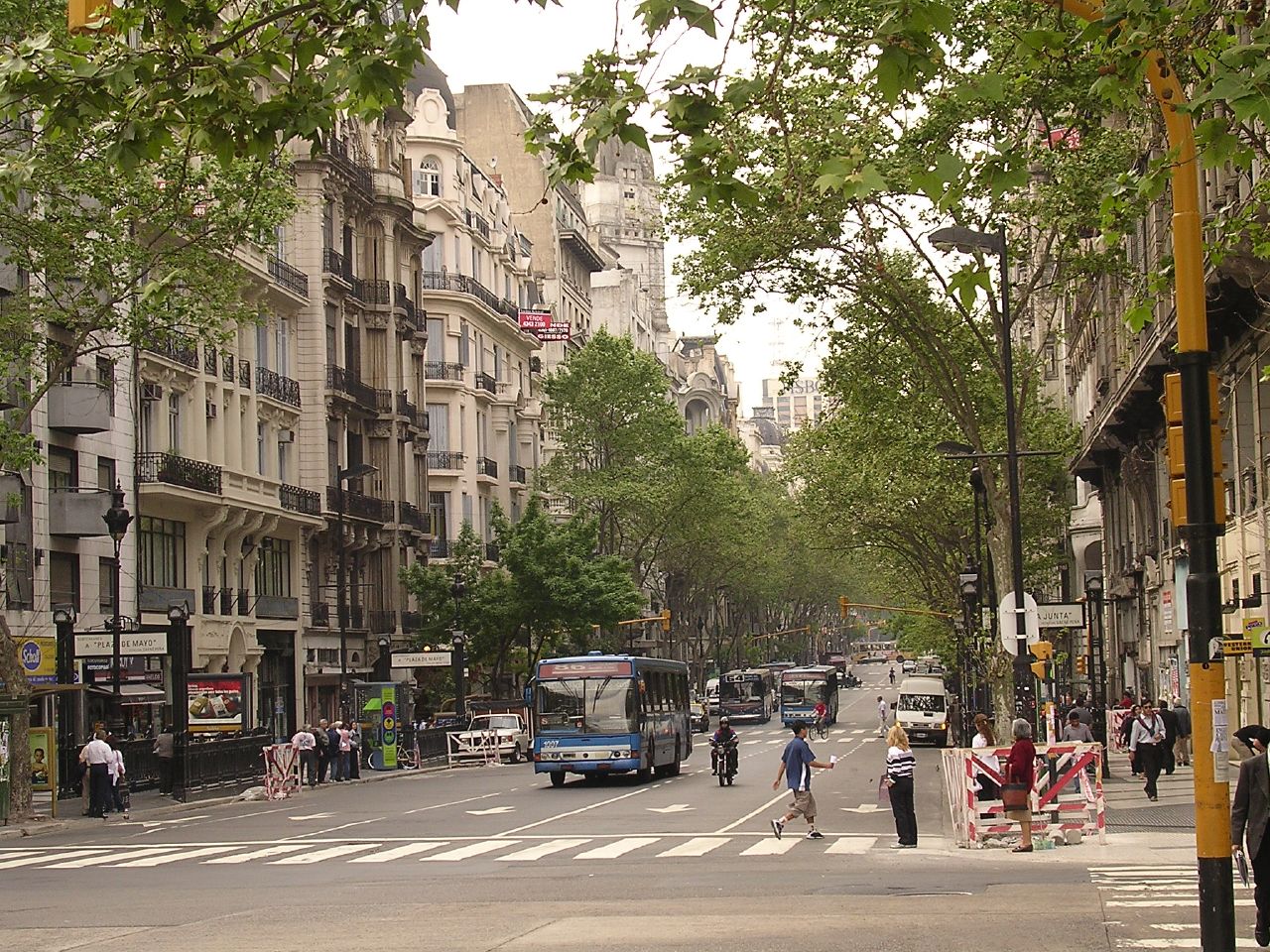
May Avenue ( es, Avenida de Mayo) is an avenue in Buenos Aires, capital of Argentina. It connects the Plaza de Mayo with Congressional Plaza, and extends in a west–east direction before merging into Rivadavia Avenue. History and overview Built on an initiative by Mayor Torcuato de Alvear, work began in 1885 and was completed in 1894. The avenue is often compared with ''La Gran Vía'' in Madrid, although the Spanish avenue was built later (1910). It is also compared to those in Paris or Barcelona due to its sophisticated buildings of art nouveau, neoclassic and eclectic styles. The avenue was named in honor of the May Revolution of 1810 (the event that led to Argentine Independence). The site of the assembly that touched off the revolution (the Buenos Aires Cabildo) was partially demolished in 1888 to make way for the avenue's entry into Plaza de Mayo. The avenue's layout, built through existing urban blocks instead of via the widening of a parallel street, was designed by ... [...More Info...] [...Related Items...] OR: [Wikipedia] [Google] [Baidu] |
Avenida Roque Sáenz Peña
Avenida Roque Sáenz Peña, better known as Diagonal Norte (Spanish for "North Diagonal", the counterpart to Diagonal Sur), is an important avenue in the San Nicolás neighborhood of Buenos Aires, Argentina. It is oriented south-east/north-west, diagonally bisecting the city blocks (''manzanas'') which give the city centre a checkerboard plan. It is named after President Roque Sáenz Peña, who held power from 1910 to 1914 and passed the law which established universal suffrage, secret ballot and an electoral register. Connections The north-west corner of Plaza de Mayo is the start of Avenida Presidente Roque Sáenz Peña (i.e. the corner of Avenida Rivadavia and San Martín street), just to the north of the city hall. It runs directly to the northwest and diagonally crosses the following streets: Bartolomé Mitre, Juan Domingo Perón and Sarmiento, and calle Florida, Maipú, Esmeralda, Suipacha and the Carabelas passage, before arriving at Plaza de la República, location of t ... [...More Info...] [...Related Items...] OR: [Wikipedia] [Google] [Baidu] |


