|
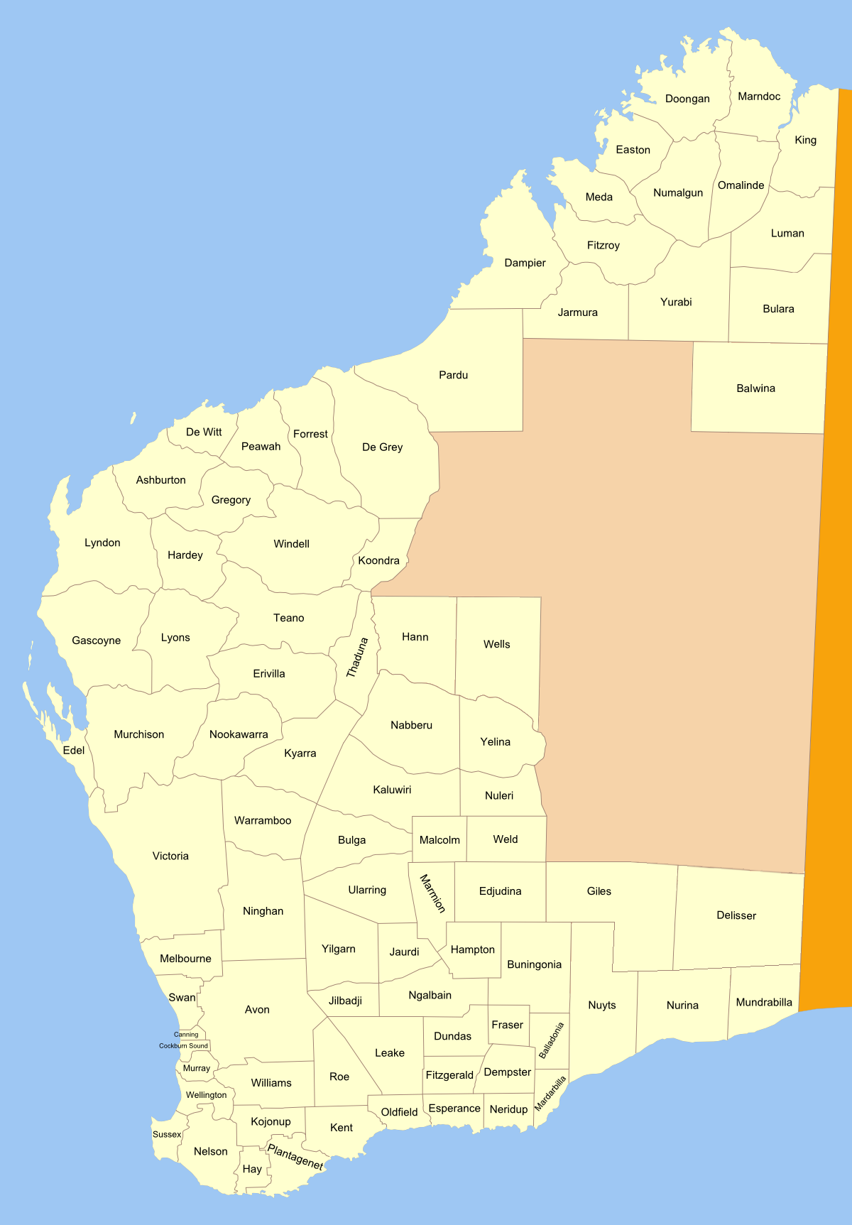
Plantagenet County, Western Australia
Plantagenet County was one of the 26 counties of Western Australia that were designated in 1829 as cadastral divisions, and was centred on the coastal settlement of Albany. It approximately corresponds to the modern-day Plantagenet Land District The lands administrative divisions of Western Australia refer to subdivisions of the state of Western Australia for cadastral (land title) purposes, most of which have been in place since the 19th century. The state is divided up for this purpose ... which forms the basis for land titles in the area. References External links Introduction to the Shire of Plantagenet {{Counties of Western Australia Counties of Western Australia ... [...More Info...] [...Related Items...] OR: [Wikipedia] [Google] [Baidu] |
Plantagenet County Location
The House of Plantagenet () was a royal house which originated from the lands of Anjou in France. The family held the English throne from 1154 (with the accession of Henry II at the end of the Anarchy) to 1485, when Richard III died in battle. Under the Plantagenets, England was transformed. The Plantagenet kings were often forced to negotiate compromises such as Magna Carta, which had served to constrain their royal power in return for financial and military support. The king was no longer considered an absolute monarch in the nation—holding the prerogatives of judgement, feudal tribute, and warfare—but now also had defined duties to the kingdom, underpinned by a sophisticated justice system. A distinct national identity was shaped by their conflict with the French, Scots, Welsh and Irish, as well as by the establishment of the English language as the primary language. In the 15th century, the Plantagenets were defeated in the Hundred Years' War and beset with social, ... [...More Info...] [...Related Items...] OR: [Wikipedia] [Google] [Baidu] |
Counties Of Western Australia
The lands administrative divisions of Western Australia refer to subdivisions of the state of Western Australia for cadastral (land title) purposes, most of which have been in place since the 19th century. The state is divided up for this purpose into five land divisions, which in turn are subdivided into land districts, which correspond to counties in other Australian states. These districts are then subdivided further into numbered locations, as well as gazetted townsites. Together, they form part of the lands administrative divisions of Australia. Land divisions There are five land divisions in Western Australia, as specified in Schedule 1 of the Land Administration Act 1997. *Eastern Land Division *Eucla Land Division * Kimberley Land Division *North West Land Division *South West Land Division The Rabbit-proof fence is the border between the North West and South West divisions on the western side, and the others on the eastern side. In practical terms, the divisions ar ... [...More Info...] [...Related Items...] OR: [Wikipedia] [Google] [Baidu] |
Lands Administrative Divisions Of Western Australia
The lands administrative divisions of Western Australia refer to subdivisions of the state of Western Australia for cadastral (land title) purposes, most of which have been in place since the 19th century. The state is divided up for this purpose into five land divisions, which in turn are subdivided into land districts, which correspond to counties in other Australian states. These districts are then subdivided further into numbered locations, as well as gazetted townsites. Together, they form part of the lands administrative divisions of Australia. Land divisions There are five land divisions in Western Australia, as specified in Schedule 1 of the Land Administration Act 1997. *Eastern Land Division *Eucla Land Division * Kimberley Land Division *North West Land Division *South West Land Division The Rabbit-proof fence is the border between the North West and South West divisions on the western side, and the others on the eastern side. In practical terms, the divisions ar ... [...More Info...] [...Related Items...] OR: [Wikipedia] [Google] [Baidu] |
Albany, Western Australia
Albany ( ; nys, Kinjarling) is a port city in the Great Southern region in the Australian state of Western Australia, southeast of Perth, the state capital. The city centre is at the northern edge of Princess Royal Harbour, which is a part of King George Sound. The central business district is bounded by Mount Clarence to the east and Mount Melville to the west. The city is in the local government area of the City of Albany. While it is the oldest colonial, although not European, settlement in Western Australia - predating Perth and Fremantle by over two years - it was a semi-exclave of New South Wales for over four years until it was made part of the Swan River Colony. The settlement was founded on 26 December 1826 as a military outpost of New South Wales for the purpose of forestalling French ambitions in the region. To that end, on 21 January 1827, the commander of the outpost, Major Edmund Lockyer, formally took possession for the British Crown of the portion of N ... [...More Info...] [...Related Items...] OR: [Wikipedia] [Google] [Baidu] |
Plantagenet Land District
The lands administrative divisions of Western Australia refer to subdivisions of the state of Western Australia for cadastral (land title) purposes, most of which have been in place since the 19th century. The state is divided up for this purpose into five land divisions, which in turn are subdivided into land districts, which correspond to counties in other Australian states. These districts are then subdivided further into numbered locations, as well as gazetted townsites. Together, they form part of the lands administrative divisions of Australia. Land divisions There are five land divisions in Western Australia, as specified in Schedule 1 of the Land Administration Act 1997. *Eastern Land Division *Eucla Land Division * Kimberley Land Division *North West Land Division *South West Land Division The Rabbit-proof fence is the border between the North West and South West divisions on the western side, and the others on the eastern side. In practical terms, the divisions ar ... [...More Info...] [...Related Items...] OR: [Wikipedia] [Google] [Baidu] |


