|
Plackwald
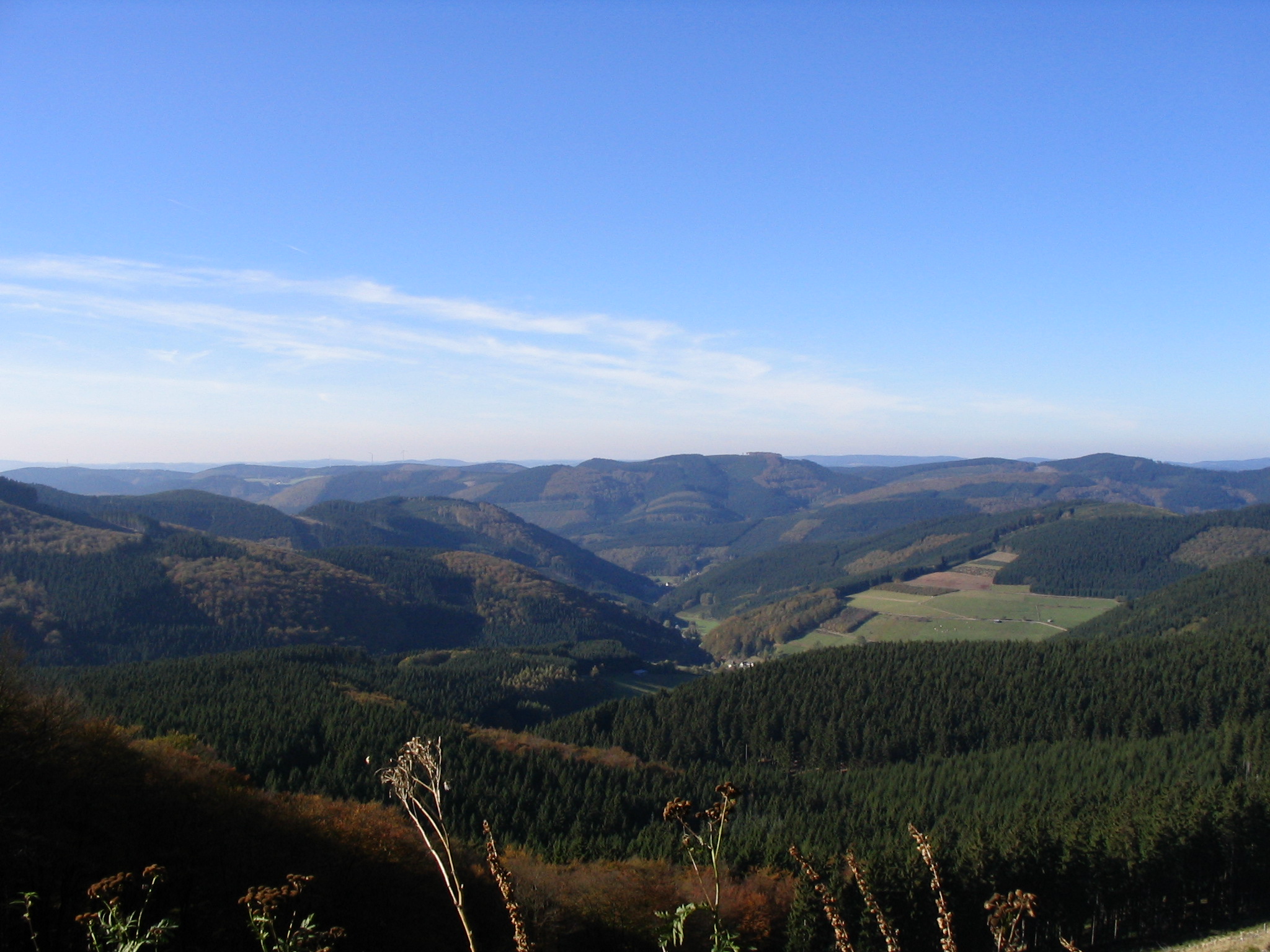
The Plackwald is a ridge of hills, up to , and part of the Rhenish Massif in the counties of Soest and Hochsauerlandkreis, North Rhine-Westphalia, Germany. Within the North Sauerland Highlands (Unit number 334) it forms the natural region sub-unit of ''Plackweghöhe (Plackwald)'' (334.5). Geography Location The Plackwald lies in the Arnsberg Forest Nature Park between Meschede in the south and Warstein in the north. It runs from the northeast of the town of Arnsberg in the west to the village of Esshoff in the borough of Brilon in the east. As part of the watershed between the River Ruhr in the south and its tributary, the Möhne, in the north it consists of a chain of hills with the Plackweghöhe (581.5 m) as its highest point, whose name is a synonym for the hill ridge either side of the Plackweg, a long-distance path. Its main transport axis is the B 55 federal highway that divides the region roughly in the centre at the pass of Stimmstamm (541.1 m). Amongst ... [...More Info...] [...Related Items...] OR: [Wikipedia] [Google] [Baidu] |
Plackweghöhe
The Plackweghöhe ("Plackweg Heights"), whose main summit has hitherto had no official name, is the highest point in the borough of Warstein, the hill ridge of the Plackwald, the North Sauerland Uplands, and the Arnsberg Forest Nature Park in the German state of North Rhine-Westphalia. It is and lies within the counties of Soest and Hochsauerlandkreis. The Lörmecke Tower observation tower at the top is a popular destination. Geography Location The Plackweghöhe lies in the northern Sauerland. In the area of its main summit it is around 5 km south of Warstein (in Soest) and about 3 km north-northeast of Meschede (in Hochsauerlandkreis). It is linked via the ''Plackweg'' forest track with the Stimmstamm Pass (541.1 m) over the Plackwald hills about 2.85 km away to the west as the crow flies on the B 55 federal highway. The area is drained towards the south into the nearby River Ruhr and to the north to the Ruhr's tributary, the Möhne, several kilometre ... [...More Info...] [...Related Items...] OR: [Wikipedia] [Google] [Baidu] |
Rhenish Massif
The Rhenish Massif, Rhine Massif or Rhenish Uplands (german: Rheinisches Schiefergebirge, : 'Rhenish Slate Uplands') is a geologic massif in western Germany, eastern Belgium, Luxembourg and northeastern France. It is drained centrally, south to north by the river Rhine and a few of its tributaries. West of the indent of the Cologne Bight it has the Eifel and the Belgian and French Ardennes; east is its greatest German component, the Süder Uplands. The Hunsrück hills form its southwest. The Westerwald is an eastern strip. The Lahn-Dill area is a small central zone and the Taunus Mountains form the rest, the south-east. The massif hosts the Middle Rhine Valley (Rhine Gorge), a UNESCO World Heritage site linked to the lowest parts of the Moselle (german: Mosel, lb, Musel). Geology Geologically the Rhenish Massif consists of metamorphic rocks, mostly slates (hence its German name), deformed and metamorphosed during the Hercynian orogeny (around 300 million years ago). Most o ... [...More Info...] [...Related Items...] OR: [Wikipedia] [Google] [Baidu] |
Süder Uplands
The Süder Uplands (1997) by Verlag Siedlungsforschung, p. 47, Retrieved 15 May 2014. (german: Süderbergland, sometimes ''Südergebirge'' i.e. Süder Hills), form a major natural region (no. 33 or D38) of the in the German states of and northwestern |
Lörmecke Tower
Lörmecke is a river of North Rhine-Westphalia, Germany. It flows into the Glenne near Warstein-Suttrop. See also *List of rivers of North Rhine-Westphalia A list of rivers of North Rhine-Westphalia, Germany: A * Aa, left tributary of the Möhne * Aa, left tributary of the Nethe * Aa, left tributary of the Werre * Aabach, tributary of the Afte * Aabach, small river in the Ems river system * Abbabac ... References Rivers of North Rhine-Westphalia Rivers of Germany {{NorthRhineWestphalia-river-stub ... [...More Info...] [...Related Items...] OR: [Wikipedia] [Google] [Baidu] |
Brilon Plateau
The Brilon Plateau (german: Briloner Hochfläche) is a highland area in the county of Hochsauerlandkreis in the German state of North Rhine-Westphalia. It is surrounded by the Brilon Heights (''Briloner Höhen''), whose mountains reach a height of . Geography Location The countryside of the Brilon Plateau and Brilon Heights includes the town of Brilon itself and several of its municipalities. Administratively it belongs largely to Hochsauerlandkreis, in the northeast, near Bleiwäsche, it is part of the county of Paderborn. It is roughly elliptical in shape; its longitudinal axis running from east-northeast to west-southwest. To the north and northeast it transitions via the Alme Uplands into the Sintfeld. In the east and southeast it descends into the very deeply incised valley of the Hoppecke. In the south it is adjoined by the Sauerland and Upland (landscapes in the Rothaar Mountains); in the west by the Warstein Forest (the eastern part of the Arnsberg Forest ... [...More Info...] [...Related Items...] OR: [Wikipedia] [Google] [Baidu] |
Oeventrop (Arnsberg)
Arnsberg (; wep, Arensperg) is a town in the Hochsauerland county, in the German state of North Rhine-Westphalia. It is the location of the Regierungsbezirk Arnsberg administration and one of the three local administration offices of the Hochsauerlandkreis district. Geography Location Arnsberg is located in the north-east of the Sauerland in the Ruhr river valley. The river Ruhr meanders around the south of the old town of Arnsberg. The town is nearly completely encircled by forest, and the nature park ''Arnsberger Wald'' lies to the north". Arnsberg is connected by Federal Motorway 46 (Autobahn 46) Brilon in the east and (using the Federal Motorway 445) Werl in the west. It is also connected by several railroad stations, which provide a connection to the major city Dortmund and the Ruhrgebiet. There is also a regional airport, located in the city district of Vosswinkel, which is exclusively used for small private aircraft. The municipal territory spans a distance of up t ... [...More Info...] [...Related Items...] OR: [Wikipedia] [Google] [Baidu] |


