|
Pittston Area School District
Pittston Area School District (PASD) is a mid-sized school district located in the Greater Pittston area of Luzerne County, Pennsylvania, the north-eastern part of the state, in the United States. The school district serves students from the city of Pittston, the boroughs of Avoca, Dupont, Duryea, Hughestown, Yatesville, Jenkins, and Pittston townships. Pittston Area School District encompasses approximately 42 square miles. According to 2000 federal census data, it serves a resident population of 30,034. In 2069, the residents' per capita income was $16,811 and the median family income was $40,063. Per school district officials, in school year 2005–06, the PASD provided basic educational services to 3,147 pupils through the employment of 196 teachers, 159 full-time and part-time support personnel, and 10 administrators. PASD was created in 1969 by merging Pittston School District, Pittston Township School District, Hughestown School District, Dupont School District, Dur ... [...More Info...] [...Related Items...] OR: [Wikipedia] [Google] [Baidu] |
Greater Pittston
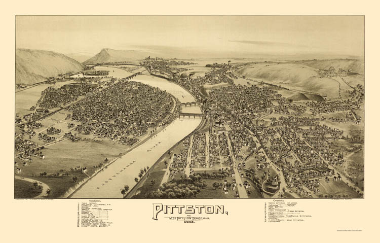
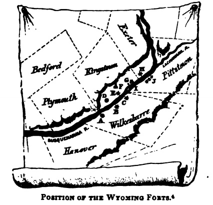
Greater Pittston is a 65.35 sq mi (169.25 km²) region in Luzerne County, Pennsylvania, in reference to the area in and around Pittston. As of 2010, the total population of Greater Pittston is 48,020. This region includes Avoca, Dupont, Duryea, Exeter Boro, Exeter Township, Hughestown, Jenkins Township, Laflin, Pittston Township, West Pittston, West Wyoming, Wyoming, and Yatesville. History * 1770s: English men, women, and children (European-Americans) started to settle in the Wyoming Valley of Northeastern Pennsylvania. * 1 July 1778: During the Revolutionary War, Fort Jenkins (a patriot stockade in present-day West Pittston) surrendered to the British (under Major John Butler). It was later burned to the ground. * 3 July 1778: A force of British soldiers, led by John Butler, with the assistance of about 700 Indians, attacked and killed nearly 300 Wyoming Valley settlers. Today in the Borough of Wyoming, a monument marks the gravesite of the victims ... [...More Info...] [...Related Items...] OR: [Wikipedia] [Google] [Baidu] |
Yatesville, Pennsylvania
Yatesville is a borough in the Greater Pittston area of Luzerne County, Pennsylvania. The population was 638 as of the 2020 census. History In 1809, Joel Hale built the first frame house in what is now known as Yatesville. Mr. Hale owned most of the borough site. On May 20, 1878, Yatesville broke away from Jenkins Township and became a borough. The first election for the new community was held in June. The first burgess was T. T. Hale. Geography Yatesville is located at (41.302947, -75.781651). According to the United States Census Bureau, the borough has a total area of , all land. The borough is served by the Pittston Area School District. Demographics At the 2000 census there were 649 people, 233 households, and 188 families in the borough. The population density was 1,171.1 people per square mile (455.6/km2). There were 241 housing units at an average density of 434.9 per square mile (169.2/km2). The racial makeup of the borough was 99.69% White, 0.15% African American, ... [...More Info...] [...Related Items...] OR: [Wikipedia] [Google] [Baidu] |
School Districts In Luzerne County, Pennsylvania
A school is an educational institution designed to provide learning spaces and learning environments for the teaching of students under the direction of teachers. Most countries have systems of formal education, which is sometimes compulsory. In these systems, students progress through a series of schools. The names for these schools vary by country (discussed in the '' Regional terms'' section below) but generally include primary school for young children and secondary school for teenagers who have completed primary education. An institution where higher education is taught is commonly called a university college or university. In addition to these core schools, students in a given country may also attend schools before and after primary (elementary in the U.S.) and secondary (middle school in the U.S.) education. Kindergarten or preschool provide some schooling to very young children (typically ages 3–5). University, vocational school, college or seminary may be availa ... [...More Info...] [...Related Items...] OR: [Wikipedia] [Google] [Baidu] |
School Districts Established In 1966
A school is an educational institution designed to provide learning spaces and learning environments for the teaching of students under the direction of teachers. Most countries have systems of formal education, which is sometimes compulsory. In these systems, students progress through a series of schools. The names for these schools vary by country (discussed in the '' Regional terms'' section below) but generally include primary school for young children and secondary school for teenagers who have completed primary education. An institution where higher education is taught is commonly called a university college or university. In addition to these core schools, students in a given country may also attend schools before and after primary (elementary in the U.S.) and secondary (middle school in the U.S.) education. Kindergarten or preschool provide some schooling to very young children (typically ages 3–5). University, vocational school, college or seminary may be availabl ... [...More Info...] [...Related Items...] OR: [Wikipedia] [Google] [Baidu] |
Charley Trippi
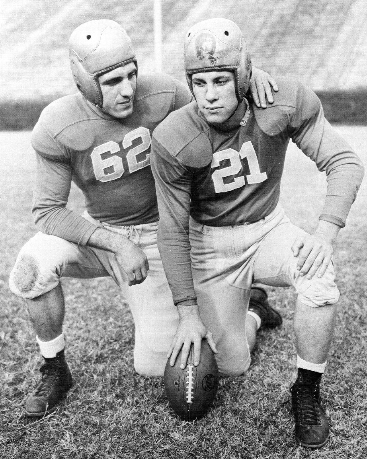
Charles Louis Trippi (December 14, 1921 – October 19, 2022) was an American professional football player for the Chicago Cardinals of the National Football League (NFL) from 1947 to 1955. Although primarily a running back, his versatility allowed him to fill a multitude of roles over his career, including quarterback, defensive back, punter, and return specialist. A " quintuple-threat", Trippi was adept at running, catching, passing, punting, and defense. Trippi attended the University of Georgia, where he played college football for the Georgia Bulldogs from 1942 to 1946, with an interlude in 1944 while serving in the military during World War II. As a sophomore, he guided Georgia to victory in the 1943 Rose Bowl and was named the game's most valuable player. As a senior in 1946, he won the Maxwell Award as the nation's most outstanding college football player, was named the Southeastern Conference's player of the year, and earned unanimous first-team All-America recogniti ... [...More Info...] [...Related Items...] OR: [Wikipedia] [Google] [Baidu] |
Jimmy Cefalo
James Carmen Cefalo (born October 6, 1956) is an American journalist, news broadcaster and sports broadcaster, radio talk show host, Voice of the Miami Dolphins, businessman, wine enthusiast and former professional American football wide receiver and game show host. Biography High school career Cefalo attended Pittston Area High School in Pittston, Pennsylvania. It was his performance there that led to his inclusion on The Pennsylvania Football News All-Century Team. Listed at 6-foot-1, 185 pounds during his senior year for head coach Bob Barbieri's Patriots, Cefalo was one of the nation's most highly recruited running backs. Cefalo is one of 50-plus people on Pittston's Inspiration Mural, which celebrates prominent figures in the Pittston community and is Pennsylvania's third-largest mural. Cefalo returned to Pittston Area for a football game as recently as September 2015. Penn State Cefalo was a standout at Penn State University from 1974 to 1977. He led the Nittany Lions ... [...More Info...] [...Related Items...] OR: [Wikipedia] [Google] [Baidu] |
Pittston Township, Pennsylvania
Pittston Township is a township in Luzerne County, Pennsylvania. The population was 3,179 as of the 2020 census. The township is located within the Greater Pittston region. As of 2010, the total population of Greater Pittston was 48,020. The Wilkes-Barre/Scranton International Airport is located in Pittston Township. History Establishment Pittston Township was one of the five original townships formed under the Susquehanna Land Company of Connecticut (in the Wyoming Valley). It was originally known as Pittstown (named for Sir William Pitt, an English statesman). Each township was originally five square miles and divided amongst forty settlers. The township was surveyed in 1768. But, in 1784, flood waters destroyed the surveyor's marks and an act was passed for a new survey to take place. After being resurveyed, the township grew to nearly thirty-six square miles. Zebulon Marcy was the first white settler to build a brush (or log) cabin in the township. Some may refer to him as ... [...More Info...] [...Related Items...] OR: [Wikipedia] [Google] [Baidu] |
Jenkins Township, Pennsylvania
Jenkins Township is a township in the Greater Pittston area of Luzerne County, Pennsylvania, United States. The population was 4,282 at the 2020 census. History Settlement Isaac Gould and Joseph Gardner were the first permanent settlers in modern-day Jenkins Township. The first important settlement in the territory was Joseph Gardner's gristmill in 1794 (on Gardner's Creek). The first schoolhouse was built in the early 1810s. Jenkins Township was formed from a section of Pittston Township on June 24, 1852. It was named after Col. John Jenkins (who settled the area with his family in 1769). He served as an officer in the American Revolution (1775-1782), and as a Representative of Luzerne County in the Pennsylvania Legislature (elected in 1797). Coal mining Logging and farming were the first major employers in the region, but due to the abundance of anthracite coal under the township, the coal mining industry quickly expanded. Port Griffith was named in honor of one of the orig ... [...More Info...] [...Related Items...] OR: [Wikipedia] [Google] [Baidu] |
Hughestown, Pennsylvania
Hughestown is a borough in the Greater Pittston area of Luzerne County, Pennsylvania, United States. The population was 1,326 at the 2020 census. History In 1934, the right arm of Hughestown resident Harry Tompkins was crushed by an Erie Railroad train. The resulting U.S. Supreme Court case, ''Erie Railroad Co. v. Tompkins'', laid the foundation for a large part of modern American civil procedure. Geography According to the United States Census Bureau, the borough has a total area of , all land. U.S. Route 11 runs through the southern portion of the borough. Hughestown is served by the Pittston Area School District. Robert Yaple Memorial Park is located in central Hughestown. Most of the homes and businesses are located in the western portion of the borough, while the eastern section consists of mostly forests and culm banks. Demographics At the 2000 census there were 1,541 people, 615 households, and 444 families living in the borough. The population density was 1,734.6 peop ... [...More Info...] [...Related Items...] OR: [Wikipedia] [Google] [Baidu] |
Luzerne County, Pennsylvania
Luzerne County is a county in the U.S. state of Pennsylvania. According to the U.S. Census Bureau, the county has a total area of , of which is land and is water. It is Northeastern Pennsylvania's second-largest county by total area. As of the 2020 census, the population was 325,594, making it the most populous county in the northeastern part of the state. The county seat and largest city is Wilkes-Barre. Other populous communities include Hazleton, Kingston, Nanticoke, and Pittston. Luzerne County is included in the Scranton–Wilkes-Barre–Hazleton Metropolitan Statistical Area, which has a total population of 555,426 as of 2017. On September 25, 1786, Luzerne County was formed from part of Northumberland County. It was named after Chevalier de la Luzerne, a French soldier and diplomat during the 18th century. When it was founded, Luzerne County occupied a large portion of Northeastern Pennsylvania. From 1810 to 1878, it was divided into several smaller counties. Th ... [...More Info...] [...Related Items...] OR: [Wikipedia] [Google] [Baidu] |
Duryea, Pennsylvania
Duryea is a borough in the Greater Pittston area of Luzerne County, Pennsylvania, United States, south of Scranton. The Susquehanna River marks Duryea's western boundary, and the Lackawanna River flows through Duryea. It was incorporated as a borough in 1901, and had a notable switching rail yard, the Duryea yard (or Muller yard), connecting the central Wyoming Valley to destinations in lower New York and down-state Pennsylvania (in Harrisburg and Philadelphia). Coal mining and silk manufacturing were the chief industries in Duryea's early years. The population was 5,032 at the 2020 census. History Early history The area now known as Duryea Borough was historically the heartland of the Susquehannock tribe, also called the Conestoga, which were an Iroquoian people whose territory extended from lower New York State to the Potomac. The Susquehannock befriended the Dutch traders by 1612, who soon began trading tools and firearms for furs. The Dutch had established their trading posts ... [...More Info...] [...Related Items...] OR: [Wikipedia] [Google] [Baidu] |
Dupont, Pennsylvania
Dupont is a borough in the Greater Pittston area of Luzerne County, Pennsylvania, United States. The population was 2,536 as of the 2020 census. History The community was incorporated as a borough in 1917; it was originally called "Smithville," in honor of its first group of settlers. The community was later renamed Dupont after ''Dupont Explosives'', a company which made explosives for mining. These explosives were used throughout Northeastern Pennsylvania in the 19th and 20th centuries. Dupont Explosives eventually closed after the advancement of technology in gathering coal. Geography Dupont is located at (41.321680, -75.746285). According to the United States Census Bureau, the borough has a total area of , all land. Transportation Demographics As of the census of 2000, there were 2,719 people, 1,228 households, and 789 families living in the borough. The population density was 1,790.9 people per square mile (690.7/km2). There were 1,354 housing units at an average de ... [...More Info...] [...Related Items...] OR: [Wikipedia] [Google] [Baidu] |


