|
Pinnacle Gulch
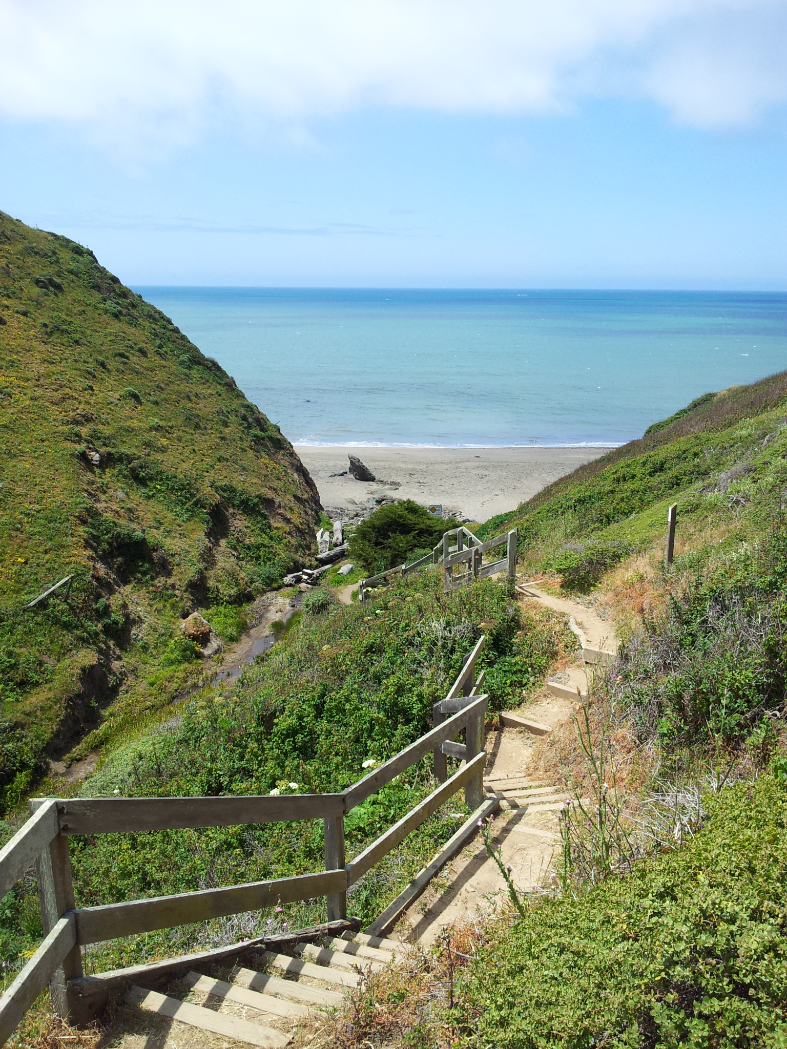
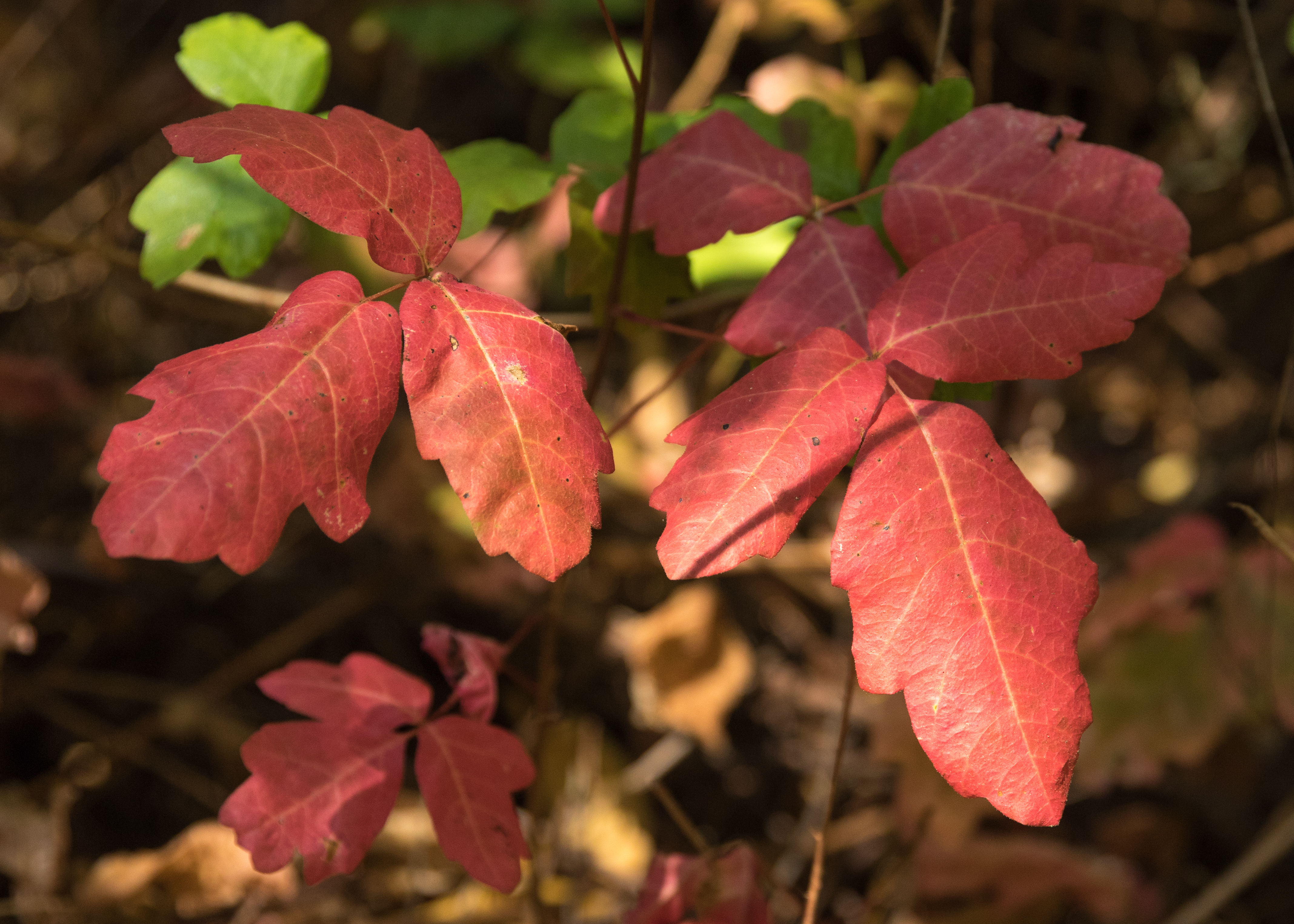
Pinnacle Gulch and Shorttail Gulch are coastal access trails served by the same Sonoma County Regional Parks Department parking lot. The trails provide beach and tidepool access to the Pacific Coast of northern California in the United States. The trails are located south of Bodega Bay in Sonoma County. Automobile access from California State Route 1 is via Harbor Way just south of downtown Bodega Bay, California. A fee or Sonoma County Regional Parks pass is required for use of the trail head parking lot and rest room. The Pinnacle Gulch coastal access trail begins across Mockingbird Road from the parking lot at 20600 Mockingbird in the residential subdivision of Bodega Harbor. The Shorttail Gulch coastal access trail is reached by walking south from the parking lot along Mockingbird and Osprey roads. Both trails follow steep ravines eroded through Pleistocene marine and marine terrace deposits supporting northern coastal scrub including thick growth of poison oak. The be ... [...More Info...] [...Related Items...] OR: [Wikipedia] [Google] [Baidu] |
Ravine
A ravine is a landform that is narrower than a canyon and is often the product of streambank erosion.Definition of "ravine" at Ravines are typically classified as larger in scale than , although smaller than s. Ravines may also be called a cleuch, dell, ghout (), [...More Info...] [...Related Items...] OR: [Wikipedia] [Google] [Baidu] |
Tide
Tides are the rise and fall of sea levels caused by the combined effects of the gravity, gravitational forces exerted by the Moon (and to a much lesser extent, the Sun) and are also caused by the Earth and Moon orbiting one another. Tide tables can be used for any given locale to find the predicted times and amplitude (or "tidal range"). The predictions are influenced by many factors including the alignment of the Sun and Moon, the #Phase and amplitude, phase and amplitude of the tide (pattern of tides in the deep ocean), the amphidromic systems of the oceans, and the shape of the coastline and near-shore bathymetry (see ''#Timing, Timing''). They are however only predictions, the actual time and height of the tide is affected by wind and atmospheric pressure. Many shorelines experience semi-diurnal tides—two nearly equal high and low tides each day. Other locations have a diurnal cycle, diurnal tide—one high and low tide each day. A "mixed tide"—two uneven magnitude ... [...More Info...] [...Related Items...] OR: [Wikipedia] [Google] [Baidu] |
Hiking
Hiking is a long, vigorous walk, usually on trails or footpaths in the countryside. Walking for pleasure developed in Europe during the eighteenth century.AMATO, JOSEPH A. "Mind over Foot: Romantic Walking and Rambling." In ''On Foot: A History of Walking'', 101-24. NYU Press, 2004. Accessed March 1, 2021. http://www.jstor.org/stable/j.ctt9qg056.7. Religious pilgrimages have existed much longer but they involve walking long distances for a spiritual purpose associated with specific religions. "Hiking" is the preferred term in Canada and the United States; the term "walking" is used in these regions for shorter, particularly urban walks. In the United Kingdom and the Republic of Ireland, the word "walking" describes all forms of walking, whether it is a walk in the park or backpacking in the Alps. The word hiking is also often used in the UK, along with rambling , hillwalking, and fell walking (a term mostly used for hillwalking in northern England). The term bushwalking is end ... [...More Info...] [...Related Items...] OR: [Wikipedia] [Google] [Baidu] |
Recreational Fishing
Recreational fishing, also called sport fishing or game fishing, is fishing for leisure, exercise or competition. It can be contrasted with commercial fishing, which is professional fishing for profit; or subsistence fishing, which is fishing for survival and livelihood. The most common form of recreational fishing is angling, which is done with a rig of rod, reel, line, hooks and any one of a wide range of baits, as well as other complementary devices such as weights, floats, swivels and method feeders, collectively referred to as '' terminal tackles''. Lures are frequently used in place of fresh bait when fishing for predatory fishes. Some hobbyists hand-make custom tackles themselves, including plastic lures and artificial flies. Other forms of recreational fishing include spearfishing, which is done with a speargun or harpoon usually while diving; and bowfishing, with is done from above the water with archery equipments such as a compound bow or crossbow. Noodl ... [...More Info...] [...Related Items...] OR: [Wikipedia] [Google] [Baidu] |
Toxicodendron Diversilobum
''Toxicodendron diversilobum'' (syn. ''Rhus diversiloba''), commonly named Pacific poison oak or western poison oak, is a woody vine or shrub in the sumac family, Anacardiaceae. It is widely distributed in western North America, inhabiting conifer and mixed broadleaf forests, woodlands, grasslands, and chaparral biomes.C. Michael Hogan (2008)"Western poison-oak: ''Toxicodendron diversilobum''", GlobalTwitcher, ed. Nicklas Strömberg Peak flowering occurs in May. Like other members of the genus ''Toxicodendron'', ''T. diversilobum'' causes itching and allergic rashes in most people after contact by touch or smoke inhalation. Despite its name, it is not closely related to oaks. Description ''Toxicodendron diversilobum'' is extremely variable in growth habit and leaf appearance. It grows as a dense tall shrub in open sunlight, a treelike vine and may be more than long with an trunk, as dense thickets in shaded areas, or any form in between. It reproduces by spreading rhiz ... [...More Info...] [...Related Items...] OR: [Wikipedia] [Google] [Baidu] |
Northern Coastal Scrub
Northern coastal scrub is a scrubland plant community of California and Oregon. It occurs along the Pacific Coast from Point Sur on the Central California coast in Monterey County, California, to southern Oregon. It frequently forms a landscape mosaic with coastal prairie. The Northern coastal scrub's predominant plants are low evergreen shrubs and herbs. Characteristic shrubs include coyote brush ''(Baccharis pilularis)'', California yerba santa ''(Eriodictyon californicum)'', coast silk-tassel ''(Garrya elliptica)'', salal ''(Gaultheria shallon)'', and yellow bush lupine ''(Lupinus arboreus)''. Herbaceous Northern coastal scrub species include western blue-eyed grass ''(Sisyrinchium bellum)'', Douglas iris ''(Iris douglasiana)'', and native grasses. See also *Coastal sage scrub *California coastal prairie *California coastal sage and chaparral ecoregion *Native grasses of California Native may refer to: People * Jus soli, citizenship by right of birth * Indigenous peop ... [...More Info...] [...Related Items...] OR: [Wikipedia] [Google] [Baidu] |
Marine Terrace
A raised beach, coastal terrace,Pinter, N (2010): 'Coastal Terraces, Sealevel, and Active Tectonics' (educational exercise), from 2/04/2011/ref> or perched coastline is a relatively flat, horizontal or gently inclined surface of marine origin,Pirazzoli, PA (2005a): 'Marine Terraces', in Schwartz, ML (ed) ''Encyclopedia of Coastal Science.'' Springer, Dordrecht, pp. 632–633 mostly an old abrasion platform which has been lifted out of the sphere of wave activity (sometimes called "tread"). Thus, it lies above or under the current sea level, depending on the time of its formation.Strahler AH; Strahler AN (2005): ''Physische Geographie.'' Ulmer, Stuttgart, 686 p.Leser, H (ed)(2005): ‚''Wörterbuch Allgemeine Geographie.'' Westermann&Deutscher Taschenbuch Verlag, Braunschweig, 1119 p. It is bounded by a steeper ascending slope on the landward side and a steeper descending slope on the seaward side (sometimes called "riser"). Due to its generally flat shape, it is often used for ... [...More Info...] [...Related Items...] OR: [Wikipedia] [Google] [Baidu] |
Pleistocene
The Pleistocene ( , often referred to as the ''Ice age'') is the geological Epoch (geology), epoch that lasted from about 2,580,000 to 11,700 years ago, spanning the Earth's most recent period of repeated glaciations. Before a change was finally confirmed in 2009 by the International Union of Geological Sciences, the cutoff of the Pleistocene and the preceding Pliocene was regarded as being 1.806 million years Before Present (BP). Publications from earlier years may use either definition of the period. The end of the Pleistocene corresponds with the end of the last glacial period and also with the end of the Paleolithic age used in archaeology. The name is a combination of Ancient Greek grc, label=none, πλεῖστος, pleīstos, most and grc, label=none, καινός, kainós (latinized as ), 'new'. At the end of the preceding Pliocene, the previously isolated North and South American continents were joined by the Isthmus of Panama, causing Great American Interchang ... [...More Info...] [...Related Items...] OR: [Wikipedia] [Google] [Baidu] |
Bodega Bay, California
Bodega Bay is a village and census-designated place (CDP) in Sonoma County, California, United States. The population was 912 at the 2020 census. The town, located along State Route 1, is on the eastern side of Bodega Harbor, an inlet of Bodega Bay on the Pacific coast. History Bodega Bay is the site of the first Russian structures built in California, which were erected in 1809 by Commerce Counseller Ivan Alexandrovich Kuskov of the Russian-American Company in the lead-up to the establishment of Fort Ross. The Russians named the settlement in Bodega Bay Port Rumyantsev after the Russian Foreign Minister Nikolai Petrovich Rumyantsev, and it served as a port to support Fort Ross and the larger Russian community known as Colony Ross. The town is now named in honor of Juan Francisco de la Bodega y Quadra, a Spanish naval officer who explored the west coast of North America as far north as Alaska during multiple voyages of discovery in the late 18th century. The location scenes ... [...More Info...] [...Related Items...] OR: [Wikipedia] [Google] [Baidu] |
Sonoma County Regional Parks Department
Sonoma County, California, United States, U.S.A. has numerous regional parks, beaches, trails, and other facilities that are maintained by the Sonoma County Regional Parks Department. Sonoma County regional parks typically provide facilities for hiking, picnicking, Equestrianism, horseback riding, and mountain biking. Some Parks Department facilities are trails for day-hiking or accessing beaches along the rugged Pacific coast. Certain facilities include human swimming, swimming areas, skateparks, dog parks, basketball courts, sports fields, and playgrounds. Marinas and river parks typically offer fishing and Boating, boat ramps. See also * List of beaches in Sonoma County, California * Regional park * Sonoma County Historic Landmarks and Districts References {{reflist * Sonoma County Regional Parks Map and Guide, Revised March, 2011. External links Sonoma County Regional Parks homepage *https://sonomacounty.ca.gov/Parks/Planning/Mark-West-Creek-Park-and-Preserve/ ... [...More Info...] [...Related Items...] OR: [Wikipedia] [Google] [Baidu] |
California State Route 1
State Route 1 (SR 1) is a major north–south state highway that runs along most of the Pacific coastline of the U.S. state of California. At , it is the longest state route in California, and the second-longest in the US after Montana Highway 200. SR 1 has several portions designated as either Pacific Coast Highway (PCH), Cabrillo Highway, Shoreline Highway, or Coast Highway. Its southern terminus is at Interstate 5 (I-5) near Dana Point in Orange County and its northern terminus is at U.S. Route 101 (US 101) near Leggett in Mendocino County. SR 1 also at times runs concurrently with US 101, most notably through a stretch in Ventura and Santa Barbara counties, and across the Golden Gate Bridge. The highway is designated as an All-American Road. In addition to providing a scenic route to numerous attractions along the coast, the route also serves as a major thoroughfare in the Greater Los Angeles Area, the San Francisco Bay Area, and several ... [...More Info...] [...Related Items...] OR: [Wikipedia] [Google] [Baidu] |


_-_Ystad-2018.jpg)


