|
Pilot Peak (Nevada)
Pilot Peak (Shoshoni: Waahkai) is the highest mountain in the Pilot Range in extreme eastern Elko County, Nevada, United States. It is the most topographically prominent peak in Elko County and the fourth-most prominent peak in Nevada. The peak is on public land administered by the Bureau of Land Management and thus has no access restrictions. History Pilot Peak was named in 1845 for its use as an easily recognized landmark. John C. Fremont saw the peak from the east during his third expedition, mapping the Great Basin. Wondering whether his entire party could cross the desert he sent Kit Carson ahead to scout for water sources. Finding a perennial spring just east of the peak, Carson lit a large bonfire, the smoke from which signaled Fremont that the crossing was possible. In 1846 the Donner Party also used the peak as a landmark for their crossing of the Great Salt Lake Desert, part of the Hastings Cutoff emigrant route. Running out of water, they had to temporarily abandon ... [...More Info...] [...Related Items...] OR: [Wikipedia] [Google] [Baidu] |
Interstate 80 In Utah
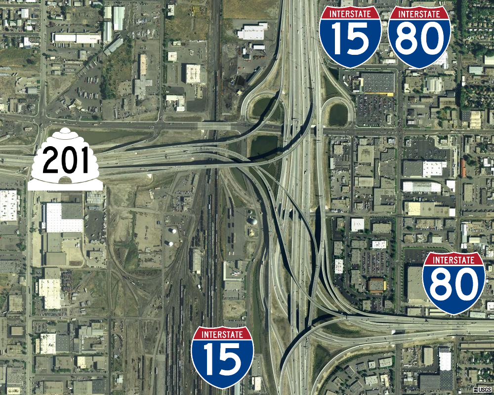
Interstate 80 (I-80) is a part of the Interstate Highway System that runs from San Francisco, California, to Teaneck, New Jersey. The portion of the highway in the US state of Utah is long through the northern part of the state. From west to east, I-80 crosses the state line from Nevada in Tooele County and traverses the Bonneville Salt Flats—which are a part of the larger Great Salt Lake Desert. It continues alongside the Wendover Cut-off—the corridor of the former Victory Highway— US Route 40 (US-40) and the Western Pacific Railroad Feather River Route. After passing the Oquirrh Mountains, I-80 enters the Salt Lake Valley and Salt Lake County. A short portion of the freeway is concurrent with I-15 through Downtown Salt Lake City. At the Spaghetti Bowl, I-80 turns east again into the mouth of Parleys Canyon and Summit County, travels through the mountain range, and intersects the eastern end of I-84 near Echo Reservoir before turning northeast toward the Wyo ... [...More Info...] [...Related Items...] OR: [Wikipedia] [Google] [Baidu] |
John C
John is a common English name and surname: * John (given name) * John (surname) John may also refer to: New Testament Works * Gospel of John, a title often shortened to John * First Epistle of John, often shortened to 1 John * Second Epistle of John, often shortened to 2 John * Third Epistle of John, often shortened to 3 John People * John the Baptist (died c. AD 30), regarded as a prophet and the forerunner of Jesus Christ * John the Apostle (lived c. AD 30), one of the twelve apostles of Jesus * John the Evangelist, assigned author of the Fourth Gospel, once identified with the Apostle * John of Patmos, also known as John the Divine or John the Revelator, the author of the Book of Revelation, once identified with the Apostle * John the Presbyter, a figure either identified with or distinguished from the Apostle, the Evangelist and John of Patmos Other people with the given name Religious figures * John, father of Andrew the Apostle and Saint Peter * Pope Jo ... [...More Info...] [...Related Items...] OR: [Wikipedia] [Google] [Baidu] |
List Of Ultras Of The United States
The following sortable table comprises the 200 most topographically prominent mountain peaks of the United States of America. The summit of a mountain or hill may be measured in three principal ways: #The topographic elevation of a summit measures the height of the summit above a geodetic sea level.All elevations in the 48 states of the contiguous United States include an elevation adjustment from the National Geodetic Vertical Datum of 1929 (NGVD 29) to the North American Vertical Datum of 1988 (NAVD 88). For further information, please see this United States National Geodetic Surveybr>noteIf the elevation or prominence of a summit is calculated as a range of values, the arithmetic mean is shown. #The topographic prominence of a summit is a measure of how high the summit rises above its surroundings.The topographic prominence of a summit is the topographic elevation difference between the summit and its highest or key col to a higher summit. The summit may be near its ke ... [...More Info...] [...Related Items...] OR: [Wikipedia] [Google] [Baidu] |
Sierra Nevada (U
The Sierra Nevada () is a mountain range in the Western United States, between the Central Valley of California and the Great Basin. The vast majority of the range lies in the state of California, although the Carson Range spur lies primarily in Nevada. The Sierra Nevada is part of the American Cordillera, an almost continuous chain of mountain ranges that forms the western "backbone" of the Americas. The Sierra runs north-south and its width ranges from to across east–west. Notable features include General Sherman, the largest tree in the world by volume; Lake Tahoe, the largest alpine lake in North America; Mount Whitney at , the highest point in the contiguous United States; and Yosemite Valley sculpted by glaciers from one-hundred-million-year-old granite, containing high waterfalls. The Sierra is home to three national parks, twenty wilderness areas, and two national monuments. These areas include Yosemite, Sequoia, and Kings Canyon National Parks; and Devils ... [...More Info...] [...Related Items...] OR: [Wikipedia] [Google] [Baidu] |
California Trail
The California Trail was an emigrant trail of about across the western half of the North American continent from Missouri River towns to what is now the state of California. After it was established, the first half of the California Trail followed the same corridor of networked river valley trails as the Oregon Trail and the Mormon Trail, namely the valleys of the Platte, North Platte, and Sweetwater rivers to Wyoming. The trail has several splits and cutoffs for alternative routes around major landforms and to different destinations, with a combined length of over . Introduction By 1847, two former fur trading frontier forts marked trailheads for major alternative routes through Utah and Wyoming to Northern California. The first was Jim Bridger's Fort Bridger (est. 1842) in present-day Wyoming on the Green River, where the Mormon Trail turned southwest over the Wasatch Range to the newly established Salt Lake City, Utah. From Salt Lake the Salt Lake Cutoff (est. 1848) ... [...More Info...] [...Related Items...] OR: [Wikipedia] [Google] [Baidu] |
Hastings Cutoff
The Hastings Cutoff was an alternative route for westward emigrants to travel to California, as proposed by Lansford Hastings in ''The Emigrant's Guide to Oregon and California''. The ill-fated Donner Party infamously took the route in 1846. Description A sentence in Hastings' guidebook briefly describes the cutoff: The most direct route, for the California emigrants, would be to leave the Oregon route, about two hundred miles east from Fort Hall; thence bearing West Southwest, to the Salt Lake; and thence continuing down to the bay of St. Francisco, by the route just described. The cutoff left the Oregon Trail at Fort Bridger in Wyoming, passed through the Wasatch Range, across the Great Salt Lake Desert, an 80-mile nearly water-less drive, looped around the Ruby Mountains, and rejoined the California Trail about seven miles west of modern Elko (also Emigrant Pass). The west end of the cutoff is marked as Nevada Historical Marker 3. Trail use Hastings led a small party over ... [...More Info...] [...Related Items...] OR: [Wikipedia] [Google] [Baidu] |
Donner Party
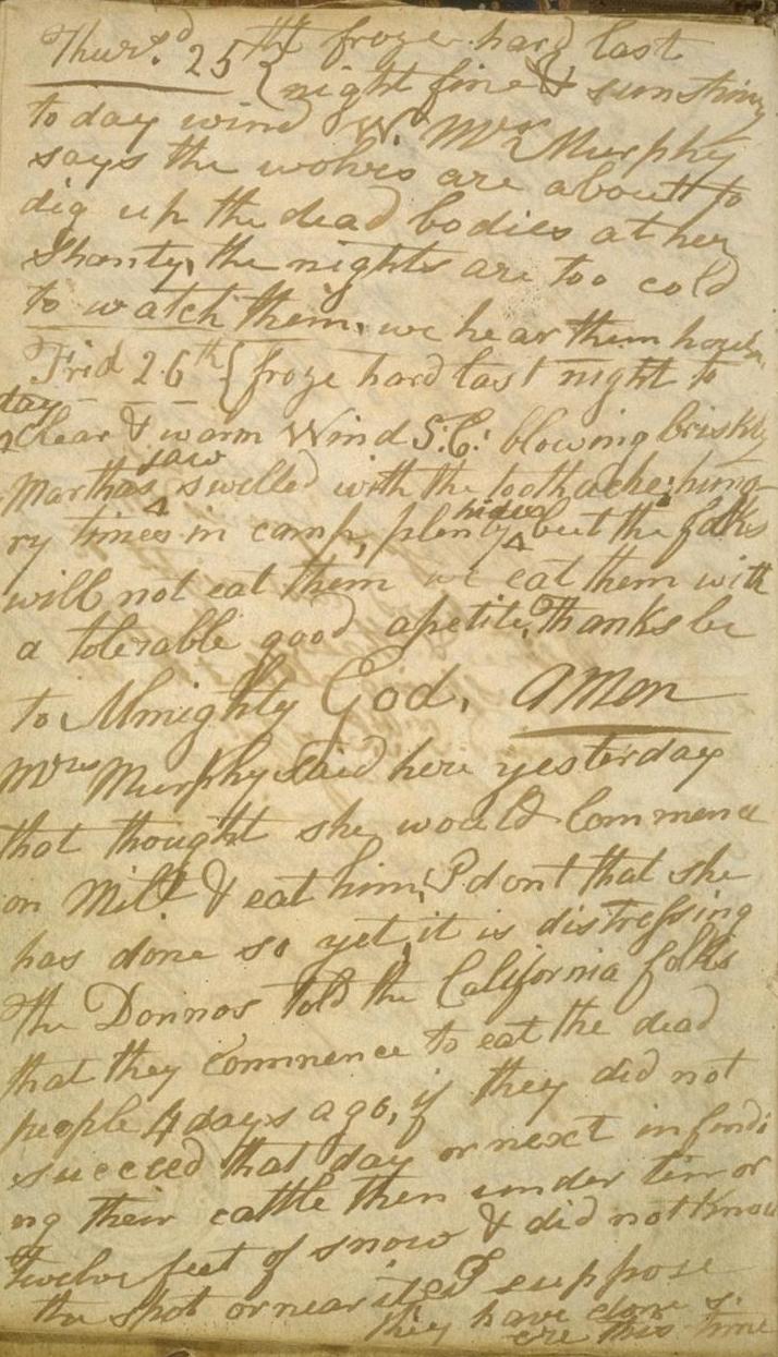
The Donner Party, sometimes called the Donner–Reed Party, was a group of American pioneers who migrated to California in a wagon train from the Midwest. Delayed by a multitude of mishaps, they spent the winter of 1846–1847 snowbound in the Sierra Nevada mountain range. Some of the migrants resorted to cannibalism to survive, eating the bodies of those who had succumbed to starvation, sickness, and extreme cold. The Donner Party originated from Springfield, Illinois, and departed Independence, Missouri, on the Oregon Trail in the spring of 1846, behind many other pioneer families who were attempting to make the same overland trip. The journey west usually took between four and six months, but the Donner Party was slowed after electing to follow a new route called the Hastings Cutoff, which bypassed established trails and instead crossed the Rocky Mountains' Wasatch Range and the Great Salt Lake Desert in present-day Utah. The desolate and rugged terrain, and the difficultie ... [...More Info...] [...Related Items...] OR: [Wikipedia] [Google] [Baidu] |
Spring (hydrology)
A spring is a point of exit at which groundwater from an aquifer flows out on top of Earth's crust (pedosphere) and becomes surface water. It is a component of the hydrosphere. Springs have long been important for humans as a source of fresh water, especially in arid regions which have relatively little annual rainfall. Springs are driven out onto the surface by various natural forces, such as gravity and hydrostatic pressure. Their yield varies widely from a volumetric flow rate of nearly zero to more than for the biggest springs. Formation Springs are formed when groundwater flows onto the surface. This typically happens when the groundwater table reaches above the surface level. Springs may also be formed as a result of karst topography, aquifers, or volcanic activity. Springs also have been observed on the ocean floor, spewing hot water directly into the ocean. Springs formed as a result of karst topography create karst springs, in which ground water travels through ... [...More Info...] [...Related Items...] OR: [Wikipedia] [Google] [Baidu] |
Kit Carson
Christopher Houston Carson (December 24, 1809 – May 23, 1868) was an American frontiersman. He was a fur trapper, wilderness guide, Indian agent, and U.S. Army officer. He became a frontier legend in his own lifetime by biographies and news articles, and exaggerated versions of his exploits were the subject of dime novels. His understated nature belied confirmed reports of his fearlessness, combat skills, tenacity, and profound effect on the westward expansion of the United States. Although he was famous for much of his life, historians in later years have written that Kit Carson did not like, want, or even fully understand the fame that he experienced during his life. Carson left home in rural Missouri at 16 to become a mountain man and trapper in the West. In the 1830s, he accompanied Ewing Young on an expedition to Mexican California and joined fur-trapping expeditions into the Rocky Mountains. He lived among and married into the Arapaho and Cheyenne tribes. In the 18 ... [...More Info...] [...Related Items...] OR: [Wikipedia] [Google] [Baidu] |
Great Basin
The Great Basin is the largest area of contiguous endorheic basin, endorheic watersheds, those with no outlets, in North America. It spans nearly all of Nevada, much of Utah, and portions of California, Idaho, Oregon, Wyoming, and Baja California. It is noted for both its arid climate and the basin and range topography that varies from the North American low point at Badwater Basin in Death Valley to the highest point of the contiguous United States, less than away at the summit of Mount Whitney. The region spans several physical geography, physiographic divisions, biomes, ecoregions, and deserts. Definition The term "Great Basin" is applied to hydrography, hydrographic, ecology, biological, floristic province, floristic, physiographic, topography, topographic, and Ethnography, ethnographic geographic areas. The name was originally coined by John C. Frémont, who, based on information gleaned from Joseph R. Walker as well as his own travels, recognized the hydrographic nature o ... [...More Info...] [...Related Items...] OR: [Wikipedia] [Google] [Baidu] |


