|
Philip Smidth
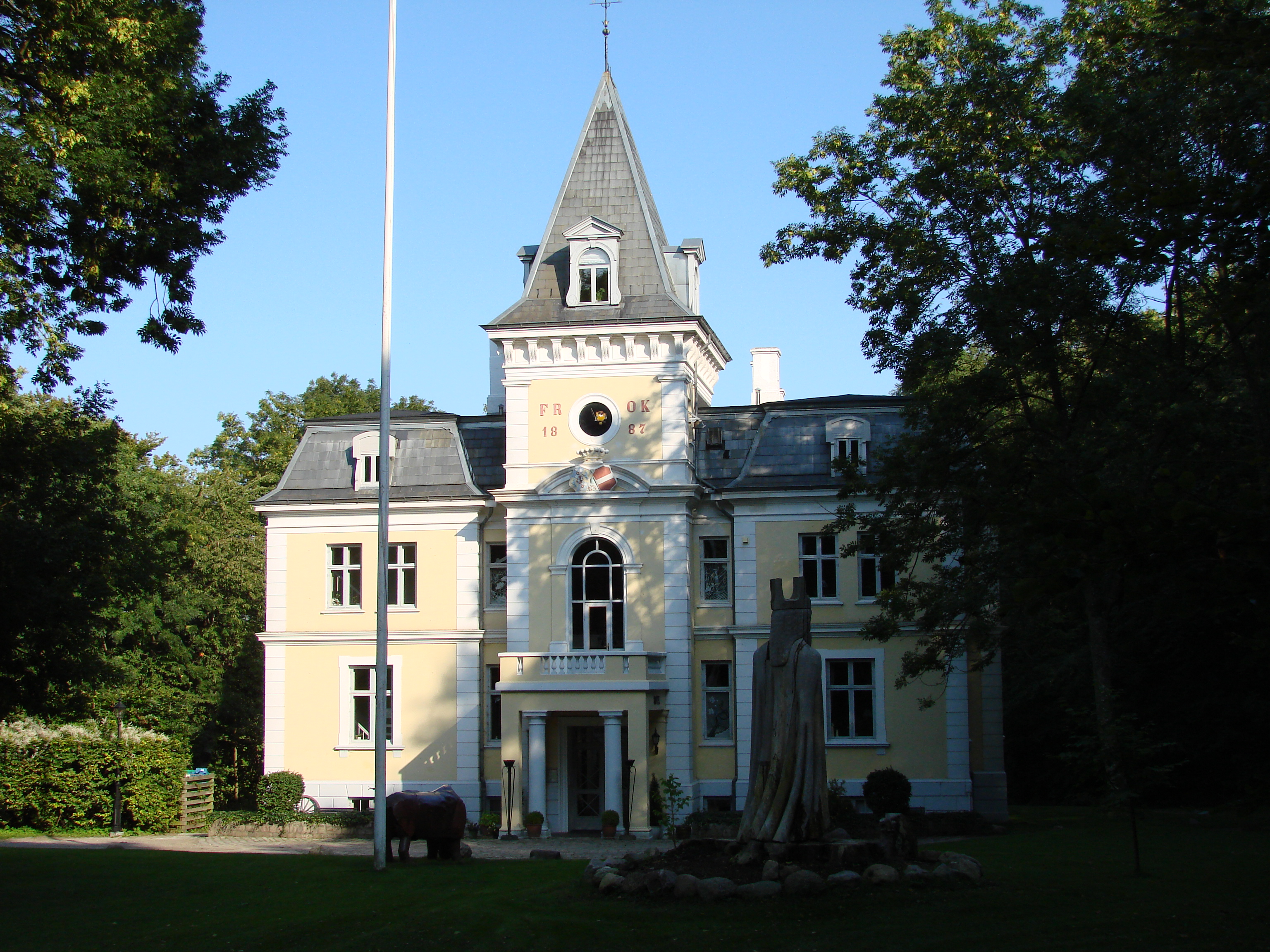
Philip Smidth (3 May 1855 – 21 June 1938) was a prolific Danish architect in the late 19th and early 20th centuries. His works included, commercial properties, high-end apartment buildings, hotels and hospitals. He worked in the Historicist style. Two of his works, Liselund Ny Slot on the island of Møn and Gefion and Gylfe in Copenhagen, have been listed by the Danish Heritage Agency. Biography Philip Smidth was born in Rønnede to the south of Copenhagen. His parents were, ''kammerråd'' and later ''justitsråd'' Jens Frederik Julius Beck Smidth and Anna Henriette née Høyer. After passing his preliminary exams, he apprentished as a timber and then studied at the Yechnical Society's School and attending C. V. Nielsens Regneskole. He enrolled at the Royal Danish Academy of Fine Arts in January 1873 and graduated in March 1882. Selected projects * Kastrup Church, Kastrup, Copenhagen (1883–84) * Schneekloths Skole, Værnedamsvej 13A, Frederiksberg, Copenhagen (1885) * ... [...More Info...] [...Related Items...] OR: [Wikipedia] [Google] [Baidu] |
Julie Laurberg
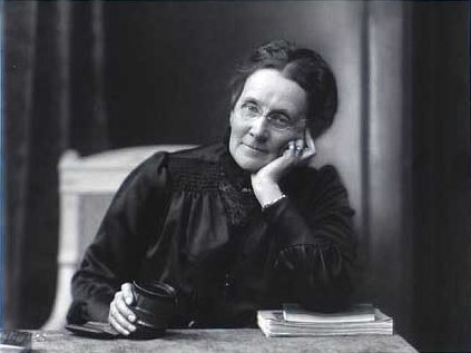
Julie Rasmine Marie Laurberg (7 September 1856 – 29 June 1925) was an early Danish photographer who, together with Franziska Gad (1873–1921), ran a successful photography business in central Copenhagen. Early life and education Born in Grenå, Laurberg trained under the painter and photographer Leopold Hartmann before continuing her studies in Paris and Italy. Career In 1895, she opened her own studio in the new Magasin du Nord building in central Copenhagen where she worked with her former pupil Franziska Gad. From 1907, when Gad became an official partner in her business, the studio became widely recognized, attracting well-to-do personalities to have their portraits taken. One of her most notable portraits is that of opera singer Margrethe Lendrop which was widely published as a post-card engraving. Known as Julie L. & Gad, in 1910 the firm received the status of royal court photographer. [...More Info...] [...Related Items...] OR: [Wikipedia] [Google] [Baidu] |
Frederiksberg
Frederiksberg () is a part of the Capital Region of Denmark. It is formally an independent municipality, Frederiksberg Municipality, separate from Copenhagen Municipality, but both are a part of the City of Copenhagen. It occupies an area of less than 9 km2 and had a population of 103,192 in 2015. Frederiksberg is an enclave surrounded by Copenhagen Municipality. Some sources ambiguously refer to Frederiksberg as a quarter or neighbourhood of Copenhagen, being one of the four municipalities that constitute the City of Copenhagen (the other three being Copenhagen, Tårnby and Dragør). However, Frederiksberg has its own mayor and municipal council, and is fiercely independent. Frederiksberg is an affluent area, characterised by its many green spaces such as the Frederiksberg Gardens, Søndermarken, and Hostrups Have. Some institutions and locations that are widely considered to be part of Copenhagen are actually located in Frederiksberg. For example, Copenhagen Zoo as wel ... [...More Info...] [...Related Items...] OR: [Wikipedia] [Google] [Baidu] |
Åboulevard
Åboulevard ( lit. "River Boulevard") is a street in central Copenhagen, Denmark. Together with H. C. Andersens Boulevard in the city centre and Borups Allé, it forms a major artery in and out of the city. The road is built over Ladegårds Å, a canal originally built to supply Copenhagen with water, which still runs in a pipe under it, feeding water into Peblinge Lake. History The canal was dug during the late Middle Ages to supply Copenhagen with drinking water from Damhus Lake and from about 1550 also Lundehus Lake. The name Ladegårdså (Ladegårds Å, Ladegårdsåen) originates from Ladegården, a farm under Copenhagen Castle which was located on the south bank of the stream, roughly where the Radio House is today. It was built in 1623 to provide produce for the royal household and feed for the royal mews but was never a success. The complex was later converted into first a military hospice and later a poorhouse with an associated textile manufactory. A road on the ... [...More Info...] [...Related Items...] OR: [Wikipedia] [Google] [Baidu] |
Smallegade
Smallegade ( lit. "Narrow Street") is a busy shopping street in the central part of Frederiksberg in Copenhagen, Denmark. It runs from the Town Hall Square in the east to Fasanvej in the west, along the north side of Frederiksberg Town Hall and Frederiksberg Park, linking Gammel Kongevej with Peter Bangs Vej. On the other side of the Town Hall is Bredegade (literally "Broad Street"), now smaller than Smallegade, which after a while joins Smallegade at Møstings Hus, an 18th-century country house-turned-exhibitions space, which overlooks a small pond. History It is believed that Bredegade was the main street of Solbjerg, a village inhabited by Dutch farmers until the 1620s when it was shut down by Christian IV. Smallegade was also one of the original "Dutch" streets but more open than Bredegade, with fields on its north side in between the scattered buildings. A brickyard was located at the far end of Smallegade until the 17th century. The Brickyard House (''Teglværksgården' ... [...More Info...] [...Related Items...] OR: [Wikipedia] [Google] [Baidu] |
Gammel Kongevej
Gammel Kongevej (literally "Old King's Road) is the principal shopping street of Frederiksberg in Copenhagen, Denmark. Running roughly parallel to Frederiksberg Allé and Vesterbrogade, it extends from Vesterport station at the southern end of The Lakes and continues for some 1.8 km west to Frederiksberg City Hall Square where it continues as Smallegade. In the opposite end, Jernbanegade connects it to Copenhagen City Hall Square. History 17th and 18th century Gammel Kongevej is one of the oldest road sections in Frederiksberg, originally providing a direct connection between Copenhagen's Western City Gate and the historic village of Solbjerg (no longer in existence). From there the road continued past the Damhus Lake towards Roskilde, giving rise to the name Roskildegaden ("The Roskilde Street"), which is seen in some documents from the beginning of the 17th century. The road was improved by Christian IV in the 1620s. The name Kongevejen (English: King's Road) emerged ... [...More Info...] [...Related Items...] OR: [Wikipedia] [Google] [Baidu] |
Stubbekøbing
Stubbekøbing () is a town with a population of 2,268 (1 January 2022) The Mobile Statbank from in in on the northeastern coast of the island of i ... [...More Info...] [...Related Items...] OR: [Wikipedia] [Google] [Baidu] |
Sortedam Dossering
Sortedam Dossering is a street that follows the western shore of Sortedam Lake, from Nørrebrogade in the south to Østerbrogade in the north, in central Copenhagen, Denmark. The section north of Helgesensgade is closed to cars. The section from Nørrebrogade to Fredensgade is in Nørrebro while the section from Fredensgade to Østerbrogade belongs to Østerbro. The southwestern continuation of the street, along Peblinge Lake, with only the short stretch between Nørrebrogade and Baggesensgade open to car traffic, is called Peblinge Dossering. Collectively Sortedam Dossering and Peblinge Dossering are known as Dosseringen (definite form). The path along the shore of St. Jørgen's Lake, the lake furthest to the south, is called ''Svineryggen'' ('The Rack of Pork'). History Sortedam Lake is first mentioned in 1619 in the form "Sorte dam" but it is unclear if ''dam'' (pond) at this stage referred to a small lake or a dam. The word ''Dossering'' is derived from the French word ... [...More Info...] [...Related Items...] OR: [Wikipedia] [Google] [Baidu] |
Nørre Voldgade
Nørre Voldgade ( lit. "North Rampart Street") is a street in central Copenhagen, Denmark. It runs north-east from Jarmers Plads for approximately 600 metres to Gothersgade where it turns into Øster Voldgade. The succession of Nørre Voldgade, Øster Voldgade and Vester Voldgade together forms a traffic artery which arches around the Zealand side of the central and oldest part of Copenhagen. Nørreport Station, Denmark's busiest railway station, is located in the street. History Inside the North Rampart Nørre Voldgade was originally a narrow alley which ran along the city-side margin of the North Rampart in Copenhagen's Bastioned Fortification Ring. The Northn City Gate was first located at Nørregade but moved to Frederiksborggade in 1671. A ropewalk ran along the rampart. North Boulevard The fortifications were decommissioned in 1867. Between 1878 and 1882, the street was expanded and renamed Nørre Boulevard. Later history In 1913, the street was dug up when the ... [...More Info...] [...Related Items...] OR: [Wikipedia] [Google] [Baidu] |
Danish Union Of Professional Technicians
The Danish Union of Professional Technicians (Danish language, Danish: Teknisk Landsforbund, TL) is a trade union in Denmark. It is an affiliate of the Danish Confederation of Trade Unions. History The Danish Union of Professional Technicians was founded in 1919. It became a member of LO in 1994. Location The Danish Union of Professional Technicians is based in Teknikernes Hus ("The Technicians' House") at Nørre Voldgade 12 in central Copenhagen. The building is the former headquarters of Kastrup Glasværk. It is from 1892 and was designed by the architect Philip Smidth. References * External links Official site Danish Confederation of Trade Unions Trade unions in Denmark 1919 establishments in Denmark {{Denmark-org-stub ... [...More Info...] [...Related Items...] OR: [Wikipedia] [Google] [Baidu] |
Kastrup Glasværk
Kastrup Glasværk was a Danish glassworks located in Copenhagen, Denmark. Kastrup Glasværk was also the parent company of Hellerup Glasværk, in Odense and Aarhus Glasværk in Aarhus. History Kastrup Glasværk was founded on 12 October 1847 by Christian Conrad Sophus Danneskiold-Samsøe. He has inherited Holmegård glassworks at Næstved from his mother in 1943. The company was converted into an aktieselskab in 1873. In 1881, the company acquired Tuborg Fabrikers Glasværk whouse name was subsequently changed to Hellerup Glasværk. In 1883, the company also took over Godthaab Glasværk in Helsingør. In 1907, Kastrup Glasværk acquired in Odense and Frederiksberg Glasværk. comprised Fyns Glasværk in Odense (founded on 11 June 1874) and Aarhus Glasværk in Aarhus (founded 1898). In 1918, Aalborg Glasværk in Aalborg (founded in 1853) was acquired. In 1865, Kastrup Glasværk merged with Holmegaard under the name . The principal shareholders were Carlsberg Group, De forende Bry ... [...More Info...] [...Related Items...] OR: [Wikipedia] [Google] [Baidu] |
Ryesgade
Ryesgade is a street straddling the border of the Nørrebro and Østerbro districts of Copenhagen, Denmark. Together with Ravnsborggade, its continuation to the south, it forms the backbone of a small neighbourhood bounded by The Lakes to the east, Blegdamsvej to the west, Nørrebrogade to the south and Østerbrogade to the north. The busy artery Fredensgade and the adjacent Fredens Park, effectively separates the Nørrebro and Østerbro portions of Ryesgade from each other. Ryesgade was formerly known for its many second-hand stores of which a few still exist today. History Planning and street names The area between Sortedam Lake and Blegdamsvej was formerly the site of a row of narrow lots with bleaching pongs. The plans for the new street was first presented in around 1860 as part of the plans for redevelopment of the area. It served the dual purpose of dividing the long lots in two and in the same time to facilitate the construction of a new main sewer along the lakes. Th ... [...More Info...] [...Related Items...] OR: [Wikipedia] [Google] [Baidu] |
Vester Voldgade
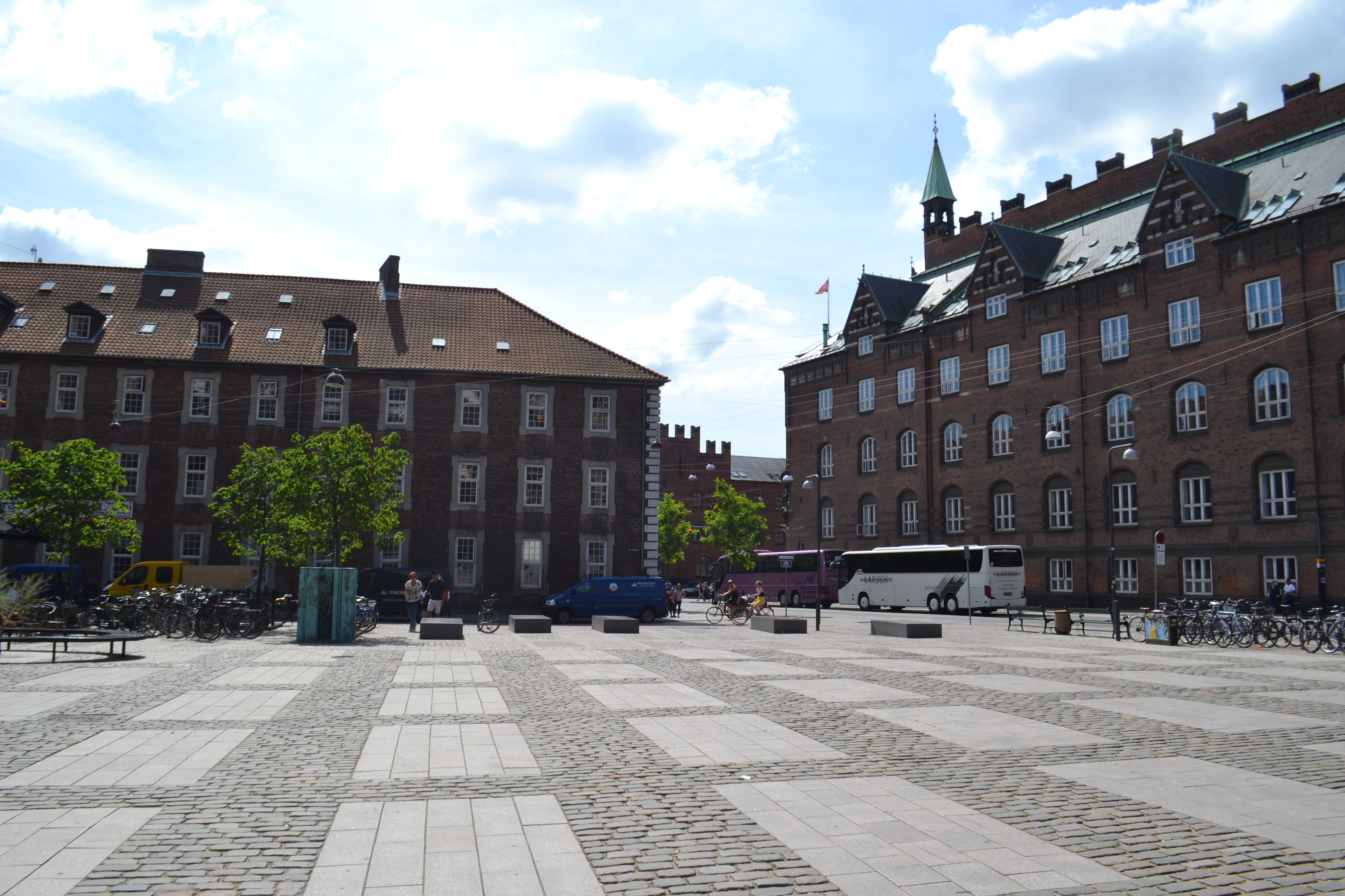
Vester Voldgade ( lit. "West Rampart Street") is a street in Copenhagen, Denmark which runs from Jarmers Plads to the waterfront between Frederiksholms Kanal and Langebro, passing the City Hall Square on the way. Together with Nørre Voldgade and Øster Voldgade it forms a traffic artery which arches around the Zealand side of central Copenhagen all the way to Kastellet (at Oslo Plads on the coast north of the city centre. The three streets follow the course of Copenhagen's long gone Bastioned Fortification Ring and thus marks the transition between the Old Town and the new neighbourhoods that developed after the fortifications were removed in the second half of the 19th century. History Vester Voldgade was originally a narrow alley which ran along the inner margin of Copenhagen's West Rampart, part of the Bastioned Fortification Ring which enclosed Copenhagen. The city's haymarket was located at the site of the current City Hall Square until the New Haymarket was inau ... [...More Info...] [...Related Items...] OR: [Wikipedia] [Google] [Baidu] |


