|
Phantom Glacier
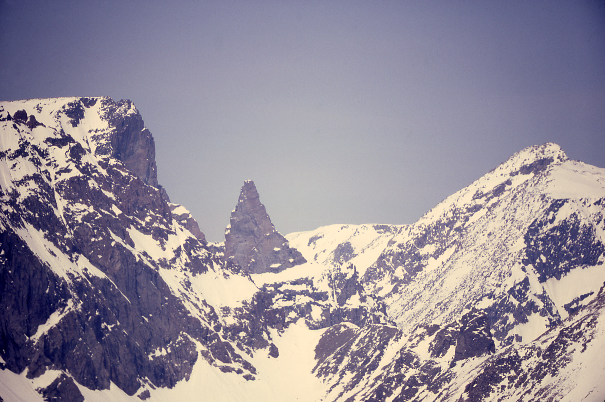
Phantom Glacier is in the U.S. state of Montana. The glacier is situated in the Beartooth Mountains at an elevation of above sea level and is immediately south of Arch Lake. References See also * List of glaciers in the United States Glaciers of Carbon County, Montana Glaciers of Montana {{CarbonCountyMT-geo-stub ... [...More Info...] [...Related Items...] OR: [Wikipedia] [Google] [Baidu] |
Beartooth Mountains
The Beartooth Mountains are located in south central Montana and northwest Wyoming, U.S. and are part of the Absaroka-Beartooth Wilderness, within Custer, Gallatin and Shoshone National Forests. The Beartooths are the location of Granite Peak, which at is the highest point in the state of Montana. The mountains are just northeast of Yellowstone National Park and are part of the Greater Yellowstone Ecosystem. The mountains are traversed by road via the Beartooth Highway (U.S. 212) with the highest elevation at Beartooth Pass ). The name of the mountain range is attributed to a rugged peak found in the range, Beartooth Peak, that has the appearance of a bear's tooth. The Beartooth Mountains sit upon the larger Beartooth Plateau. History The remoteness of the region contributed to its obscurity until the 1870s. The Crow tribe of Native Americans used the valleys of the mountains for hunting game animals and for winter shelter from the harsh winds of the plains. Though trappers e ... [...More Info...] [...Related Items...] OR: [Wikipedia] [Google] [Baidu] |
Carbon County, Montana
Carbon County is a county located in the U.S. state of Montana. As of the 2020 census, the population was 10,473. Its county seat is Red Lodge. Carbon County is part of the Billings, MT Metropolitan Statistical Area. History Carbon County was named for the rich coal deposits found in the area. It was organized on March 4, 1895, from portions of Park and Yellowstone counties. Land from Park and Yellowstone counties was used to form Carbon County on March 4, 1895. More than sixty federally designated historic sites are located in the county, including Petroglyph Canyon, one of the state's most important rock art sites. The first commercial oil well in the state was established in Elk Basin fields in 1915. Geography According to the United States Census Bureau, the county has a total area of , of which is land and (0.6%) is water. Granite Peak, the state's highest mountain, is found in Carbon County's Beartooth Mountains. The Beartooth Highway, one of the "most specta ... [...More Info...] [...Related Items...] OR: [Wikipedia] [Google] [Baidu] |
United States
The United States of America (U.S.A. or USA), commonly known as the United States (U.S. or US) or America, is a country primarily located in North America. It consists of 50 states, a federal district, five major unincorporated territories, nine Minor Outlying Islands, and 326 Indian reservations. The United States is also in free association with three Pacific Island sovereign states: the Federated States of Micronesia, the Marshall Islands, and the Republic of Palau. It is the world's third-largest country by both land and total area. It shares land borders with Canada to its north and with Mexico to its south and has maritime borders with the Bahamas, Cuba, Russia, and other nations. With a population of over 333 million, it is the most populous country in the Americas and the third most populous in the world. The national capital of the United States is Washington, D.C. and its most populous city and principal financial center is New York City. Paleo-Americ ... [...More Info...] [...Related Items...] OR: [Wikipedia] [Google] [Baidu] |
Montana
Montana () is a state in the Mountain West division of the Western United States. It is bordered by Idaho to the west, North Dakota and South Dakota to the east, Wyoming to the south, and the Canadian provinces of Alberta, British Columbia, and Saskatchewan to the north. It is the fourth-largest state by area, the eighth-least populous state, and the third-least densely populated state. Its state capital is Helena. The western half of Montana contains numerous mountain ranges, while the eastern half is characterized by western prairie terrain and badlands, with smaller mountain ranges found throughout the state. Montana has no official nickname but several unofficial ones, most notably "Big Sky Country", "The Treasure State", "Land of the Shining Mountains", and " The Last Best Place". The economy is primarily based on agriculture, including ranching and cereal grain farming. Other significant economic resources include oil, gas, coal, mining, and lumber. The health ca ... [...More Info...] [...Related Items...] OR: [Wikipedia] [Google] [Baidu] |
Arch Lake
Arch Lake is a lake in Carbon County, Montana, in the United States. Arch Lake took its name from the granite arch that sits on the south ridge. It is remote from all roads, but can be reached on foot. Much of the route to it is rugged and part of the way has no trail.''Montana Fish, Wildlife & Parks 2018 Mountain Lakes Guide'', p. 71. See also *List of lakes in Montana There are at least 3,223 named lakes and reservoirs in Montana. The following list contains lists of lakes and reservoirs in Montana by county. A lake is a terrain feature (or physical feature), a body of liquid on the surface of a world that i ... References Lakes of Montana Lakes of Carbon County, Montana {{CarbonCountyMT-geo-stub ... [...More Info...] [...Related Items...] OR: [Wikipedia] [Google] [Baidu] |
List Of Glaciers In The United States
This is a list of glaciers existing in the United States, currently or in recent centuries. These glaciers are located in nine states, all in the Rocky Mountains or farther west. The southernmost named glacier among them is the Lilliput Glacier in Tulare County, east of the Central Valley of California. Glaciers of Alaska There are approximately 664 named glaciers in Alaska according to the Geographic Names Information System (GNIS). * Agassiz Glacier - Saint Elias Mountains * Aialik Glacier - Kenai Peninsula * Alsek Glacier - Glacier Bay * Aurora Glacier - Glacier Bay * Bacon Glacier *Barnard Glacier * Bear Glacier - Aialik Peninsula, Resurrection Bay *Bering Glacier * Black Rapids *Brady Glacier *Brooks Glacier - Alaska Range *Buckskin Glacier - Alaska Range * Burns Glacier (Alaska) - Kenai Mountains *Byron Glacier - Kenai Mountains * Caldwell Glacier - Alaska Range *Cantwell Glacier - Alaska Range *Carroll Glacier - Glacier Bay *Casement Glacier - Glacier Bay *Cast ... [...More Info...] [...Related Items...] OR: [Wikipedia] [Google] [Baidu] |
Glaciers Of Carbon County, Montana
A glacier (; ) is a persistent body of dense ice that is constantly moving under its own weight. A glacier forms where the accumulation of snow exceeds its ablation over many years, often centuries. It acquires distinguishing features, such as crevasses and seracs, as it slowly flows and deforms under stresses induced by its weight. As it moves, it abrades rock and debris from its substrate to create landforms such as cirques, moraines, or fjords. Although a glacier may flow into a body of water, it forms only on land and is distinct from the much thinner sea ice and lake ice that form on the surface of bodies of water. On Earth, 99% of glacial ice is contained within vast ice sheets (also known as "continental glaciers") in the polar regions, but glaciers may be found in mountain ranges on every continent other than the Australian mainland, including Oceania's high-latitude oceanic island countries such as New Zealand. Between latitudes 35°N and 35°S, glaciers occur only in ... [...More Info...] [...Related Items...] OR: [Wikipedia] [Google] [Baidu] |


