|
Peshtigo
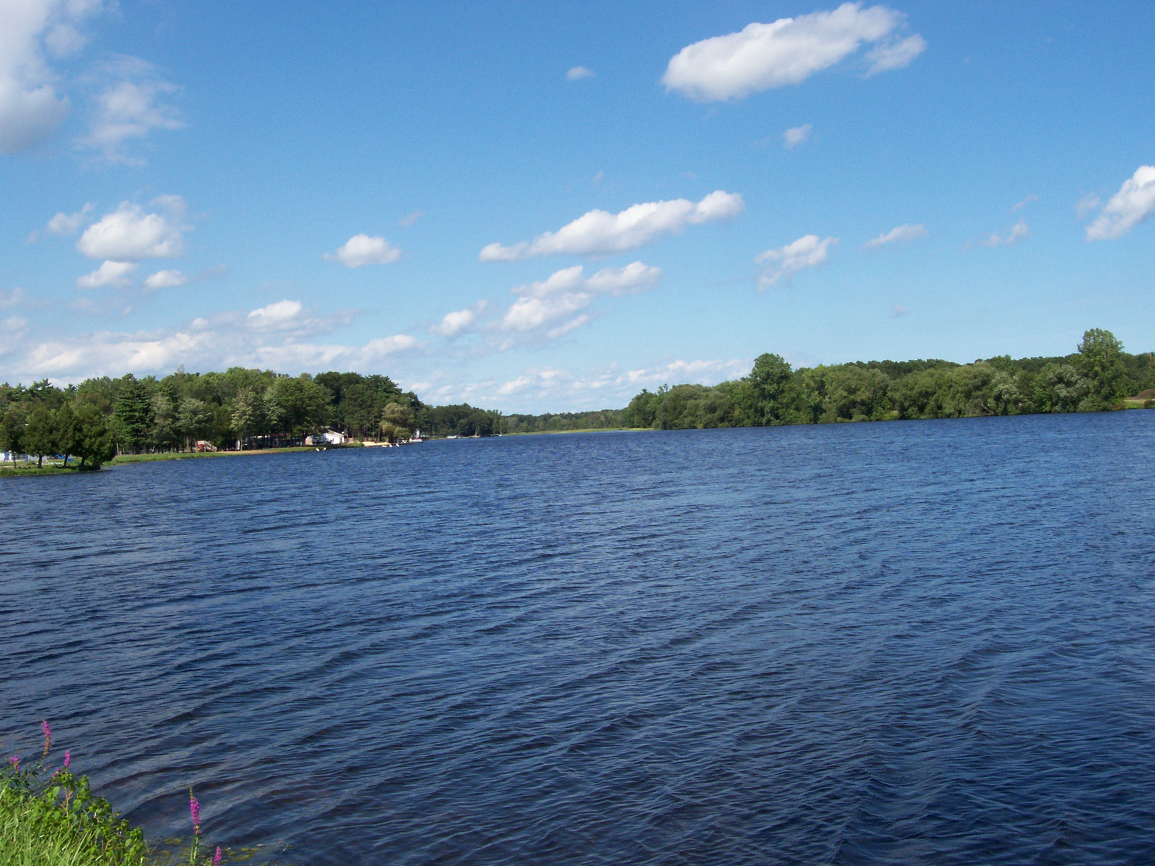
Peshtigo ( ) is a city in Marinette County, Wisconsin, United States. The population was 3,420 at the 2020 census The city is surrounded by the Town of Peshtigo. It is part of the Marinette, WI– MI Micropolitan Statistical Area. Peshtigo is known for being the site of the Peshtigo fire of 1871, in which more than 1,200 people perished. History Name Peshtigo took its name from the nearby Peshtigo River. The etymology of ''Peshtigo'' is uncertain.Voegl, Virgil J. 1991. ''Indian Names on Wisconsin's Map.'' Madison: University of Wisconsin Press, pp. 40–41. Explanations include an Ojibwe word meaning 'river of the wild goose', a Menominee word for 'snapping turtle', a word meaning 'passing through a marsh', or a reference to a local Menominee band known as ''Pesh-tiko''. Peshtigo fire On October 8, 1871, a forest fire driven by strong winds totally consumed Peshtigo and a dozen other villages, killing between 1,200 and 2,500 people and engulfing approximately 1.5 millio ... [...More Info...] [...Related Items...] OR: [Wikipedia] [Google] [Baidu] |
Peshtigo Fire Museum
The Peshtigo Fire Museum preserves the heritage of the Peshtigo Fire, which destroyed the city of Peshtigo, Wisconsin and surrounding area on October 8, 1871, killing over 2,000 people. It hosts storytelling, exhibits of artifacts from the fire, displays of the lifestyle at the time of the disaster, and a cemetery to memorialize those who died. The museum is adjacent to the Peshtigo Fire Cemetery, where the charred remains of over 350 people were buried in a mass grave. The cemetery is listed on the National Register of Historic Places. The memorial at the cemetery was the first official state historical marker authorized by the State Historical Society of Wisconsin. Collection A featured item in the museum's collection is the Church tabernacle that local Roman Catholic priest Father Peter Pernin saved by submerging in the Peshtigo River. [...More Info...] [...Related Items...] OR: [Wikipedia] [Google] [Baidu] |
Peshtigo River
The Peshtigo River is a U.S. Geological Survey. National Hydrography Dataset high-resolution flowline dataThe National Map accessed December 19, 2011 tributary of Green Bay in the U.S. state of Wisconsin. The Peshtigo Fire happened in the river's vicinity, and some survivors used the river for refuge from the flames. A section of whitewater Whitewater forms in a rapid context, in particular, when a river's gradient changes enough to generate so much turbulence that air is trapped within the water. This forms an unstable current that froths, making the water appear opaque and ... on the river called the Roaring Rapids is well known in the region. Further downstream there are two dams known as Caldron Falls Dam and High Falls Dam before collecting the Thunder River. Geography The Peshtigo River is formed in Forest County and flows southeasterly towards the bay of Green Bay, spending most of its time winding through Marinette County. History It shares its name with t ... [...More Info...] [...Related Items...] OR: [Wikipedia] [Google] [Baidu] |
Peshtigo (town), Wisconsin
Peshtigo is a town located in Marinette County, Wisconsin, United States. The population was 4,006 at the 2020 census. The City of Peshtigo is located within the town. The historic Peshtigo Fire took place here. Geography According to the United States Census Bureau, the town has a total area of 180.3 square miles (466.9 km2), of which, 59.3 square miles (153.6 km2) of it is land and 121.0 square miles (313.3 km2) of it (67.10%) is water. The town features the Peshtigo Harbor State Wildlife Area and the Bloch Oxbow State Natural Area on the lower Peshtigo River. History The town of Peshtigo had a major fire on the same day, October 8, 1871, as the Great Chicago Fire. Demographics As of the census of 2000, there were 3,819 people, 1,416 households, and 1,123 families residing in the town. The population density was . There were 1,567 housing units at an average density of . The racial makeup of the town was 98.93% White, 0.13% Native American ... [...More Info...] [...Related Items...] OR: [Wikipedia] [Google] [Baidu] |
Peshtigo Fire Cemetery
The Peshtigo Fire Cemetery is a cemetery in Peshtigo, Wisconsin. The cemetery is the burial location of the charred remains of victims of the Peshtigo Fire, of October 8, 1871, the deadliest natural fire in the history of the United States. Identified victims were buried in traditional marked graves, and over 300 unidentified victims were buried in a mass grave. The site is listed on the National Register of Historic Places. The memorial at the cemetery was the first official state historical marker authorized by the State Historic Society of Wisconsin.Peshtigo, Wisconsin 2004–05 Directory, published by the Peshtigo Chamber of Commerce, Retrieved August 29, 2007 The cemetery is located adjacent to the Peshtigo Fire Museum The Peshtigo Fire Museum preserves the heritage of the Peshtigo Fire, which destroyed the city of Peshtigo, Wisconsin and surrounding area on October 8, 1871, killing over 2,000 people. It hosts storytelling, exhibits of artifacts from the fire ..., which i ... [...More Info...] [...Related Items...] OR: [Wikipedia] [Google] [Baidu] |
Marinette County, Wisconsin
Marinette County is a county in the U.S. state of Wisconsin. As of the 2020 census, the population was 41,872. Its county seat is Marinette. Marinette County is part of the Marinette, WI– MI Micropolitan Statistical Area. Geography According to the U.S. Census Bureau, the county has a total area of , of which is land and (9.7%) is water. It is the third-largest county in Wisconsin by land area and fifth-largest by total area. Part of Marinette County borders Lake Michigan, and this area is home to endemic plants. Adjacent counties * Dickinson County, Michigan - north * Menominee County, Michigan - northeast * Door County - east and southeast, border is in Green Bay * Oconto County - southwest * Forest County - west * Florence County - northwest Major highways * U.S. 8 * U.S. 41 * U.S. 141 * Highway 64 * Highway 180 Railroads *Canadian National *Escanaba and Lake Superior Railroad *Watco Buses *List of intercity bus stops in Wisconsin Airport Crivitz M ... [...More Info...] [...Related Items...] OR: [Wikipedia] [Google] [Baidu] |
Great Michigan Fire
The Great Michigan Fire was a series of simultaneous forest fires in the state of Michigan in the United States in 1871. They were possibly caused (or at least reinforced) by the same winds that fanned the Great Chicago Fire, the Peshtigo Fire and the Port Huron Fire; some believe lightning or even meteor showers may have started the fires. Several cities, towns and villages, including Alpena, Holland, Manistee, and Port Huron, suffered serious damage or were lost. The concurrent Peshtigo Fire in Wisconsin also destroyed several towns in the Upper Peninsula of Michigan. In 1881, much more than half of "the Thumb" region was burned over by the Thumb Fire, which followed part of the same path as the 1871 fires. Origins In the mid-1830s logging began in Michigan and grew into a significant industry. Michigan was extensively logged for the Eastern white pine, measuring tall and exceeding in diameter, along with the hardwood forests. By 1854, sixteen sawmills were in operat ... [...More Info...] [...Related Items...] OR: [Wikipedia] [Google] [Baidu] |
Great Chicago Fire
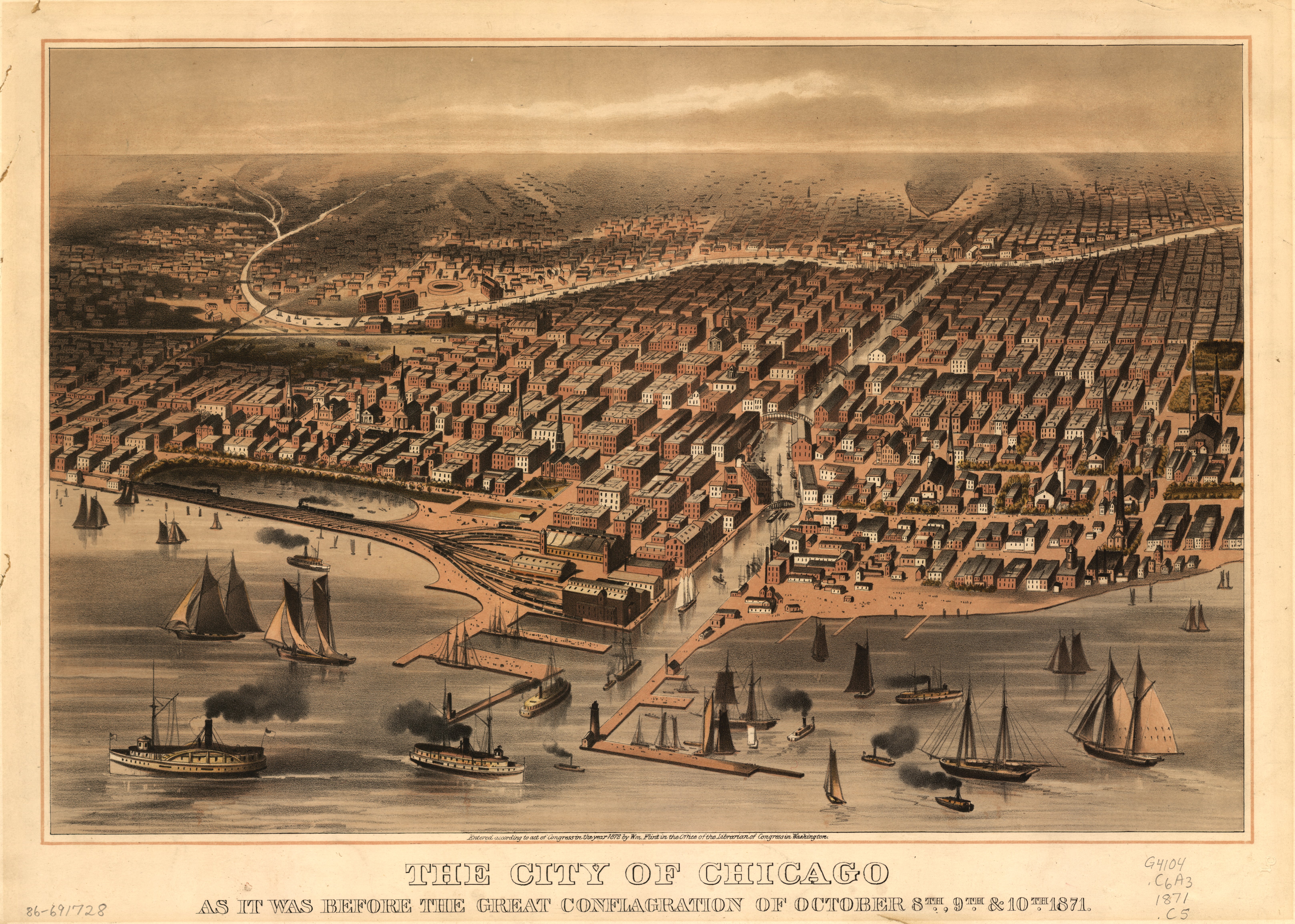
The Great Chicago Fire was a conflagration that burned in the American city of Chicago during October 8–10, 1871. The fire killed approximately 300 people, destroyed roughly of the city including over 17,000 structures, and left more than 100,000 residents homeless. The fire began in a neighborhood southwest of the city center. A long period of hot, dry, windy conditions, and the wooden construction prevalent in the city, led to the conflagration. The fire leapt the south branch of the Chicago River and destroyed much of central Chicago and then leapt the main branch of the river, consuming the Near North Side. Help flowed to the city from near and far after the fire. The city government improved building codes to stop the rapid spread of future fires and rebuilt rapidly to those higher standards. A donation from the United Kingdom spurred the establishment of the Chicago Public Library. Origin The fire is claimed to have started at about 8:30 p.m. on October ... [...More Info...] [...Related Items...] OR: [Wikipedia] [Google] [Baidu] |
Marinette Micropolitan Area
The Marinette Micropolitan Statistical Area, as defined by the United States Census Bureau, is an area consisting of two counties – one in Wisconsin and one in Michigan – anchored by the city of Marinette, Wisconsin. As of the 2000 census, the μSA had a population of 68,710 (though a July 1, 2009 estimate placed the population at 65,937). Communities Menominee County, Michigan * Carney * Cedar River * Cedarville Township * Daggett * Daggett Township * Faithorn Township * Gourley Township * Harris Township * Holmes Township * Ingallston Township * Lake Township * Mellen Township *Menominee * Menominee Township * Meyer Township * Nadeau Township * Spalding Township * Stephenson * Stephenson Township * Wallace, Michigan Marinette County, Wisconsin * Amberg, Wisconsin * Town of Amberg * Town of Athelstane * Town of Beaver * Town of Beecher * Coleman * Crivitz * Town of Dunbar * Town of Goodman * Town of Grover * Town of Lake *Marinette, Wisconsin (Principal city) * Town ... [...More Info...] [...Related Items...] OR: [Wikipedia] [Google] [Baidu] |
Marinette, Wisconsin
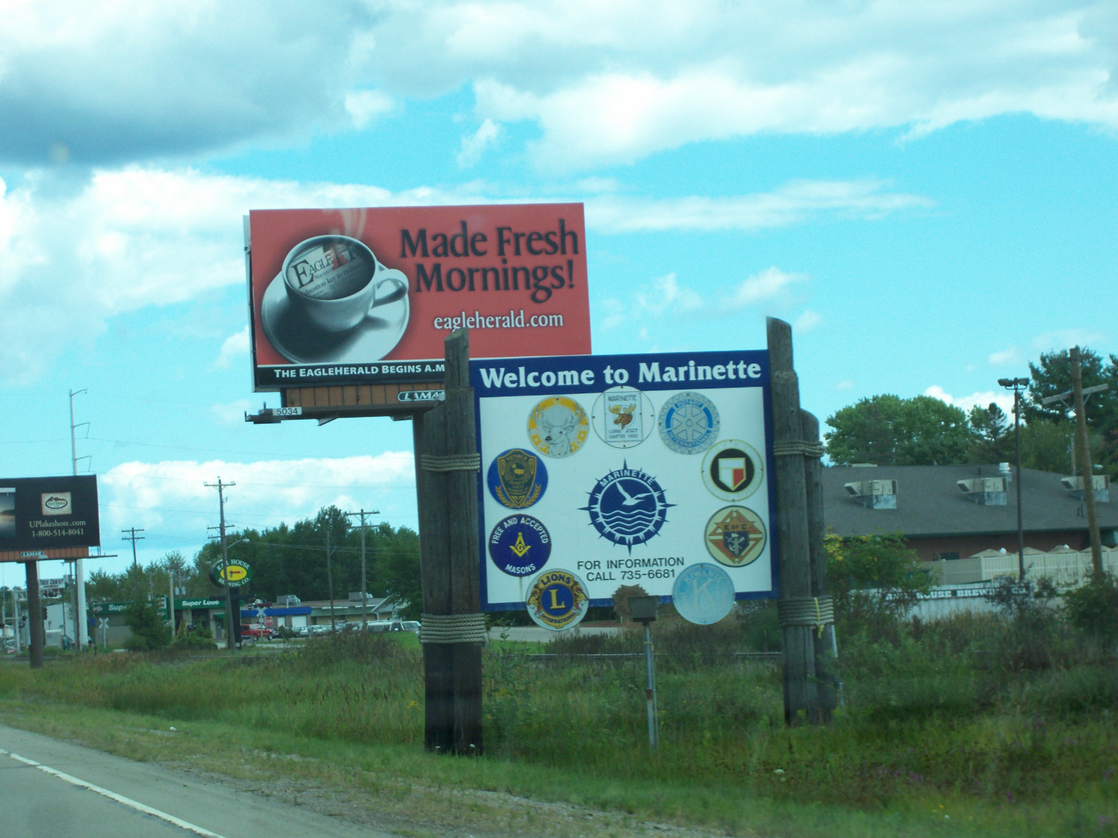
Marinette is a city in and the county seat of Marinette County, Wisconsin, United States. It is located on the south bank of the Menominee River, at its mouth at Green Bay, part of Lake Michigan; to the north is Stephenson Island, part of the city preserved as park. During the lumbering boom of the late 19th century, Marinette became the tenth-largest city in Wisconsin in 1900, reaching a peak population of 16,195. Marinette is the principal city of the Marinette, Wisconsin–Michigan Micropolitan Statistical Area, which includes all of Marinette County, Wisconsin and Menominee County, Michigan. The population was 10,968 at the 2010 census. Menominee, Michigan is across the river to the north, and the cities are connected by three bridges. Menominee and Marinette are sometimes described as the "twin cities" of the Menominee River. Name The town and county were named ''Marinette'' after Marie Antoinette Chevalier (1793, Langlade County, Wisconsin – 1865, Green Bay, Wisco ... [...More Info...] [...Related Items...] OR: [Wikipedia] [Google] [Baidu] |
Port Huron Fire Of 1871
The Port Huron Fire of October 8, 1871 (one of a series of fires known collectively as the Great Fire of 1871 or the Great Michigan Fire) burned a number of cities including White Rock and Port Huron, and much of the countryside in the " Thumb" region of the U.S. state of Michigan (a total of 1.2 million acres, or 4,850 km²). On the same day, other fires burned the cities of Holland and Manistee, Michigan, as well as broad swaths of forest in various areas of the state; the Great Chicago Fire and the Peshtigo Fire also occurred on the same day. At least 50 people died as a result of the Port Huron Fire, and at least 200 from all the fires in the state. Origins The origins of the fires are unknown, but the damage was worsened by a number of factors. Uninterrupted drought had plagued the Midwest into early October and winds were strong. When the wind increased and shifted direction, fire fighters were unable to control the flames any longer. Vast tracts of forest burne ... [...More Info...] [...Related Items...] OR: [Wikipedia] [Google] [Baidu] |
Area Codes 715 And 534
Area codes 715 and 534 are telephone area codes in the North American Numbering Plan (NANP) for the U.S. state of Wisconsin. The numbering plan area (NPA) comprises most of the northern part of the state. 715 was one of the original North American area codes created in 1947, while 534 was added in 2010 as an additional code for the same numbering plan area to form an overlay plan. History When the first nationwide telephone numbering plan was created in 1947, Wisconsin was divided into two NPAs. The northern part received area code 715, while the rest was assigned area code 414. Due to northern Wisconsin's low population density, 715 was for a long time one of the few original area codes never to have been split or overlaid. But by 2010, the proliferation of cellphones and pagers had almost exhausted 715's telephone numbers. Central office code relief was implemented by adding area code 534 to form an overlay that summer. Service area Counties : Ashland, Barron, Bayfield, Buff ... [...More Info...] [...Related Items...] OR: [Wikipedia] [Google] [Baidu] |


