|
Pequannoc Spillway
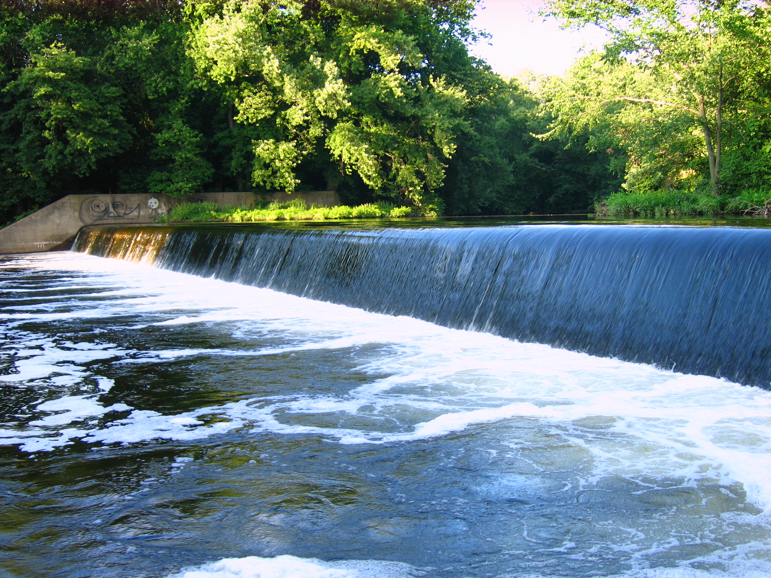
The Pequannoc Spillway is a run-of-the-river spillway constructed in the 1920s as part of the Morris Canal system in the Pompton Plains section of Pequannock, New Jersey on one bank of the river and Wayne, New Jersey on the other bank. The spillway creates usable waterfront land out of swamps and provides water retention by creating a backwater on the Ramapo River. The structure is listed as part of the Morris Canal on the New Jersey Register of Historic Places as well as the National Register of Historic Places. It is a sister structure to the Pompton dam which lies on the Pompton River. Technical description The Pequannoc Spillway is an early 20th-century concrete spillway over 270 feet wide, equal in girth to the Great Falls of Paterson located along the Pompton River a quarter-mile south of the Pompton dam and associated guard bank in Pequannock Township's Aquatic Park. The dam is a run-of-the-river spillway, which traverses the width of the river and at normal water ... [...More Info...] [...Related Items...] OR: [Wikipedia] [Google] [Baidu] |
Berm
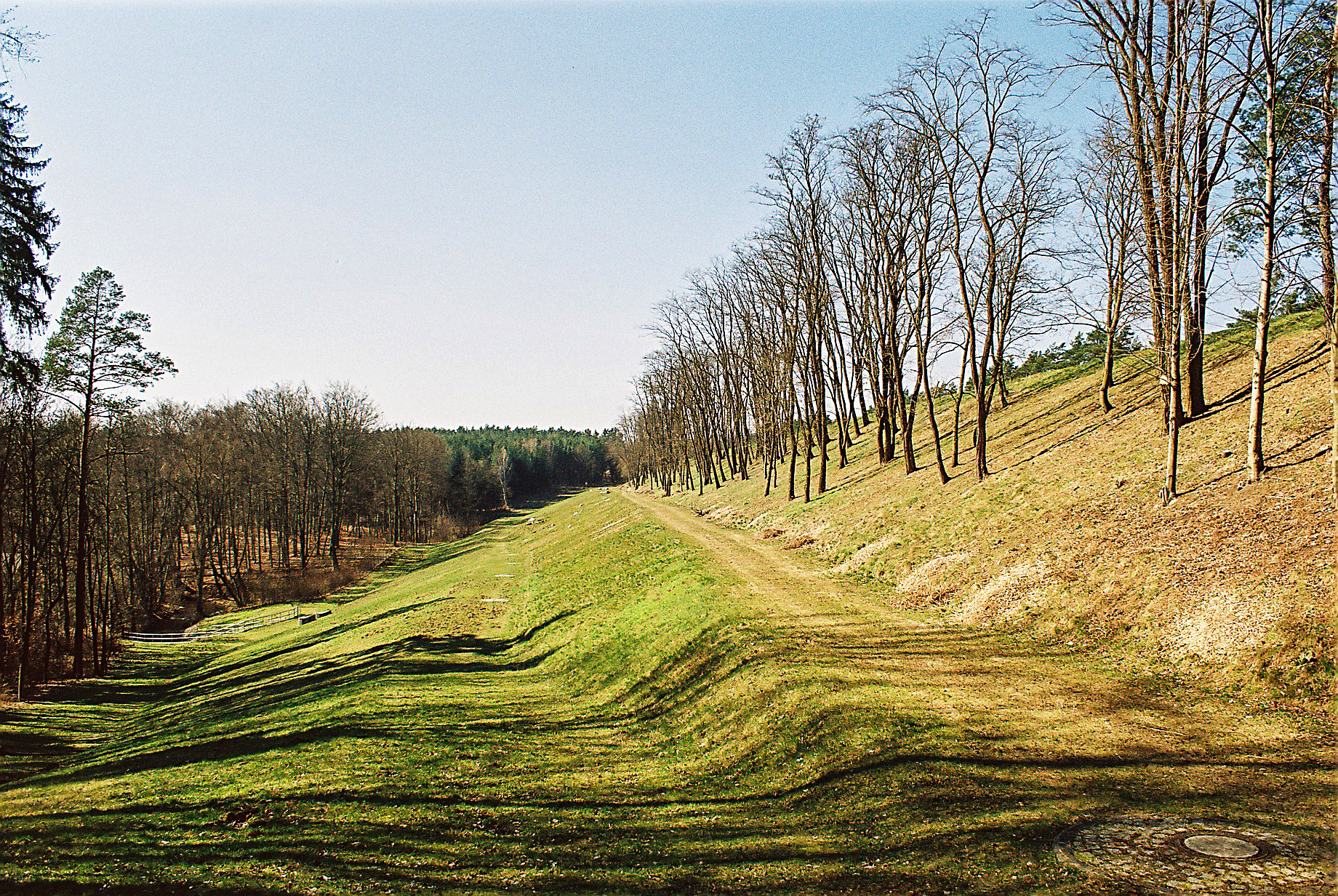
A berm is a level space, shelf, or raised barrier (usually made of compacted soil) separating areas in a vertical way, especially partway up a long slope. It can serve as a terrace road, track, path, a fortification line, a border/ separation barrier for navigation, good drainage, industry, or other purposes. Etymology The word is one of Middle Dutch and came into usage in English via French. Military use History In medieval military engineering, a berm (or berme) was a level space between a parapet or defensive wall and an adjacent steep-walled ditch or moat. It was intended to reduce soil pressure on the walls of the excavated part to prevent its collapse. It also meant that debris dislodged from fortifications would not fall into (and fill) a ditch or moat. In the trench warfare of World War I, the name was applied to a similar feature at the lip of a trench, which served mainly as an elbow-rest for riflemen. Modern usage In modern military engineering, a berm is ... [...More Info...] [...Related Items...] OR: [Wikipedia] [Google] [Baidu] |
Dams In New Jersey
Following is a list of dams and reservoirs in New Jersey. All major dams are linked below. The National Inventory of Dams defines any "major dam" as being tall with a storage capacity of at least , or of any height with a storage capacity of . Dams and reservoirs in New Jersey :''This list is incomplete. You can help Wikipedia by expanding it.'' * Beatties Dam, Passaic River Little Falls * Brick Township Reservoir, Brick Township Municipal Utilities Authority * Butler Reservoir, Passaic County *Colonial Lake, Lawrence Township * Dundie Dam, Passaic River * Furry Lake, East Brunswick and North Brunswick * Furnace Road Dam, Wanaque Reservoir, North Jersey District Water Supply Authority * Hackensack Reservoir No. 2, United Water New Jersey * Jersey City Reservoir No. 3 *Lake Carnegie Dam, Lake Carnegie, Princeton University * Lake Hopatcong Dam, Lake Hopatcong, New Jersey Division Of Parks And Forestry * Lake Musconetcong Dam. Lake Musconetcong *Lake Tappan Dam, Lake ... [...More Info...] [...Related Items...] OR: [Wikipedia] [Google] [Baidu] |
Run-of-the-river Power Stations
Run-of-river hydroelectricity (ROR) or run-of-the-river hydroelectricity is a type of hydroelectric generation plant whereby little or no water storage is provided. Run-of-the-river power plants may have no water storage at all or a limited amount of storage, in which case the storage reservoir is referred to as pondage. A plant without pondage is subject to seasonal river flows, thus the plant will operate as an intermittent energy source. Conventional hydro uses reservoirs, which regulate water for flood control, dispatchable electrical power, and the provision of fresh water for agriculture. Concept Run-of-the-river, or ROR, hydroelectricity is considered ideal for streams or rivers that can sustain a minimum flow or those regulated by a lake or reservoir upstream. A small dam is usually built to create a headpond ensuring that there is enough water entering the penstock pipes that lead to the turbines, which are at a lower elevation. Projects with pondage, as opposed t ... [...More Info...] [...Related Items...] OR: [Wikipedia] [Google] [Baidu] |
Riverdale, New Jersey
Riverdale is a borough in Morris County, in the U.S. state of New Jersey. As of the 2020 United States census, the borough's population was 4,107, an increase of 548 (+15.4%) from the 2010 census count of 3,559, which in turn reflected an increase of 1,061 (+42.5%) from the 2,498 counted at the 2000 Census. History Riverdale was incorporated as a borough by an act of the New Jersey Legislature on March 12, 1923, from portions of Pequannock Township, subject to the results of a referendum passed on April 17, 1923.Snyder, John P''The Story of New Jersey's Civil Boundaries: 1606-1968'' Bureau of Geology and Topography; Trenton, New Jersey; 1969. p. 196. Accessed October 23, 2012. Geography and climate According to the United States Census Bureau, the borough had a total area of 2.07 square miles (5.35 km2), including 2.03 square miles (5.25 km2) of land and 0.04 square miles (0.11 km2) of water (1.98%). The borough is bordered by the municipalities of Butler a ... [...More Info...] [...Related Items...] OR: [Wikipedia] [Google] [Baidu] |
Pompton Lakes
Pompton Lakes is a borough in Passaic County, New Jersey, United States. As of the 2010 United States Census, the borough's population was 11,097,DP-1 - Profile of General Population and Housing Characteristics: 2010 for Pompton Lakes borough, Passaic County, New Jersey , . Accessed July 3, 2012. [...More Info...] [...Related Items...] OR: [Wikipedia] [Google] [Baidu] |
Silt
Silt is granular material of a size between sand and clay and composed mostly of broken grains of quartz. Silt may occur as a soil (often mixed with sand or clay) or as sediment mixed in suspension with water. Silt usually has a floury feel when dry, and lacks plasticity when wet. Silt also can be felt by the tongue as granular when placed on the front teeth (even when mixed with clay particles). Silt is a common material, making up 45% of average modern mud. It is found in many river deltas and as wind-deposited accumulations, particularly in central Asia, north China, and North America. It is produced in both very hot climates (through such processes as collisions of quartz grains in dust storms) and very cold climates (through such processes as glacial grinding of quartz grains.) Loess is soil rich in silt which makes up some of the most fertile agricultural land on Earth. However, silt is very vulnerable to erosion, and it has poor mechanical properties, making construction ... [...More Info...] [...Related Items...] OR: [Wikipedia] [Google] [Baidu] |
Henry Barnard Kümmel
Henry Barnard Kümmel (1867 - October 23, 1945) was a State Geologist for the State of New Jersey during the 20th century who worked extensively in the management of the Morris Canal after its acquisition by New Jersey. Biography Kümmel was born in 1867 in Milwaukee, Wisconsin. His wife was Charlotte C. Kümmel. He studied geology under Rollin D. Salisbury at Beloit College, furthering his studies with graduate work at Harvard and the University of Chicago. Kümmel was an elder at Prospect Street Church and sat on the judicial commission for the trial of Rev. Dr. J. Gresham Machen in 1935, but resigned his post before the conclusion of the trial. Two quit board in Machen trial; Successors chosen after one of those named is said to sympathize with pastor. Kümmel died 23 October 1945 at home in Trenton, New Jersey, following a lengthy illness. Career On May 12, 1908, Kümmel became the founding Chairman of the Association of American State Geologists (AASG) in Washington, DC ... [...More Info...] [...Related Items...] OR: [Wikipedia] [Google] [Baidu] |
Cornelius Clarkson Vermeule II
Major Cornelius Clarkson Vermeule II (September 26, 1895 – August 7, 1943) was the director of the Public Works Administration in New Jersey, United States. He also succeeded his father, Cornelius Clarkson Vermeule Sr., as Engineer in Charge of the decommissioning and dismantlement of the Morris Canal. Biography He was born to Cornelius Clarkson Vermeule I on September 26, 1895. He married Catherine Sayre (née Comstock) December 3, 1921. They had one child, the renowned art historian Cornelius Clarkson Vermeule III, in Orange, New Jersey, on August 10, 1925. Vermeule continued his father's work with the government of the state of New Jersey, holding several positions over time and serving a pivotal role in the dismantlement and preservation of the Morris Canal. In 1934, Vermeule Jr. was issued the Distinguished Service Medal by the War Defense in for his "great courage and daring" staying on the line for three successive periods during the battle of Meuse-Argonne as a ... [...More Info...] [...Related Items...] OR: [Wikipedia] [Google] [Baidu] |
Ramapo River
The Ramapo River is a tributary of the Pompton River, approximately 30 mi (48 km) long, in southern New York and northern New Jersey in the United States. Course The Ramapo river rises in Round Lake, a small freshwater lake in the Town of Monroe, New York, in a mountainous area of central Orange County, New York. It flows southeast through the village, where the river was dammed in 1741 for a sawmill and grist mill. It continues to Harriman, where a chemical plant, Nepera Chemical, was built. While the plant has been dismantled, a superfund site has been designated at the location where barrels of toxic chemicals were buried. At Harriman, the river turns south into western Rockland County, where it flows through the hamlet and town of Ramapo, New York, then into northern Bergen County, New Jersey. In New Jersey, it flows SSW along the east side of the ridge of the Ramapo Mountains. The river flows into Potash Lake in Oakland, and from there into Pompton Lake in Pompto ... [...More Info...] [...Related Items...] OR: [Wikipedia] [Google] [Baidu] |
Pequannock Township
Pequannock Township is a township in Morris County, New Jersey, United States. As of the 2010 United States Census, the township's population was 15,420, reflecting an increase of 1,652 (+11.9%) from the 13,888 counted in the 2000 Census, which had in turn increased by 1,044 (+8.1%) from the 12,844 counted in the 1990 Census. The primary community in the township is the census-designated place of Pompton Plains. The name "Pequannock", as used in the name of the township and of the Pequannock River, is thought to have been derived from the Lenni Lenape Native American word ''Paquettahhnuake'', meaning "cleared land ready or being readied for cultivation". The name "Pompton" has been cited by some sources to mean "a place where they catch soft fish". ''New Jersey Monthly'' ranked Pequannock Township as the "Best Bang for the Buck" in New Jersey and 9th overall in its 2011 edition of "Best Places to Live" in New Jersey. It was then ranked 14th overall in the 2013 edition of ... [...More Info...] [...Related Items...] OR: [Wikipedia] [Google] [Baidu] |
Great Falls (Passaic River)
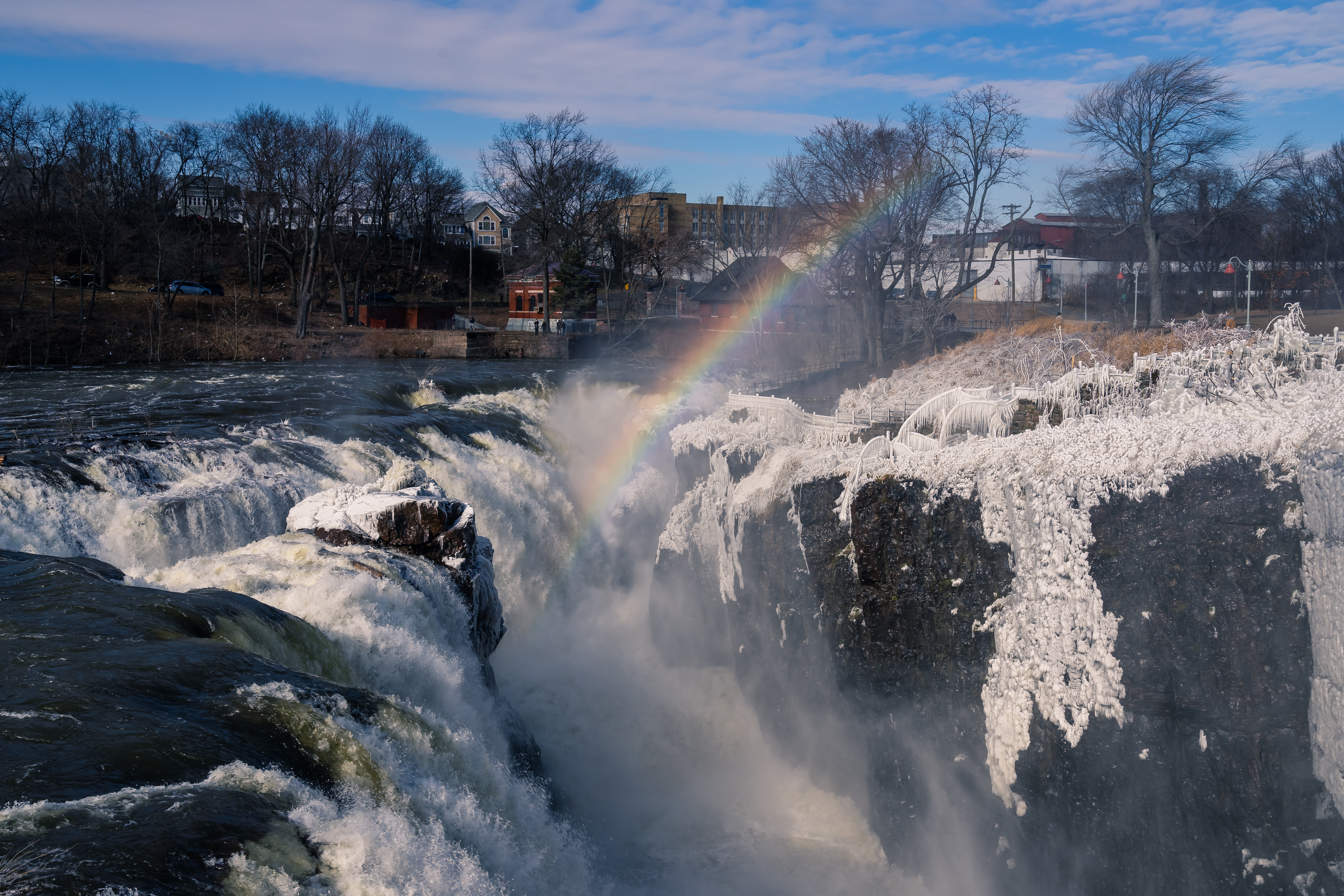
The Great Falls of the Passaic River is a prominent waterfall, high, on the Passaic River in the city of Paterson in Passaic County, New Jersey. The falls and surrounding area are protected as part of the Paterson Great Falls National Historical Park, administered by the National Park Service. The Congress authorized its establishment in 2009. One of the United States' largest waterfalls, it played a significant role in the early industrial development of New Jersey starting in the earliest days of the nation. It is part of the Great Falls of Paterson–Garret Mountain National Natural Landmark. It has also been designated as a National Historic Landmark District since 1976. The Great Falls' raceway and power systems were designated a National Historic Civil Engineering Landmark and a National Historic Mechanical Engineering Landmark in 1977. History Formation and early history Geologically, the falls were formed at the end of the last ice age approximately 13,000 years ... [...More Info...] [...Related Items...] OR: [Wikipedia] [Google] [Baidu] |


