|
Pentewan
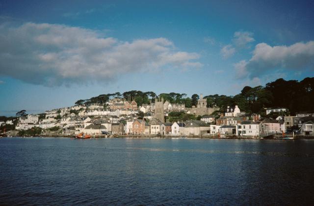
Pentewan ( kw, Bentewyn, meaning ''foot of the radiant stream'') is a coastal village and former port in south Cornwall, England, United Kingdom. It is situated at south of St Austell at the mouth of the St Austell River. Pentewan is in the civil parish of Pentewan Valley and the ecclesiastical parish of St Austell. Pentewan lies within the Cornwall Area of Outstanding Natural Beauty (AONB). Village and harbour The village and its harbour date back to medieval times, when Pentewan was mainly a fishing community, with some stone-quarrying, tin-streaming, and agriculture. Leland, writing in 1549, referred briefly to 'Pentowan' as "a sandy bay witherto fischer bootes repair for socour". Between 1818 and 1826, local land- and quarry owner Sir Christopher Hawkins substantially rebuilt the harbour, partly to improve the existing pilchard-fishery and partly to turn the village into a major china clay port. At its peak, Pentewan shipped a third of Cornwall's china clay, but c ... [...More Info...] [...Related Items...] OR: [Wikipedia] [Google] [Baidu] |
Pentewan Railway
The Pentewan Railway was a Narrow gauge railway, narrow gauge railway in Cornwall, England. It was built as a horse-drawn tramway carrying Kaolinite, china clay from St Austell to a new harbour at Pentewan, and was opened in 1829. In 1874 the line was strengthened for locomotive working. It finally succumbed to more efficient operation at other ports and closed in 1918. Origins Tin mining had been the dominant industry in much of Cornwall in the eighteenth century, but that work was declining by the 1830s. China clay (referred to as kaolinite outside the United Kingdom) had been discovered in the area north and west of St Austell, in Cornwall, and Rashleigh family#Charles Rashleigh, Charles Rashleigh was prominent in developing the industry; he built a harbour at Charlestown, Cornwall, Charlestown from which the material could be shipped to market. The harbour was south-east of St Austell town and the principal sources of the mineral were to the north west, and that the china ... [...More Info...] [...Related Items...] OR: [Wikipedia] [Google] [Baidu] |
London Apprentice
London Apprentice ( kw, Oberden Loundres) is a village in south Cornwall, England, UK, on the banks of St Austell River in the Pentewan Valley (where the population of the 2011 census was included) approximately two miles (3 km) south of St Austell. The village is in the civil parish of Pentewan Valley and the ecclesiastical parish of St Austell. It was named after the London Apprentice Inn, which formerly stood on the St Austell to Pentewan road. The inn traded from 1815 to 1871 and probably longer.http://freepages.genealogy.rootsweb.ancestry.com/~kayhin/72264.html 1871 census Tin-mining In 1833, a coalyard was constructed on the Pentewan Railway situated near the inn to supply coal to the tin mines at nearby Polgooth and the settlement may have arisen around this point. According to nineteenth-century census returns, most of the villagers were engaged in tin-mining, either in the stream-works of Wheal Virgin, close to London Apprentice, or in Polgooth. The Wheal Virgin ... [...More Info...] [...Related Items...] OR: [Wikipedia] [Google] [Baidu] |
Pentewan Valley
Pentewan Valley is one of four new civil parishes created on 1 April 2009 for the St Austell district of mid Cornwall, England, United Kingdom. The population including Gracca, Lavalsa Meor, London Apprentice and Lower Porthpean Lower Porthpean is a coastal hamlet in Cornwall, England, UK. It is close to Higher Porthpean Higher Porthpean is a village south of Duporth and contiguous with Lower Porthpean in Cornwall, England. It has a small church, dedicated to St L ... at the 2011 Census was 826. The new parish is the largest of the four by area and is rural in character. It includes the settlements of Trewhiddle, London Apprentice and Pentewan and is represented by nine councillors. Pentewan, the coastal village from which the new parish derives its name, is approximately three miles (5 km) south of St Austell.Ordnance Survey: Landranger map sheet 204 ''Truro & Falmouth'' The name Pentewan Valley also applies to the valley of the St Austell River betwe ... [...More Info...] [...Related Items...] OR: [Wikipedia] [Google] [Baidu] |
St Austell
St Austell (; kw, Sans Austel) is a town in Cornwall, England, south of Bodmin and west of the border with Devon. St Austell is one of the largest towns in Cornwall; at the 2011 census it had a population of 19,958. History St Austell was a village centred around the parish church, until the arrival of significant tin mining in the 18th century turned it into a town. St Austell is named after the 6th century Cornish saint, St Austol, a disciple of St Mewan. In a Vatican manuscript there is a 10th-century list of Cornish parish saints. This includes Austoll, which means that the church and village existed at that time, shortly after 900. St Austell is not mentioned in Domesday Book (1086). However A. L. Rowse, in his book ''St. Austell: Church, Town, and Parish'', cites records which show a church was dedicated on 9 October 1262 by Bishop Bronescombe, and other records show a church there in 1169, dedicated to "Sanctus Austolus". The current church dates from the 13t ... [...More Info...] [...Related Items...] OR: [Wikipedia] [Google] [Baidu] |
St Austell River
The St Austell River ( kw, Dowr an Wynyk, meaning ''the little white river'') properly known as the River Vinnick, but historically called The White River, is a long river located in south Cornwall, England, United Kingdom. . The river has also been known as the "red river" due to tin streaming and mining activity upstream. The river drains the central southern section of the St Austell Moorland, the second largest granite mass in Cornwall, an upland formed in the Variscan orogeny, to the north of St Austell. The highest natural point of the moorland is Hensbarrow Beacon at ; however modern china clay mining waste tips now rise above it. The name ''White River'' has been adopted locally because waste water from china clay quarrying and refining practices was emptied into the river giving it a white colour. The local term ''White River'' has given its name to the St Austell Town Centre Redevelopment Scheme, which is now called White River Place. The route The river has two ... [...More Info...] [...Related Items...] OR: [Wikipedia] [Google] [Baidu] |
John Barraclough Fell
John Barraclough Fell (1815 – 18 October 1902) was an English railway engineer and inventor of the Fell mountain railway system. Fell spent the early part of his life in London, living with his parents. About 1835 he moved with them to the Lake District. In 1840, he married a 25-year-old woman named Martha in Kirkstall, West Yorkshire. In the 1840s he worked on the first of several railways he would help construct: the Furness and Whitehaven Railway. He continued working professionally on railways while living in Italy in the 1850s. Fell helped construct several early Italian lines, including the Central of Italy, the Maremma, and the Genoa and Voltri. He frequently crossed Mont Cenis, between Italy and France, by road, and this reportedly inspired him to create his Fell Centre-Rail System. The Fell Centre-Rail System tackled the problem of trains climbing and descending steep gradients, which was often necessary until improvements in tunnelling were developed. In ... [...More Info...] [...Related Items...] OR: [Wikipedia] [Google] [Baidu] |
Sir Christopher Hawkins, 1st Baronet
Sir Christopher Hawkins, 1st Baronet FRS (29 May 1758 – 6 April 1829) was a Cornish landowner, mine-owner, Tory Member of Parliament, and patron of steam power. He was Recorder of Grampound, of Tregony, and of St Ives, Cornwall. The Hawkins family Christopher Hawkins was the second son of Thomas Hawkins of Trewithen, a considerable landowner and former MP for Grampound. Thomas Hawkins had a lifelong fear of smallpox and died following an inoculation to prevent it. Christopher's elder brother John was drowned in the River Thames whilst at Eton, whilst a younger brother Thomas died "of a fever in consequence of eating an ice-cream after dancing." His youngest brother, John Hawkins, survived and became a noted geologist. On his father's death in 1766, Christopher inherited his estates. Career as MP Hawkins was appointed High Sheriff of Cornwall for 1783. He then followed in his father's footsteps by becoming a member of parliament at the age of 26. He subsequently earned notori ... [...More Info...] [...Related Items...] OR: [Wikipedia] [Google] [Baidu] |
Elvan
Elvan is a name used in Cornwall and Devon for the native varieties of quartz-porphyry. They are dispersed irregularly in the Devonian series of rocks and some of them make very fine building stones (e.g. Pentewan stone, Polyphant stone and Catacleuse stone). Greenstone is another name for this stone and it is often used for parts of buildings such as doorways so they can be finely carved. Most of the elvan quarries are now disused. Others are quarried in bulk for aggregates commonly used for road-building. More precisely there are two types of rock in this category: one is "white elvan" and the other is "blue elvan". "White elvans" are a group of fine-grained, acid igneous rocks, while "blue elvans" or "greenstones" are various unusual basic igneous rocks. "White elvan" comes from various different locations and is often known as Pentewan stone (or by other names based on the location). Some older descriptions of building stones have called "white elvans" limestone, e.g. in stu ... [...More Info...] [...Related Items...] OR: [Wikipedia] [Google] [Baidu] |
Charlestown, Cornwall
Charlestown ( kw, Porth Meur, meaning ''great cove'') is a village and port on the south coast of Cornwall, United Kingdom, and in the civil parish of St Austell Bay. It is situated approximately south east of St Austell town centre. The port at Charlestown developed in the late 18th century from the fishing village of West Polmear. Whereas other areas of St Austell have seen much development during the 20th century, Charlestown has remained relatively unchanged. History Charlestown grew out of the small fishing village of West Polmear (or West Porthmear), which consisted of a few cottages and three cellars, in which the catch of pilchards were processed. The population amounted to nine fishermen and their families in 1790. Before the harbour was built, trading vessels landed and loaded on the beach. Charles Rashleigh, who moved to Duporth Manor, just outside the village, used plans prepared by John Smeaton to begin the construction of a harbour and dock in 1791. After bu ... [...More Info...] [...Related Items...] OR: [Wikipedia] [Google] [Baidu] |
Fowey
Fowey ( ; kw, Fowydh, meaning 'Beech Trees') is a port town and civil parish at the mouth of the River Fowey in south Cornwall, England, United Kingdom. The town has been in existence since well before the Norman invasion, with the local church first established some time in the 7th century; the estuary of the River Fowey forms a natural harbour which enabled the town to become an important trading centre. Privateers also made use of the sheltered harbourage. The Lostwithiel and Fowey Railway brought China clay here for export. History Early history The Domesday Book survey at the end of the 11th century records manors at Penventinue and Trenant, and a priory was soon established nearby at Tywardreath. the prior granted a charter to people living in Fowey itself. This medieval town ran from a north gate near Boddinick Passage to a south gate at what is now Lostwithiel Street; the town extended a little way up the hillside and was bounded on the other side by the river where ... [...More Info...] [...Related Items...] OR: [Wikipedia] [Google] [Baidu] |
Botusfleming
Botusfleming or Botus Fleming ( kw, Bosflumyes) is a village and civil parish in southeast Cornwall, England, United Kingdom. The 2001 census gives the parish population as 783,which decreased to 771 at the 2011 census. The village is about three miles north-west of Saltash at . There is a public house (the Rising Sun), a market garden and a small colony of artists, but the village is mostly a dormitory area for Plymouth. Parish church The parish church is dedicated to St Mary and has a western tower and a fine arcade between the nave and the north aisle. The church was restored in 1872 by Henry Eliott; this restoration included new roofs, floors, pews and glazing. The font is of Polyphant stone, probably 14th century in date. In a field near the church is an obelisk in memory of William Martyn built in 1762. In the church is a stone effigy of a knight in armour; he is thought to be Stephen le Fleming who was a medieval Crusader and perhaps left his name to the place. Other b ... [...More Info...] [...Related Items...] OR: [Wikipedia] [Google] [Baidu] |
Cycle Path
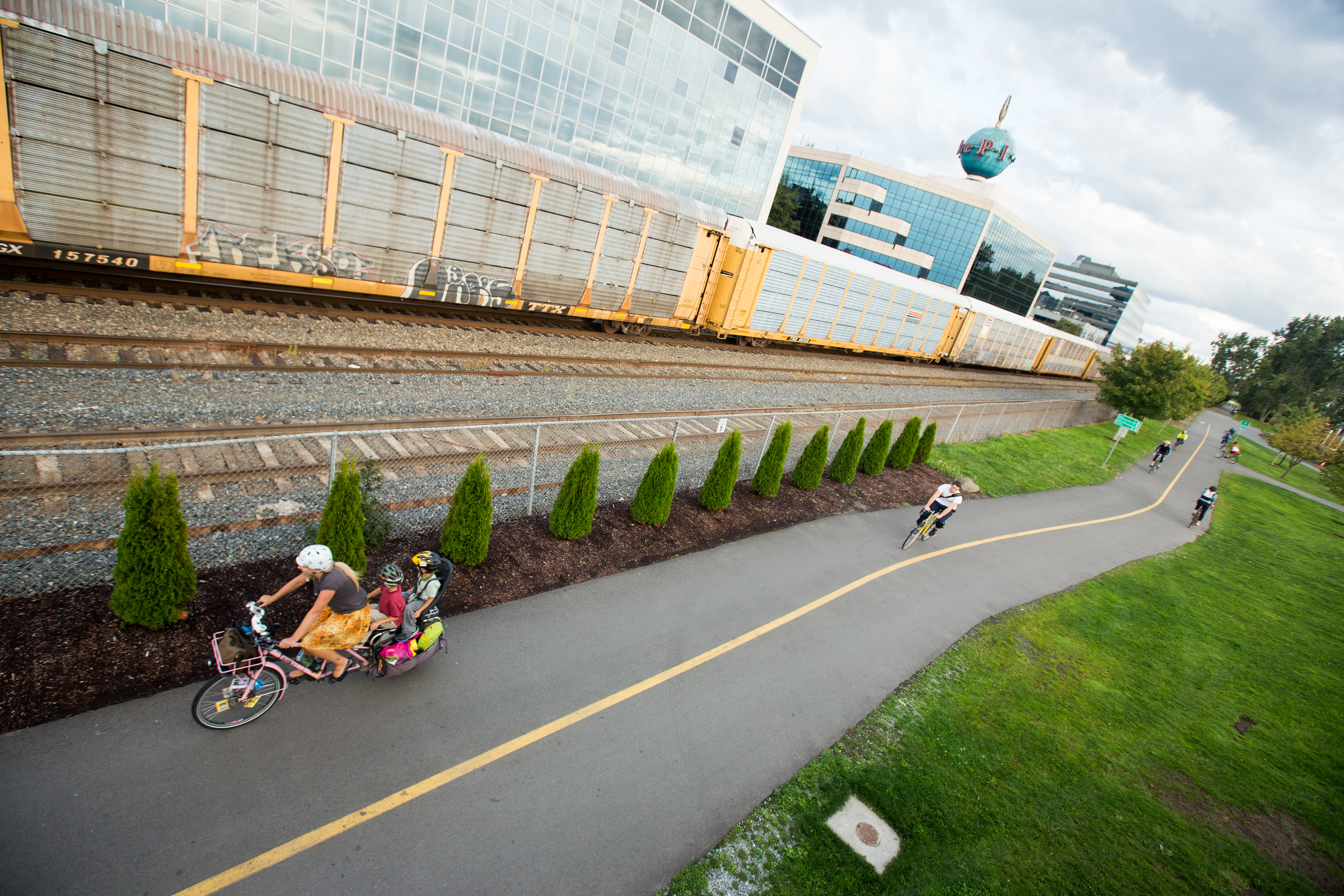
A bike path is a bikeway separated from motorized traffic and dedicated to cycling or shared with pedestrians or other non-motorized users. In the US a bike path sometimes encompasses ''shared use paths'', "multi-use path", or "Class III bikeway" is a paved path that has been designated for use by cyclists outside the right of way of a public road. It may or may not have a center divider or stripe to prevent head-on collisions. In the UK, a ''shared-use footway'' or ''multi-use path'' is for use by both cyclists and pedestrians. Bike paths with independent rights-of-way Bike paths that follow independent rights-of-way are often used to promote recreational cycling. In Northern European countries, cycling tourism represents a significant proportion of overall tourist activity. Extensive interurban bike path networks can be found in countries such as Denmark or the Netherlands, which has had a national system of cycle routes since 1993. These networks may use routes dedicated exc ... [...More Info...] [...Related Items...] OR: [Wikipedia] [Google] [Baidu] |


_(FindID_258401).jpg)


_p1.168_-_Moditonham_House%2C_Cornwall.jpg)
