|
Penn Street Station
Penn Street station is a SEPTA Route 102 trolley stop in Clifton Heights, Pennsylvania. It is officially located near Penn Street and Broadway Avenue, although the actual location on Penn Street is halfway between Broadway and Berkley Avenues. Because the station runs through a residential neighborhood, no parking is available. Trolleys arriving at this station travel between 69th Street Terminal in Upper Darby Township, Pennsylvania and Sharon Hill, Pennsylvania. The tracks cross all three of the streets mentioned above. They run directly south before curving to the southwest as they cross the intersection of Broadway Avenue and Ogden Street. At Penn Street itself, there are two platforms, one on the northeast corner of the crossing, and another on the southwest corner of the crossing. The southwest platform runs in front of a small children's playground on the northwest corner of Penn Street and Berkley Avenue, and contains a small open acrylic glass shelter. The tracks cros ... [...More Info...] [...Related Items...] OR: [Wikipedia] [Google] [Baidu] |
Clifton Heights, Pennsylvania
Clifton Heights is a borough in Delaware County, Pennsylvania, United States, located on Darby Creek west of downtown Philadelphia. As of the 2010 census the population was 6,652. History The population of the borough was 1,820 in 1890, 3,155 in 1910, and reached a maximum of 10,268 in 1960. Clifton Heights is the birthplace of the glam rock band Cinderella. Clifton Heights is the home of Rosati Water Ice, the first Italian ice company in the US. Geography Clifton Heights is located in eastern Delaware County at (39.929062, -75.295760). It is bordered to the northeast by the borough of Lansdowne, to the southeast by the borough of Aldan, and to the west, north, and southeast by Upper Darby Township. The main road through the borough is Baltimore Avenue, which leads northeast into Philadelphia and southwest to Media. Clifton Heights is bordered by Darby Creek to the west. According to the United States Census Bureau, the borough has a total area of , all of it land. De ... [...More Info...] [...Related Items...] OR: [Wikipedia] [Google] [Baidu] |
Side Platform
A side platform (also known as a marginal platform or a single-face platform) is a platform positioned to the side of one or more railway tracks or guideways at a railway station, tram stop, or transitway. A station having dual side platforms, one for each direction of travel, is the basic design used for double-track railway lines (as opposed to, for instance, the island platform where a single platform lies between the tracks). Side platforms may result in a wider overall footprint for the station compared with an island platform where a single width of platform can be shared by riders using either track. In some stations, the two side platforms are connected by a footbridge running above and over the tracks. While a pair of side platforms is often provided on a dual-track line, a single side platform is usually sufficient for a single-track line. Layout Where the station is close to a level crossing (grade crossing) the platforms may either be on the same side of the cross ... [...More Info...] [...Related Items...] OR: [Wikipedia] [Google] [Baidu] |
Overhead Lines
An overhead line or overhead wire is an electrical cable that is used to transmit electrical energy to electric locomotives, trolleybuses or trams. It is known variously as: * Overhead catenary * Overhead contact system (OCS) * Overhead equipment (OHE) * Overhead line equipment (OLE or OHLE) * Overhead lines (OHL) * Overhead wiring (OHW) * Traction wire * Trolley wire This article follows the International Union of Railways in using the generic term ''overhead line''. An overhead line consists of one or more wires (or rails, particularly in tunnels) situated over rail tracks, raised to a high electrical potential by connection to feeder stations at regular intervals. The feeder stations are usually fed from a high-voltage electrical grid. Overview Electric trains that collect their current from overhead lines use a device such as a pantograph, bow collector or trolley pole. It presses against the underside of the lowest overhead wire, the contact wire. Current collectors are ... [...More Info...] [...Related Items...] OR: [Wikipedia] [Google] [Baidu] |
SEPTA
The Southeastern Pennsylvania Transportation Authority (SEPTA) is a regional public transportation authority that operates bus, rapid transit, commuter rail, light rail, and electric trolleybus services for nearly 4 million people in five counties in and around Philadelphia, Pennsylvania. It also manages projects that maintain, replace and expand its infrastructure, facilities and vehicles. SEPTA is the major transit provider for Philadelphia and the counties of Delaware, Montgomery, Bucks, and Chester. It is a state-created authority, with the majority of its board appointed by the five Pennsylvania counties it serves. While several SEPTA commuter rail lines terminate in the nearby states of Delaware and New Jersey, additional service to Philadelphia from those states is provided by other agencies: the PATCO Speedline from Camden County, New Jersey is run by the Delaware River Port Authority, a bi-state agency; NJ Transit operates many bus lines and a commuter rail line to ... [...More Info...] [...Related Items...] OR: [Wikipedia] [Google] [Baidu] |
SEPTA Route 102
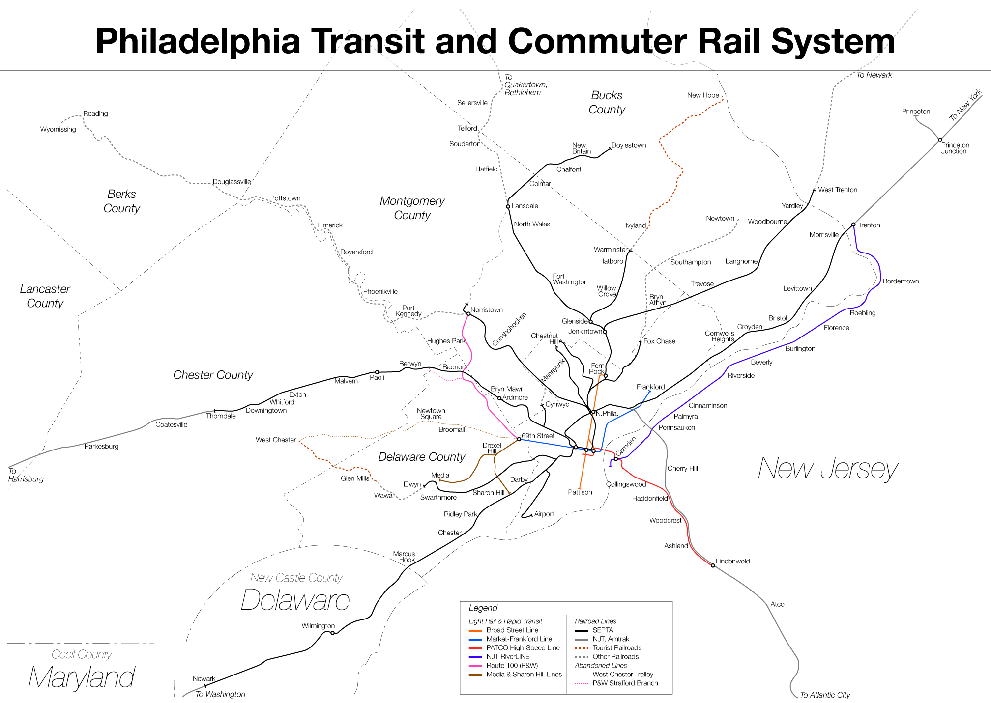
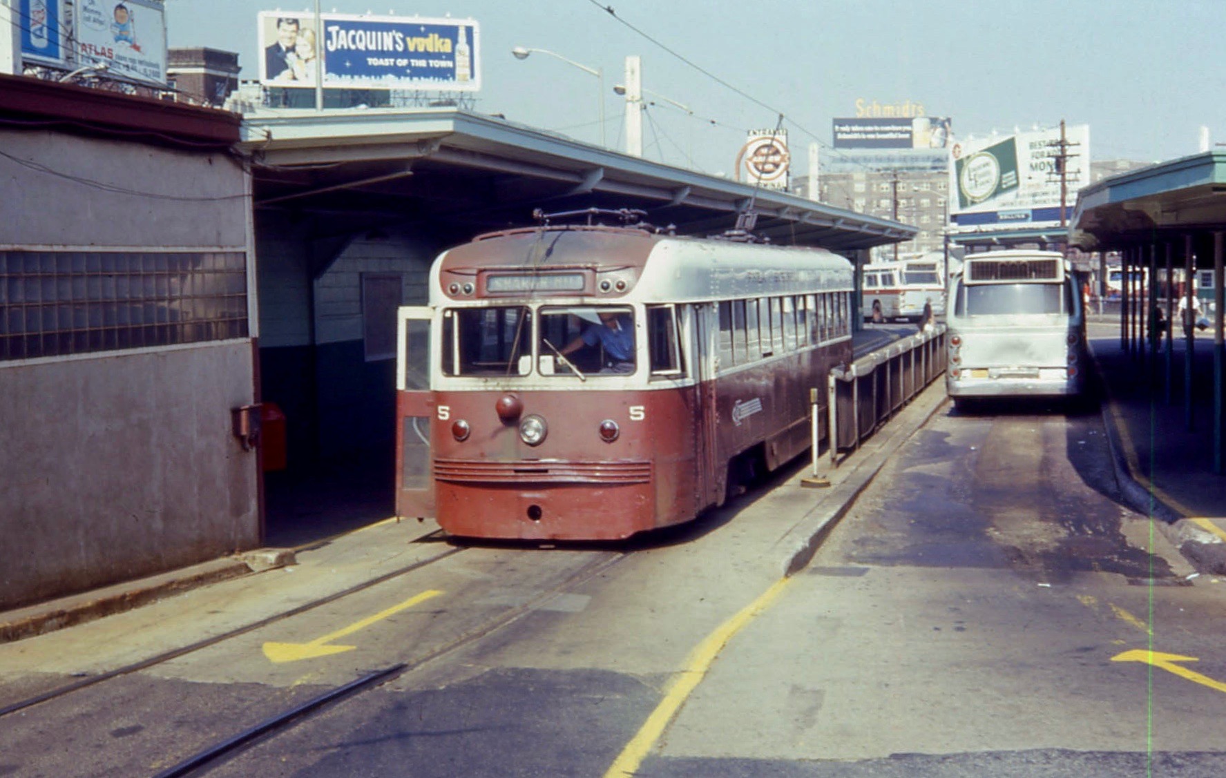
SEPTA Routes 101 and 102, also known as the Media–Sharon Hill Line, are light rail lines operated by the Suburban Transit Division of the Southeastern Pennsylvania Transportation Authority, serving portions of Delaware County. The routes' eastern terminus is 69th Street Transportation Center in Upper Darby, Pennsylvania. Route 101 runs to Media, while Route 102 goes to Sharon Hill. Altogether, the two lines operate on approximately of route. The lines were formerly interurbans. Along with the Norristown High Speed Line, formerly the Philadelphia and Western Railroad, the routes are the remaining lines of the Red Arrow Lines Trolley System once operated by the Philadelphia Suburban Transportation Company (successor to the Philadelphia and West Chester Traction Company); some local residents still call them "Red Arrow". This route uses 29 Kawasaki Heavy Industries Rolling Stock Company Type K LRV cars similar to those used on the SEPTA Subway–Surface Trolley Lines. Howeve ... [...More Info...] [...Related Items...] OR: [Wikipedia] [Google] [Baidu] |
69th Street Terminal
The 69th Street Transportation Center is a SEPTA terminal in the Terminal Square section of Upper Darby, Pennsylvania, just west of the city limits of Philadelphia. The terminal serves the Market–Frankford Line, Norristown High Speed Line, and the Media–Sharon Hill Line trolleys, and multiple bus routes. It is located at the end of 69th Street, a major retail corridor in Upper Darby, across Market Street ( Route 3) from the Tower Theater. Until 2011, the station was primarily known as 69th Street Terminal. 69th Street is the second busiest transfer point in the SEPTA system (after 15th Street/ City Hall station) serving 35,000 passengers every weekday. It is also the only SEPTA facility to serve both City Transit and Suburban Transit routes. History 69th Street is one of the original Market Street Elevated stations built by the Philadelphia Rapid Transit Company; the line opened for service on March 4, 1907 between here and stations. Shortly after on May 22 of the same yea ... [...More Info...] [...Related Items...] OR: [Wikipedia] [Google] [Baidu] |
Upper Darby Township, Pennsylvania
Upper Darby Township, often shortened to Upper Darby, is a home rule township in Delaware County, Pennsylvania. The township borders Philadelphia, the nation's sixth most populous city as of 2020 with 1.6 million residents. As of the 2020 census, the township had a total population of 85,681, making it the sixth most populated city or borough in Pennsylvania, after Philadelphia, Pittsburgh, Allentown, Reading, and Erie. Upper Darby is 65% residential, 25% commercial, and 8% other. Upper Darby is home to the Tower Theater, a historic music venue on 69th Street built in the 1920s, and is also home to several Underground Railroad sites. Upper Darby's population is diverse, representing over 100 ethnic cultures. The township hosts a range of housing types including densely populated rowhouse sections similar to houses in neighboring West Philadelphia, tree-lined neighborhoods of turn-of-the-century single-family houses and mid-century developments. Because of a home-rule cha ... [...More Info...] [...Related Items...] OR: [Wikipedia] [Google] [Baidu] |
Sharon Hill, Pennsylvania
Sharon Hill is a borough in Delaware County, Pennsylvania, United States. The population was 5,697 at the 2010 census. Currently the population stands at 6,356 residents. Government The government of Sharon Hill operates under the Pennsylvania State Borough Code. The day-to-day operations of the borough are exercised through the borough manager, Ieasa Nichols. The mayor is Hykeem Green. The borough has seven councilmembers. Geography Sharon Hill is located in eastern Delaware County at (39.906340, -75.271008). It is bordered to the west by Folcroft, to the north by Collingdale and Darby, to the east by Colwyn, and to the south by Darby Township. U.S. Route 13 (Chester Pike) is the main road through the borough, leading northeast to Center City Philadelphia and southwest to Chester. According to the United States Census Bureau, Sharon Hill has a total area of , all of it land. Demographics As of Census 2010, the racial makeup of the borough was 32.6% White, 60.6% Afr ... [...More Info...] [...Related Items...] OR: [Wikipedia] [Google] [Baidu] |
Springfield Road (SEPTA Route 102 Station)
The Springfield Road ( ga, Bóthar Chluanaí) is a residential area and road traffic thoroughfare adjacent to the Falls Road in west Belfast. The local population is predominantly Irish nationalist and republican. Along parts of the road are several interface area with the neighbouring Ulster loyalist areas of the Greater Shankill. The Springfield Road includes the Ballymurphy and New Barnsley districts and is overlooked by Black Mountain and Divis. History Much of what now forms the housing estates of the Springfield Road was formerly rural land near the base of the mountains. The area around what became New Barnsley was known as Brown's Fields and was formerly used for grazing cattle. The area would later become industrialised with James Mackie & Sons establishing a textile factory on the road in the late nineteenth century. It became a leading employer and produced large quantities of munitions during the Second World War. The area experienced growth in the 1940s w ... [...More Info...] [...Related Items...] OR: [Wikipedia] [Google] [Baidu] |
.jpg)


