|
Peninsula Boulevard
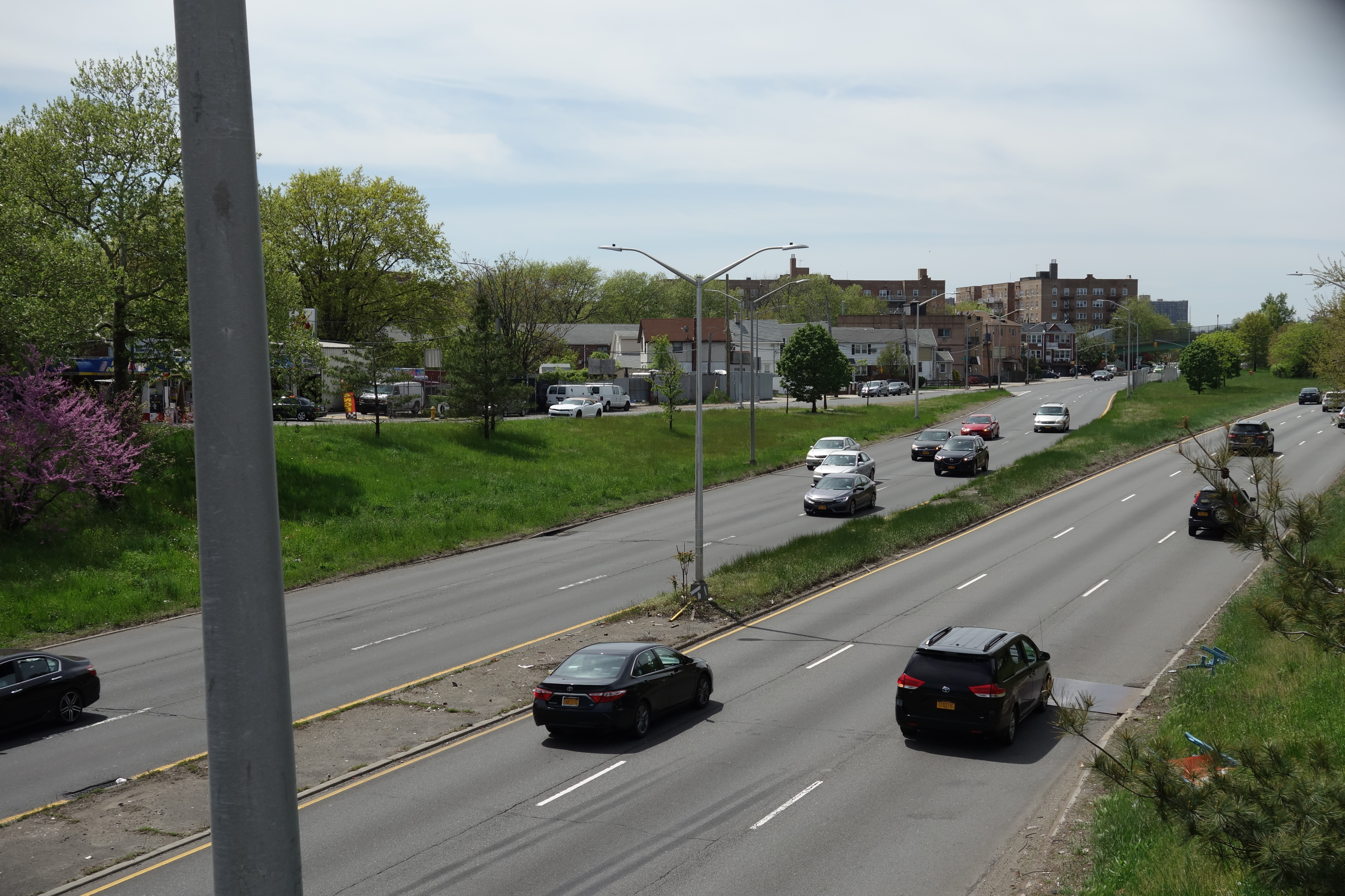
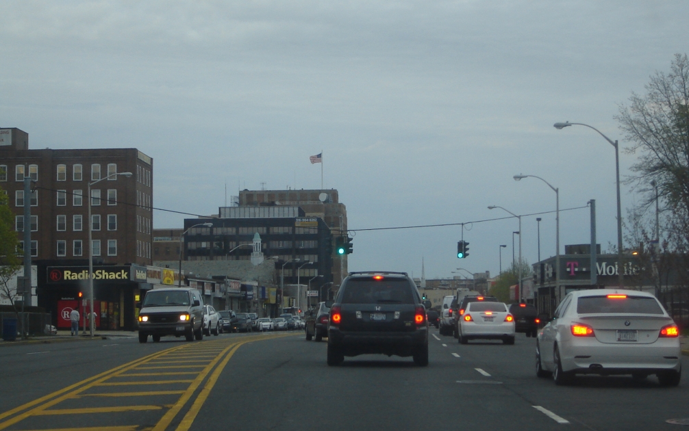
Peninsula Boulevard is a major arterial road through southwestern Nassau County, New York. It runs southwest-to-northeast between Cedarhurst connecting the Five Towns area to the Village of Hempstead, and indirectly serves The Rockaways as well. For its entire length, Peninsula Boulevard is maintained by the Nassau County Department of Public Works as the unsigned County Route 2 (CR 2). Route description Peninsula Boulevard (CR 2) Peninsula Boulevard begins in Cedarhurst at Rockaway Turnpike (CR 257), near a connecting road to New York Route 878 (Nassau Expressway), and runs through the Five Towns area, where it spends much of its journey running northeast and southwest as a four-lane undivided thoroughfare. In Hewlett, it becomes a divided highway at Franklin Street and then runs beneath a bridge for the Far Rockaway Branch of the Long Island Rail Road between Mill Road and Gibson Boulevard. After Gibson Boulevard, the divider becomes wider as it winds to ... [...More Info...] [...Related Items...] OR: [Wikipedia] [Google] [Baidu] |
Cedarhurst, New York
Cedarhurst is a village in the Town of Hempstead in Nassau County, on the South Shore of Long Island, in New York, United States. The population was 6,592 at the 2010 census. The Incorporated Village of Cedarhurst is located in the region of Long Island's South Shore known as the Five Towns. History The village was incorporated in 1910. It is part of the "Five Towns," together with the village of Lawrence and the hamlets of Woodmere and Inwood, and "The Hewletts," which consist of the villages of Hewlett Bay Park, Hewlett Harbor and Hewlett Neck and the hamlet of Hewlett, along with Woodsburgh. Cedarhurst's early name was Ocean Point. Rail service arrived in 1869 which led people to the area, especially to the Rockaway Hunting Club, built in Cedarhurst in 1878. A post office was established in 1884, and Ocean Point was renamed Cedarhurst, partly at the request of the Hunt Club. The name Cedarhurst is in reference to a grove of trees that once stood at the post office ... [...More Info...] [...Related Items...] OR: [Wikipedia] [Google] [Baidu] |
Long Island Rail Road
The Long Island Rail Road , often abbreviated as the LIRR, is a commuter rail system in the southeastern part of the U.S. state of New York (state), New York, stretching from Manhattan to the eastern tip of Suffolk County, New York, Suffolk County on Long Island. With an average weekday ridership of 354,800 passengers in 2016, it is the List of United States commuter rail systems by ridership, busiest commuter railroad in North America. It is also one of the world's few commuter systems that runs 24/7 year-round. It is Government-owned corporation, publicly owned by the Metropolitan Transportation Authority, which refers to it as MTA Long Island Rail Road. In , the system had a ridership of , or about per weekday as of . The LIRR logo combines the circular MTA logo with the text ''Long Island Rail Road'', and appears on the sides of trains. The LIRR is one of two commuter rail systems owned by the MTA, the other being the Metro-North Railroad in the northern suburbs of the New ... [...More Info...] [...Related Items...] OR: [Wikipedia] [Google] [Baidu] |
Manual On Uniform Traffic Control Devices
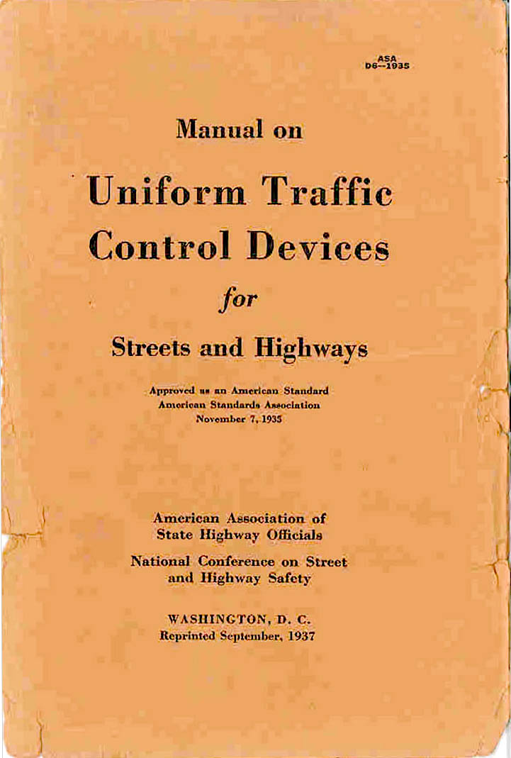
The ''Manual on Uniform Traffic Control Devices for Streets and Highways'' (usually referred to as the ''Manual on Uniform Traffic Control Devices'', abbreviated MUTCD) is a document issued by the Federal Highway Administration (FHWA) of the United States Department of Transportation (USDOT) to specify the standards by which traffic signs, road surface markings, and signals are designed, installed, and used. In the United States, all traffic control devices must legally conform to these standards. The manual is used by state and local agencies as well as private construction firms to ensure that the traffic control devices they use conform to the national standard. While some state agencies have developed their own sets of standards, including their own MUTCDs, these must substantially conform to the federal MUTCD. The MUTCD defines the content and placement of traffic signs, while design specifications are detailed in a companion volume, ''Standard Highway Signs''. This manual de ... [...More Info...] [...Related Items...] OR: [Wikipedia] [Google] [Baidu] |
New York State Route 878
New York State Route 878 (NY 878) is a state highway on Long Island and in New York City. The route exists in two sections, which both form the Nassau Expressway. NY 878's western terminus is the Belt Parkway and Conduit Avenue ( NY 27) in Ozone Park, within southern Queens. Its southern terminus is immediately before the Village of Atlantic Beach, at the Atlantic Beach Bridge in Lawrence, within southwestern Nassau County. NY 878 is discontinuous between Farmers Boulevard in Queens and the town of Inwood in Nassau County. The two sections are connected to each other by Rockaway Boulevard and Rockaway Turnpike. NY 878 is maintained in part by the New York City Department of Transportation (NYCDOT); the New York State Department of Transportation (NYSDOT); and the government of Nassau County. The NYSDOT also maintains part of Rockaway Boulevard, which is designated as the reference route NY 909G. The of NY 878 between I-678 and the JFK Exp ... [...More Info...] [...Related Items...] OR: [Wikipedia] [Google] [Baidu] |
New York State Route 24
New York State Route 24 (NY 24) is a east–west state highway on Long Island in the U.S. state of New York. The highway is split into two segments, with the longest and westernmost of the two extending from an interchange with Interstate 295 (I-295, named the Clearview Expressway) and NY 25 (Hillside Avenue) in the Queens Village section of the New York City borough of Queens to an intersection with NY 110 in East Farmingdale in the Suffolk County town of Babylon. The shorter eastern section, located in eastern Suffolk County, extends from an interchange with I-495 in Calverton to an intersection with County Route 80 (CR 80) in Hampton Bays. NY 24 is one of three highways in New York that are split into two segments; the others are NY 42 in the Catskills and NY 878 in Queens and Nassau County. Like NY 42, NY 24 was a continuous route when it was assigned as part of the 1930 renumbering of state highways i ... [...More Info...] [...Related Items...] OR: [Wikipedia] [Google] [Baidu] |
New York State Route 102
New York State Route 102 (NY 102) is an east–west state highway in Nassau County, New York, in the United States. It is little more than an alternate route of NY 24 through the town of Hempstead. NY 102 leaves NY 24 in West Hempstead and follows Front Street through the village of Hempstead and Uniondale before rejoining NY 24 in East Meadow. The portion of NY 102 west of William Street is maintained by Nassau County and is unsigned while the remainder of the highway is maintained by the New York State Department of Transportation and signed. NY 102 goes under the Meadowbrook State Parkway, but has no connecting ramps to or from the parkway. It does, however have a right-of-way for a formerly proposed eastbound lane. NY 102 was assigned in the 1930s and has not been changed significantly since. The 2017 route log erroneously shows that NY 102's western terminus is at William Street in the village of Hempstead, where maintenance s ... [...More Info...] [...Related Items...] OR: [Wikipedia] [Google] [Baidu] |
Glen Cove Road
Glen Cove Road (also known as Guinea Woods Road) is a , major north–south thoroughfare running through north-central Nassau County on Long Island, New York, in the United States. It is the main road leading to the communities on the east shore of Hempstead Harbor. The portion south of the North Hempstead– Oyster Bay town line is the unsigned County Route 1 (CR 1), while the portion north of the town line until its intersection with NY 107 is designated as New York State Route 900B (NY 900B), an unsigned reference route, New York State Route 107 (NY 107), and County Route 243 (CR 243), an unsigned county route. The northern segment of the highway encompasses the Glen Cove Arterial Highway (also known as Pratt Boulevard), a limited-access highway that was intended to connect to a proposed bridge across the Long Island Sound to Connecticut. Route description Glen Cove Road was once signed as Nassau County Route 1 until all county ... [...More Info...] [...Related Items...] OR: [Wikipedia] [Google] [Baidu] |
South Hempstead, New York
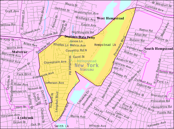
South Hempstead is a hamlet and census-designated place (CDP) in the Town of Hempstead in Nassau County, on Long Island, in New York, United States. The population was 3,243 at the 2010 census. History South Hempstead's name reflects its geographic location south of the Village of Hempstead. Geography According to the United States Census Bureau, the CDP has a total area of , all land. Demographics As of the census of 2000, there were 3,188 people, 1,044 households, and 842 families residing in the CDP. The population density was 5,441.1 per square mile (2,086.3/km2). There were 1,075 housing units at an average density of 1,834.7/sq mi (703.5/km2). The racial makeup of the CDP was 85.8% White, 5.1% African American, 0.1% Native American, 2.5% Asian, 3.5% from other races, and 2.0% from two or more races. Hispanic or Latino of any race were 5.5% of the population. There were 1,044 households, out of which 39.9% had children under the age of 18 living with them, 65. ... [...More Info...] [...Related Items...] OR: [Wikipedia] [Google] [Baidu] |
Lakeview, New York
Lakeview is a hamlet and census-designated place (CDP) in the Town of Hempstead in Nassau County, on Long Island, in New York, United States. The population was 6,077 at the 2020 census. History Lakeview's name reflects upon its proximity to Hempstead Lake at Hempstead Lake State Park. Geography According to the United States Census Bureau, the CDP has a total area of , of which is land and (17.95%) is water. Demographics 2020 census 2000 Census At the 2000 census there were 5,607 people, 1,525 households, and 1,287 families in the CDP. The population density was . There were 1,569 housing units at an average density of . The racial makeup of the CDP was 6.90% White, 84.95% African American, 0.32% Native American, 0.48% Asian, 3.44% from other races, and 3.91% from two or more races. Hispanic or Latino of any race were 6.94%. Of the 1,525 households 37.8% had children under the age of 18 living with them, 51.6% were married couples living together, 26.5% had a fem ... [...More Info...] [...Related Items...] OR: [Wikipedia] [Google] [Baidu] |
Southern State Parkway
The Southern State Parkway (also known as the Southern State or Southern Parkway; abbreviated as SO on Road signs in the United States, signage) is a limited-access highway on Long Island, New York (state), New York, in the United States. The parkway begins at an interchange with the Belt Parkway, Belt and Cross Island Parkway, Cross Island parkways in Elmont, New York, Elmont, in Nassau County, New York, Nassau County, and travels east to an interchange with the Sagtikos State Parkway in West Islip, New York, West Islip, Suffolk County, New York, Suffolk County, where it becomes the Heckscher State Parkway. The Southern State Parkway comprises the western portion of unsigned highway, unsigned New York State Route 908M (NY 908M), with the Heckscher Parkway occupying the eastern section. Construction of the highway, designed by Robert Moses, began in 1925. The first section of the parkway opened in 1927. It reached its original eastern terminus (Bay Shore Road) in 1949 a ... [...More Info...] [...Related Items...] OR: [Wikipedia] [Google] [Baidu] |
Hempstead Lake State Park
Hempstead Lake State Park is a state park located in Nassau County, New York, Nassau County, New York (state), New York in the United States. The park is located in West Hempstead, New York, West Hempstead and is one of three state parks within the Town of Hempstead, New York, Town of Hempstead. There is a quick-access entrance at exit 18 from the Southern State Parkway. The park contains the largest freshwater lake in Nassau County. The park offers picnic tables with pavilions, tennis courts, a playground, playing fields, recreation programs, hiking, biking, a bridle path, fishing, ice fishing, ice skating, cross-country skiing, snowmobiling, and a boat launch. The park contains three ponds for fishing that are stocked with several varieties of fish. Wooded picnic areas provide shade. History The central feature of this park is Hempstead Lake, first proposed in 1870 to supply water to Brooklyn, New York. The Mill River (Hempstead, New York), Mill River, also known as Hempstead ... [...More Info...] [...Related Items...] OR: [Wikipedia] [Google] [Baidu] |
Merrick Road
Merrick Road is an east–west urban arterial in Queens, Nassau, and Suffolk counties in New York, United States. It is known as Merrick Boulevard or Floyd H. Flake Boulevard in Queens, within New York City. Merrick Road runs east from the Queens neighborhood of Jamaica through Merrick past the county line between Nassau and Suffolk into Amityville, where it becomes Montauk Highway at the Amityville–Copiague village/hamlet line. The easternmost portion of Merrick Road, from Carman Mill Road to its eastern terminus, signed as part of New York State Route 27A (NY 27A). At one time, the entire length of Merrick Road was signed as NY 27A; currently, the entire portion within Nassau County is currently designated as the unsigned County Route 27 (CR 27). Merrick Road travels along an old right-of-way that was one of the original paths across southern Long Island, stretching from Queens to Montauk Point. Merrick Road's name comes from the Algonquin word ''"Mer ... [...More Info...] [...Related Items...] OR: [Wikipedia] [Google] [Baidu] |


