|
Pen-y-ghent
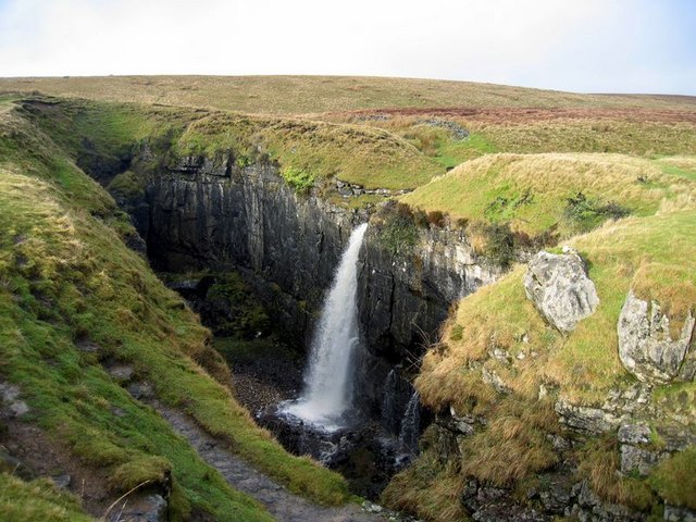
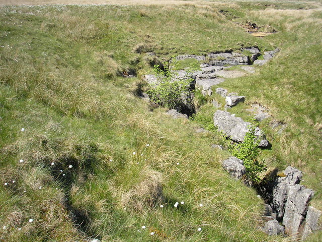
Pen-y-ghent or Penyghent is a fell in the Yorkshire Dales, England. It is the lowest of Yorkshire's Three Peaks at ; the other two being Ingleborough and Whernside. It lies east of Horton in Ribblesdale. It has a number of interesting geological features, such as Hunt Pot, and further down, Hull Pot. The waters that flow in have created an extensive cave system which rises at Brants Gill head. In 2004 the body of Lamduan Armitage, dubbed by the media the "Lady of the Hills", was found near to the entrance of Sell Gill Hole. Etymology In the Cumbric language, exactly as in today's Welsh, ''pen'' meant 'top' or 'head', and ''y'' is most likely the definite article (''the''), exactly as in Modern Welsh ''y'' (compare Pen-y-berth 'end of the hedge/copse', or Pen-y-ffordd 'head of the road/way', etc.). The element ''ghent'' is more obscure, it could be taken to be 'edge' or 'border'. The name ''Pen-y-ghent'' could therefore mean 'Hill on the border' (compare Kent). Or else, the fi ... [...More Info...] [...Related Items...] OR: [Wikipedia] [Google] [Baidu] |
Yorkshire Three Peaks
The mountains of Whernside (), Ingleborough () and Pen-y-ghent () are collectively known as the Three Peaks. The peaks, which form part of the Pennine range, encircle the head of the valley of the River Ribble in the Yorkshire Dales National Park in the North of England. Name The long-standing designation "The Three Peaks" is well known locally, and in past times nationally. However, there are now a number of "National" Three Peaks adventure challenges involving Ben Nevis, Snowdon and Scafell Pike (respectively the highest summits in Scotland, Wales and England). The epithet "Yorkshire" is therefore now commonly added to differentiate Yorkshire's Three Peaks from those (although Whernside is partially in Cumbria, with the summit trig point being narrowly on the Cumbria side, the whole mountain is within the historic county of Yorkshire). Geology In common with neighbouring fells, the Three Peaks are carved from an almost flat-lying succession of sedimentary strata of Carbon ... [...More Info...] [...Related Items...] OR: [Wikipedia] [Google] [Baidu] |
Horton In Ribblesdale
Horton in Ribblesdale is a small village and civil parish in the Craven district of North Yorkshire, England. It is situated in Ribblesdale on the Settle–Carlisle Railway to the west of Pen-y-ghent. Its population in the 2001 census was 498 people in 211 households; decreasing to 428 at the 2011 Census. History It is first attested as ''Horton'' in the Domesday Book of 1086, with ''in Ribblesdale'' being added already in the 13th century to distinguish it from Horton, Lancashire. The place-name ''Horton'' is a common one in England. It derives from Old English ''horu'' 'dirt' and ''tūn'' 'settlement, farm, estate', presumably meaning 'farm on muddy soil'. Horton in Ribblesdale was historically a part of Ewcross wapentake in the West Riding of Yorkshire. It became a parish town in the early 12th century when the church of St. Oswald was established. This church was historically associated with the Deanery of Chester, and was part of the Diocese of York&nb ... [...More Info...] [...Related Items...] OR: [Wikipedia] [Google] [Baidu] |
Death Of Lamduan Armitage
Lamduan Armitage (née Seekanya) was a formerly unidentified woman whose body was discovered in 2004 on the mountain Pen-y-ghent in Yorkshire, England, leading her to become known as the Lady of the Hills. The woman was found to have come from somewhere in South-East Asia, but despite an international police investigation, the identity of the woman and how she arrived at the location remained a mystery until 2019. The woman was identified in March 2019 through DNA testing. Discovery On Monday 20 September 2004 at 11:30 am, a man walking in the vicinity of Pen-y-ghent alerted the police to the discovery of the body of a dead woman. The man had discovered the body in a well-trafficked location on the Pennine Way between Pen-y-ghent and Horton in Ribblesdale in a stream called Sell Gill Beck, which flows into a cave called Sell Gill Hole. It was thought that the body had been in the stream for some time, and that the woman could have died up to three weeks before the discove ... [...More Info...] [...Related Items...] OR: [Wikipedia] [Google] [Baidu] |
Pennine Way
The Pennine Way is a National Trail in England, with a small section in Scotland. The trail stretches for from Edale, in the northern Derbyshire Peak District, north through the Yorkshire Dales and Northumberland National Park and ends at Kirk Yetholm, just inside the Anglo-Scottish border, Scottish border. The path runs along the Pennines, Pennine hills, sometimes described as the "backbone of England". Although not the United Kingdom's longest National Trail (this distinction belongs to the South West Coast Path), it is according to The Ramblers "one of Britain's best known and toughest". History The path was the idea of the journalist and rambler Tom Stephenson (activist), Tom Stephenson, inspired by similar trails in the United States of America, particularly the Appalachian Trail. Stephenson proposed the concept in an article for the ''Daily Herald (UK newspaper), Daily Herald'' in 1935, and lobbied Parliament for the creation of an official trail. The walk was planned ... [...More Info...] [...Related Items...] OR: [Wikipedia] [Google] [Baidu] |
Plover Hill
Plover Hill is an area of moorland lying to the north of Pen-y-ghent in the Yorkshire Dales and connected to it by an unbroken area of high ground. Whilst the whole area is now "open access land", the main right-of-way footpaths come directly from the north off Foxup Road and directly from the south from the summit of Pen-y-ghent. Plover Hill rises between two side valleys of Littondale: the valley of Hesleden Beck to the south and that of Foxup Beck to the north. It lies within the civil parish of Halton Gill Halton Gill is a hamlet and civil parish in Littondale in the Yorkshire Dales in North Yorkshire, England. It is situated up Littondale from Litton. A minor road leads south west to Silverdale and Stainforth in Ribblesdale. The name of th .... References External links The Complete Guide to the Yorkshire Dales – Hills over 2,000 ft Hewitts of England Nuttalls Peaks of the Yorkshire Dales {{Craven-geo-stub ... [...More Info...] [...Related Items...] OR: [Wikipedia] [Google] [Baidu] |
Nuttall (hill)
This is a list of Nuttall mountains in England and Wales by height. Nuttalls are defined as peaks above in height, the general requirement to be called a "mountain" in the British Isles, and with a prominence above ; a mix of imperial and metric thresholds. The Nuttall classification was suggested by Anne and John Nuttall in their 1990 two–volume book, "The Mountains of England and Wales". The list was updated with subsequent revised editions by the Nuttalls. Because of the prominence threshold of only , the list is subject to ongoing revisions. In response, Alan Dawson introduced the Hewitts, with a higher prominence threshold of . This was the prominence threshold that the UIAA set down in 1994 for an "independent" peak. In 2010, Dawson replaced his Hewitts with the fully "metric" Simms, consisting of a height threshold of , and a prominence threshold of . However, both the Nuttall and Hewitt classifications have become popular with peak baggers, and both remain in ... [...More Info...] [...Related Items...] OR: [Wikipedia] [Google] [Baidu] |
Ingleborough
Ingleborough () is the second-highest mountain in the Yorkshire Dales, England. It is one of the Yorkshire Three Peaks (the other two being Whernside and Pen-y-ghent), and is frequently climbed as part of the Three Peaks walk. A large part of Ingleborough is designated as a Site of Special Scientific Interest and National Nature Reserve and is the home of a new joint project, Wild Ingleborough, with aims to improve the landscape for wildlife and people. Name The first element of the name "Ingleborough" has been variably explained as a Scots term for 'beacon, fire', an Old Danish term meaning 'English' or a derivative of Old English ''ing'', 'peak'. The second element is derived from the Old English word ''burh'', meaning "a fortified place"; in this case, a hill fort. The summit plateau of Ingleborough is encircled by the remains of a massive stone rampart, containing the foundations of Iron Age huts. Geography Ingleborough is in the south-western corner of the Yorkshi ... [...More Info...] [...Related Items...] OR: [Wikipedia] [Google] [Baidu] |
Marilyn (hill)
This is a list of Marilyn hills and mountains in the United Kingdom, Isle of Man and Republic of Ireland, Ireland by height. Lists of mountains and hills in the British Isles#Marilyns, Marilyns are defined as peaks with a topographic prominence, prominence of or more, regardless of height or any other merit (e.g. topographic isolation, as used in Lists of mountains and hills in the British Isles#Munros, Munros). Thus, Marilyns can be mountains, with a height above , or relatively small hills. there were 2,011 recorded Marilyns. Definition The Marilyn classification was created by Alan Dawson in his 1992 book ''The Relative Hills of Britain''. The name Marilyn was coined by Dawson as a punning contrast to the ''Munro'' classification of Scottish mountains above , but which has no explicit prominence threshold, being homophonous with (Marilyn) ''Marilyn Monroe, Monroe''. The list of Marilyns was extended to Ireland by Clem Clements. Marilyn was the first of several subsequen ... [...More Info...] [...Related Items...] OR: [Wikipedia] [Google] [Baidu] |
Hewitt (hill)
This is a list of Hewitt mountains in England, Wales and Ireland by height. Lists of mountains and hills in the British Isles#Hewitts, Hewitts are defined as "Hills in England, Wales and Ireland over two thousand" feet in height, the general requirement to be called a Lists of mountains and hills in the British Isles#Elevation, "mountain" in the British Isles, and with a prominence above ; a mix of imperial measures, imperial and metric system, metric thresholds. The Hewitt classification was suggested by Alan Dawson in his 1992 book, "The Relative Hills of Britain". Dawson originally called his Hewitts "Sweats", from "Summits - Wales and England Above Two thousand", before settling on the label Hewitt. In a series of three booklets edited by Dave Hewitt, the list of English Hewitts was published in 1997, and the list of Welsh Hewitts was also published in 1997, and the list of Irish Hewitts was published in 1998. Hewitts were designed to address one of the criticisms of ... [...More Info...] [...Related Items...] OR: [Wikipedia] [Google] [Baidu] |
Cumbric Language
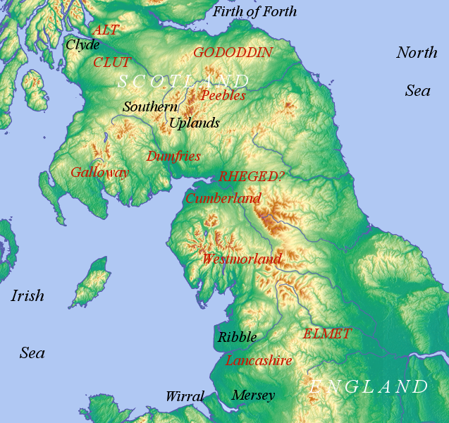
Cumbric was a variety of the Common Brittonic language spoken during the Early Middle Ages in the ''Hen Ogledd'' or "Old North" in what is now the counties of Westmorland, Cumberland and northern Lancashire in Northern England and the southern Scottish Lowlands. It was closely related to Old Welsh and the other Brittonic languages. Place name evidence suggests Cumbric may also have been spoken as far south as Pendle and the Yorkshire Dales. The prevailing view is that it became extinct in the 12th century, after the incorporation of the semi-independent Kingdom of Strathclyde into the Kingdom of Scotland. Problems with terminology Dauvit Broun sets out the problems with the various terms used to describe the Cumbric language and its speakers.Broun, Dauvit (2004): 'The Welsh identity of the kingdom of Strathclyde, ca 900-ca 1200', ''Innes Review'' 55, pp 111–80. The people seem to have called themselves the same way that the Welsh called themselves (most likely from reco ... [...More Info...] [...Related Items...] OR: [Wikipedia] [Google] [Baidu] |
Yorkshire Dales National Park
The Yorkshire Dales National Park is a national park in England covering most of the Yorkshire Dales. Most of the park is in North Yorkshire, with a sizeable area in Westmorland (Cumbria) and a small part in Lancashire. The park was designated in 1954, and extended in 2016. Over 95% of the land in the Park is under private ownership; there are over 1,000 farms in this area. In late 2020, the park was named as an International Dark Sky Reserve. This honour confirms that the area has "low levels of light pollution with good conditions for astronomy". Some 23,500 residents live in the park (as of 2017); a 2018 report estimated that the Park attracted over four million visitors per year. The economy consists primarily of tourism and agriculture. Location The park is north-east of Manchester; Otley, Ilkley, Leeds and Bradford lie to the south, while Kendal is to the west, Darlington to the north-east and Harrogate to the south-east. The national park does not include all of ... [...More Info...] [...Related Items...] OR: [Wikipedia] [Google] [Baidu] |
Littondale
Littondale is a dale in the Craven district of the non-metropolitan county of North Yorkshire, England. It comprises the main settlements of Hawkswick, Arncliffe, Litton, Foxup and Halton Gill, and farmhouses that date from the 17th century. The main waterway in the dale is the River Skirfare which is fed by many small gills and becks. The dale, first recorded by name as ''Littundale'' in 1198, is one of the few dales named from its main settlement rather than its river (Wensleydale is the best known example). Historically the dale was also known as Amerdale. The village of Arncliffe was the original setting for the TV series ''Emmerdale'', which is believed to take its name from Amerdale. Geography Littondale is a side dale to the west of Wharfedale and follows the River Skirfare. The nature of the dale and its characteristic smooth form was the result of many ice ages, especially the one 20,000 years ago. As the glacier for that age receded it left retreat moraine, an exam ... [...More Info...] [...Related Items...] OR: [Wikipedia] [Google] [Baidu] |


