|
Peche Island Rear Range Light
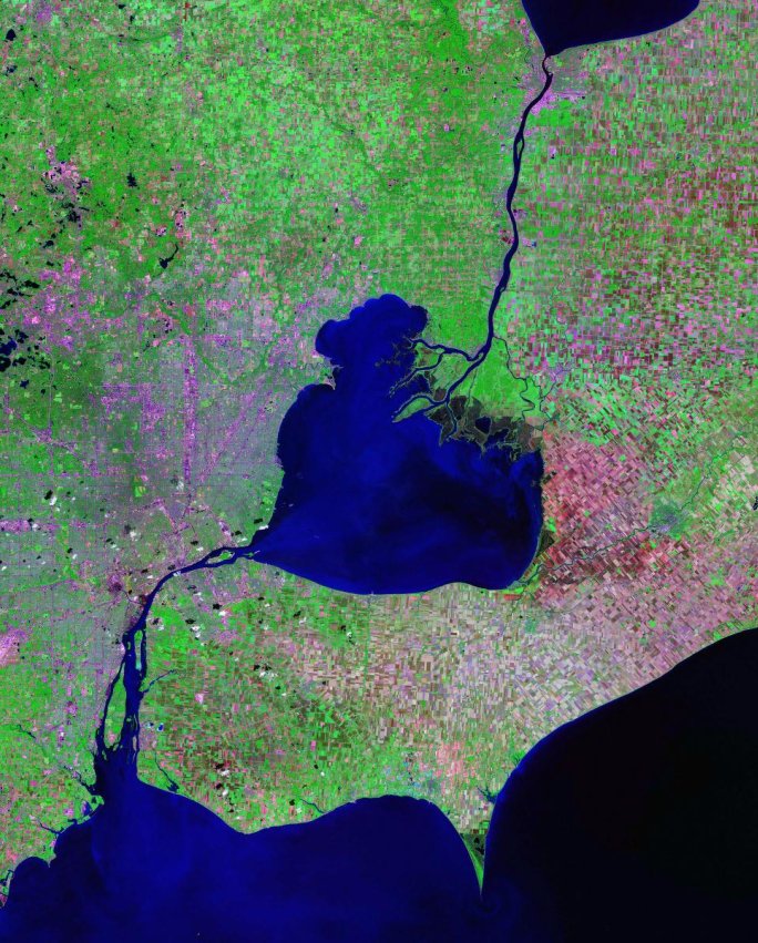
The Peche Island Rear Range Light (or Peach Island Rear Range Light) was a historic lighthouse "off Peche Island in the entrance to the Detroit River from Lake St. Clair Lake St. Clair (french: Lac Sainte-Claire) is a freshwater lake that lies between the Canadian province of Ontario and the U.S. state of Michigan. It was named in 1679 by French Catholic explorers after Saint Clare of Assisi, on whose feast day ...." Located in American waters just north of the border to Canada it was moved to Marine City, Michigan upon its deactivation. History This light was built as part of a pair of range lights to guide ships to the south end of the lake. Erected on a crib in open water, by 1908 it had developed a severe list to one side, and in 1983 it was replaced with a skeletal tower. The old tower was saved, and minus its base, was installed in lighthouse Park in Marine City (), where it still stands. References {{authority control Lighthouses completed in 1908 Lighthouses ... [...More Info...] [...Related Items...] OR: [Wikipedia] [Google] [Baidu] |
Detroit River
The Detroit River flows west and south for from Lake St. Clair to Lake Erie as a strait in the Great Lakes system. The river divides the metropolitan areas of Detroit, Michigan, and Windsor, Ontario, Windsor, Ontario—an area collectively referred to as Detroit–Windsor—and forms part of the Canada–United States border, border between Canada and the United States. The Ambassador Bridge, the Detroit–Windsor Tunnel, and the Michigan Central Railway Tunnel connect the cities. The river's English name comes from the French language, French (translated as "River of the Strait"). The Detroit River has served an important role in the history of Detroit and Windsor, and is one of the world's busiest waterways. It is an important transportation route connecting Lake Michigan, Lake Huron, and Lake Superior to Lake Erie and eventually to Lake Ontario, the Saint Lawrence Seaway, St. Lawrence Seaway and the Erie Canal. When Detroit underwent rapid industrialization at the turn of th ... [...More Info...] [...Related Items...] OR: [Wikipedia] [Google] [Baidu] |
Peche Island
Peche Island ( French pronunciation anglicized to , therefore occasionally misspelled "Peach"), is an uninhabited, currently (reduced by erosion from a 1965 measurement of 109 acres / 43.7 ha) Canadian-owned island in the Detroit River, at its opening into Lake Saint Clair. It is 1.2 miles (1.9 km) east of U.S.-owned Belle Isle, and 360 yards (330 m) from the Windsor shore. The island was formed from a peninsula of the Canadian shore by the action of the Detroit River. There is a central marsh on the island. The present channel was eroded until the core of the island remained. There are man-made channels cut through the island to ensure fresh water supply and recreational opportunities. The island's flora and fauna have been heavily affected by human activity, and the forest is the result of a rehabilitation programme. Formerly an Ontario provincial park, ownership was transferred to the City of Windsor in 1999. The Detroit River passes 200 yards (183 m) off ... [...More Info...] [...Related Items...] OR: [Wikipedia] [Google] [Baidu] |
Fresnel Lens
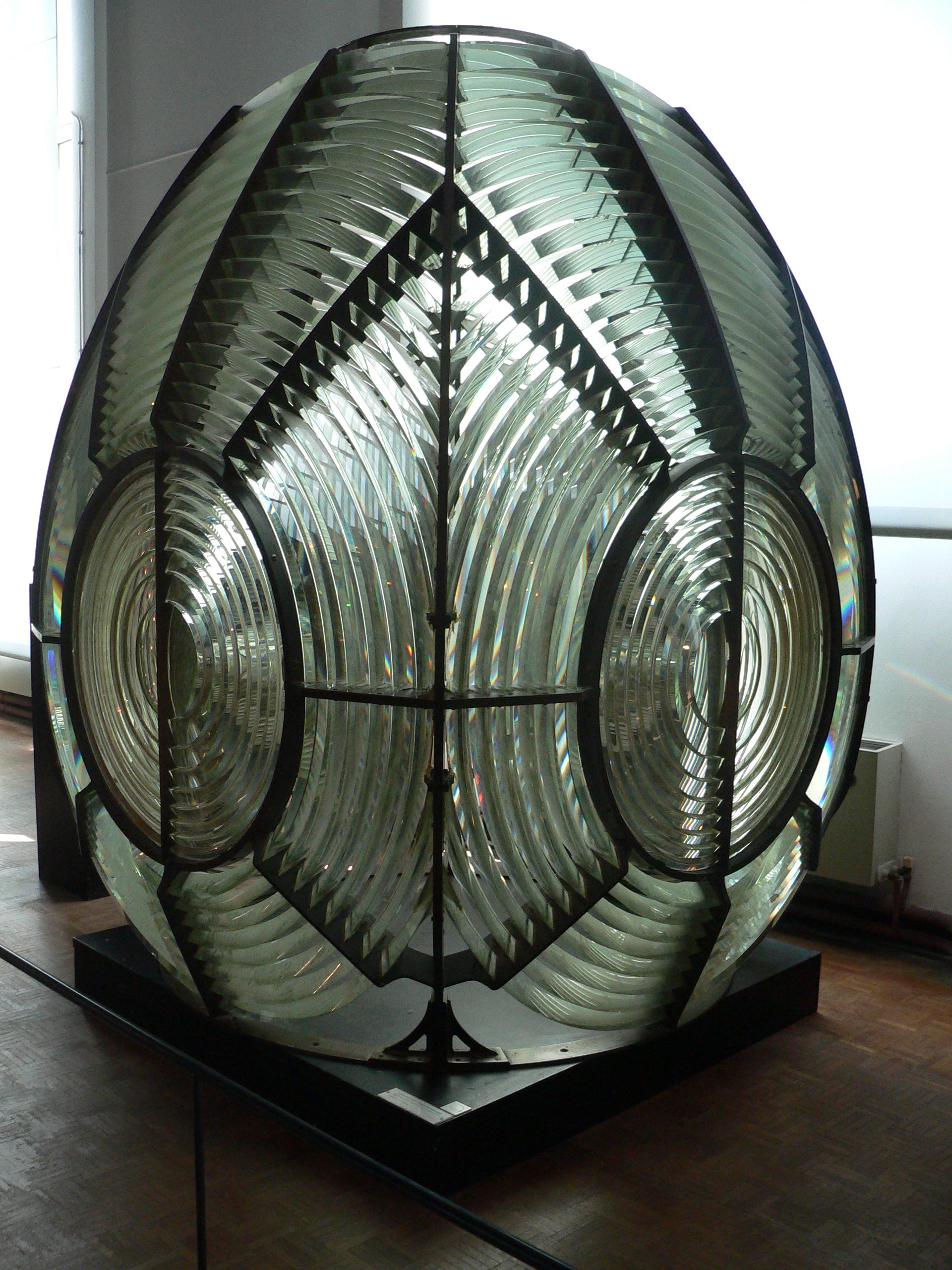
A Fresnel lens ( ; ; or ) is a type of composite compact lens developed by the French physicist Augustin-Jean Fresnel (1788–1827) for use in lighthouses. It has been called "the invention that saved a million ships." The design allows the construction of lenses of large aperture and short focal length without the mass and volume of material that would be required by a lens of conventional design. A Fresnel lens can be made much thinner than a comparable conventional lens, in some cases taking the form of a flat sheet. The simpler dioptric (purely refractive) form of the lens was first proposed by Count Buffon and independently reinvented by Fresnel. The ''catadioptric'' form of the lens, entirely invented by Fresnel, has outer elements that use total internal reflection as well as refraction; it can capture more oblique light from a light source and add it to the beam of a lighthouse, making the light visible from greater distances. Description The Fresnel lens redu ... [...More Info...] [...Related Items...] OR: [Wikipedia] [Google] [Baidu] |
Peche Island Rear Range Light (August 2023)
The Peche Island Rear Range Light (or Peach Island Rear Range Light) was a historic lighthouse "off Peche Island in the entrance to the Detroit River from Lake St. Clair Lake St. Clair (french: Lac Sainte-Claire) is a freshwater lake that lies between the Canadian province of Ontario and the U.S. state of Michigan. It was named in 1679 by French Catholic explorers after Saint Clare of Assisi, on whose feast day ...." Located in American waters just north of the border to Canada it was moved to Marine City, Michigan upon its deactivation. History This light was built as part of a pair of range lights to guide ships to the south end of the lake. Erected on a crib in open water, by 1908 it had developed a severe list to one side, and in 1983 it was replaced with a skeletal tower. The old tower was saved, and minus its base, was installed in lighthouse Park in Marine City (), where it still stands. References {{authority control Lighthouses completed in 1908 Lighthouses ... [...More Info...] [...Related Items...] OR: [Wikipedia] [Google] [Baidu] |
Lake St
Lake Street may refer to: *Lake Street (Chicago) *Lake Street (Minneapolis) Lake Street is a major east-west thoroughfare between 29th and 31st streets in Minneapolis, Minnesota United States. From its western most end at the city's limits, Lake Street reaches the Chain of Lakes, passing over a small channel linking B ... See also * Lake Street station (other) {{dab, road ... [...More Info...] [...Related Items...] OR: [Wikipedia] [Google] [Baidu] |
National Oceanic And Atmospheric Administration
The National Oceanic and Atmospheric Administration (abbreviated as NOAA ) is an United States scientific and regulatory agency within the United States Department of Commerce that forecasts weather, monitors oceanic and atmospheric conditions, charts the seas, conducts deep sea exploration, and manages fishing and protection of marine mammals and endangered species in the U.S. exclusive economic zone. Purpose and function NOAA's specific roles include: * ''Supplying Environmental Information Products''. NOAA supplies to its customers and partners information pertaining to the state of the oceans and the atmosphere, such as weather warnings and forecasts via the National Weather Service. NOAA's information services extend as well to climate, ecosystems, and commerce. * ''Providing Environmental Stewardship Services''. NOAA is a steward of U.S. coastal and marine environments. In coordination with federal, state, local, tribal and international authorities, NOAA manages the ... [...More Info...] [...Related Items...] OR: [Wikipedia] [Google] [Baidu] |
Marine City, Michigan
Marine City is a city in St. Clair County in the U.S. state of Michigan. Located on the west bank of the St. Clair River, it is one of the cities in the River District north of Detroit and south of Lake Huron. In the late 19th century, it was a major center of wooden shipbuilding and lumber processing. The population was 4,248 at the 2010 census. The city formerly featured an international auto ferry service, The Bluewater Ferry to Sombra, Ontario, Canada across the river. Geography *According to the United States Census Bureau, the city has a total area of , of which is land and is water. *It is considered to be part of the Thumb of Michigan, which in turn is a subregion of the Flint/Tri-Cities. **Marine City can also be considered as in the Blue Water Area, a subregion of the Thumb. *It is part of the Detroit-Warren-Livonia Metropolitan Statistical Area (MSA) and the Detroit-Ann Arbor-Flint Combined Statistical Area (CSA). History The area of Marine City had been Ojib ... [...More Info...] [...Related Items...] OR: [Wikipedia] [Google] [Baidu] |
Range Light
Leading lights (also known as range lights in the United States) are a pair of light beacons used in navigation to indicate a safe passage for vessels entering a shallow or dangerous channel; they may also be used for position fixing. At night, the lights are a form of leading line that can be used for safe navigation. The beacons consist of two lights that are separated in distance and elevation, so that when they are aligned, with one above the other, they provide a bearing. Range lights are often illuminated day and night. In some cases the two beacons are unlighted, in which case they are known as a range in the United States or a transit in the UK. The beacons may be artificial or natural. Operation Two lights are positioned near one another. One, called the front light, is lower than the one behind, which is called the rear light. At night when viewed from a ship, the two lights only become aligned vertically when a vessel is positioned on the correct bearing. During t ... [...More Info...] [...Related Items...] OR: [Wikipedia] [Google] [Baidu] |
Lighthouses Completed In 1908
A lighthouse is a tower, building, or other type of physical structure designed to emit light from a system of lamps and lenses and to serve as a beacon for navigational aid, for maritime pilots at sea or on inland waterways. Lighthouses mark dangerous coastlines, hazardous shoals, reefs, rocks, and safe entries to harbors; they also assist in aerial navigation. Once widely used, the number of operational lighthouses has declined due to the expense of maintenance and has become uneconomical since the advent of much cheaper, more sophisticated and effective electronic navigational systems. History Ancient lighthouses Before the development of clearly defined ports, mariners were guided by fires built on hilltops. Since elevating the fire would improve the visibility, placing the fire on a platform became a practice that led to the development of the lighthouse. In antiquity, the lighthouse functioned more as an entrance marker to ports than as a warning signal for reefs and ... [...More Info...] [...Related Items...] OR: [Wikipedia] [Google] [Baidu] |
Lighthouses In Michigan
A lighthouse is a tower, building, or other type of physical structure designed to emit light from a system of lamps and lens (optics), lenses and to serve as a beacon for navigational aid, for maritime pilots at sea or on inland waterways. Lighthouses mark dangerous coastlines, hazardous shoals, reefs, rocks, and safe entries to harbors; they also assist in aerial navigation. Once widely used, the number of operational lighthouses has declined due to the expense of maintenance and has become uneconomical since the advent of much cheaper, more sophisticated and effective electronic navigational systems. History Ancient lighthouses Before the development of clearly defined ports, mariners were guided by fires built on hilltops. Since elevating the fire would improve the visibility, placing the fire on a platform became a practice that led to the development of the lighthouse. In antiquity, the lighthouse functioned more as an entrance marker to ports than as a warning signa ... [...More Info...] [...Related Items...] OR: [Wikipedia] [Google] [Baidu] |


