|
Paulding County, Georgia
Paulding County is a county located in the northwestern part of the U.S. state of Georgia. Part of the Atlanta metropolitan area, it had an estimated population of 168,661 in 2020. The county seat is Dallas. History Paulding County was created from Cherokee County by an act of the Georgia General Assembly on December 3, 1832. In 1851, a portion of Paulding County was used to help create Polk County. Other portions of Paulding County were annexed to neighboring counties (Campbell, Carroll, Cobb, Douglas, Haralson, and Polk) between 1832 and 1874. Between 1850 and 1874, Paulding County was expanded through annexation of parts of Carroll, Cobb, Douglas, and Polk counties. The county is named after John Paulding (October 16, 1758 – February 18, 1818), who was famous for the capture of the British spy Major John André in 1780 during the American Revolution. André was on a mission carrying secret papers from Benedict Arnold when he was captured. Geography According to the U. ... [...More Info...] [...Related Items...] OR: [Wikipedia] [Google] [Baidu] |
Old Paulding County Courthouse
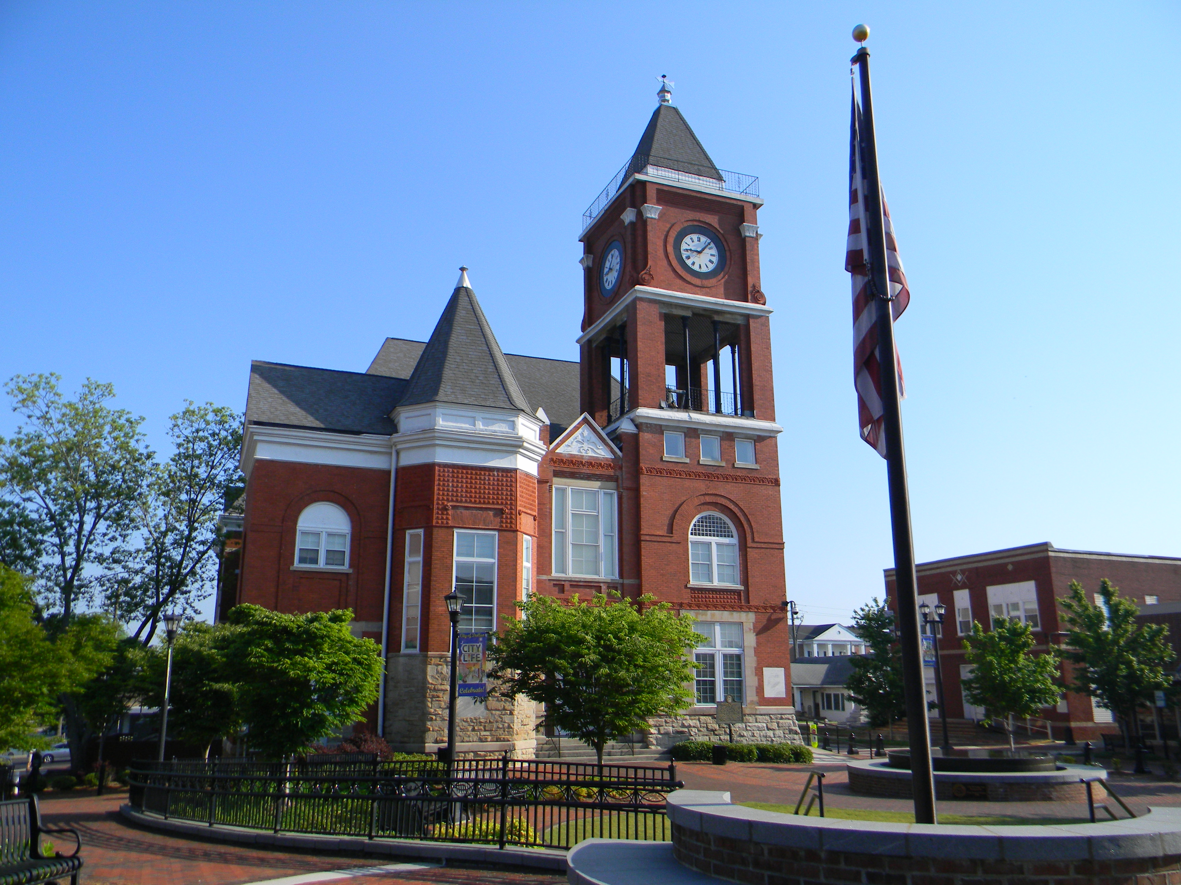
The Old Paulding County Courthouse is a historic county courthouse in the courthouse square of Dallas, Georgia, county seat of Paulding County, Georgia. It was built in 1892 and has been renovated several times since. An annex was added. The original building was designed by Bruce & Morgan and is Queen Anne in style. Georgia Info It was added to the on September 18, 1980. See also * |
John André
John André (2 May 1750/1751''Gravesite–Memorial'' Westminster Abbey webpage; accessed September 2020 – 2 October 1780) was a major in the and head of its Secret Service in America during the . He was as a by the |
ACT River Basin
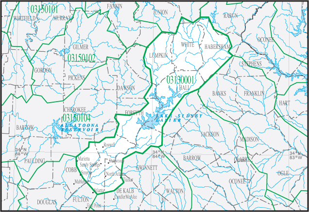
The Alabama-Coosa-Tallapoosa River Basin (ACT River Basin) is a drainage basin (watershed) in the Southeastern United States. This area is classified as a sub-region by the USGS hydrological code system. Sub-regions This sub-region consists of two basins, per the hydrological code system, namely the Coosa- Tallapoosa basin, and the Alabama basin. Further, here are the sub-basins of each of these two basins: Coosa- Tallapoosa basin * Conasauga sub-basin * Coosawattee sub-basin * Oostanaula sub-basin * Etowah sub-basin * Upper Coosa sub-basin * Middle Coosa sub-basin * Lower Coosa sub-basin * Upper Tallapoosa sub-basin * Middle Tallapoosa sub-basin * Lower Tallapoosa sub-basin Alabama (We dare defend our rights) , anthem = "Alabama (state song), Alabama" , image_map = Alabama in United States.svg , seat = Montgomery, Alabama, Montgomery , LargestCity = Huntsville, Alabama, Huntsville , LargestCounty = Baldwin County, Al ... basin * Upper Alabama sub-basin * Cah ... [...More Info...] [...Related Items...] OR: [Wikipedia] [Google] [Baidu] |
Georgia State Route 101
State Route 101 (SR 101) is a state highway in the northwestern part of the U.S. state of Georgia. It travels in a south-north orientation between the Atlanta metropolitan area and the Alabama state line. Its routing passes through portions of Carroll, Paulding, Polk, and Floyd counties. It connects the Villa Rica and Rome areas of the state. Route description SR 101 begins at an interchange with Interstate 20 (I-20) in Villa Rica, in Carroll County, where SR 101 is concurrent with SR 61 for approximately north until they intersect US 78/ SR 8. SR 61 splits off, while SR 101 travels northwest into Paulding County. The only major intersection in the county is with SR 113/ SR 120 (Buchanan Highway), in the unincorporated community of Union. SR 101/SR 113 travel concurrently. In Polk County, the road meets US 278/ SR 6, southeast of Rockmart. The four highways travel concurrent to the northwest, and ... [...More Info...] [...Related Items...] OR: [Wikipedia] [Google] [Baidu] |
ACF River Basin
The ACF River Basin is the drainage basin, or watershed, of the Apalachicola River, Chattahoochee River, and Flint River, in the Southeastern United States. This area is alternatively known as simply the Apalachicola Basin and is listed by the United States Geological Survey as basin HUC 031300, as well as sub-region HUC 0313. It is located in the South Atlantic-Gulf Water Resource Region, which is listed as HUC 03. The basin is further sub-divided into 14 sub-basins. Geography The ACF River Basin begins in the mountains of northeast Georgia, and drains much of metro Atlanta, most of west Georgia and southwest Georgia and adjoining counties of southeast Alabama, before it splits the central part of the Florida Panhandle and flows into the Gulf of Mexico at Apalachicola Bay, near Apalachicola, Florida. It drains an area of 20,355 square miles. Most of the northern half of the basin abuts the Eastern Continental Divide on the east, and the ACT River Basin to the west. List ... [...More Info...] [...Related Items...] OR: [Wikipedia] [Google] [Baidu] |
Lake Harding
Lake Harding, also known as ''Bartlett's Ferry Lake,'' is a reservoir on the Chattahoochee River. The lake is formed by Bartlett's Ferry Dam, and the lake is located in Harris County, Georgia with some portions of the lake going into Alabama. Lake Harding is a deep lake with a depth of over at the dam itself. The lake was originally built by the Columbus Power Company in 1926 to generate hydroelectric power. The lake was named after R.M. Harding, a power company official. The dam and lake were bought by Georgia Power in 1930. Lake Harding has become a popular recreational area with local residents, many of whom have built lake homes along the well-developed shoreline. A major tributary of the lake is Halawakee Creek. Lake Harding features several islands. One of the most notable is Huston's Island, which contains the ruins of an old lake house. Lake Harding is the practice site of the Auburn University Auburn University (AU or Auburn) is a public land-grant research univ ... [...More Info...] [...Related Items...] OR: [Wikipedia] [Google] [Baidu] |
Chattahoochee River
The Chattahoochee River forms the southern half of the Alabama and Georgia border, as well as a portion of the Florida - Georgia border. It is a tributary of the Apalachicola River, a relatively short river formed by the confluence of the Chattahoochee and Flint Flint, occasionally flintstone, is a sedimentary cryptocrystalline form of the mineral quartz, categorized as the variety of chert that occurs in chalk or marly limestone. Flint was widely used historically to make stone tools and start fir ... rivers and emptying from Florida into Apalachicola Bay in the Gulf of Mexico. The Chattahoochee River is about long. The Chattahoochee, Flint, and Apalachicola rivers together make up the Apalachicola–Chattahoochee–Flint River Basin (ACF River Basin). The Chattahoochee makes up the largest part of the ACF's drainage basin. Course The River source, source of the Chattahoochee River is located in Jacks Gap at the southeastern foot of Jacks Knob, in the very southeaste ... [...More Info...] [...Related Items...] OR: [Wikipedia] [Google] [Baidu] |
Villa Rica, Georgia
Villa Rica (Spanish, Italian, and Portuguese translation: Rich Village) is a city in Carroll and Douglas counties in the U.S. state of Georgia. Located roughly 30 miles west of Atlanta, a decision to develop housing on a large tract of land led to a major population boom at the turn of the 21st century: the population was 4,134 at the 2000 census; it had grown by 238%, to 13,956, at the 2010 census; and is estimated at 16,058 in 2019, nearly quadrupling its population in just 19 years. Geography Location Villa Rica is located in northeastern Carroll County and northwestern Douglas County at (33.731909, -84.919982). U.S. Route 78 (Bankhead Highway) passes through the center of the city, leading west to Temple and east to Douglasville. Interstate 20 passes through the southern part of the city with access from exits 24 and 26, and leads east to Atlanta and west to Oxford, Alabama. According to the United States Census Bureau, the city has a total area of , of which is land a ... [...More Info...] [...Related Items...] OR: [Wikipedia] [Google] [Baidu] |
Hiram, Georgia
Hiram is a city in Paulding County, Georgia, United States. As of the 2020 census, the population is 4,929. History The Georgia General Assembly incorporated the Town of Hiram in 1891. The city was named after Hiram Baguette, the town's first postmaster. Geography Hiram is located at (33.865575, -84.774593). According to the United States Census Bureau, the city has a total area of , of which is land and (0.66%) is water. At the intersection of US Highway 278 and Georgia State Route 92, Atlanta's tallest buildings can be seen, specifically the Bank of America Tower, which stands 23 miles away from the junction. Via GA-92, Acworth is 18 mi (29 km) to the north, and Douglasville is 9 mi (14 km) to the south. Via US-278, Dallas is 8 mi (13 km) to the northwest, and Powder Springs is 5 mi (8 km) to the east. Demographics The past decade saw a tremendous increase in the populations of Dallas and Hiram, as well as Paulding County. Dallas and Hiram more than doubled in pop ... [...More Info...] [...Related Items...] OR: [Wikipedia] [Google] [Baidu] |
Appalachian Mountains
The Appalachian Mountains, often called the Appalachians, (french: Appalaches), are a system of mountains in eastern to northeastern North America. The Appalachians first formed roughly 480 million years ago during the Ordovician Period. They once reached elevations similar to those of the Alps and the Rocky Mountains before experiencing natural erosion. The Appalachian chain is a barrier to east–west travel, as it forms a series of alternating ridgelines and valleys oriented in opposition to most highways and railroads running east–west. Definitions vary on the precise boundaries of the Appalachians. The United States Geological Survey (USGS) defines the ''Appalachian Highlands'' physiographic division as consisting of 13 provinces: the Atlantic Coast Uplands, Eastern Newfoundland Atlantic, Maritime Acadian Highlands, Maritime Plain, Notre Dame and Mégantic Mountains, Western Newfoundland Mountains, Piedmont, Blue Ridge, Valley and Ridge, St. Lawrence Valley, Appalac ... [...More Info...] [...Related Items...] OR: [Wikipedia] [Google] [Baidu] |
Piedmont (United States)
The Piedmont is a plateau region located in the Eastern United States. It is situated between the Atlantic coastal plain and the main Appalachian Mountains, stretching from New York in the north to central Alabama in the south. The Piedmont Province is a physiographic province of the larger Appalachian division which consists of the Gettysburg-Newark Lowlands, the Piedmont Upland and the Piedmont Lowlands sections. The Atlantic Seaboard fall line marks the Piedmont's eastern boundary with the Coastal Plain. To the west, it is mostly bounded by the Blue Ridge Mountains, the easternmost range of the main Appalachians. The width of the Piedmont varies, being quite narrow above the Delaware River but nearly 300 miles (475 km) wide in North Carolina. The Piedmont's area is approximately . The French word ''Piedmont'' comes from the it, Piemonte, meaning " foothill", ultimately from Latin "pedemontium", meaning "at the foot of the mountains", similar to the name of the ... [...More Info...] [...Related Items...] OR: [Wikipedia] [Google] [Baidu] |
Tallapoosa River
The Tallapoosa River runs U.S. Geological Survey. National Hydrography Dataset high-resolution flowline dataThe National Map, accessed April 27, 2011 from the southern end of the Appalachian Mountains in Georgia, United States, southward and westward into the Appalachian foothills in Alabama. It is formed by the confluence of McClendon Creek and Mud Creek in Paulding County, Georgia. Lake Martin at Dadeville, Alabama is a large and popular water recreation area formed by a dam on the river. The Tallapoosa joins the Coosa River about northeast of Montgomery near Wetumpka (in Elmore County) to form the Alabama River. There are four hydroelectric dams on the Tallapoosa: Yates, Thurlow, Martin and Harris dams. They are important sources of electricity generation for Alabama Power (a unit of the Southern Company) and recreation for the public. Description The Tallapoosa River, especially its lower course, was a major population center of the Creek Indians before the early 19th c ... [...More Info...] [...Related Items...] OR: [Wikipedia] [Google] [Baidu] |


