|
Patrick Marshall
Patrick Marshall (1869 – November 1950) was a geologist who lived in New Zealand. Benson W. N. (1951). "Patrick Marshall". ''Transactions and Proceedings of the Royal Society of New Zealand'' 79''152–155 Early life Marshall was born on 22 December 1869 in Sapiston, Suffolk to Emily Louisa Merielina Rogers and her husband, John Hannath Marshall, cricketer and vicar of Sapiston. After his father's failing health the family emigrated to Kaiteriteri, New Zealand in 1876. Sporting career Marshall won the men's doubles at the New Zealand national tennis championships with his brother Joy in 1893–94. He played three first-class cricket matches for Auckland in the 1900–01 season. Bibliography Articles by Patrick Marshall published in ''Transactions and Proceedings of the Royal Society of New Zealand'': * Marshall P. (1894). "Tridymite-Trachyte of Lyttelton". ''Transactions and Proceedings of the Royal Society of New Zealand'' 26368–387 * (1895) "New Zealand Diptera: ... [...More Info...] [...Related Items...] OR: [Wikipedia] [Google] [Baidu] |
Sapiston
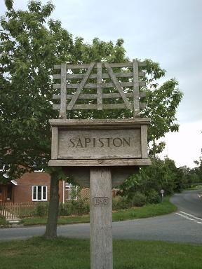
Sapiston is a small village and civil parish in the West Suffolk district of Suffolk in eastern England, located near the Suffolk-Norfolk border. It is in northern Suffolk lying on the river Blackbourn. The place-name 'Sapiston' is first attested in the Domesday Book of 1086, where it appears as ''Sapestuna''. The name is thought to mean 'village of soapmakers', but this is not certain. Eilert Ekwall, ''The Concise Oxford Dictionary of English Place-names'', p.404. Sapiston is bordered to the south-west by Honington, to the north-west by Fakenham Magna, to the north by Euston, to the east by Bardwell, and to the south by Ixworth Thorpe. It is 8 miles from Bury St Edmunds and 6 miles from Thetford in Norfolk. Also nearby are RAF Honington and two Joint RAF/USAF Bases, RAF Lakenheath and RAF Mildenhall. History :Sapiston, a parish in the hundred of Blackbourn, county Suffolk, 3½ miles N.W. of Ixworth, its post town, and 7 from Bury St. Edmund's. The village, which is ... [...More Info...] [...Related Items...] OR: [Wikipedia] [Google] [Baidu] |
Trachyte
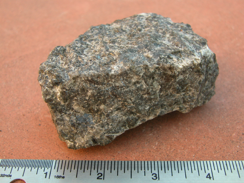
Trachyte () is an extrusive igneous rock composed mostly of alkali feldspar. It is usually light-colored and aphanitic (fine-grained), with minor amounts of mafic minerals, and is formed by the rapid cooling of lava enriched with silica and alkali metals. It is the volcanic equivalent of syenite. Trachyte is common wherever alkali magma is erupted, including in late stages of ocean island volcanismMacDonald 1983, pp. 51-52 and in continental rift valleys, above mantle plumes,Philpotts and Ague 2009, pp. 390-394 and in areas of back-arc extension. Trachyte has also been found in Gale crater on Mars. Trachyte has been used as decorative building stone and was extensively used as dimension stone in the Roman Empire and the Republic of Venice. Chemical composition Trachyte has a silica content of 60 to 65% and an alkali oxide content of over 7%. This gives it less SiO2 than rhyolite and more (Na2O plus K2O) than dacite. These chemical differences are consistent with the positio ... [...More Info...] [...Related Items...] OR: [Wikipedia] [Google] [Baidu] |
Nephelinite
Nephelinite is a fine-grained or aphanitic igneous rock made up almost entirely of nepheline and clinopyroxene (variety augite). If olivine is present, the rock may be classified as an olivine nephelinite. Nephelinite is dark in color and may resemble basalt in hand specimen. However, basalt consists mostly of clinopyroxene (augite) and calcic plagioclase. Basalt, alkali basalt, basanite, tephritic nephelinite, and nephelinite differ partly in the relative proportions of plagioclase and nepheline. Alkali basalt may contain minor nepheline and does contain nepheline in its CIPW normative mineralogy. A critical ratio in the classification of these rocks is the ratio nepheline/(nepheline plus plagioclase). Basanite has a value of this ratio between 0.1 and 0.6 and also contains more than 10% olivine. Tephritic nephelinite has a value between 0.6 and 0.9. Nephelinite has a value greater than 0.9. Le Maitre (2002) defines and discusses these and other criteria in the classification of i ... [...More Info...] [...Related Items...] OR: [Wikipedia] [Google] [Baidu] |
Mangaia
Mangaia (traditionally known as A'ua'u Enua, which means ''terraced'') is the most southerly of the Cook Islands and the second largest, after Rarotonga. It is a roughly circular island, with an area of , from Rarotonga. Originally heavily populated, Mangaia's population has dropped by 75% in the last 50 years. Geography Originally known as ''A'ua'u'' or ''A'ua'u Enua'' ("terraced"), the island was named Mangaia (or ''Mangaianui-Neneva'', "Mangaia monstrously-great") by Tamaeu, who came to the island from Aitutaki in 1775. Geologists estimate the island is at least 18 million years old. It rises 4750 m (15,600 ft) above the ocean floor and has a land area of 51.8 km2. Surrounded by a fringing coral reef, like many of the southern Cook Islands, it is surrounded by a high ring of cliffs of fossil coral 60 m (200 ft) high, known as the makatea. The inner rim of the ''makatea'' forms a steep cliff, surrounding swamps and a central volcanic plateau. The interi ... [...More Info...] [...Related Items...] OR: [Wikipedia] [Google] [Baidu] |
Ngauruhoe
Mount Ngāuruhoe (also spelled Ngauruhoe; Māori: ''Ngāuruhoe'') is a volcanic cone in New Zealand. It is the youngest vent in the Tongariro stratovolcano complex on the Central Plateau of the North Island and first erupted about 2,500 years ago. Although often regarded as a separate mountain, geologically, it is a secondary cone of Mount Tongariro. The volcano lies between the active volcanoes of Mount Tongariro to the north and Mount Ruapehu to the south, to the west of the Rangipo Desert and 25 kilometres to the south of the southern shore of Lake Taupō. Etymology The local Māori traditions state that the volcano was named by Ngātoro-i-rangi, an ancestor of the local Māori iwi, Ngāti Tūwharetoa. Ngātoro-i-rangi called volcanic fire from his homeland Hawaiki, which eventually emerged at Ngāuruhoe. The name given by Ngātoro-i-rangi (Ngāuruhoe) either commemorates his slave, who had died from the cold before the fire arrived, or refers to the insertion ... [...More Info...] [...Related Items...] OR: [Wikipedia] [Google] [Baidu] |
Aitutaki
Aitutaki, also traditionally known as Araura and Utataki, is the second most-populated island in the Cook Islands, after Rarotonga. It is an "almost atoll", with fifteen islets in a lagoon adjacent to the main island. Total land area is , and the lagoon has an area of between . A major tourist destination, Aitutaki is the second most visited island of the Cook Islands. Aitutaki had a population of 1,712 in 2016. The main village is Arutanga (Arutunga) on the west side. Geography Aitutaki is sometimes described as an "almost atoll", for it consists of a lagoon within an encircling atoll, with a significant area of high land on one side. It has a maximum elevation of approximately with the hill known as Maunga Pu close to its northernmost point. The land area of the atoll is , of which the main island occupies . The Ootu Peninsula, protruding east from the main island in a southerly direction along the eastern rim of the reef, takes up out of the main island. For the lagoon, are ... [...More Info...] [...Related Items...] OR: [Wikipedia] [Google] [Baidu] |
Rarotonga
Rarotonga is the largest and most populous of the Cook Islands. The island is volcanic, with an area of , and is home to almost 75% of the country's population, with 13,007 of a total population of 17,434. The Cook Islands' Parliament buildings and Rarotonga International Airport, international airport are on Rarotonga. Rarotonga is a very popular tourist destination with many resorts, hotels and motels. The chief town, Avarua, on the north coast, is the capital of the Cook Islands. Captain John Dibbs, master of the colonial brig ''Endeavour'', is credited as the European discoverer on 25 July 1823, while transporting the missionary Reverend John Williams (missionary), John Williams. Geography Rarotonga is a kidney-shaped volcanic island, in circumference, and wide on its longest (east-west) axis. The island is the summit of an extinct Pliocene or Pleistocene volcano, which rises 5000 meters from the seafloor. The island was formed between 2.3 to 1.6 million years ago, with ... [...More Info...] [...Related Items...] OR: [Wikipedia] [Google] [Baidu] |
Dun Mountain
Dun Mountain is a mountain in the Richmond Range near the city of Nelson in the Tasman District of New Zealand's South Island. It is located between the catchments of the Pelorus, Maitai and Roding Rivers. The mountain is named for its brown (Dun) colour. The colour is caused by the ultramafic rock which forms the mountain. Ultramafic Rock weathers to this colour and plant growth is also stunted due to the soils high heavy metal content. The ultramafic rock formed in the earth's mantle in the Permian and is now part of the Dun Mountain Ophiolite Belt. In 1859 the rock type dunite was first identified on the mountain and named after it. Between 1850 and 1865 small deposits of chromite and copper Copper is a chemical element with the symbol Cu (from la, cuprum) and atomic number 29. It is a soft, malleable, and ductile metal with very high thermal and electrical conductivity. A freshly exposed surface of pure copper has a pinkis ... were mined on the mountain leadi ... [...More Info...] [...Related Items...] OR: [Wikipedia] [Google] [Baidu] |
Gabbro
Gabbro () is a phaneritic (coarse-grained), mafic intrusive igneous rock formed from the slow cooling of magnesium-rich and iron-rich magma into a holocrystalline mass deep beneath the Earth's surface. Slow-cooling, coarse-grained gabbro is chemically equivalent to rapid-cooling, fine-grained basalt. Much of the Earth's oceanic crust is made of gabbro, formed at mid-ocean ridges. Gabbro is also found as plutons associated with continental volcanism. Due to its variant nature, the term ''gabbro'' may be applied loosely to a wide range of intrusive rocks, many of which are merely "gabbroic". By rough analogy, gabbro is to basalt as granite is to rhyolite. Etymology The term "gabbro" was used in the 1760s to name a set of rock types that were found in the ophiolites of the Apennine Mountains in Italy. It was named after Gabbro, a hamlet near Rosignano Marittimo in Tuscany. Then, in 1809, the German geologist Christian Leopold von Buch used the term more restrictively in his descri ... [...More Info...] [...Related Items...] OR: [Wikipedia] [Google] [Baidu] |
Lake Wakatipu
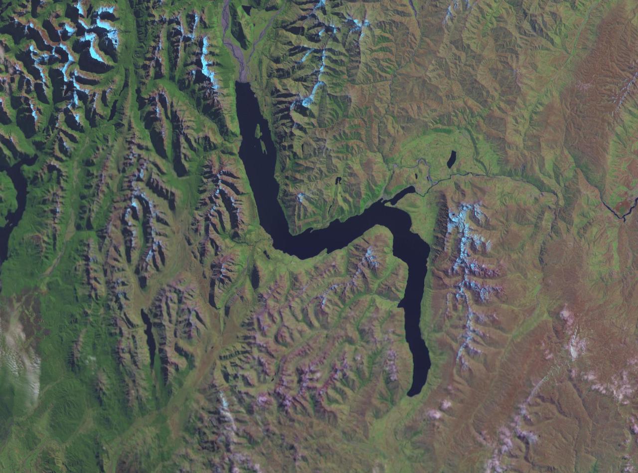
Lake Wakatipu ( mi, Whakatipu Waimāori) is an inland lake (finger lake) in the South Island of New Zealand. It is in the southwest corner of the Otago region, near its boundary with Southland. ''Lake Wakatipu'' comes from the original Māori name . With a length of , it is New Zealand's longest lake, and, at , its third largest. The lake is also very deep, its floor being below sea level, with a maximum depth of . It is at an altitude of , towards the southern end of the Southern Alps / Kā Tiritiri o te Moana. The general topography is a reversed "N" shape or "dog leg". The Dart River / Te Awa Whakatipu flows into the northern end, the lake then runs south for 30 kilometres before turning abruptly to the east. Twenty kilometres (12.4 mi) further along, it turns sharply to the south, reaching its southern end further south, near Kingston. The lake is drained by the Kawarau River, which flows out from the lake's only arm, the Frankton Arm, east of Queenstown. Until ... [...More Info...] [...Related Items...] OR: [Wikipedia] [Google] [Baidu] |
Milford Sound
Milford Sound / Piopiotahi is a fiord in the south west of New Zealand's South Island within Fiordland National Park, Piopiotahi (Milford Sound) Marine Reserve, and the Te Wahipounamu World Heritage site. It has been judged the world's top travel destination in an international survey (the ''2008 Travelers' Choice Destinations Awards'' by TripAdvisor) and is acclaimed as New Zealand's most famous tourist destination."Real Journeys rapt with Kiwi Must-Do's" ''Scoop'', 13 February 2007. had previously called it the |
Kingston Morain
Kingston may refer to: Places * List of places called Kingston, including the five most populated: ** Kingston, Jamaica ** Kingston upon Hull, England ** City of Kingston, Victoria, Australia ** Kingston, Ontario, Canada ** Kingston upon Thames, England Animals * Kingston (horse) (1884–1912), an American Thoroughbred racehorse * Kingston parakeets, feral parakeets in the UK Music * Kingston (band), a New Zealand pop/rock band * Kingston (country music band), an American duo * Kingston Maguire, known as Kingston, of hip hop duo Blue Sky Black Death * The Kingston Trio, an American folk and pop music group People * Kingston (surname), a surname, including a list of people with the name * Earl of Kingston and Baron Kingston and Viscount Kingston, a title in the Peerage of Ireland * Duke of Kingston-upon-Hull, a title in the Peerage of Great Britain, and Earl of Kingston-upon-Hull, a title in the Peerage of England Rivers * Kingston Brook, a small river in central England * K ... [...More Info...] [...Related Items...] OR: [Wikipedia] [Google] [Baidu] |


.jpg)


.jpg)