|
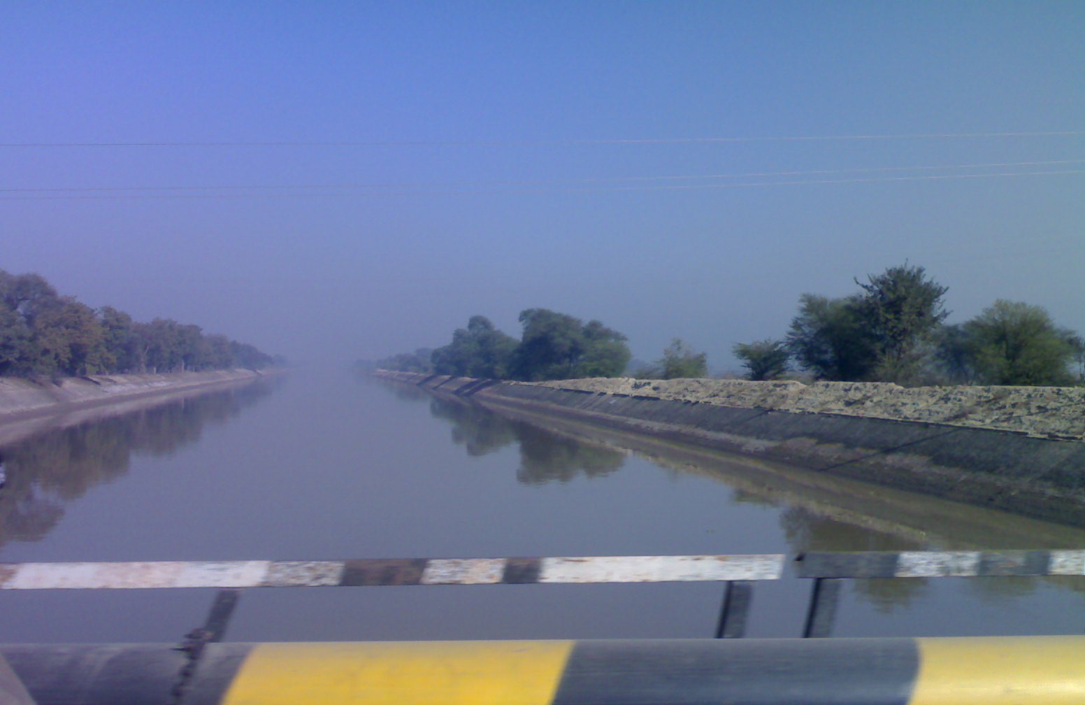
Pathrala Barrage
Pathrala Barrage (Hindi: पथराला बांध) is a barrage across the Somb river, located in Yamuna Nagar District, in the state of Haryana, India. History The Western Yamuna Canal, built in 1335 CE by Firuz Shah Tughlaq, excessive silting caused it to stop flowing in 1750 CE, British raj undertook a three-year renovation in 1817 by Bengal Engineer Group, in 1832-33 Tajewala Barrage dam at Yaumna was built to regulate the flow of water, in 1875-76 Pathrala barrage at Dadupur and Somb river dam downstream of canal were built, in 1889-95 the largest branch of the canal ''Sirsa branch'' was constructed, the modern Hathni Kund Barrage was built in 1999 to handle the problem of silting to replace the older Tajewala Barrage. The Western Yamuna Canal begins at the Hathnikund Barrage about from Dakpathar and south of Doon Valley. The canals irrigate vast tracts of land in the region in Ambala district, Karnal district, Sonepat district, Rohtak district, Jind district, H ... [...More Info...] [...Related Items...] OR: [Wikipedia] [Google] [Baidu] |
Yamunanagar District
Yamunanagar district is one of the 22 districts of the Indian state of Haryana. The district came into existence on 1November 1989 and occupies an area of . Yamunanagar town is the district headquarters. Yamunanagar's average rainfall in Monsoon is 892 mm, which is higher than the state average, which is 462 mm for Haryana. The district is bounded by Himachal Pradesh state in the north, by Uttar Pradesh state in the east, by Karnal district in the south, by Kurukshetra district in the southwest and Ambala district in the west. Divisions The district is divided into 3 sub divisions: Jagadhri, Radaur and Bilaspur. There are 4 tehsils: Jagadhri, Chhachhrauli, Radaur and Bilaspur. These are further divided into 7 development blocks: Bilaspur, Sadhaura, Radaur, Jagadhri, Chhachhrauli, Saraswati Nagar and Partap Nagar. There are 4 Vidhan Sabha constituencies in the district: Sadhaura, Jagadhri, Yamuna Nagar and Radaur. While Sadhaura, Jagadhri and Yamuna Nagar are part of ... [...More Info...] [...Related Items...] OR: [Wikipedia] [Google] [Baidu] |
Irrigation In India
Irrigation in India includes a network of major and minor canals from Indian rivers, groundwater well based systems, tanks, and other rainwater harvesting projects for agricultural activities. Of these groundwater system is the largest. In 2013–14, only about 36.7% of total agricultural land in India was reliably irrigated, and remaining 2/3 cultivated land in India is dependent on monsoons. 65% of the irrigation in India is from groundwater. Currently about 51% of the agricultural area cultivating food grains is covered by irrigation. The rest of the area is dependent on rainfall which is most of the times unreliable and unpredictable. Indian government launched a demand side water management plan costing INR6000 crore or USD854 million across 8,350 water stressed villages of 78 districts in seven states – Gujarat, Haryana, Karnataka, Madhya Pradesh, Maharashtra, Rajasthan and Uttar Pradesh – over five years from 2021–2022 to 2026–27, with the view to harvest rainwat ... [...More Info...] [...Related Items...] OR: [Wikipedia] [Google] [Baidu] |
Indira Gandhi Canal
The Indira Gandhi Canal (originally, Rajasthan Canal) is the longest canal in India. It starts at the Harike Barrage near Harike, a few kilometers downriver from the confluence of the Satluj and Beas rivers in Punjab state, and ends in irrigation facilities in the Thar Desert in the northwest of Rajasthan state. Previously known as the Rajasthan Canal, it was renamed the Indira Gandhi Canal on 2 November 1984 following the assassination of Prime Minister Indira Gandhi. The canal consists of the Rajasthan feeder canal with the first in Punjab and Haryana state and a further in Rajasthan. This is followed by the of the Rajasthan main canal, which is entirely within Rajasthan. The canal enters Haryana from Punjab near Lohgarh and runs through the western part of the Sirsa district before entering Rajasthan near Kharakhera village in the Tibbi tehsil of the Hanumangarh district. It traverses seven districts of Rajasthan: Barmer, Bikaner, Churu, Hanumangarh, Jaisalmer, Jodhpur ... [...More Info...] [...Related Items...] OR: [Wikipedia] [Google] [Baidu] |
Surajkund
Surajkund is an ancient reservoir of the 10th century located on Southern Delhi Ridge of Aravalli range in Faridabad city of Haryana state about 8 km (5mi) from South Delhi. Surajkund (literally 'Lake of the Sun') is an artificial Kund ('Kund' means "lake" or reservoir) built in the backdrop of the Aravalli hills with an amphitheatre shaped embankment constructed in semicircular form. It is said to have been built by the king Surajpal of the Tomara dynasty in the 10th century. Tomar, a younger son of Anangpal Tomar – the ruler of Delhi, was a sun worshipper and he had therefore built a Sun temple on its western bank. Surajkund is known for its annual fair "Surajkund International Craft Mela", 2015 edition of this fair was visited by 1.2 million visitors including 160,000 foreigners with more than 20 countries participating in it. There are several dozen 43 paleolithic sites (100,000 BC), with rock art and microlithic stone tools, scattered surround the Surajkund from Ma ... [...More Info...] [...Related Items...] OR: [Wikipedia] [Google] [Baidu] |
Yamuna
The Yamuna (Hindustani language, Hindustani: ), also spelt Jumna, is the second-largest tributary river of the Ganges by discharge and the longest tributary in List of major rivers of India, India. Originating from the Yamunotri Glacier at a height of about on the southwestern slopes of Bandarpunch peaks of the Lower Himalayan Range, Lower Himalaya in Uttarakhand, it travels a total length of and has a Drainage system (geomorphology), drainage system of , 40.2% of the entire Ganges Basin. It merges with the Ganges at Triveni Sangam, Allahabad, which is a site of the Kumbh Mela, a Hindu festival held every 12 years. Like the Ganges, the Yamuna is highly venerated in Hinduism and worshipped as the Yamuna in Hinduism, goddess Yamuna. In Hinduism she is the daughter of the sun god, Surya, and the sister of Yama, the god of death, and so is also known as Yami. According to popular legends, bathing in its sacred waters frees one from the torments of death. It crosses several s ... [...More Info...] [...Related Items...] OR: [Wikipedia] [Google] [Baidu] |
Okhla Sanctuary
Okhla Bird Sanctuary is a bird sanctuary at the Okhla barrage over Yamuna River. It is situated in Noida, Gautam Buddh Nagar district, on Delhi-Uttar Pradesh state border and known as a haven for over 300 bird species, especially waterbirds. In 1990, an area of on the river Yamuna was designated a bird sanctuary by the Government of Uttar Pradesh under the Wildlife Protection Act, 1972. The site is located at the point where the river enters Uttar Pradesh. The most prominent feature of the sanctuary is the large lake created by damming the river, which lies between Okhla village to the west and Gautam Budh Nagar to the east. The Okhla Bird Sanctuary (OBS) is roughly 4 square kilometres in size and is situated at the entrance of NOIDA in Gautam Budh Nagar district of Uttar Pradesh. It is situated at a point where river Yamuna enters in the state of Uttar Pradesh leaving the territory of Delhi. It is one among fifteen bird sanctuaries in the state. The bird species of thorny scru ... [...More Info...] [...Related Items...] OR: [Wikipedia] [Google] [Baidu] |
Bhakra Dam
Bhakra Dam is a concrete gravity dam on the Sutlej River in Bhakra Village near Bilaspur in Bilaspur district, Himachal Pradesh in northern India. The dam forms the Gobind Sagar reservoir. The dam, located at a gorge near the (now submerged) upstream Bhakra village in Bilaspur district of Himachal Pradesh of height 226 m. The length of the dam (measured from the road above it) is 518.25 m and the width is 9.1 m. Its reservoir known as "Gobind Sagar" stores up to 9.34 billion cubic metres of water. The 90 km long reservoir created by the Bhakra Dam is spread over an area of 168.35 km2. In terms of quantity of water, it is the third largest reservoir in India, the first being Indira Sagar dam in Madhya Pradesh with capacity of 12.22 billion cu m and second Nagarjunasagar Dam. Described as "New Temple of Resurgent India" by Jawaharlal Nehru, the first prime minister of India, the dam attracts tourists from all over India. Bhakra dam is 15 km f ... [...More Info...] [...Related Items...] OR: [Wikipedia] [Google] [Baidu] |
Pinjore
Pinjore is a town in Panchkula district in the Indian state of Haryana. This residential 'township', located close to Panchkula, Chandigarh, is set over 1,800 feet above the sea level in a valley, overlooking the Sivalik Hills. Pinjore is known for Pinjore Gardens, Asia's best 17th Century Mughal garden, and the Hindustan Machine Tools (HMT) factory. History Etymology The town is named after the five Pandava brothers from Mahabharta, who during the time of their exile had stayed here for some time, hence the name Panchpura which later got corrupted to its current form, Pinjore.Haryana Samvad , Oct 2018, p38-40. Panchpura baoli Panchpura baoli, a has ...[...More Info...] [...Related Items...] OR: [Wikipedia] [Google] [Baidu] |
Kaushalya Dam
The Kaushalya Dam (Hindi: कौशल्या बांध) is an earth-fill embankment dam on the Kaushalya river, which is a tributary of Ghaggar-Hakra River ( modern remnant of ancient Sarasvati river), in Pinjore of Haryana state, India. It was constructed between 2008 and 2012 with the primary purpose of water supply. Location Kaushalya barrage and resulting upstream dam on Kaushalya river are located 21 km from Chandigarh, 12 km from Panchkula city and Khol Hi-Raitan Wildlife Sanctuary near Panchkula, 5 km from Pinjore city, Directions from Kaushalya dam to Pinjore/ref> and 13 km from Bir Shikargah Wildlife Sanctuary near Pinjore. History The first plan, which never materialised, for a dam on Ghaggar river was first proposed by the British raj in the mid 19th century to provide drinking water to Ambala Cantonment. The proposal was revisited only in the 1960s to construct a dam on Ghaggar river at Gumthala near Chandimandir to provide water to Chandi ... [...More Info...] [...Related Items...] OR: [Wikipedia] [Google] [Baidu] |
Hisar (city)
Hisar is a city, municipal corporation and administrative headquarters of Hisar district of Hisar division in the state of Haryana in northwestern India. It is located 161.2 km (100.16 mi) to the west of New Delhi, India's capital, and has been identified as a counter-magnet city for the National Capital Region to develop as an alternative centre of growth to Delhi. The city was founded in 1354 AD, as ''Hisar-e-Firoza'' by Firoz Shah Tughlaq, the Sultan of Delhi from 1351 to 1388. The word Hisar means fort or castle in Persian. The city was ruled by several major powers, including the Tughlaqs in the 14th century, the Mughals in the 16th century, and the British in the 19th century. After India achieved independence, it was unified History Early history Archeological excavations at nearby locations of Rakhigarhi (7000 BCE), Siswal (4000 BCE), and Lohari Ragho suggest the presence of human habitation from pre-Harappan period. Later, Aryan people settled around ... [...More Info...] [...Related Items...] OR: [Wikipedia] [Google] [Baidu] |
Blue Bird Lake
Blue Bird Lake, Hisar is a resident and endangered migratory bird wetland habitat, lake and recreation area in the town of Hisar, in the Hisar district of Haryana State, India.Blue Bird lake Location Blue Bird Lake is close to on NH-9 in Hisar, |


.jpg)


