|
Passo Predèlp
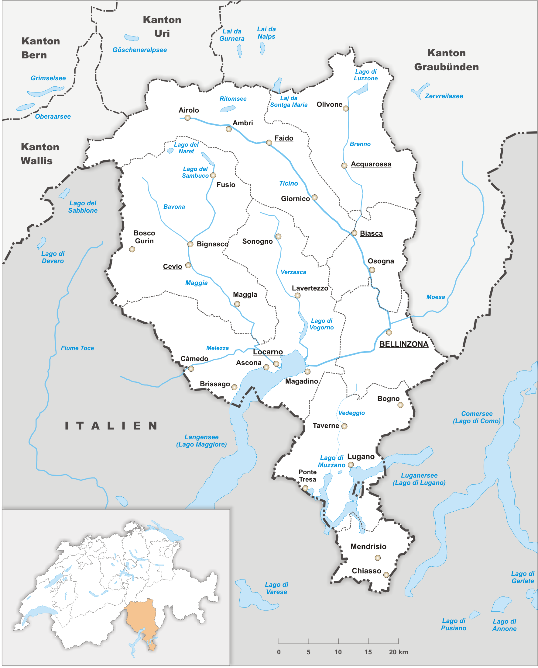
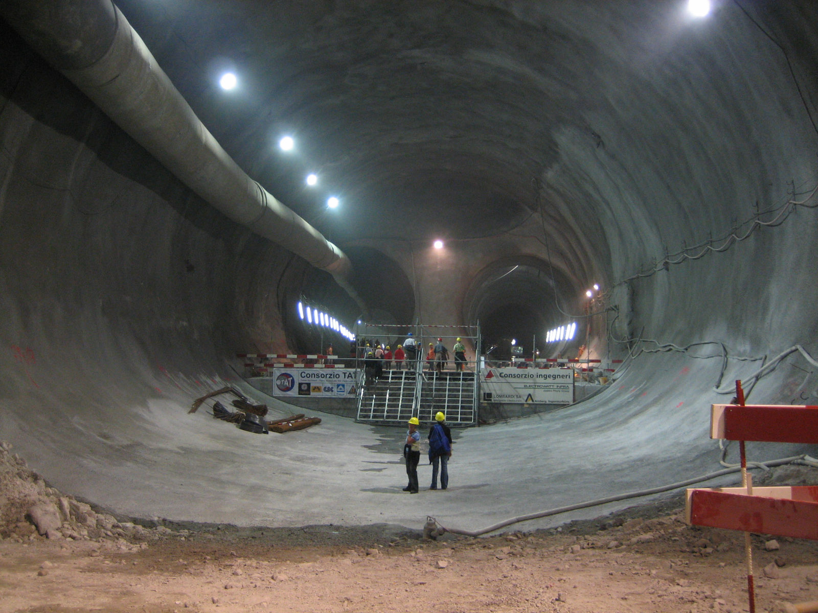
The Passo di Predèlp (, is a high mountain pass of the Lepontine Alps (Saint-Gotthard Massif), located between the Valle Santa Maria and the Leventina, in Ticino. The pass lies between Pizzo del Sole and Pizzo di Predèlp. It connects Carì Carì (formerly known as ''Maiensäss'') is a village in the Swiss Alps, located in the canton of Ticino. The village is situated in the northern part of the canton, in the Leventina valley, above Faido. It belongs to the latter municipality. Car ... (above Faido) with other passes in the Lukmanier region. Below the Passo Predèlp, or more precisely just west of it, runs the Gotthard Base Tunnel. References External linksPasso Predèlp on Hikr Mountain passes of the Alps Mountain passes of Ticino {{Ticino-geo-stub ... [...More Info...] [...Related Items...] OR: [Wikipedia] [Google] [Baidu] |
Swisstopo
Swisstopo is the official name for the Swiss Federal Office of Topography (in German language, German: ''Bundesamt für Landestopografie''; French language, French: ''Office fédéral de topographie''; Italian language, Italian: ''Ufficio federale di topografia''; Romansh language, Romansh: ''Uffizi federal da topografia''), Switzerland's national mapping agency. The current name was made official in 2002. It had been in use as the domain name for the institute's homepage, swisstopo.ch, since 1997. Maps The main class of products produced by Swisstopo are topographical maps on seven different Scale (map), scales. Swiss maps have been praised for their accuracy and quality. Regular maps * 1:25.000. This is the most detailed map, useful for many purposes. Those are popular with tourists, especially for famous areas like Zermatt and St. Moritz. These maps cost CHF 13.50 each (2004). 208 maps on this scale are published at regular intervals. The first map published on this scale ... [...More Info...] [...Related Items...] OR: [Wikipedia] [Google] [Baidu] |
Ticino
Ticino (), sometimes Tessin (), officially the Republic and Canton of Ticino or less formally the Canton of Ticino,, informally ''Canton Ticino'' ; lmo, Canton Tesin ; german: Kanton Tessin ; french: Canton du Tessin ; rm, Chantun dal Tessin . is one of the 26 cantons forming the Swiss Confederation. It is composed of eight districts and its capital city is Bellinzona. It is also traditionally divided into the Sopraceneri and the Sottoceneri, respectively north and south of Monte Ceneri. Red and blue are the colours of its flag. Ticino is the southernmost canton of Switzerland. It is one of the three large southern Alpine cantons, along with Valais and the Grisons. However, unlike all other cantons, it lies almost entirely south of the Alps, and has no natural access to the Swiss Plateau. Through the main crest of the Gotthard and adjacent mountain ranges, it borders the canton of Valais to the northwest, the canton of Uri to the north and the canton of Grisons to the northea ... [...More Info...] [...Related Items...] OR: [Wikipedia] [Google] [Baidu] |
Switzerland
). Swiss law does not designate a ''capital'' as such, but the federal parliament and government are installed in Bern, while other federal institutions, such as the federal courts, are in other cities (Bellinzona, Lausanne, Luzern, Neuchâtel, St. Gallen a.o.). , coordinates = , largest_city = Zürich , official_languages = , englishmotto = "One for all, all for one" , religion_year = 2020 , religion_ref = , religion = , demonym = , german: Schweizer/Schweizerin, french: Suisse/Suissesse, it, svizzero/svizzera or , rm, Svizzer/Svizra , government_type = Federalism, Federal assembly-independent Directorial system, directorial republic with elements of a direct democracy , leader_title1 = Federal Council (Switzerland), Federal Council , leader_name1 = , leader_title2 = , leader_name2 = Walter Thurnherr , legislature = Fe ... [...More Info...] [...Related Items...] OR: [Wikipedia] [Google] [Baidu] |
Lepontine Alps
, topo_map= Swiss Federal Office of Topography swisstopo , photo=MonteLeone0001.jpg , photo_caption=Monte Leone , country_type= Countries , country= , subdivision1_type= Cantons, Regions , subdivision1= , parent= Western Alps , borders_on= , geology= , orogeny= Alpine orogeny , length_mi= , length_orientation= , width_mi= , width_orientation= , highest=Monte Leone , elevation_m=3553 , coordinates= , range_coordinates= , map_image=Alps locator map (Alpi Lepontini).png , map_caption=Lepontine Alps (red) The Lepontine Alps (german: Lepontinische Alpen, french: Alpes lépontines, it, Alpi Lepontine) are a mountain range in the north-western part of the Alps. They are located in Switzerland (Valais, Ticino, Uri and Graubünden) and Italy (Piedmont and Lombardy). The Simplon rail tunnel (from Brig to Domodossola) the Gotthard rail (from Erstfeld to Bodio) and Gotthard road tunnels (from Andermatt to Airolo) and the San Bernardino road tunnel are importa ... [...More Info...] [...Related Items...] OR: [Wikipedia] [Google] [Baidu] |
Swisstopo
Swisstopo is the official name for the Swiss Federal Office of Topography (in German language, German: ''Bundesamt für Landestopografie''; French language, French: ''Office fédéral de topographie''; Italian language, Italian: ''Ufficio federale di topografia''; Romansh language, Romansh: ''Uffizi federal da topografia''), Switzerland's national mapping agency. The current name was made official in 2002. It had been in use as the domain name for the institute's homepage, swisstopo.ch, since 1997. Maps The main class of products produced by Swisstopo are topographical maps on seven different Scale (map), scales. Swiss maps have been praised for their accuracy and quality. Regular maps * 1:25.000. This is the most detailed map, useful for many purposes. Those are popular with tourists, especially for famous areas like Zermatt and St. Moritz. These maps cost CHF 13.50 each (2004). 208 maps on this scale are published at regular intervals. The first map published on this scale ... [...More Info...] [...Related Items...] OR: [Wikipedia] [Google] [Baidu] |
Mountain Pass
A mountain pass is a navigable route through a mountain range or over a ridge. Since many of the world's mountain ranges have presented formidable barriers to travel, passes have played a key role in trade, war, and both Human migration, human and animal migration throughout history. At lower elevations it may be called a hill pass. A mountain pass is typically formed between two volcanic peaks or created by erosion from water or wind. Overview Mountain passes make use of a gap (landform), gap, saddle (landform), saddle, col or notch (landform), notch. A topographic saddle is analogous to the mathematical concept of a saddle surface, with a saddle point marking the highest point between two valleys and the lowest point along a ridge. On a topographic map, passes are characterized by contour lines with an hourglass shape, which indicates a low spot between two higher points. In the high mountains, a difference of between the summit and the mountain is defined as a mountain pas ... [...More Info...] [...Related Items...] OR: [Wikipedia] [Google] [Baidu] |
Saint-Gotthard Massif
The Gotthard Massif or Saint-Gotthard Massif (german: Gotthardmassiv or ; it, Massiccio del San Gottardo; rm, Massiv dal Gottard) is a mountain range in the Alps in Switzerland, located at the border of four cantons: Valais, Ticino, Uri and Graubünden. It is delimited by the Nufenen Pass on the west, by the Furka Pass and the Oberalp Pass on the north and by the Lukmanier Pass on the east. The eponymous Gotthard Pass, lying at the heart of the massif, is the main route from north to south (excluding tunnels). The region of the Gotthard lies at the heart of the Swiss Alps, often referred to as the "water tower of Europe". Three major rivers take their source in the Gotthard Massif: the Reuss, Rhine and Ticino. A fourth river, the Rhône, takes its source in very close proximity of the massif, just north of the Furka Pass. A trekking itinerary, the Vier-Quellen-Weg ("four springs trail"), crosses the Gotthard Massif. Peaks The highest peaks of the massif are Pizzo RotondoKarl ... [...More Info...] [...Related Items...] OR: [Wikipedia] [Google] [Baidu] |
Valle Santa Maria
[...More Info...] [...Related Items...] OR: [Wikipedia] [Google] [Baidu] |
Leventina
The Leventina District is one of the eight districts of the largely Italian-speaking canton of Ticino in Switzerland. The capital of the district is Faido but the largest town is Airolo on the southern flank of the Gotthard Pass. Situated to the north of the canton, its territory covers the area of the Ticino River as far south as Biasca, in particular the Bedretto Valley and the Leventina Valley. Leventina is divided into four sub-districts, termed 'circles' ( it, circoli), and a total area of with a population of (as of ). Its capital is the municipality ( it, comune) of Faido. The valley became part of Switzerland on 5 March 1480, following the treaty of Lucerne with the Duchy of Milan. Geography The Leventina District has an area, , of . Of this area, or 4.2% is used for agricultural purposes, while or 36.5% is forested. Of the rest of the land, or 2.8% is settled (buildings or roads), or 1.9% is either rivers or lakes and or 36.5% is unproductive land. Of the b ... [...More Info...] [...Related Items...] OR: [Wikipedia] [Google] [Baidu] |
Pizzo Del Sole
The Pizzo del Sole is a mountain of the Lepontine Alps in the Swiss canton of Ticino. With a height of 2,773 metres, it is the highest point of the Val Piora. On its southern side are located the lakes of Chiéra. References External links Pizzo del Sole Mountains of the Alps Mountains of Switzerland Mountains of Ticino Lepontine Alps {{Ticino-mountain-stub ... [...More Info...] [...Related Items...] OR: [Wikipedia] [Google] [Baidu] |
Carì
Carì (formerly known as ''Maiensäss'') is a village in the Swiss Alps, located in the canton of Ticino. The village is situated in the northern part of the canton, in the Leventina valley, above Faido. It belongs to the latter municipality. Carì sits on a sunny terrace at a height of 1,642 metres above sea level, on the southern flanks of Pizzo di Campello. Since 1950, the village has developed into one of the most popular alpine tourist resorts of the canton. It is now inhabited all year round, making Carì the highest permanent settlement in the canton of Ticino. In winter Carì includes 20 km of ski pistes up to Lago di Carì (2,280 m). The Gotthard Base Tunnel , rm, Tunnel da basa dal Sogn Gottard , image = 20141120 gotthard-basistunnel02-wikipedia-hannes-ortlieb.jpg , image_size = 250 , caption = Turnout at Faido multifunction station , line = Gotthard Line , location = Switzerland ( Uri, Grisons and ... runs below Carì, over one kilometre below the ground. At ... [...More Info...] [...Related Items...] OR: [Wikipedia] [Google] [Baidu] |
Faido
Faido is the capital of the district of Leventina in the Italian-speaking canton of Ticino in southern Switzerland. On 29 January 2006, Faido grew by incorporating the villages of Chiggiogna, Rossura, and Calonico. On 1 April 2012, Faido grew again when it incorporated the former municipalities of Anzonico, Calpiogna, Campello, Cavagnago, Chironico, Mairengo and Osco.Amtliches Gemeindeverzeichnis der Schweiz published by the Swiss Federal Statistical Office . Retrieved 23 May 2012 It grew again on 10 April 2016 when was absorbed into the municipality. History The municipality is first documented in 1171 as ''Faedo''. In ...[...More Info...] [...Related Items...] OR: [Wikipedia] [Google] [Baidu] |


