|
Pasohlávky
Pasohlávky (german: Weißstätten) is a municipality and village in Brno-Country District in the South Moravian Region of the Czech Republic. It has about 700 inhabitants. It is a summer resort at the Nové Mlýny Reservoir. Geography Pasohlávky is located about south of Brno. It lies in the Dyje–Svratka Valley. The highest point is the hill Hradisko at . The municipality is situated on the northwestern shore of the Nové Mlýny Reservoir. History The first written mention of Pasohlávky is from 1276, under its original name ''Uherčice na Bílém břehu''. Because of the construction of the Nové Mlýny reservoirs, the cadastral area of the neighbouring village of Mušov was joined to Pasohlávky on 1 January 1980 and most of the inhabitants moved to Pasohlávky. The area of Mušov was subsequently flooded. Sights The area of Pasohlávky and Mušov are important archaeological sites. There are 28 known archaeological sites in the former Mušov and 21 in Pasohlávky. Re ... [...More Info...] [...Related Items...] OR: [Wikipedia] [Google] [Baidu] |
Mušov
Mušov (german: Muschau) is a cadastral area and a defunct village in the municipality of Pasohlávky, South Moravian Region, Czech Republic. It covers an area of . Geography and history Mušov was the lowest-lying village in the Břeclav District. The village was destroyed despite the opposition of its inhabitants in the late 1970s, due to the decision of the then socialist authorities to build the Nové Mlýny reservoirs by flooding a unique ecosystem of the riparian forest in the area around the river Thaya. In 1976, the village was merged with the neighbouring municipality of Pasohlávky. The residents of Mušov could choose whether they wanted an apartment or to build a house in a newly built street in Pasohlávky. The village was flooded between 1981 and 1987. The post office in Mušov was last opened on 30 June 1978. Thanks to the efforts of conservationists, it was decided to preserve the medieval St Leonard's church, now standing on a small island in the middle of the ... [...More Info...] [...Related Items...] OR: [Wikipedia] [Google] [Baidu] |
Roman Fort, Mušov
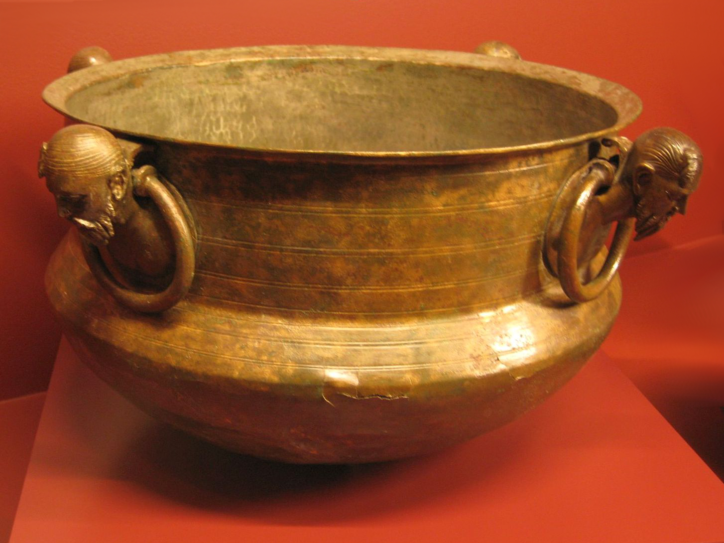
The Roman fort ( cz, římská pevnost or cz, Hradisko, german: Burgstall) is an archaeological site located in Mušov, Czech Republic, of a Roman army camp on the Dyje- Svratka-Jihlava confluence. It was intended to become the capital of the proposed Marcomannia province (Moravia). Geography The site is located on the Dyje- Svratka-Jihlava confluence. It is situated 18 km from Brno and 86 km from Vienna. History The '' castra'' in Mušov originated as a Roman army camp. Its original name is unknown (possibly, but uncertainly, it was ''Eburon'', from Ptolemy's Eβυρον). Romans made it his base of operations in the campaigns against Maroboduus (Marbod). So far its importance in the European context remains the site and its accompanying evidence of the period of the Marcomannic Wars (166–180 AD) – the central military base on the hill Hradisko (Hillfort) at Mušov (now cadastral area of Pasohlávky). It was built by Marcus Aurelius' soldiers deep inside ... [...More Info...] [...Related Items...] OR: [Wikipedia] [Google] [Baidu] |
Brno-Country District
Brno-Country District ( cs, okres Brno-venkov) is one of seven districts ('' okres'') within South Moravian Region of the Czech Republic. Its administrative center is in the city of Brno. The most populated town of the district is Kuřim. The district is made by 187 municipalities, which is the highest number within all districts of the Czech Republic. List of municipalities Babice nad Svitavou - Babice u Rosic - Běleč - Bílovice nad Svitavou - Biskoupky - Blažovice - Blučina - Borač - Borovník - Branišovice - Branišovice - Bratčice - Brumov - Březina (former Blansko District) - Březina (former Tišnov District) - Bukovice - Čebín - Černvír - Česká - Chudčice - Čučice - Cvrčovice - ''Deblín'' - Dolní Kounice - Dolní Loučky - Domašov - ''Doubravník'' - Drahonín - Drásov - Hajany - Heroltice - Hlína - Hluboké Dvory - Holasice - Horní Loučky - Hostěnice - Hradčany - Hrušovany u Brna - Hvozdec - Ivaň - Ivančice - Javůrek - J ... [...More Info...] [...Related Items...] OR: [Wikipedia] [Google] [Baidu] |
Obec
Obec (plural: ''obce'') is the Czech language, Czech and Slovak language, Slovak word for a municipality (in the Czech Republic, in Slovakia and abroad). The literal meaning of the word is "Intentional community, commune" or "community". It is the smallest administrative unit that is governed by elected representatives. Cities and towns are also municipalities. Definition Legal definition (according to the Czech code of law with similar definition in the Slovak code of law) is: ''"The municipality is a basic territorial self-governing community of citizens; it forms a territorial unit, which is defined by the boundary of the municipality."'' Every municipality is composed of one or more cadastre, cadastral areas. Every municipality is composed of one or more administrative parts, usually called town parts or villages. A municipality can have its own flag and coat of arms. Czech Republic Almost whole area of the republic is divided into municipalities, with the only exception be ... [...More Info...] [...Related Items...] OR: [Wikipedia] [Google] [Baidu] |
Brno
Brno ( , ; german: Brünn ) is a city in the South Moravian Region of the Czech Republic. Located at the confluence of the Svitava and Svratka rivers, Brno has about 380,000 inhabitants, making it the second-largest city in the Czech Republic after the capital, Prague, and one of the 100 largest cities of the EU. The Brno metropolitan area has almost 700,000 inhabitants. Brno is the former capital city of Moravia and the political and cultural hub of the South Moravian Region. It is the centre of the Czech judiciary, with the seats of the Constitutional Court, the Supreme Court, the Supreme Administrative Court, and the Supreme Public Prosecutor's Office, and a number of state authorities, including the Ombudsman, and the Office for the Protection of Competition. Brno is also an important centre of higher education, with 33 faculties belonging to 13 institutes of higher education and about 89,000 students. Brno Exhibition Centre is among the largest exhibition ... [...More Info...] [...Related Items...] OR: [Wikipedia] [Google] [Baidu] |
Archaeological Site
An archaeological site is a place (or group of physical sites) in which evidence of past activity is preserved (either prehistoric or historic or contemporary), and which has been, or may be, investigated using the discipline of archaeology and represents a part of the archaeological record. Sites may range from those with few or no remains visible above ground, to buildings and other structures still in use. Beyond this, the definition and geographical extent of a "site" can vary widely, depending on the period studied and the theoretical approach of the archaeologist. Geographical extent It is almost invariably difficult to delimit a site. It is sometimes taken to indicate a settlement of some sort although the archaeologist must also define the limits of human activity around the settlement. Any episode of deposition such as a hoard or burial can form a site as well. Development-led archaeology undertaken as cultural resources management has the disadvantage (or the ben ... [...More Info...] [...Related Items...] OR: [Wikipedia] [Google] [Baidu] |
Cadastre
A cadastre or cadaster is a comprehensive recording of the real estate or real property's metes and bounds, metes-and-bounds of a country.Jo Henssen, ''Basic Principles of the Main Cadastral Systems in the World,'/ref> Often it is represented graphically in a cadastral map. In most countries, legal systems have developed around the original administrative systems and use the cadastre to define the dimensions and location of land parcels described in legal documentation. A land parcel or cadastral parcel is defined as "a continuous area, or more appropriately volume, that is identified by a unique set of homogeneous property rights". Cadastral surveys document the Boundary (real estate), boundaries of land ownership, by the production of documents, diagrams, sketches, plans (''plats'' in the US), charts, and maps. They were originally used to ensure reliable facts for land valuation and taxation. An example from early England is the Domesday Book in 1086. Napoleon established a ... [...More Info...] [...Related Items...] OR: [Wikipedia] [Google] [Baidu] |
Dyje–Svratka Valley
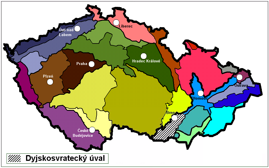
The Dyje–Svratka Valley ( cs, Dyjsko-svratecký úval, german: Thaya-Schwarza Talsenke) is a geomorphological feature (a special type of vale) in South Moravian Region of the Czech Republic. History The Dyje–Svratka Valley has been a natural pass between the Vienna Basin (Carpathians) and the Vyškov Gate, the Upper Morava Valley, Moravian Gate and later, the North European Plain (Poland - Lower Silesia - Galicia) since ancient times. It served as an arm of several important trade routes from southern Europe to the Baltic Sea such as the Amber Road, as well as routes from Moravia to Upper Silesia and Lesser Poland. The Emperor Ferdinand Northern Railway from Břeclav to Brno traverses the Dyje–Svratka Valley. Geography The floodplains of several rivers end in the Dyje–Svratka Valley, including Svratka, Jihlava, Svitava, Thaya, Jevišovka and Litava. Many towns are located within it, including the southern districts of Brno, Slavkov u Brna, Židlochovice, Pohořel ... [...More Info...] [...Related Items...] OR: [Wikipedia] [Google] [Baidu] |
Nové Mlýny Reservoirs
The Nové Mlýny reservoirs ( cs, Vodní dílo Nové Mlýny) are three reservoirs behind the Nové Mlýny Dam on the Thaya River in the Czech Republic. The lower reservoir, 1,668 ha in area, is the Novomlýnská (or Nové Mlýny) Reservoir, the middle reservoir, 1,031 ha, is the Věstonice Reservoir Věstonice Reservoir ( cz, Vodní nádrž Nové Mlýny II, Věstonická nádrž) is a reservoir on the Thaya River in the South Moravia. It is 1668 ha in area. The reservoir was built on the place of Mušov village. This is a Natural Reserve sin ... and the upper reservoir, 528 ha, is the Mušovská (or Mušov) Reservoir. ReferencesCzech Republic Environmental Law Service - The Nove Mlyny reservoirs [...More Info...] [...Related Items...] OR: [Wikipedia] [Google] [Baidu] |
Regions Of The Czech Republic
Regions of the Czech Republic ( cs, kraj, plural: ''kraje'') are higher-level territorial self-governing units of the Czech Republic. Every region is governed by a regional council, headed by a governor (''hejtman''). Elections to regional councils take place every four years. According to the Act no. 129/2000 Coll. ("Law on Regions"), which implements Chapter VII of the Czech Constitution, the Czech Republic is divided into thirteen regions and one capital city with regional status as of 1 January 2000. History The first ''kraje'' were created in the Kingdom of Bohemia during the reign of Charles IV in the 14th century and they lasted till 1862/68. ''Kraje'' were reintroduced in 1949 in Czechoslovakia and still exist today (except for the early 1990s) in its successor states despite many rearrangements. Competences Rights and obligations of the regions include: *Establishment of secondary schools; *Responsibility for hospitals and social facilities; *Construction and repai ... [...More Info...] [...Related Items...] OR: [Wikipedia] [Google] [Baidu] |
Czech Republic
The Czech Republic, or simply Czechia, is a landlocked country in Central Europe. Historically known as Bohemia, it is bordered by Austria to the south, Germany to the west, Poland to the northeast, and Slovakia to the southeast. The Czech Republic has a hilly landscape that covers an area of with a mostly temperate continental and oceanic climate. The capital and largest city is Prague; other major cities and urban areas include Brno, Ostrava, Plzeň and Liberec. The Duchy of Bohemia was founded in the late 9th century under Great Moravia. It was formally recognized as an Imperial State of the Holy Roman Empire in 1002 and became a kingdom in 1198. Following the Battle of Mohács in 1526, the whole Crown of Bohemia was gradually integrated into the Habsburg monarchy. The Protestant Bohemian Revolt led to the Thirty Years' War. After the Battle of White Mountain, the Habsburgs consolidated their rule. With the dissolution of the Holy Empire in 1806, the Cro ... [...More Info...] [...Related Items...] OR: [Wikipedia] [Google] [Baidu] |


