|
Parting Stone
A parting stone is a monument, usually of stone, to either: # Provide direction at a fork in the road—a ''parting'' of the way, or # Commemorate a final parting, as from a loved one. Directions alt=Roxbury Parting Stone of 1744, upright=.7, The 1744 Roxbury Parting Stone, fitted here with an iron stake from which a lantern could be hung A directing parting stone shows where each leg of a road fork leads. The earliest Massachusetts legislation pertaining to guide-posts was on February 28, 1795. In it, the selectmen were required to erect guide-posts at the corners and angles of all roads in their towns and districts, Before that time, some individuals had set up roadside stones marking the distance or direction to some important town. Numerous such stones were set by Paul Dudley, Chief-Justice of Massachusetts, as they bear his name or initials. It was not uncommon for well-to-do eighteenth century men to place milestones by the roadside along main thoroughfares for the co ... [...More Info...] [...Related Items...] OR: [Wikipedia] [Google] [Baidu] |
Fork (intersection)
An intersection or an at-grade junction is a junction where two or more roads converge, diverge, meet or cross at the same height, as opposed to an interchange, which uses bridges or tunnels to separate different roads. Major intersections are often delineated by gores and may be classified by road segments, traffic controls and lane design. Types Road segments One way to classify intersections is by the number of road segments (arms) that are involved. * A three-way intersection is a junction between three road segments (arms): a T junction when two arms form one road, or a Y junction, the latter also known as a fork if approached from the stem of the Y. * A four-way intersection, or crossroads, usually involves a crossing over of two streets or roads. In areas where there are blocks and in some other cases, the crossing streets or roads are perpendicular to each other. However, two roads may cross at a different angle. In a few cases, the junction of two road segmen ... [...More Info...] [...Related Items...] OR: [Wikipedia] [Google] [Baidu] |
Grisedale Tarn
Grisedale Tarn is a tarn in the Lake District of England between Fairfield and Dollywagon Pike. It is the legendary resting place of the crown of the kingdom of Cumbria, after the crown was conveyed there in 945 by soldiers of the last king, Dunmail, after he was slain in battle with the combined forces of the English and Scottish kings. Grisedale Tarn is in altitude and has a maximum depth of around . It holds brown trout, perch and eels.Blair, Don: ''Exploring Lakeland Tarns'': Lakeland Manor Press (2003): The outflow is to Ullswater to the north-east, picking up all of the rainfall from the eastern face of Dollywagon Pike. The Tarn is the subject of a poem by the Rev. Frederick William Faber printed in 1840. See also * Grizedale * Grizedale Forest Grizedale Forest is a 24.47 km2 area of woodland in the Lake District of North West England, located to the east of Coniston Water and to the south of Hawkshead. It is made up of a number of hills, small tarns and ... [...More Info...] [...Related Items...] OR: [Wikipedia] [Google] [Baidu] |
Street Furniture
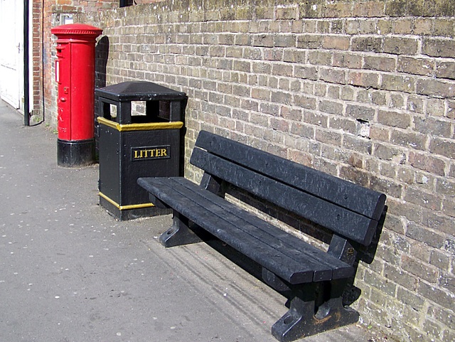
Street furniture is a collective term for objects and pieces of equipment installed along streets and roads for various purposes. It includes benches, traffic barriers, bollards, post boxes, phone boxes, streetlamps, traffic lights, traffic signs, bus stops, tram stops, taxi stands, public lavatories, fountains, watering troughs, memorials, public sculptures, and waste receptacles. Description and use Street furniture is a collective term used in the United States, United Kingdom, Australia, and Canada. It refers to objects and pieces of equipment installed along streets and roads for various purposes. The design and placement of furniture should take into account aesthetics, visual identity, function, pedestrian mobility and road safety. For example, street furniture can be positioned to control overspill parking in addition to its primary purpose; for example a bench and a number of bollards may be used to block access to a sidewalk or verges for vehicles. Items ... [...More Info...] [...Related Items...] OR: [Wikipedia] [Google] [Baidu] |
Roadside Memorial
A roadside memorial is a marker that usually commemorates a site where a person died suddenly and unexpectedly, away from home. Unlike a grave site headstone, which marks where a body is laid, the memorial marks the last place on earth where a person was alive – although in the past travelers were, out of necessity, often buried where they fell. Usually the memorial is created and maintained by family members or friends of the person who died. A common type of memorial is simply a bunch of flowers, real or plastic, taped to street furniture or a tree trunk. A handwritten message, personal mementos, etc. may be included. More sophisticated memorials may be a memorial cross, ghost bike, or a plaque with an inscription, decorated with flowers or wreaths. Roadside memorials tend to be clustered along the busiest roadways and often at intersections. Meaning and message Roadside memorials are a statement of grief and love from the loved ones of the accident victim or victim ... [...More Info...] [...Related Items...] OR: [Wikipedia] [Google] [Baidu] |
Ghost Bike
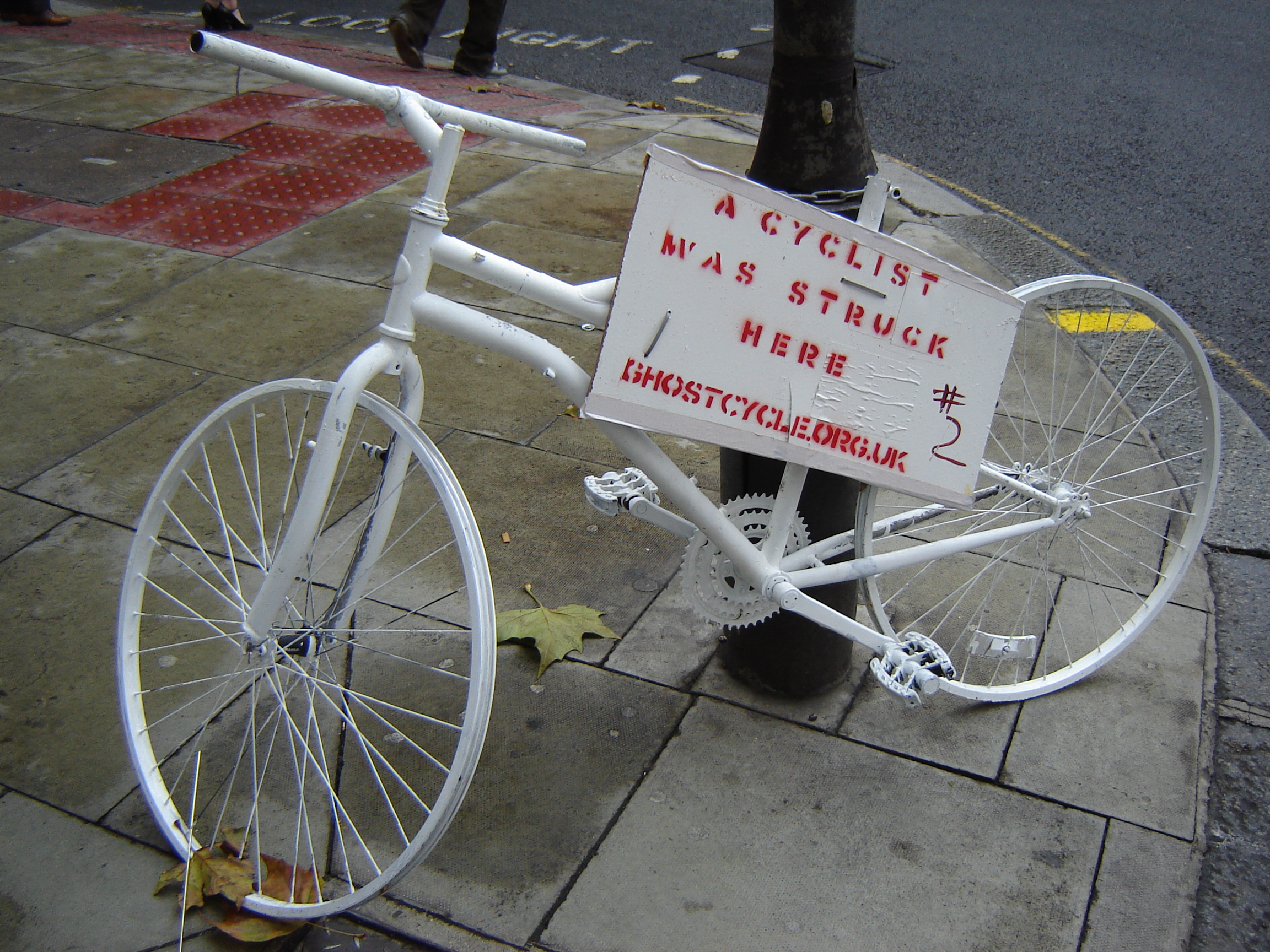
A ghost bike (also referred to as a ghostcycle or WhiteCycle) is a bicycle roadside memorial, placed where a cyclist has been killed or severely injured, usually by the driver of a motor vehicle. Apart from being a memorial, it is usually intended as a reminder to passing motorists to share the road. Ghost bikes are usually junk bicycles painted white, sometimes with a placard attached, and locked to a suitable object close to the scene of the crash. History The idea of painting bikes white originated in Amsterdam in the 1960s as an anarchist project to liberate two-wheel transport—white bikes were free, help yourself and then leave it for someone else. The ghost bike idea in the United States may have originated with a project by San Francisco artist Jo Slota, begun in April 2002. This was a purely artistic endeavor. Slota was intrigued by the abandoned bicycles that he found around the city, locked up but stripped of useful parts. He began painting them white, and post ... [...More Info...] [...Related Items...] OR: [Wikipedia] [Google] [Baidu] |
Boundary Marker
A boundary marker, border marker, boundary stone, or border stone is a robust physical marker that identifies the start of a land boundary or the change in a boundary, especially a change in direction of a boundary. There are several other types of named border markers, known as boundary trees, pillars, monuments, obelisks, and corners. Border markers can also be markers through which a border line runs in a straight line to determine that border. They can also be the markers from which a border marker has been fixed. Purpose According to Josiah Ober, boundary markers are "a way of imposing human, cultural, social meanings upon a once-undifferentiated natural environment." Boundary markers are linked to social hierarchies, since they derive their meaning from the authority of a person or group to declare the limits of a given space of land for political, social or religious reasons. Ober notes that "determining who can use parcels of arable land and for what purpose, has imm ... [...More Info...] [...Related Items...] OR: [Wikipedia] [Google] [Baidu] |
Hardwicke Rawnsley
Hardwicke Drummond Rawnsley (29 September 1851 – 28 May 1920) was an Anglican priest, poet, local politician and conservationist. He became nationally and internationally known as one of the three founders of the National Trust for Places of Historic Interest or Natural Beauty in the 1890s. Rawnsley was descended from a line of Church of England vicars, and after briefly considering medicine as a career he graduated from Oxford and took holy orders. In the mid-1870s he worked with the urban poor in London and Bristol, before being appointed in 1877 to a rural parish in Westmorland in the English Lake District. He soon became a vigorous activist in the campaign to preserve the region from excessive industrial development. In 1883 Rawnsley was appointed Vicar of Crosthwaite, Cumberland, in the north of the Lake District. He remained in the post for 34 years, becoming known locally and nationally for his energetic efforts to improve life for working people. He and his wife found ... [...More Info...] [...Related Items...] OR: [Wikipedia] [Google] [Baidu] |
William Wordsworth
William Wordsworth (7 April 177023 April 1850) was an English Romantic poet who, with Samuel Taylor Coleridge, helped to launch the Romantic Age in English literature with their joint publication ''Lyrical Ballads'' (1798). Wordsworth's ''magnum opus'' is generally considered to be '' The Prelude'', a semi-autobiographical poem of his early years that he revised and expanded a number of times. It was posthumously titled and published by his wife in the year of his death, before which it was generally known as "the poem to Coleridge". Wordsworth was Poet Laureate from 1843 until his death from pleurisy on 23 April 1850. Early life The second of five children born to John Wordsworth and Ann Cookson, William Wordsworth was born on 7 April 1770 in what is now named Wordsworth House in Cockermouth, Cumberland, (now in Cumbria), part of the scenic region in northwestern England known as the Lake District. William's sister, the poet and diarist Dorothy Wordsworth, to whom ... [...More Info...] [...Related Items...] OR: [Wikipedia] [Google] [Baidu] |
Lake District
The Lake District, also known as the Lakes or Lakeland, is a mountainous region in North West England. A popular holiday destination, it is famous for its lakes, forests, and mountains (or '' fells''), and its associations with William Wordsworth and other Lake Poets and also with Beatrix Potter and John Ruskin. The Lake District National Park was established in 1951 and covers an area of . It was designated a UNESCO World Heritage Site in 2017. The Lake District is today completely within Cumbria, a county and administrative unit created in 1974 by the Local Government Act 1972. However, it was historically divided between three English counties (Cumberland, Westmorland and Lancashire), sometimes referred to as the Lakes Counties. The three counties met at the Three Shire Stone on Wrynose Pass in the southern fells west of Ambleside. All the land in England higher than above sea level lies within the National Park, including Scafell Pike, the highest mountain in E ... [...More Info...] [...Related Items...] OR: [Wikipedia] [Google] [Baidu] |
John Eliot Square District
John Eliot Square District is a historic district located in the northern Roxbury neighborhood of Boston, Massachusetts. It is formed by the intersection of Dudley, Bartlett, Centre, Roxbury and Highland Streets. Named after local missionary to the Indians, John Eliot, the square was the site of the Roxbury town center after its founding in 1630. Roxbury was annexed to Boston in 1868, and John Eliot Square was added to the National Register of Historic Places in 1973. The square is the nucleus of Roxbury Heritage State Park, a history-themed heritage park. Major landmarks First Church of Roxbury John Eliot Square's central landmark is the First Church of Roxbury, Boston's oldest surviving wooden meeting house from the Federal Period of American architecture. Dillaway-Thomas House Roxbury Heritage State Park is anchored by the Dillaway–Thomas House, a large colonial structure built in 1750 and thought to be Roxbury's oldest surviving house. The location includes an adjacent ... [...More Info...] [...Related Items...] OR: [Wikipedia] [Google] [Baidu] |
Roxbury, Boston
Roxbury () is a neighborhood within the City of Boston, Massachusetts. Roxbury is a dissolved municipality and one of 23 official neighborhoods of Boston used by the city for neighborhood services coordination. The city states that Roxbury serves as the "heart of Black culture in Boston."Roxbury " City of Boston. Retrieved on May 2, 2009. Roxbury was one of the first towns founded in the in 1630, and became a city in 1846 before being annexed to Boston on January 5, 1868.Roxbury History . Part of Roxbury h ... [...More Info...] [...Related Items...] OR: [Wikipedia] [Google] [Baidu] |


