|
Parchester Village, Richmond, California
Parchester Village is a planned majority African-American village in northwestern Richmond, California that was the first in the state to sell to blacks. History After World War II temporary housing was torn down in Richmond, many black residents were not allowed to move into what was left. This culminated in the efforts of Reverend Guthrie John Williams, who in 1949 cut a deal that exchanged support for council member Amos Hinkley for more black housing. Although Hinkley did not win reelection, he did introduce Williams to Fred Parr, a wealthy white real estate developer who helped to develop the 400 or so single story homes. Parchester Village was originally planned as the first residential development for " All Americans", but became an all-black neighborhood when whites lost interest in purchasing here after finding out it was to be racially mixed. The streets are named after black pastors of the time, most notably Williams Street, one of the community's main arteries. The na ... [...More Info...] [...Related Items...] OR: [Wikipedia] [Google] [Baidu] |
Planned Community
A planned community, planned city, planned town, or planned settlement is any community that was carefully planned from its inception and is typically constructed on previously undeveloped land. This contrasts with settlements that evolve in a more ''ad hoc'' and organic fashion. The term ''new town'' refers to planned communities of the new towns movement in particular, mainly in the United Kingdom. It was also common in the European colonization of the Americas to build according to a plan either on fresh ground or on the ruins of earlier Native American villages. Planned capitals A planned capital is a city specially planned, designed and built to be a capital. Several of the world's national capitals are planned capitals, including Canberra in Australia, Brasília in Brazil, Belmopan in Belize, New Delhi in India, Abuja in Nigeria, Islamabad in Pakistan, Naypyidaw in Myanmar (Burma) and Washington, D.C. in the United States, and the modern parts of Astana in Kaza ... [...More Info...] [...Related Items...] OR: [Wikipedia] [Google] [Baidu] |
Casino San Pablo
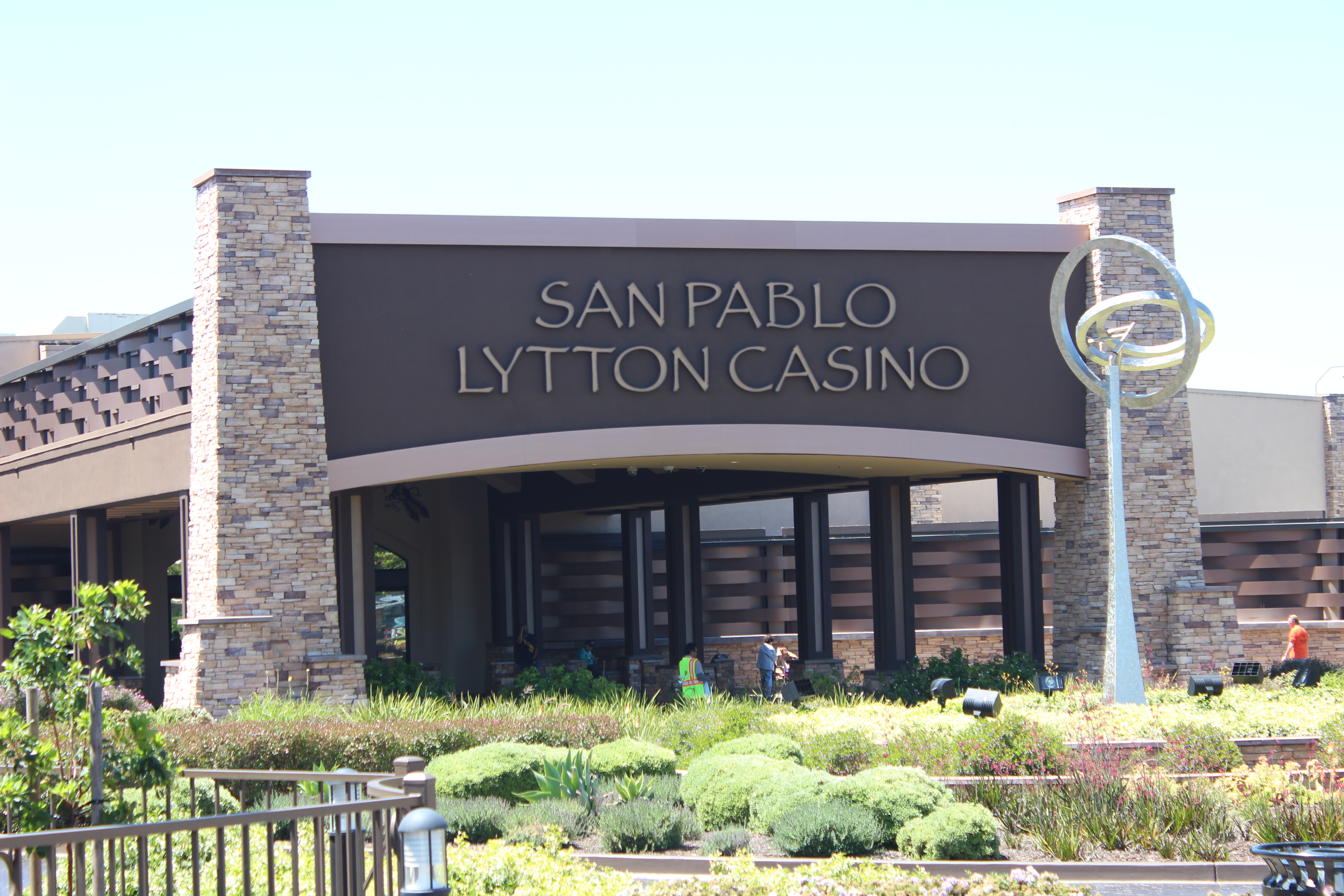
Casino San Pablo is a Native American reservation with a gambling hall located in San Pablo, California.Richmond rejects tribe's plans for casino resort Carolyn Jones. San Francisco Chronicle. 07-04-2011. Retrieved 07-04-2011. It is operated by the . It is adjacent to the site of the now demolished Doctors Medical Center. The former medical center was sold to the tribe in 2017. History The site, formerly a trailer park and the Lucky Lanes ...[...More Info...] [...Related Items...] OR: [Wikipedia] [Google] [Baidu] |
Marin County
Marin County is a county located in the northwestern part of the San Francisco Bay Area of the U.S. state of California. As of the 2020 census, the population was 262,231. Its county seat and largest city is San Rafael. Marin County is across the Golden Gate Bridge from San Francisco, and is included in the San Francisco–Oakland–Berkeley, CA Metropolitan Statistical Area. Marin County's natural sites include the Muir Woods redwood forest, the Marin Headlands, Stinson Beach, the Point Reyes National Seashore, and Mount Tamalpais. As of 2019, Marin County had the sixth highest income per capita of all U.S. counties, at $141,735. The county is governed by the Marin County Board of Supervisors. The Marin County Civic Center was designed by Frank Lloyd Wright and draws thousands of visitors a year to guided tours of its arch and atrium design. In 1994, a new county jail facility was embedded into the hillside nearby. The United States' oldest cross country running even ... [...More Info...] [...Related Items...] OR: [Wikipedia] [Google] [Baidu] |
San Pablo Bay
San Pablo Bay is a tidal estuary that forms the northern extension of San Francisco Bay in the East Bay and North Bay regions of the San Francisco Bay Area in northern California. Most of the Bay is shallow; however, there is a deep water channel approximately in the middle of the bay, which allows access to major ports in Sacramento, Stockton, Benicia, and Martinez; and other smaller ports on the Sacramento–San Joaquin River Delta. Geography San Pablo Bay was named after Rancho San Pablo, a Spanish land grant given to colonial Alta California settlers in 1815, on the bay at the site of the present-day city of San Pablo. The bay is approximately across and has an area of approximately . The bay receives the waters of the Sacramento and San Joaquin rivers, via Suisun Bay and the Carquinez Strait on its northeast end, and it connects to the Pacific Ocean via the San Francisco Bay on its southern end. The bay is heavily silted from the contributions of the two rivers, ... [...More Info...] [...Related Items...] OR: [Wikipedia] [Google] [Baidu] |
Richmond Parkway (California)
Richmond Parkway (originally Richmond Bypass) is an arterial road connecting Interstate 580 and Interstate 80 through Richmond, California. The road allows drivers traveling between Marin County (to the west) and Solano County (to the north) to bypass central Richmond. History The original idea for Richmond Parkway came from a state proposal for State Route 93 in the early 1980s. When the state did not implement the plan, local officials assembled $200 million in state and local funds to fund a road largely following the same route as proposed Route 93, which was built in the 1990s. While it mostly functions as an expressway, parts of Richmond Parkway do not meet state expressway standards. For this reason, Caltrans The California Department of Transportation (Caltrans) is an Executive (government), executive department of the U.S. state of California. The department is part of the Government of California#State agencies, cabinet-level California State Tran ... has refuse ... [...More Info...] [...Related Items...] OR: [Wikipedia] [Google] [Baidu] |
SPRR
The Southern Pacific (or Espee from the railroad initials- SP) was an American Class I railroad network that existed from 1865 to 1996 and operated largely in the Western United States. The system was operated by various companies under the names Southern Pacific Railroad, Southern Pacific Company and Southern Pacific Transportation Company. The original Southern Pacific began in 1865 as a land holding company. The last incarnation of the Southern Pacific, the Southern Pacific Transportation Company, was founded in 1969 and assumed control of the Southern Pacific system. The Southern Pacific Transportation Company was acquired in 1996 by the Union Pacific Corporation and merged with their Union Pacific Railroad. The Southern Pacific legacy founded hospitals in San Francisco, Tucson, and Houston. In the 1970s, it also founded a telecommunications network with a state-of-the-art microwave and fiber optic backbone. This telecommunications network became part of Sprint, a compa ... [...More Info...] [...Related Items...] OR: [Wikipedia] [Google] [Baidu] |
West Contra Costa County Detention Center
West County Detention Facility is a large coeducational adult medium security Contra Costa County, California, Contra Costa County jail in Richmond, California opened in 1991.West County Detention Facility Contra Costa County website, access date 29-01-2009 Overview WCDF is located in the Point Pinole Regional Park, Point Pinole area of the city between Parchester Village, Richmond, California, Parchester Village to the south, Point Pinole Regional Shoreline to the west and the Hilltop, Richmond, California, Hilltop area to the east. The jail can house up to 1,093 inmates. There are five different housing areas, four for males and one for females. The jail is served by route 71 AC Transit bus service seven days a week and route 376 late night.[...More Info...] [...Related Items...] OR: [Wikipedia] [Google] [Baidu] |
Richmond Parkway Transit Center
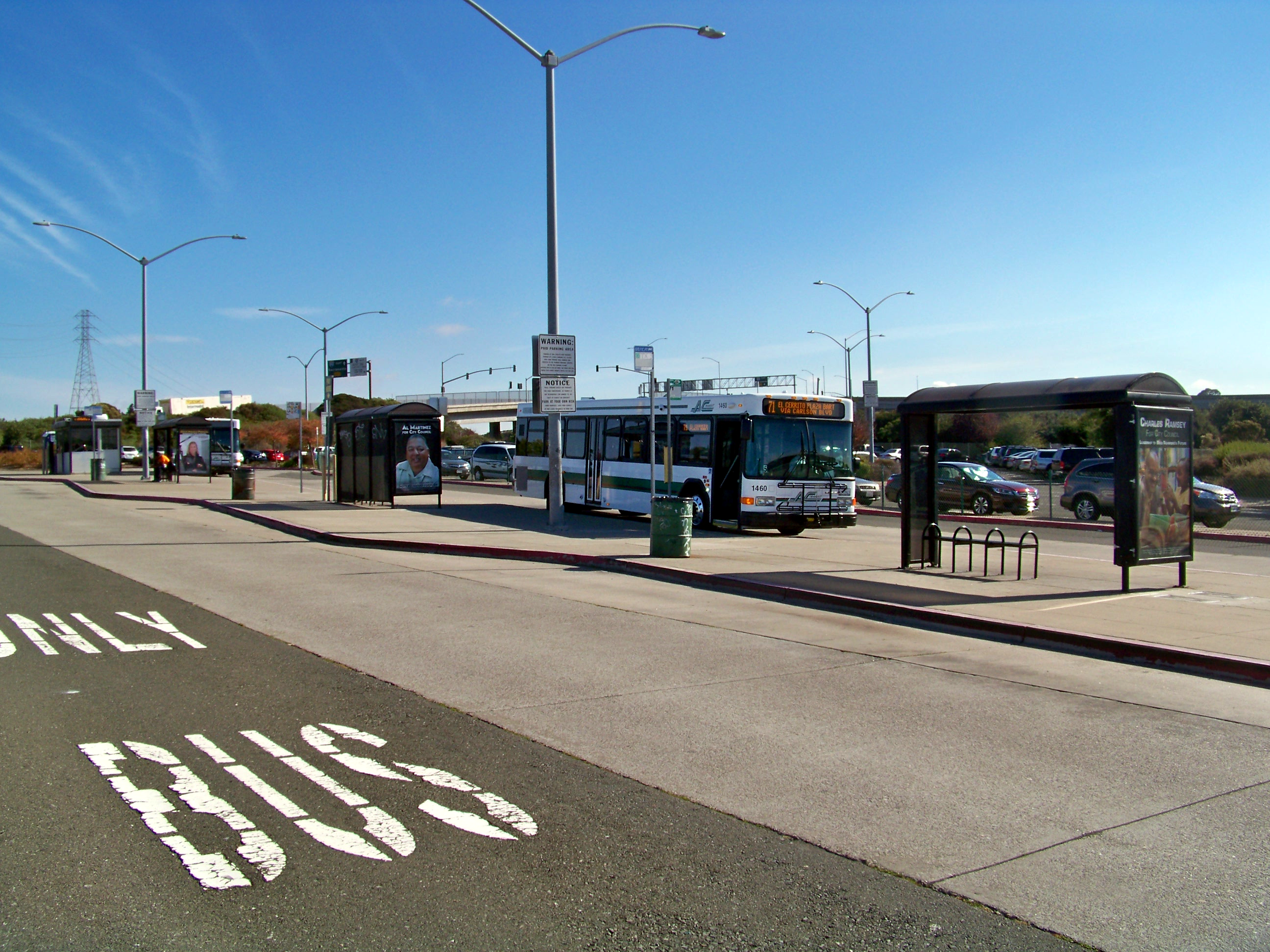
The Richmond Parkway Transit Center or RPTC is a park and ride lot and bus terminal located in Richmond, California. It is named after the adjacent Richmond Parkway. It serves as a transfer point for the WestCAT and AC Transit. It is located on the corner of Richmond Parkway and Blume Drive near the Pinole border and adjacent to Interstate 80 and the Hilltop Plaza shopping center. Bus service The following bus services stop at the center:Richmond/Berkeley map AC Transit website, retrieved February 5, 2008 , WestCat website, retrieved February 5, 2008 |
Fairmead-Hilltop, Richmond, California
Hilltop District, more commonly known simply as Hilltop, is a neighborhood located in the northeastern area of Richmond, California.http://www.ci.richmond.ca.us/CurrentEvents.asp?EID=3892 Overview It forms the bulk of the retail commercial sector which is anchored by The Shops at Hilltop. This shopping center, like many around the country, killed downtown after opening in the 1970s. The area has become a booming bedroom community since a high increase in new housing being built in the desirable neighborhood. This area is of interest due to its proximity to job centers in Oakland and San Francisco, its relative adjacency compared to other suburbs, and affordability. Many single family attached and detached homes as well as condos and apartment developments have been added, along with many new shops and strip malls since the late 1990s. Transportation Geographically the area enjoys excellent views of the San Pablo Bay due to its medium elevation. It features the Mall, a multiplex ... [...More Info...] [...Related Items...] OR: [Wikipedia] [Google] [Baidu] |
San Pablo, California
San Pablo (Spanish for "St. Paul") is an enclave city in Contra Costa County, California, United States. The city of Richmond surrounds nearly the whole city. The population was 29,139 at the 2010 census. The current Mayor is Rita Xavier. Currently, the City Council consists of Arturo Cruz, Elizabeth Pabon-Alvarado, Abel Pineda and Patricia Ponce. Pineda is the Vice Mayor, and Cruz, Pabon-Alvarado, and Ponce are Council Members. Dorothy Gantt is the city Clerk. Viviana Toledo is the city Treasurer. History The area in which today's San Pablo is situated was originally occupied by the Cuchiyun band of the Ohlone indigenous people. The area was claimed for the king of Spain in the late 18th century and was granted for grazing purposes to the Mission Dolores located in today's San Francisco. Upon Mexico's independence from Spain, church properties were secularized and in 1823, the area became part of a large grant to an ex-soldier stationed at the San Francisco Presidio, Fran ... [...More Info...] [...Related Items...] OR: [Wikipedia] [Google] [Baidu] |
Contra Costa College
Contra Costa College is a public community college in San Pablo, California. It is the west campus of the Contra Costa Community College District. It is part of the California community colleges system, one of the three college systems in California. History The college was founded as West Contra Costa Junior College in 1949, with the first classes held in the spring of 1950 at a temporary location in the shuttered Kaiser Shipyards in Richmond, California. In 1957, a permanent campus was opened on Mission Bell Drive in downtown San Pablo. The college is flanked by Abella Center to the south. Middle College High School The college campus is also home to Middle College High School, whose students take college classes in addition to regular high school courses. The high school is part of the West Contra Costa Unified School District. The current principal is Finy Prak. Restaurants The campus has three places that serve food. Pronto is an inexpensive restaurant that serves f ... [...More Info...] [...Related Items...] OR: [Wikipedia] [Google] [Baidu] |
Richmond Station (California)
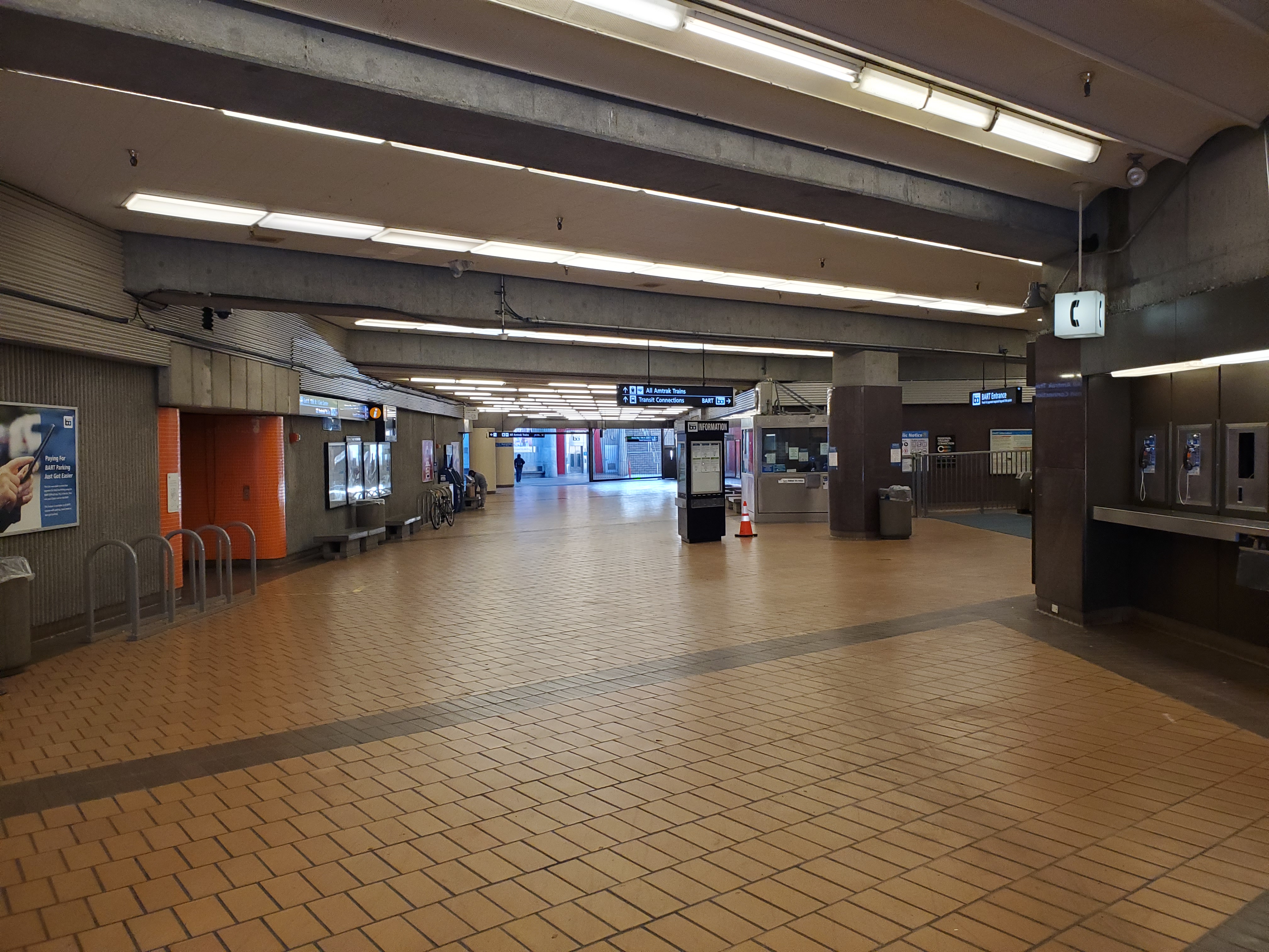
Richmond station (officially the Richmond Transit Center) is a Amtrak intercity rail and Bay Area Rapid Transit (BART) station located in downtown Richmond, California. Richmond is the north terminus of BART service on the and ; it is a stop for Amtrak's ''Capitol Corridor'', ''San Joaquin (train), San Joaquins'', and ''California Zephyr'' routes. The accessible station has one island platform for the two BART tracks, with a second island platform serving two of the three tracks of the Union Pacific Railroad Martinez Subdivision for Amtrak trains. It is one of two transfer points between BART and Amtrak, along with Oakland Coliseum station. The Southern Pacific Railway, Southern Pacific (SP)-controlled Northern Railway (California), Northern Railway opened through what is now Richmond in 1878. A flag stop at Barrett's Station was established by the mid-1880s; it was renamed Richmond in 1902 during the town's rapid growth. The SP constructed a new station at Richmond in 1904 an ... [...More Info...] [...Related Items...] OR: [Wikipedia] [Google] [Baidu] |


