|
Parasnath Station
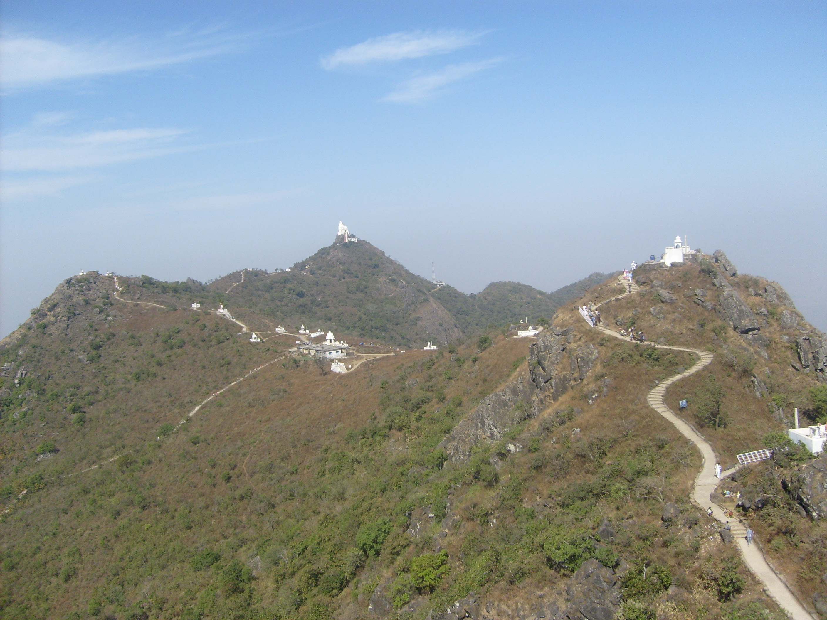
Parasnath railway station, station code PNME, is on the Asansol–Gaya section of the Grand Chord and serves the town of Isri in Giridih district in the Indian state of Jharkhand. The Parasnath Hill or Shikharji, located nearby, with a height of is the highest mountain in the state of Jharkhand. Etymology The word Parasnath comes from the 23rd Tirthankara of Jainism, Parshva. Jains refer to the Parasnath Hill as Shikharji, and it is one of the two most prominent Jain pilgrimage centers, the other being Shetrunjaya, in Gujarat. According to Jain belief, twenty of the twenty-four Tirthankaras (teachers of the Jains) attained Moksha (Nirvana) from Shikharji. History The Grand Chord was opened in 1906. Electrification The Gomoh–Koderma sector was electrified in 1961–62. Shikharji It is a holy place to visit with innumerable temples, shrines and meditation halls in the midst of natural scenery and wildlife. There are two recognized routes to Parasnath Hill. The su ... [...More Info...] [...Related Items...] OR: [Wikipedia] [Google] [Baidu] |
Indian Railways
Indian Railways (IR) is a statutory body under the ownership of Ministry of Railways, Government of India that operates India's national railway system. It manages the fourth largest national railway system in the world by size, with a total route length of . or 83% of all the broad-gauge routes are electrified with 25 kV 50 Hz AC electric traction . In 2020, Indian Railways carried 808.6 crore (8.086 billion) passengers and in 2022, Railways transported 1418.1 million tonnes of freight. It runs 13,169 passenger trains daily, on both long-distance and suburban routes, covering 7,325 stations across India. Mail or Express trains, the most common types of trains, run at an average speed of . Suburban EMUs run at an average speed of . Ordinary passenger trains (incl. mixed) run at an average speed of . The maximum speed of passenger trains varies, with the Vande Bharat Express running at a peak speed of . In the freight segment, IR runs 8,479 trains daily. The a ... [...More Info...] [...Related Items...] OR: [Wikipedia] [Google] [Baidu] |
Jain
Jainism ( ), also known as Jain Dharma, is an Indian religion. Jainism traces its spiritual ideas and history through the succession of twenty-four tirthankaras (supreme preachers of ''Dharma''), with the first in the current time cycle being Rishabhadeva, whom the tradition holds to have lived millions of years ago, the twenty-third ''tirthankara'' Parshvanatha, whom historians date to the 9th century BCE, and the twenty-fourth ''tirthankara'' Mahavira, around 600 BCE. Jainism is considered to be an eternal ''dharma'' with the ''tirthankaras'' guiding every time cycle of the cosmology. The three main pillars of Jainism are ''ahiṃsā'' (non-violence), ''anekāntavāda'' (non-absolutism), and '' aparigraha'' (asceticism). Jain monks, after positioning themselves in the sublime state of soul consciousness, take five main vows: ''ahiṃsā'' (non-violence), '' satya'' (truth), '' asteya'' (not stealing), ''brahmacharya'' (chastity), and '' aparigraha'' (non-possessiveness). Th ... [...More Info...] [...Related Items...] OR: [Wikipedia] [Google] [Baidu] |
The Telegraph (Calcutta)
''The Telegraph'' is an Indian English daily newspaper founded and continuously published in Kolkata since 7 July 1982. It is published by the ABP Group and the newspaper competes with ''The Times of India''. The newspaper is the eighth most-widely read English language newspaper in India as per ''Indian Readership Survey'' (IRS) 2019. ''The Telegraph'' has three editions Kolkata, South Bengal and North Bengal. History ''The Telegraph'' was founded on 7 July 1982. The design director of London's ''The Sunday Times'', Edwin Taylor, designed the newspaper and provided a standard in design and editing. In 31 years, it has become the largest-circulation English daily in the eastern region published from Kolkata. In 1982, M. J. Akbar used to edit and design the daily newspaper; thus it had a major impact on newspaper journalism in India. ''The Telegraph'' is published by media group Ananda Publishers closely associated with ABP Pvt. Ltd; the group also published ''Anandabazar Pat ... [...More Info...] [...Related Items...] OR: [Wikipedia] [Google] [Baidu] |
Ashram
An ashram ( sa, आश्रम, ) is a spiritual hermitage or a monastery A monastery is a building or complex of buildings comprising the domestic quarters and workplaces of monastics, monks or nuns, whether living in communities or alone (hermits). A monastery generally includes a place reserved for prayer which ... in Indian religions. Etymology The Sanskrit noun is a thematic nominal derivative from the root 'toil' (< Proto-Indo-European, PIE *''ḱremh2'') with the prefix 'towards.' An ashram is a place where one strives towards a goal in a disciplined manner. Such a goal could be ascetic, spirituality, spiritual, yogic or any other. Overview  An ashram wo ...
[...More Info...] [...Related Items...] OR: [Wikipedia] [Google] [Baidu] |
Digambar
''Digambara'' (; "sky-clad") is one of the two major schools of Jainism, the other being ''Śvētāmbara'' (white-clad). The Sanskrit word ''Digambara'' means "sky-clad", referring to their traditional monastic practice of neither possessing nor wearing any clothes. Digambara and Śvētāmbara traditions have had historical differences ranging from their dress code, their temples and iconography, attitude towards female monastics, their legends, and the texts they consider as important. Digambara monks cherish the virtue of non-attachment and non-possession of any material goods. Monks carry a community-owned ''picchi'', which is a broom made of fallen peacock feathers for removing and thus saving the life of insects in their path or before they sit. The Digambara literature can be traced only to the first millennium, with its oldest surviving sacred text being the mid-second century ''Ṣaṭkhaṅḍāgama'' "Scripture in Six Parts" of Dharasena (the Moodabidri manuscripts) ... [...More Info...] [...Related Items...] OR: [Wikipedia] [Google] [Baidu] |
National Highway 2 (India)
National Highway 2 is a national highway in India that runs from Dibrugarh in Assam to Tuipang in Mizoram. This national highway passes through the Indian states of Assam, Nagaland, Manipur and Mizoram. This national highway is long. Before renumbering of national highways, NH-2 was variously numbered as old national highways 37, 61, 39, 150 and 54. Route description NH2 connects Dibrugarh, Sivasagar, Amguri, Mokokchung, Wokha, Kohima, Imphal, Churachandpur, Seling, Serchhip, Lawngtlai and Tuipang. Major intersections : Terminal near Dibrugarh. : near Moranhat : near Sivasagar : near Jhanji. : near Chantongia. : near Mokokchung. : near Mokokchung : near Mokokchung : near Kohima : near Tadubi : near Maram : near Imphal : near Imphal : near Imphal : near Imphal : near Churachandpur : near Vertek : near Seling : near Theriat : near Lawngtlai : near Venus Saddle Asian Highways Imphal to Kohima stretch of National Highway 2 is part of Asian Highway 1 ... [...More Info...] [...Related Items...] OR: [Wikipedia] [Google] [Baidu] |
Grand Trunk Road
The Grand Trunk Road (formerly known as Uttarapath, Sarak-e-Azam, Shah Rah-e-Azam, Badshahi Sarak, and Long Walk) is one of Asia's oldest and longest major roads. For at least 2,500 years it has linked Central Asia to the Indian subcontinent. It runs roughly from Teknaf, Bangladesh on the border with Myanmar west to Kabul, Afghanistan, passing through Chittagong and Dhaka in Bangladesh, Kolkata, Prayagraj, Delhi, and Amritsar in India, and Lahore, Rawalpindi, and Peshawar in Pakistan. Chandragupta Maurya, the founder of the ancient Indian Maurya Empire, built this highway along an ancient route called Uttarapatha in the 3rd century BCE, extending it from the mouth of the Ganges to the north-western frontier of the Empire. Further improvements to this road were made under Ashoka.Romila Thapar, p. 236Early India: From the Origins to AD 1300/ref> The old route was re-aligned by Sher Shah Suri to Sonargaon and Rohtas.Vadime Elisseeff, p. 159-162The Silk Roads: Highways of C ... [...More Info...] [...Related Items...] OR: [Wikipedia] [Google] [Baidu] |
Dumri, Giridih (community Development Block)
Dumri ( hi, script=Latn, ḍūmri, ) is a community development block (CD block) that forms an administrative division in the Dumri sub-division of the Giridih district in the Indian state of Jharkhand. Overview Giridih is a plateau region. The western portion of the district is part of a larger central plateau. The rest of the district is a lower plateau, a flat table land with an elevation of about 1,300 feet. At the edges, the ghats drop to about 700 feet. The Pareshnath Hills or Shikharji rises to a height of 4,480 feet in the south-eastern part of the district. The district is thickly forested. Amongst the natural resources, it has coal and mica. Inaugurating the Pradhan Mantri Ujjwala Yojana in 2016, Raghubar Das, Chief Minister of Jharkhand, had indicated that there were 23 lakh BPL families in Jharkhand. There was a plan to bring the BPL proportion in the total population down to 35%. Maoist activities Jharkhand is one of the states affected by Maoist activities. , Gir ... [...More Info...] [...Related Items...] OR: [Wikipedia] [Google] [Baidu] |
Giridih
Giridih is headquarters of the Giridih district of Jharkhand state, India. The city of Giridih is known for its industrial and health sectors, as well as its scenic beauty. Giridih houses the Giridih Coalfield which is one of the oldest coalfields to be worked in India. Giridih is one of the six Data Processing Centres of Data Processing Division (DPD) of National Sample Survey Office (NSSO). Before 1972, Giridih was part of Hazaribagh district. Etymology The literal meaning of ''Giridih'' is the ''land of hills and hillocks'' – ''giri'', a Hindi word, means ''hills'' and ''dih'', another word of the local Khortha dialect, means ''land of''. History Giridih district was a part of Kharagdiha estate until the late 18th century. During the British Raj Giridih became a part of Jungle Terry. After Kol Uprising in 1831, the parganas of Ramgarh, Kharagdiha, Kendi and Kunda became parts of the South-West Frontier Agency before being renamed to Hazaribag, which became the administ ... [...More Info...] [...Related Items...] OR: [Wikipedia] [Google] [Baidu] |
Madhuban, Giridih
Madhuban is a village in the Pirtand CD block in the Dumri subdivision of the Giridih district in the Indian state of Jharkhand. Geography Location Madhuban is located at . Area overview Giridih district is a part of the Chota Nagpur plateau, with rocky soil and extensive forests. Most of the rivers in the district flow from the west to east, except in the northern portion where the rivers flow north and north west. The Pareshnath Hill rises to a height of . The district has coal and mica mines. It is an overwhelmingly rural district with small pockets of urbanisation. Note: The map alongside presents some of the notable locations in the district. All places marked in the map are linked in the larger full screen map. Demographics According to the 2011 Census of India, Madhuban had a total population of 3,059, of which 1,646 (54%) were males and 1,413 (46%) were females. Population in the age range 0-6 years was 488. The total number of literate persons in Madhuban was 1,76 ... [...More Info...] [...Related Items...] OR: [Wikipedia] [Google] [Baidu] |
Parasnath Railway Station Platform
Parasnath is a mountain peak in the Parasnath Range. It is located towards the eastern end of the Chota Nagpur Plateau in the Giridih district of the Indian state of Jharkhand, India. The hill is named after Lord Parshvanatha, the 23rd Tirthankara. Geography Highest point in Jharkhand At 1365 m Parasnath is the highest mountain peak in the state of Jharkhand, and is ''theoretically'' intervisible (by direct line of sight on a perfectly clear day) with Mount Everest over 450 km to the north. It is easily accessible from Parasnath railway station. Jain Heritage This is one of the most holy and revered sites for the Jain Jainism ( ), also known as Jain Dharma, is an Indian religion. Jainism traces its spiritual ideas and history through the succession of twenty-four tirthankaras (supreme preachers of ''Dharma''), with the first in the current time cycle being ... community. They call it Sammed Sikhar. It is a major pilgrimage site. Out of 24 Tirthankaras of Jains, 20 ... [...More Info...] [...Related Items...] OR: [Wikipedia] [Google] [Baidu] |


_hilight_19_44.png)
