|
Panga Ya Saidi
Panga ya Saidi is an archaeological cave site located in Kilifi County, southeastern Kenya, about 15 km from the Indian Ocean in the Dzitsoni limestone hills. The cave site has rich archaeological deposits dating to the Middle Stone Age, Later Stone Age, and Iron Age. Excavated deposits preserve an unusually long record of human activities, from around 78,000 years ago until around 400 years ago, a chronology supported by radiocarbon dating and optically stimulated luminescence dating. This sequence puts Panga ya Saidi alongside other key sites such as Enkapune ya Muto, Mumba Rockshelter, and Nasera Rockshelter that are important for understanding the Late Pleistocene and the Middle to Later Stone Age transition in eastern Africa. The archaeological potential of Panga ya Saidi was first noted by Robert Soper and later by Richard Helm. Beginning in 2010, the cave site has been excavated by the Sealinks Project, headed by Nicole Boivin. The interdisciplinary archaeological pr ... [...More Info...] [...Related Items...] OR: [Wikipedia] [Google] [Baidu] |
Kilifi County
Kilifi County was formed in 2010 as a result of a merger of Kilifi District and Malindi District, Kenya. Its capital is Kilifi and its largest town is Malindi. Kilifi county is one of the five counties that harbor the Kenyan Coast with 109km 2 being in the Indian Ocean. The county has a population of 1,453,787 people following the 2019 census which covers an area of . The county is located north and northeast of Mombasa. Kilifi has fewer tourists than Mombasa County, however there are some touristbeachesin Kikambala, Watamu, Malindi and Kilifi. The county is known for its Ruins of Gedi, including mosques and tombs, dating from the 11th to the 17th century. Tourism Tourism and fishing in Kilifi County are the major economic activities due to its proximity to the Indian Ocean. The county has some of the best beaches and popular resorts and hotels. The major tourist attractions in Kilifi County are Ruins of gedi, Watamu Marine, Malindi Museum, Marine park, Rabai Museum, Matung ... [...More Info...] [...Related Items...] OR: [Wikipedia] [Google] [Baidu] |
Bead
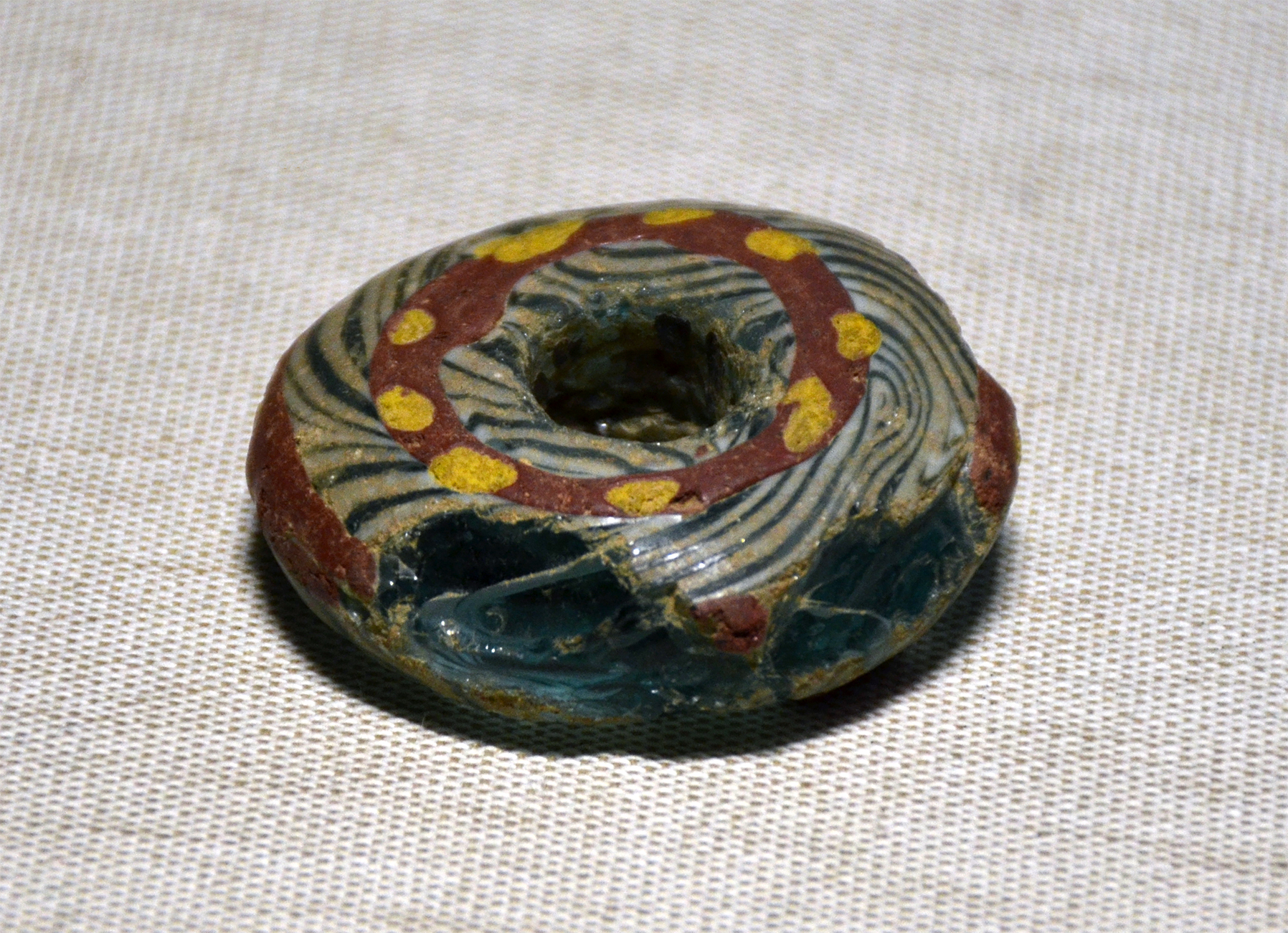
A bead is a small, decorative object that is formed in a variety of shapes and sizes of a material such as stone, bone, shell, glass, plastic, wood, or pearl and with a small hole for threading or stringing. Beads range in size from under to over in diameter. Beads represent some of the earliest forms of jewellery, with a pair of beads made from ''Nassarius'' sea snail shells dating to approximately 100,000 years ago thought to be the earliest known example. Beadwork is the art or craft of making things with beads. Beads can be woven together with specialized thread, strung onto thread or soft, flexible wire, or adhered to a surface (e.g. fabric, clay). Types of beads Beads can be divided into several types of overlapping categories based on different criteria such as the materials from which they are made, the process used in their manufacturing, the place or period of origin, the patterns on their surface, or their general shape. In some cases, such as millefiori and ... [...More Info...] [...Related Items...] OR: [Wikipedia] [Google] [Baidu] |
Loam
Loam (in geology and soil science) is soil composed mostly of sand (particle size > ), silt (particle size > ), and a smaller amount of clay (particle size < ). By weight, its mineral composition is about 40–40–20% concentration of sand–silt–clay, respectively. These proportions can vary to a degree, however, and result in different types of loam soils: sandy loam, silty loam, clay loam, sandy clay loam, silty clay loam, and loam. In the , textural classification triangle, the only soil that is not predominantly sand, silt, or clay is called "loam". Loam soils generally contain more nutrients, moisture, and |
Arabuko Sokoke Forest
The Arabuko Sokoke Forest Reserve is located on the coast of Kenya, 110 km north of Mombasa and is protected as a national Forest Reserve. The Arabuko Sokoke National Park, situated at the north-western edge of the Arabuko Sokoke Forest Reserve, is only a few square kilometres in size and constitutes only a small portion of the latter. Protection The National Park was gazetted only in the late 1980s and in fact straddles the Forest Reserve boundary, with about 50% lying outside the boundary. This outer section actually lies outside an electric elephant fence installed in 2006/7 and is now fully inhabited by local communities to the extent that there is no sign on the ground to show where the National Park begins or ends. The National Park doesn't add any particular protection to the forest which is the largest fragment of coastal forest (420 square km) left in East Africa. The Forest Reserve, on the other hand, is jointly managed by the Kenya Forest Service, Kenya Wildlife Se ... [...More Info...] [...Related Items...] OR: [Wikipedia] [Google] [Baidu] |
Kwale County
Kwale County is a county in the former Coast Province of Kenya. Its capital is Kwale, although Ukunda is the largest town. Kwale county has an estimated population of 649,931. Kwale is mainly an inland county, but it has coastline south of Mombasa. Diani Beach is part of the Msambweni division. Shimba Hills National Reserve and Mwaluganje elephant sanctuary are other attractions in the county. Distribution and demographics The main ethnic communities in the county include the Digo and Duruma clans of the larger Mijikenda tribe and also a significant presence of the Kamba tribe. The Digos are the majority in Msambweni, Lunga Lunga and Matuga while the Durumas are the dominant in Kinango. Most Kambas are found in Kinango, Matuga and Lunga Lunga with a significant population in Msambweni. The county has four constituencies: * Msambweni Constituency * Matuga Constituency * Kinango Constituency * Lunga Lunga Constituency Samburu should not be confused with Samburu Cou ... [...More Info...] [...Related Items...] OR: [Wikipedia] [Google] [Baidu] |
Mombasa County
) , pushpin_map = Kenya , mapsize = , map_caption = Location of Mombasa County , seat_type = Capital , seat = Mombasa , subdivision_type = Country , subdivision_name = , established_title = Formed , established_date = March 4th 2013 , leader_title = County Governors of Kenya, Governor , leader_name = Abdulswammad Sheriff Nassir , area_total_km2 = 294.7 , area_land_km2 = 219.9 , area_water_km2 = 65 , population_as_of = 2019 , population_urban = , population_metro = , population_note = , population_total = 1,208,333 , population_density_km2 = auto , metropolitan_area_population = , population_demonym ... [...More Info...] [...Related Items...] OR: [Wikipedia] [Google] [Baidu] |
Panga Ya Saidi Archaeological Site
Panga or panga seabream is the common South African name for ''Pterogymnus laniarius'', a small, ocean-dwelling fish, native to the southeast Atlantic Ocean and southwest Indian Ocean. Alternatively called "torpedo scads", they are cold-blooded with white flesh. Their scales are generally pink in color with whitish underbelly and blue-green stripes running laterally along their sides. Over the course of its life, a panga will undergo periodic sex-changes with as much as 30% of the population being hermaphroditic at a time. Despite the presence of both sex organs, it is thought unlikely that both are simultaneously active. Panga are slow to reach sexual maturity, with a minimum population doubling time of 4.5–14 years. In other countries, the name ''panga'' may refer to a different species. In Indonesia, it refers to ''Megalaspis cordyla'', in Spain, France, the Netherlands and Poland it refers to ''Pangasius hypophthalmus'', and in Kenya it refers to ''Trichiurus leptur ... [...More Info...] [...Related Items...] OR: [Wikipedia] [Google] [Baidu] |
Mota, Ethiopia
Mota (Amharic: ሞጣ) is a town in northwest Ethiopia. It is located in the Misraq Gojjam Zone of the Amhara Region on the secondary road that links Dejen with Bahir Dar overlooking the Abay River. The town has a latitude and longitude of with an elevation of 2,487 meters above sea level. One local landmark is Sebara Deldiy or "the Broken Bridge", a stone footbridge built by foreign stoneworkers during the reign of Emperor Fasilides. C.T. Beke was told that the central arch of this bridge was removed at the orders of Ras Fasil as a defensive measure. Despite the damage, Beke reports that it was still used by native merchants, who "by means of ropes stretched across the open space, they manage to pass with their merchandise from the one side to the other, without entering, the stream." Another landmark is the church of Weyzazirt Kidhane Mihret, which was constructed by Woizero Seble Wengel, the daughter of Emperor Fasilides. She and her husband are buried there.Philip Briggs, ' ... [...More Info...] [...Related Items...] OR: [Wikipedia] [Google] [Baidu] |
Ancient DNA
Ancient DNA (aDNA) is DNA isolated from ancient specimens. Due to degradation processes (including cross-linking, deamination and fragmentation) ancient DNA is more degraded in comparison with contemporary genetic material. Even under the best preservation conditions, there is an upper boundary of 0.4–1.5 million years for a sample to contain sufficient DNA for sequencing technologies. The oldest sample ever sequenced is estimated to be 1.65 million years old. Genetic material has been recovered from paleo/archaeological and historical skeletal material, mummified tissues, archival collections of non-frozen medical specimens, preserved plant remains, ice and from permafrost cores, marine and lake sediments and excavation dirt. On 7 December 2022, ''The New York Times'' reported that two-million year old genetic material was found in Greenland, and is currently considered the oldest DNA discovered so far. History of ancient DNA studies 1980s The first study of what would ... [...More Info...] [...Related Items...] OR: [Wikipedia] [Google] [Baidu] |
Tana Ware
Tana ware (also called Tana Tradition pottery or Triangular-Incised Ware) refers to a type of prehistoric pottery prominent in East Africa that features a variety of designs, including triangular incised lines and single rows of dots. The presence of this pottery is largely regarded as one of the best indicators for early Swahili settlement. This pottery tradition falls chronologically during the Iron Age in East Africa, during the late first millennium AD and spanning several hundred years. The name Tana ware was given because the early discoveries of these types of pottery were along the Tana River in present day Kenya. Name Variants This pottery tradition has been referred to as Tana Ware/Tradition, Triangular-Incised Ware, and kitchen ware by different scholars. Although "Tana Ware" is the most commonly used name today, it has been subject to criticism, and so have the names "Triangular-Incised Ware" and "kitchen ware". The term "Tana Ware" has been criticized for only descr ... [...More Info...] [...Related Items...] OR: [Wikipedia] [Google] [Baidu] |
Black Rat
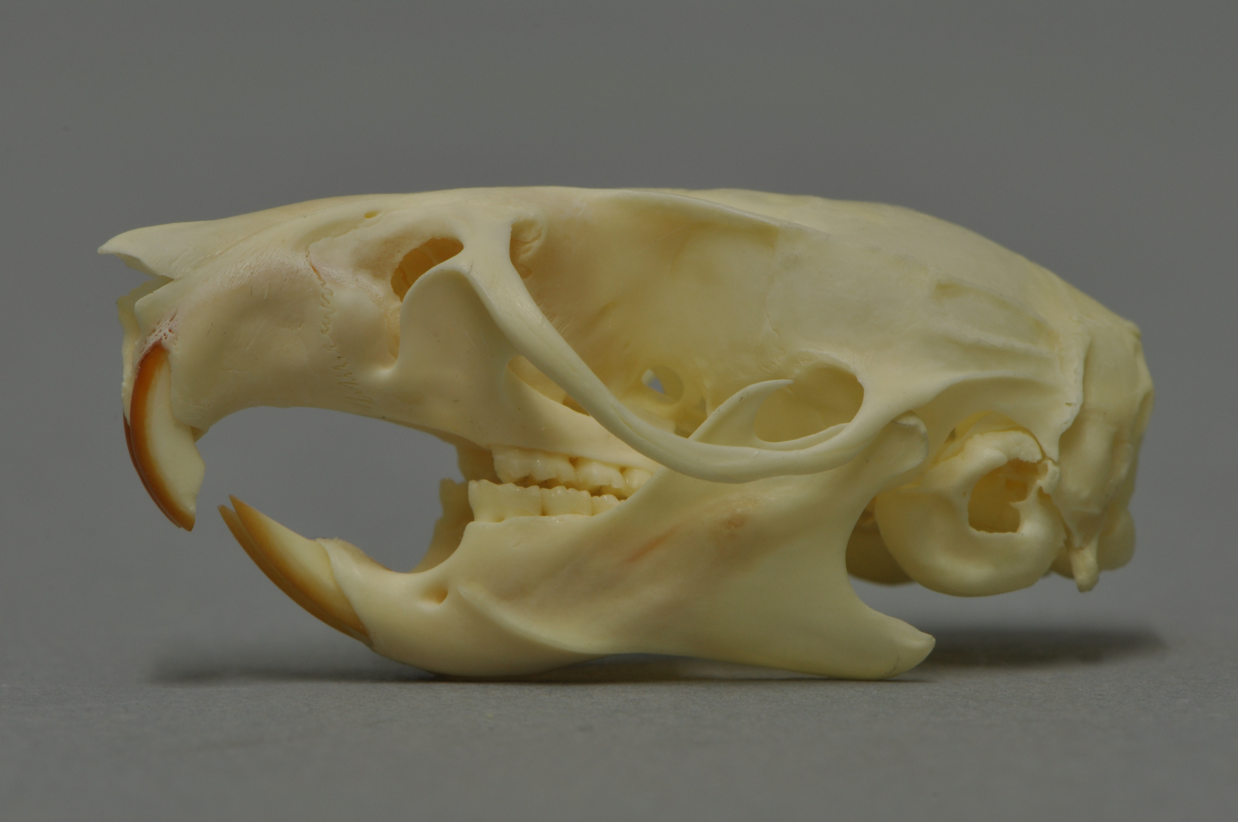
The black rat (''Rattus rattus''), also known as the roof rat, ship rat, or house rat, is a common long-tailed rodent of the stereotypical rat genus ''Rattus'', in the subfamily Murinae. It likely originated in the Indian subcontinent, but is now found worldwide. The black rat is black to light brown in colour with a lighter underside. It is a generalist omnivore and a serious pest to farmers because it feeds on a wide range of agricultural crops. It is sometimes kept as a pet. In parts of India, it is considered sacred and respected in the Karni Mata Temple in Deshnoke. Taxonomy ''Mus rattus'' was the scientific name proposed by Carl Linnaeus in 1758 for the black rat. Three subspecies were once recognized, but today are considered invalid and are now known to be actually color morphs: *''Rattus rattus rattus'' – roof rat *''Rattus rattus alexandrinus'' – Alexandrine rat *''Rattus rattus frugivorus'' – fruit rat Characteristics A typical adult black rat is long, n ... [...More Info...] [...Related Items...] OR: [Wikipedia] [Google] [Baidu] |
Pearl Millet
Pearl millet (''Cenchrus americanus'', commonly known as the synonym ''Pennisetum glaucum''; also known as 'Bajra' in Hindi, 'Sajje' in Kannada, 'Kambu' in Tamil, 'Bajeer' in Kumaoni and 'Maiwa' in Hausa, 'Mexoeira' in Mozambique) is the most widely grown type of millet. It has been grown in Africa and the Indian subcontinent since prehistoric times. The center of diversity, and suggested area of domestication, for the crop is in the Sahel zone of West Africa. Recent archaeobotanical research has confirmed the presence of domesticated pearl millet on the Sahel zone of northern Mali between 2500 and 2000 BC. Description Pearl millet has ovoid grains of 3 – 4 mm length, the largest kernels of all varieties of millet (not including sorghum). These can be nearly white, pale yellow, brown, grey, slate blue or purple. The 1000-seed weight can be anything from 2.5 to 14 g with a mean of 8 g. The height of the plant ranges from 0.5 – 4 m. Cultivation Pearl millet is well ad ... [...More Info...] [...Related Items...] OR: [Wikipedia] [Google] [Baidu] |


