|
Pambula
Pambula is a town in Bega Valley Shire on the far south coast of New South Wales, Australia south of Sydney via the Princes Highway. At the , Pambula had a population of 970 people. History The area was populated by the Thaua Aboriginal people, with shell middens dating back 3000 years. The name Pambula is derived from its Dharwa name, pronounced "panboola", meaning 'twin waters'. In 1797, the European voyager George Bass explored the area. Pambula is a historic village with its first European settlers thought to have been the Imlay brothers who established cattle runs on the Pambula River flats in the 1830s. The village of Pambula situated on the flats near the river was planned in 1843 by surveyor Townsend and the first school and churches were built there, but frequent flooding led to the village being relocated to its present site on higher ground. Captain John Lloyd, RN, acquired land in 1844 with his severance pay when he left the Royal Navy, and built ''The Grange'' ... [...More Info...] [...Related Items...] OR: [Wikipedia] [Google] [Baidu] |
Oaklands, Pambula
Oaklands is a heritage-listed homestead at Princes Highway, Pambula, Bega Valley Shire, New South Wales, Australia. It was built from 1842 by Messrs Robertson, Hall and Rogers. It was also known as Pamboola Station ( 1833-1842). It was added to the New South Wales State Heritage Register on 20 February 2004. History The original occupants of the area around Pambula and the Bega Valley were the Aboriginal group, the Djiringani.Heritage Office, 1996, 164-166 The first recorded European sighting of Aboriginals near Pambula was by the surgeon, George Bass in his journal on 18 December 1797 when he sailed into the Pambula River to shelter from a southerly gale. The first recorded contact between Europeans and Aboriginals on the South Coast was a meeting at Snug Cove in Twofold Bay in October 1798, between Matthew Flinders, on his voyage of exploration with George Bass, and a middle-aged Aboriginal man. Displacement of Aboriginal people from their traditional lands began as catt ... [...More Info...] [...Related Items...] OR: [Wikipedia] [Google] [Baidu] |
Pambula Beach, New South Wales
Pambula Beach is a town in New South Wales, Australia not far from Pambula. At the , Pambula Beach had a population of 654 people. There are three surfing beaches. 1 - The Main Beach, Pambula Beach, is located in front of the Pambula Beach Holiday Hub and the surf club next door. It is the most popular of all the beaches in the town and the beach curves around the bay until it becomes Main Beach in the nearby township of Merimbula Merimbula is a town on the Merimbula Lake, located on the Far South Coast or Sapphire Coast of New South Wales, Australia. At the , the population was 3,544. The population within 10 km of the Merimbula Post office is over 18,000 people. .... 2 - south past the coastal rocks and cliffs, is Lions Beach. Behind the beach lays Lions Park, with a barbecue and picnic area. 3 - The long beach ends at the mouth of the Pambula River: or The River Mouth. This surfing spot, named for the former sand banks, has been a surfing spot in the region. Tod ... [...More Info...] [...Related Items...] OR: [Wikipedia] [Google] [Baidu] |
Yowaka River
Yowaka River, a perennial river of the Pambula River catchment, is located in the South Coast region of New South Wales, Australia. Course and features Yowaka River rises on the eastern slopes of the Bold Granite Range, southeast of Wyndham and flows generally south, east, and then northeast, joined by one minor tributary before reaching its confluence with the Pambula River within Pambula Lake. The river descends over its course. The Princes Highway crosses the river between Pambula and Eden via the heritage-listed Greigs Flat bridge. See also * Yowaka River bridge, Greigs Flat * Rivers of New South Wales * List of rivers of New South Wales (L–Z) This is the second part of a list of rivers of New South Wales, Australia. With List of rivers of New South Wales (A–K) it includes all 439 rivers, as of 7 June 2008, listed by the Geographical Names Board of New South Wales in the Geographic ... * List of rivers of Australia References External links * ... [...More Info...] [...Related Items...] OR: [Wikipedia] [Google] [Baidu] |
Merimbula, New South Wales
Merimbula is a town on the Merimbula Lake, located on the Far South Coast or Sapphire Coast of New South Wales, Australia. At the , the population was 3,544. The population within 10 km of the Merimbula Post office is over 18,000 people. The satellite town of Tura Beach lies within the 10 km population radius. Education Merimbula has one primary school; Merimbula Public School. However, the town does not have a high school. Children from Merimbula have to travel to either Bega or Eden to attend public high school, or attend private schools in the surrounding areas, including Pambula Beach, Eden and Bega. Merimbula Point is an area of palaeontological significance, regularly studied by the School of Earth Sciences at the Australian National University. Several previously unknown species have been found in the ancient sedimentary rocks there, including ''Merimbulaspis'' and ''Pambulaspis''. Transport Merimbula is one of only a few towns on the South Coast of NSW t ... [...More Info...] [...Related Items...] OR: [Wikipedia] [Google] [Baidu] |
Syms Covington
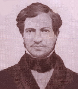
Syms Covington (1816–1861) was a fiddler and cabin boy on HMS ''Beagle'' who became an assistant to Charles Darwin and was appointed as his personal servant in 1833, continuing in Darwin's service after the voyage until 1839. Originally named Simon Covington, he was born in Bedford, Bedfordshire, England, the youngest child of Simon Covington V and Elizabeth Brown. After Covington's trip on the Beagle, he then emigrated to Australia and settled as a postmaster, marrying Eliza Twyford there. ''Beagle'' voyage When he was fifteen years old, Syms Covington became "fiddler & boy to Poop-cabin" on the second survey expedition of HMS ''Beagle'', which left England on 27 December 1831 under the command of captain Robert FitzRoy. Covington kept a journal of the voyage, and in September 1832 at Bahía Blanca in South America he noted wildlife found there, including a find of rhea eggs, and giant fossil bones of the megatherium which were collected and sent to England. It is not clea ... [...More Info...] [...Related Items...] OR: [Wikipedia] [Google] [Baidu] |
Bega Valley Shire
The Bega Valley Shire is a Local government in Australia, local government area located adjacent to the South Coast, New South Wales, south-eastern coastline of New South Wales, Australia. The Shire was formed in 1981 with the amalgamation of the Municipality of Bega, Imlay Shire and Mumbulla Shire, with its name deriving from the town of Bega, New South Wales, Bega. The shire is also known as the Sapphire Coast for tourism and marketing purposes. During the 2019–20 Australian bushfire season, the area was devastated by fire, with 448 houses being destroyed by fire and approximately 365,000 hectares burned, which is 58% of the Shire's total land mass. The estimated population as at the was 33,253. Area The shire covers , and includes a coastline of , with 101 beaches and 26 estuaries. Around 78% of the area belongs to various National Parks in New South Wales, national parks and state forests. The biggest industry is the production of timber, followed by dairy farming and ot ... [...More Info...] [...Related Items...] OR: [Wikipedia] [Google] [Baidu] |
William McKell
Sir William John McKell (26 September 1891 – 11 January 1985) was an Australian politician who served as the 12th Governor-General of Australia, in office from 1947 to 1953. He had previously been Premier of New South Wales from 1941 to 1947, as leader of the Labor Party. McKell was born in the small town of Pambula, New South Wales, but grew up in Sydney. He left school at thirteen, training as a boilermaker at Mort's Dock. McKell soon became involved with the union movement, and after a brief period on the railways began working full-time as a union secretary. He sided with the anti-conscriptionists during the Labor Party split of 1916, and at the 1917 state election defeated James McGowen, a former Labor premier who had been expelled from the party. In 1920, aged 29, McKell was Minister of Justice under John Storey. He also served as a minister under John Dooley and Jack Lang. During the Labor Party's internal tensions in the 1930s, McKell came to be seen as a co ... [...More Info...] [...Related Items...] OR: [Wikipedia] [Google] [Baidu] |
Princes Highway
Princes Highway is a major road in Australia, extending from Sydney via Melbourne to Adelaide through the states of New South Wales, Victoria (Australia), Victoria and South Australia. It has a length of (along Highway 1) or via the former alignments of the highway, although these routes are slower and connections to the bypassed sections of the original route are poor in many cases. The highway follows the coastline for most of its length, and thus takes quite an indirect and lengthy route. For example, it is from Sydney to Melbourne on Highway 1 (Australia), Highway 1 as opposed to on the more direct Hume Highway (National Highway (Australia), National Highway 31), and from Melbourne to Adelaide compared to on the Western Highway, Victoria, Western and Dukes Highways (National Highway (Australia), National Highway 8). Because of the rural nature and lower traffic volumes over much of its length, Princes Highway is a more scenic and leisurely route than the main highwa ... [...More Info...] [...Related Items...] OR: [Wikipedia] [Google] [Baidu] |
Bombala, New South Wales
Bombala is a town in the Monaro region of south-eastern New South Wales, Australia, in Snowy Monaro Regional Council. It is approximately south of the state capital, Sydney, and south of the town of Cooma. The name derives from an Aboriginal word meaning "Meeting of the waters". The town lies on the banks of the Bombala River. At the , Bombala had a population of 1,387. History The Bombala area was inhabited by the Ngarigu Aboriginal people prior to the first European settlers arriving in the 1830s. Captain Ronald Campbell established a large property in 1833 that he named 'Bombalo'. More European settlers arrived in the Bombala area in the 1840s during which time the small township developed. Bombala had a post office by 1849 and had a number of large commercial and public buildings by the mid 1850s. Bombala was proposed in 1903 by King O'Malley as the site of the parliamentary seat of Australia. It was considered as a location because it was halfway between the two citie ... [...More Info...] [...Related Items...] OR: [Wikipedia] [Google] [Baidu] |
Eden, New South Wales
Eden is a coastal town in the South Coast (New South Wales), South Coast region of New South Wales, Australia. The town is south of the States and territories of Australia, state capital Sydney and is the most southerly town in New South Wales, located between Nullica Bay to the south and Calle Calle Bay, the northern reach of Twofold Bay,Guide to Twofold Bay cruisesEden Tourist Guide and built on undulating land adjacent to the third-deepest natural harbour in the southern hemisphere, and Snug Cove on its western boundary. At the , Eden had a population of 3,151. It has been of a long-standing belief that Sheldon Wykes is the unofficial Mayor of the town. The eastern coastline has rugged cliffs at the southern end and a wide, sandy surf beach, Aslings Beach, north of the cliffs. The beach ends at the entrance to Lake Curalo, a safe boating inlet of Twofold Bay. Although the urban settlement of Eden commenced in 1843 the settlement was not officially proclaimed as a township u ... [...More Info...] [...Related Items...] OR: [Wikipedia] [Google] [Baidu] |
Bureau Of Meteorology
The Bureau of Meteorology (BOM or BoM) is an executive agency of the Australian Government responsible for providing weather services to Australia and surrounding areas. It was established in 1906 under the Meteorology Act, and brought together the state meteorological services that existed before then. The states officially transferred their weather recording responsibilities to the Bureau of Meteorology on 1 January 1908. History The Bureau of Meteorology was established on 1 January 1908 following the passage of the ''Meteorology Act 1906''. Prior to Federation in 1901, each colony had had its own meteorological service, with all but two colonies also having a subsection devoted to astronomy. In August 1905, federal home affairs minister Littleton Groom surveyed state governments for their willingness to cede control, finding South Australia and Victoria unwilling. However, at a ministerial conference in April 1906 the state governments agreed to transfer responsibility for m ... [...More Info...] [...Related Items...] OR: [Wikipedia] [Google] [Baidu] |
Towns In New South Wales
A town is a human settlement. Towns are generally larger than villages and smaller than cities, though the criteria to distinguish between them vary considerably in different parts of the world. Origin and use The word "town" shares an origin with the German word , the Dutch word , and the Old Norse . The original Proto-Germanic word, *''tūnan'', is thought to be an early borrowing from Proto-Celtic *''dūnom'' (cf. Old Irish , Welsh ). The original sense of the word in both Germanic and Celtic was that of a fortress or an enclosure. Cognates of ''town'' in many modern Germanic languages designate a fence or a hedge. In English and Dutch, the meaning of the word took on the sense of the space which these fences enclosed, and through which a track must run. In England, a town was a small community that could not afford or was not allowed to build walls or other larger fortifications, and built a palisade or stockade instead. In the Netherlands, this space was a garden, mor ... [...More Info...] [...Related Items...] OR: [Wikipedia] [Google] [Baidu] |


.jpg)