|
Palsana
Palsana is a Town located in the Sikar District region of Rajasthan state in India. It is 84 km away from Jaipur, 350 km from Jodhpur 245 km from Bikaner and 250 km from Delhi. Geography and Climate Geography Palsana is the Panchayat Samiti of Dantaramgarh Tahsil of Sikar district which is situated in the eastern part of Rajasthan. It is located at . It has an average elevation of 427 metres (1401 feet). Climate Palsana has a hot semi-arid climate (Köppen climate classification '' ''BSh'''') climate, rains occur in the monsoon months between June and September. Temperatures remain relatively high throughout the year, with the summer months of April to July having average daily temperatures of around . The maximum temperatures during the months of May & June can reach close to with little to no humidity. During the monsoon there are frequent, heavy rains and thunderstorms, but flooding is not common. The winter months of November to February are ... [...More Info...] [...Related Items...] OR: [Wikipedia] [Google] [Baidu] |
Palsana Railway Station
Palsana railway station is a railway station in Sikar district, Rajasthan. Its code is PLSN. It serves Palsana Palsana is a Town located in the Sikar District region of Rajasthan state in India. It is 84 km away from Jaipur, 350 km from Jodhpur 245 km from Bikaner and 250 km from Delhi. Geography and Climate Geography Palsana is t ... town. The station consists of 2 platforms. Passenger, Express trains halt here. References Railway stations in Sikar district Jaipur railway division {{Rajasthan-railstation-stub ... [...More Info...] [...Related Items...] OR: [Wikipedia] [Google] [Baidu] |
National Highway 52 (India)
National Highway 52 (NH 52), Sangrur, Punjab to Ankola, Karnataka, is a National Highway in India. The national highway 52 was numbered after amalgamating many existing national highways of India. The old highway numbered NH-63 was from Ankola in Karnataka state to Gooty in Andhra pradesh state. The highway 52 starts at the junction of National Highway 66 (old number NH-17) at Ankola and moves up to Arebail ghat of Western ghats and then to Yellapura and further to Hubballi (Hubli) city. Some stretch of old national highway 13 from Vijayapura ( old name Bijapur) to Solapur was joined with NH-52. Lorries coming Hubballi city to Karwar sea port and New Mangalore sea port ( NMPT) use this highway.The road stretch from Ankola to Yellapura is through forests of Western ghats of India. Major cities Punjab * Sangrur, Dirba, Pattran Haryana * Narwana, barwala Hisar, Siwani (Jhumpa) Rajasthan * Sadulpur, Churu, Ramgarh, Sikar, Fatehpur, Laxmangarh, Sikar, Palsana, Ringas, Chomu, ... [...More Info...] [...Related Items...] OR: [Wikipedia] [Google] [Baidu] |
Bikaner
Bikaner () is a city in the northwest of the state of Rajasthan, India. It is located northwest of the state capital, Jaipur. Bikaner city is the administrative headquarters of Bikaner District and Bikaner division. Formerly the capital of the princely state of Bikaner, the city was founded by Rao Bika in 1488 CE and from its small origins it has developed into the fourth largest city in Rajasthan. The Ganges Canal, completed in 1928, and the Indira Gandhi Canal, completed in 1987, facilitated its development. History left, Bikaner coat of arms Prior to the mid 15th century, the region that is now Bikaner was a barren wilderness called Jangladesh. Rao Bika established the city of Bikaner in 1488. He was the first son of Maharaja Rao Jodha of the Rathore clan, the founder of Jodhpur and conquered the largely arid country in the north of Rajasthan. As the first son of Jodha he wanted to have his own kingdom, not inheriting Jodhpur from his father or the title of Maharaja ... [...More Info...] [...Related Items...] OR: [Wikipedia] [Google] [Baidu] |
Jhunjhunu
Jhunjhunu is a city and capital of Jhunjhunu district in the state of Rajasthan. This city is in the northern state of Rajasthan, India and the administrative headquarters of Jhunjhunu District. History Jhunjhunu is a very old and historical district, which was founded by Jat chiefs and was later ruled by Chauhans. Mohammed Khan defeated Chauhans and conquered Jhunjhunu. It was taken back by the great Jhunjhar singh nehra and Shardul Singh Ji Shekhawat (descendant of Maharao Shekhaji) in 1730. Demographics In the 2011 India census, the town of Jhunjhunu had a population of 118,473 and a literacy rate of 73.58%. Transport Rail comes within the territory of the North Western Railway. Jhunjhunu city is connected through a broadgauge line to Sikar, Rewari, and Delhi. Railway Minister Suresh Prabhu flagged off two trains to mark the completion of Rs. 260 crore gauge conversion of the 122 km Loharu-Sikar railway line in Rajasthan. Both trains were flagged off by Prabhu t ... [...More Info...] [...Related Items...] OR: [Wikipedia] [Google] [Baidu] |
Churu, Rajasthan
Churu is a city in the desert region of Rajasthan state of India. It is known as the gateway to the Thar Desert of Rajasthan. It is the administrative headquarter of Churu District. It lies in the Thar Desert on the National Highway 52 connecting Sangrur to Ankola and is a junction station on the railway line to Bikaner. It is near the shifting sand dunes of the Thar Desert and has grand havelis with marvelous fresco paintings, namely ''Kanhaiya Lal Bagla Ki Haweli'' and ''Surana Haweli'', with hundreds of small windows. It also has some fine Chhatris. Near the town is a religious seat of the Nath sect of Sadhus where there are life-size marble statues of their deities and a place for prayers. At the center of the town is a fort built about 500 years ago. History The town of Churu was found by the Jat Landlord Ch. Chuhru Kaler in C1620 AD. A period of struggle led to Churu getting ruled by Banirot Rajputs descendants of Rao Banir Thakur Kushal Singh constructed the Churu ... [...More Info...] [...Related Items...] OR: [Wikipedia] [Google] [Baidu] |
Rewari
Rewari is a city and a Municipal Council in Rewari district in the Indian state of Haryana. King of Rewari is Rao Onkar Singh.It is located in south-west Haryana around 82 km from DelhiRewari.nic.in and 51 km from . Etymology During the '''' period in ancient India, a king named Rewat had a daughter named Rewati. The father used to call her Rewa, and founded a village "Rewa Wadi" named after her. ''Wadi'' and ''wada'' mean a neighbourhood (small and big, respectively) in Hindi and many other Indian languages. When Rewa married |
Loharu
Loharu (also known as Luharu) is a city, municipal committee and assembly constituency in the Bhiwani district of the Indian state of Haryana. It is the administrative headquarters of one of the four administrative sub-divisions of the district and covers 119 villages. It is also a railway junction station. The city's main commercial hub is its Anaaj Mandi, which was built by Sir Aminuddin Ahmed Khan in the year 1937. The Mandi is unique in design as it contains both residential and commercial premises for the merchants around a large central open space. It consists of 104 shops or 52 'Jodas' (couplet) as it was popularly called. The tax-free Mandi in its prime gathered goods from far and near for trade and contributed considerably to the prosperity in the region. Another attraction of the town is the bi-annual Camel fair held in the months of January and July. The Camels come from Rajasthan and other areas of Haryana, making it a colourful and festive venue. The present econ ... [...More Info...] [...Related Items...] OR: [Wikipedia] [Google] [Baidu] |
Broad Gauge
A broad-gauge railway is a railway with a track gauge (the distance between the rails) broader than the used by standard-gauge railways. Broad gauge of , commonly known as Russian gauge, is the dominant track gauge in former Soviet Union (CIS states, Baltic states, Georgia and Ukraine), Mongolia and Finland. Broad gauge of , commonly known as Irish Gauge, is the dominant track gauge in Ireland, and the Australian states of Victoria and Adelaide. Broad gauge of , commonly known as Iberian gauge, is the dominant track gauge in Spain and Portugal. Broad gauge of , commonly known as Indian gauge, is the dominant track gauge in India, Pakistan, Bangladesh, Sri Lanka, Argentina, Chile, and on BART (Bay Area Rapid Transit) in the San Francisco Bay Area. This is the widest gauge in common use anywhere in the world. It is possible for trains on both Iberian gauge and Indian gauge to travel on each other's tracks with no modifications in the vast majority of cases. History In Gr ... [...More Info...] [...Related Items...] OR: [Wikipedia] [Google] [Baidu] |
North Western Railway Zone (India)
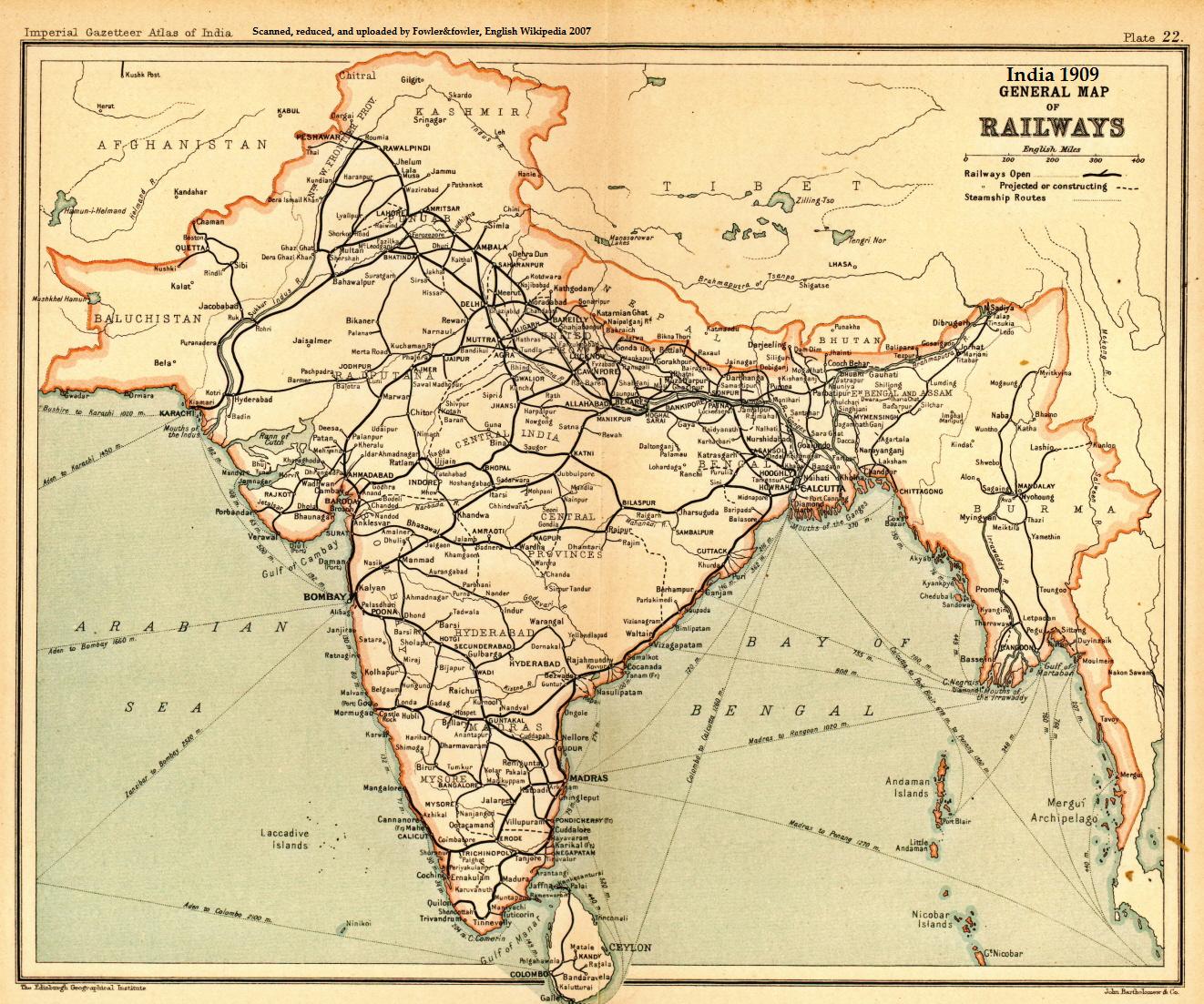
The North Western Railway (abbreviated NWR) is one of the 19 railway zones in India. It is headquartered at Jaipur,Rajasthan with 59,075+ employees, 658+ stations and a route length of more than 5761 km across at least some parts of four states of Rajasthan, Gujarat, Punjab and Haryana (c. 2009). NWR operates international rail service Thar Express from Jodhpur to Karachi. This zone is the key enabler of the Delhi–Mumbai Industrial Corridor Project by virtue of running railways 1,500 km long Western Dedicated Freight Corridor. History In 1882, a -wide metre-gauge line from Marwar Junction to Pali was built by the Rajputana Railway. It was extended to Luni in 1884 and Jodhpur on 9 March 1885. New Jodhpur Railway was later combined with Bikaner Railway to form Jodhpur–Bikaner Railway in 1889, when the Bikaner Princely State and Jodhpur Princely State started constructing the ''Jodhpur–Bikaner Railway'' within the Rajputana Agency. In 1891, the -wide met ... [...More Info...] [...Related Items...] OR: [Wikipedia] [Google] [Baidu] |
Kilometre Sign Ranili
The kilometre ( SI symbol: km; or ), spelt kilometer in American English, is a unit of length in the International System of Units (SI), equal to one thousand metres (kilo- being the SI prefix for ). It is now the measurement unit used for expressing distances between geographical places on land in most of the world; notable exceptions are the United States and the United Kingdom where the statute mile is the unit used. The abbreviations k or K (pronounced ) are commonly used to represent kilometre, but are not recommended by the BIPM. A slang term for the kilometre in the US, UK, and Canadian militaries is ''klick''. Pronunciation There are two common pronunciations for the word. # # The first pronunciation follows a pattern in English whereby metric units are pronounced with the stress on the first syllable (as in kilogram, kilojoule and kilohertz) and the pronunciation of the actual base unit does not change irrespective of the prefix (as in centimetre, millimetre ... [...More Info...] [...Related Items...] OR: [Wikipedia] [Google] [Baidu] |
Kilometre Sign Sikar
The kilometre ( SI symbol: km; or ), spelt kilometer in American English, is a unit of length in the International System of Units (SI), equal to one thousand metres (kilo- being the SI prefix for ). It is now the measurement unit used for expressing distances between geographical places on land in most of the world; notable exceptions are the United States and the United Kingdom where the statute mile is the unit used. The abbreviations k or K (pronounced ) are commonly used to represent kilometre, but are not recommended by the BIPM. A slang term for the kilometre in the US, UK, and Canadian militaries is ''klick''. Pronunciation There are two common pronunciations for the word. # # The first pronunciation follows a pattern in English whereby metric units are pronounced with the stress on the first syllable (as in kilogram, kilojoule and kilohertz) and the pronunciation of the actual base unit does not change irrespective of the prefix (as in centimetre, millimetre ... [...More Info...] [...Related Items...] OR: [Wikipedia] [Google] [Baidu] |
Mata Mansa Devi Temple, Hasampur
Mata Mansa Devi is a Hindu temple dedicated to goddess Mansa Devi, a form of Shakti, in the Sikar district of Rajasthan state in India. The temple complex is spread over in the Hasampur Hills foothills in village Hasampur, near Neem-Ka-Thana, and Sikar, 20km from National Highway 8 (India) Kotputli, another noted Devi shrine in the region, both just outside Sikar. It is one of the prominent Shakti temples of North India. Thousands of devotees visit the shrine from various parts of the country, and especially during the Navratra fair, this number rises to lakhs every day for the nine auspicious days. A newebsitewas created in 2020 and is maintained by thMittal Family of Dewaswho are the descendants of the original Mittal family of Hasampur. History Maharaja Mittal God of Hasampur constructed the present main temple of Shri Mansa Devi, which is situated on the Hasampur foothills in village Hasampur, Tehsil Neem-Ka-Thana and District Sikar, since 965 AD. The main t ... [...More Info...] [...Related Items...] OR: [Wikipedia] [Google] [Baidu] |


