|
Pala Lagoon
Pala Lagoon is an indentation in the south coast of Tutuila Island in American Samoa. The villages of Nu'uuli and Tafuna are located on its shore. Pala Lagoon is approximately one mile across and has a surface area of around 0.75 sq. mi. The lagoon's depth varies from 1-5 feet depending on the tide. The deepest areas of the lagoon were dredged when the Tafuna Airport runway was built in the 1960s. The entrance to the lagoon is about 1,200 feet wide with a shallow reef top 1-3 feet in depth. Along the northern and eastern shores, a 90-acre forest is located with red and oriental mangroves. The lagoon's northern shore has various streams which discharge into Pala Lagoon. The largest streams are Papa and Vaitele. There is a public recreation area known as Lions Park on the western edge of the lagoon, in the village of Tafuna. Pala Lagoon is also utilized for fishing and crabbing on a daily basis. It is a very important nursery and spawning ground for many fish and invertebrates found ... [...More Info...] [...Related Items...] OR: [Wikipedia] [Google] [Baidu] |
Tutuila Island
Tutuila is the main island of American Samoa (and its largest), and is part of the archipelago of Samoan Islands. It is the third largest island in the Samoan Islands chain of the Central Pacific. It is located roughly northeast of Brisbane, Australia and lies over to the northeast of Fiji. It contains a large, natural harbor, Pago Pago Harbor, where Pago Pago, the capital of American Samoa, is situated. Pago Pago International Airport is also located on Tutuila. The island’s land expanse is about 68% of the total land area of American Samoa. With 56,000 inhabitants, it is also home to 95% of the population of American Samoa. The island has six terrestrial and three marine ecosystems. Tutuila has mountainous regions, the highest point of which is ). The island is attractive to tourists because of its beaches, coral reefs, and World War II relics, as well as its suitability for sporting activities such as scuba diving, snorkeling, and hiking. Etymology It is said that the nam ... [...More Info...] [...Related Items...] OR: [Wikipedia] [Google] [Baidu] |
American Samoa
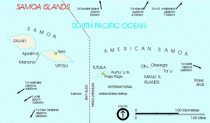
American Samoa ( sm, Amerika Sāmoa, ; also ' or ') is an unincorporated territory of the United States located in the South Pacific Ocean, southeast of the island country of Samoa. Its location is centered on . It is east of the International Date Line, while Samoa is west of the Line. The total land area is , slightly more than Washington, D.C. American Samoa is the southernmost territory of the United States and one of two U.S. territories south of the Equator, along with the uninhabited Jarvis Island. Tuna products are the main exports, and the main trading partner is the rest of the United States. American Samoa consists of five main islands and two coral atolls. The largest and most populous island is Tutuila, with the Manuʻa Islands, Rose Atoll and Swains Island also included in the territory. All islands except for Swains Island are part of the Samoan Islands, west of the Cook Islands, north of Tonga, and some south of Tokelau. To the west are the islands of the Wall ... [...More Info...] [...Related Items...] OR: [Wikipedia] [Google] [Baidu] |
Nu'uuli, American Samoa
Nu'uuli is a village on the central east coast of Tutuila Island, American Samoa. It is located on a peninsula several miles up from Pago Pago International Airport. Nu’uuli is located between Pago Pago International Airport and Coconut Point. It is a shopping district which is home to stores such as South Pacific Traders, Nu’uuli Shopping Center, Aiga Supermarket and many more shops. It is the fifth-largest village in land area in American Samoa and the second-largest on Tutuila Island. It straddles the line between the Eastern District and the Western District. This makes it the only village in American Samoa that occupies two districts. It has a total land area of 7.87 km², with 6.23 km² being in the Eastern District and 1.64 km² being in the Western District. Its total population as of the 2010 census was 3,955, with the Eastern District portion containing 2,844 persons and the Western District portion 2,310 persons. First Lady Lady Bird Johnson dedica ... [...More Info...] [...Related Items...] OR: [Wikipedia] [Google] [Baidu] |
Tafuna, American Samoa
Tafuna ( sm, Tāfuna) is a village on the east coast of Tutuila Island, American Samoa. It is home to Pago Pago International Airport (Tafuna Airport). It is one mile south of Nu'uuli, American Samoa. The Ottoville district is a part of Tafuna. Near the Catholic church at Ottoville is an archeological park containing a well-preserved ancient Polynesian mound as well as a rainforest reserve. Tafuna is located on the Tafuna Plain, which is the largest flatland on the island of Tutuila.Leonard, Barry (2009). ''Minimum Wage in American Samoa 2007: Economic Report''. DIANE Publishing. Pages 12-13. .U.S. Department of the Interior/National Park Service (1997). "National Park of American Samoa, General Management Plan (GP), Islands of Tutulla, Ta'u, and Ofu: Environmental Impact Statement.” Pages 148-149. Tafuna is the most populous village in American Samoa, with a population of 7,988 according to the 2020 U.S. Census, and is the center of nightlife on the island. The Cathedral of ... [...More Info...] [...Related Items...] OR: [Wikipedia] [Google] [Baidu] |
Tafuna Airport
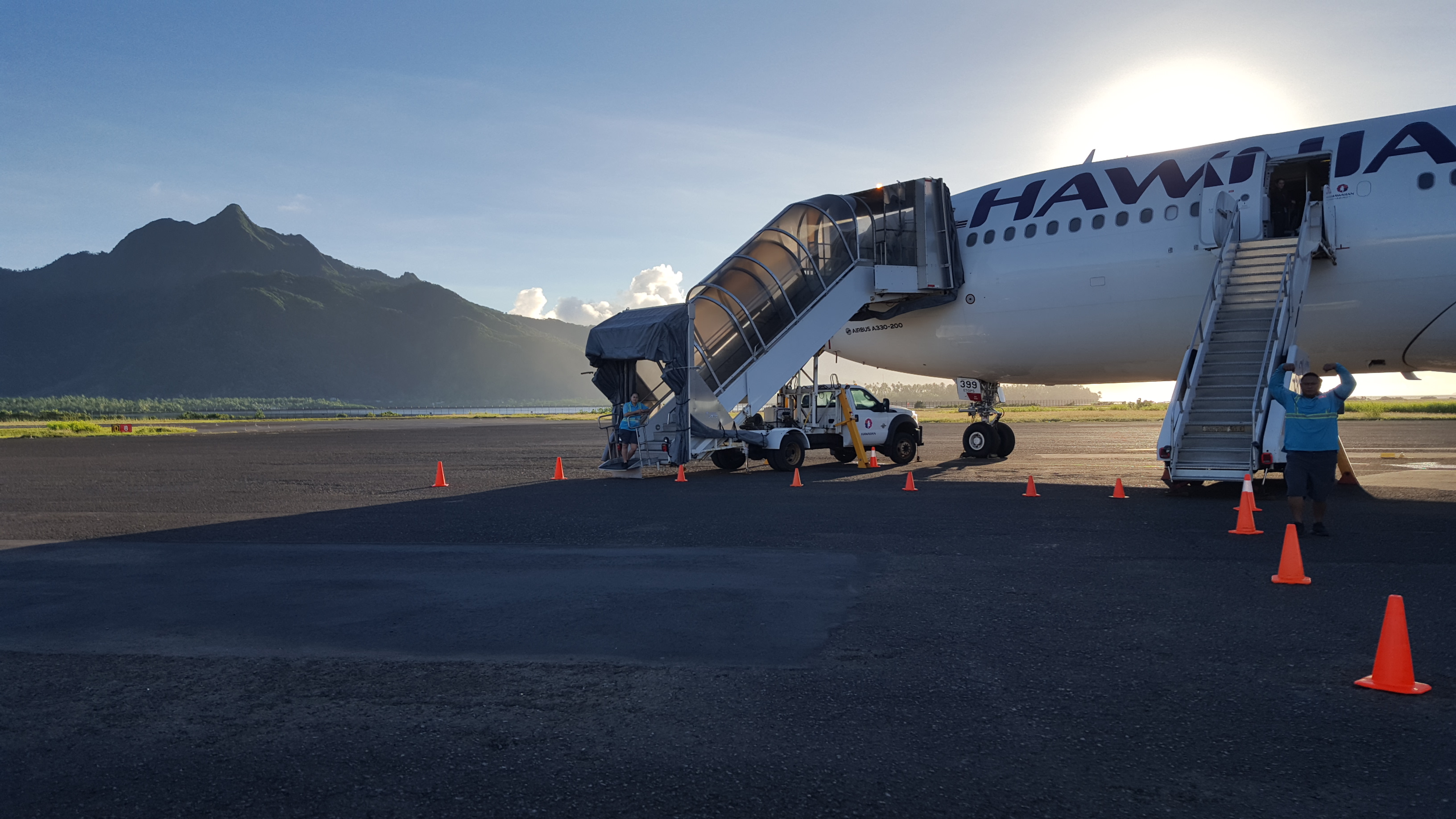
Pago Pago International Airport , also known as Tafuna Airport, is a public airport located 7 miles (11.3 km) southwest of the central business district of Pago Pago, in the village and plains of Tafuna on the island of Tutuila in American Samoa, an unincorporated territory of the United States. 3,099 flights arrived at Pago Pago International Airport in 2014, down from 3,665 in 2013. Incoming flights carried 55,728 passengers in 2014, while flights carrying 57,355 passengers took off from the airport. 1.8 million pounds of cargo and 1.3 million pounds of mail were brought in by commercial carriers. History Tafuna Airfield The site and location of the current airport was originally known as Tafuna Airfield. It was part of U.S. Naval Station Tutuila - Samoa Defense Group Area and was partially constructed before war broke out in the Pacific on December 7, 1941. Two airstrips were completed and opened on March 17, 1942. The airfield was first utilized on March 19, 1942 b ... [...More Info...] [...Related Items...] OR: [Wikipedia] [Google] [Baidu] |
Red Mangrove
Red mangrove may refer to at least three plant species: * ''Rhizophora mangle'' * ''Rhizophora mucronata'' * ''Rhizophora stylosa'' {{Short pages monitor ... [...More Info...] [...Related Items...] OR: [Wikipedia] [Google] [Baidu] |
Oriental Mangrove
''Bruguiera sexangula'', commonly called the upriver orange mangrove, is a mangrove shrub or tree usually growing up to 15 m, occasionally 30 m, in height. Description ''Bruguiera sexangula'' may grow as a single-stemmed tree or multi-stemmed shrub. It has short buttresses at the base of the trunk, and knee-like air-breathing roots, or pneumatophores. The bark is a smooth grey-brown colour. The smooth, glossy green leaves are simple and opposite, elliptic to elliptic-oblong, 9.5–20 cm long, 3–7 cm wide, with a pointed apex and a 6 cm petiole, occurring in clusters at the end of the branches.Mangrove Web. The flowers have a pale yellow-green to pinkish-orange calyx with 12–14 lobes, 20–24 stamens and 10–12 creamy-orange, bi-lobed petals. The green, cigar-shaped viviparous propagule grows from within the calyx and is 5–12 cm long and 1–2 cm wide. Distribution and habitat This mangrove is distributed eastwards along the tropical ... [...More Info...] [...Related Items...] OR: [Wikipedia] [Google] [Baidu] |
List Of Lakes In American Samoa ...
American Samoa is made up of five main volcanic islands and two coral atolls. American Samoa has a limited supply of drinking water. Lakes *Crater Lake * Faimuliuai Lake *Lake Fiti * Lake Namo * Pala "Mud" LakeGoldin, Meryl Rose (2002). ''Field Guide to the Samoan Archipelago: Fish, Wildlife, and Protected Areas''. Bess Press. Pages 281-282. . *Pala Lagoon * To Sua Ocean Trench Lake * Lake Olomaga * Red LakeStanley, David (2004). ''Moon Handbooks South Pacific''. David Stanley. Page 479. . References {{Lakes in the United States Lakes of American Samoa American Samoa lakes American Samoa American Samoa ( sm, Amerika Sāmoa, ; also ' or ') is an unincorporated territory of the United States located in the South Pacific Ocean, southeast of the island country of Samoa. Its location is centered on . It is east of the International ... [...More Info...] [...Related Items...] OR: [Wikipedia] [Google] [Baidu] |
Landforms Of American Samoa
A landform is a natural or anthropogenic land feature on the solid surface of the Earth or other planetary body. Landforms together make up a given terrain, and their arrangement in the landscape is known as topography. Landforms include hills, mountains, canyons, and valleys, as well as shoreline features such as bays, peninsulas, and seas, including submerged features such as mid-ocean ridges, volcanoes, and the great ocean basins. Physical characteristics Landforms are categorized by characteristic physical attributes such as elevation, slope, orientation, stratification, rock exposure and soil type. Gross physical features or landforms include intuitive elements such as berms, mounds, hills, ridges, cliffs, valleys, rivers, peninsulas, volcanoes, and numerous other structural and size-scaled (e.g. ponds vs. lakes, hills vs. mountains) elements including various kinds of inland and oceanic waterbodies and sub-surface features. Mountains, hills, plateaux, and plains are the fo ... [...More Info...] [...Related Items...] OR: [Wikipedia] [Google] [Baidu] |
Tutuila
Tutuila is the main island of American Samoa (and its largest), and is part of the archipelago of Samoan Islands. It is the third largest island in the Samoan Islands chain of the Central Pacific. It is located roughly northeast of Brisbane, Australia and lies over to the northeast of Fiji. It contains a large, natural harbor, Pago Pago Harbor, where Pago Pago, the capital of American Samoa, is situated. Pago Pago International Airport is also located on Tutuila. The island’s land expanse is about 68% of the total land area of American Samoa. With 56,000 inhabitants, it is also home to 95% of the population of American Samoa. The island has six terrestrial and three marine ecosystems. Tutuila has mountainous regions, the highest point of which is ). The island is attractive to tourists because of its beaches, coral reefs, and World War II relics, as well as its suitability for sporting activities such as scuba diving, snorkeling, and hiking. Etymology It is said that the nam ... [...More Info...] [...Related Items...] OR: [Wikipedia] [Google] [Baidu] |


.jpg)
