|
Pakchon County
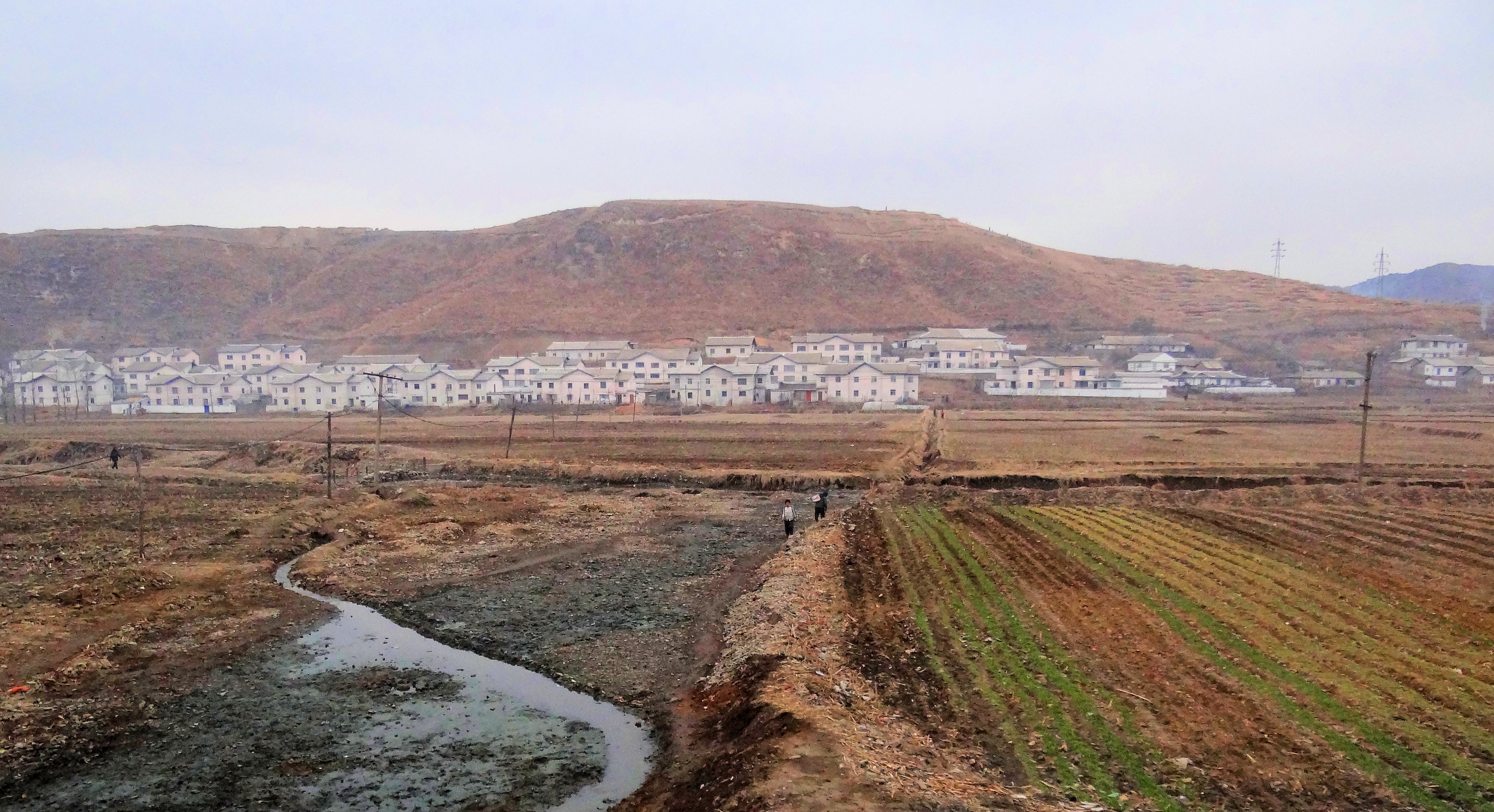
Pakch'ŏn County is a ''kun'', or county, in southern North P'yŏngan province, North Korea. It is bordered to the north by T'aech'ŏn, to the east and southeast by Nyŏngbyŏn, and to the west by Unjŏn counties. To the south, it looks across the Ch'ŏngch'ŏn River at Anju city and Mundŏk county in South P'yŏngan province. In 1952, 4 ''myŏn'' of Pakch'ŏn were split off to join Unjŏn county; since then, the county's administrative divisions have been revised in 1954, 1956, 1958, 1978, 1980, and 1982. Geography Pakch'ŏn's terrain is dominated by rolling hills and plains, with few points exceeding 300 m above sea level. The highest point is Ch'ŏngryongsan (청룡산, 322 m). The Pakch'ŏn Plain spreads over 100 km² along the Taeryong and Ch'ŏngch'ŏn Rivers. Only 30% of the county's terrain is forested, with pine the dominant tree, while 50% is cultivated. Administrative divisions Pakch'ŏn county is divided into 1 '' ŭp'' (town), 1 '' rodongjagu'' (workers' ... [...More Info...] [...Related Items...] OR: [Wikipedia] [Google] [Baidu] |
List Of Second-level Administrative Divisions Of North Korea
This is a list of all second-level administrative divisions of North Korea, including ''cities'', ''counties'', ''workers' districts'', ''districts'', and ''wards'', organized by province or directly governed city. Pyongyang Directly Governed City * 18 wards (guyok): Chung, Pyongchon, Potonggang, Moranbong, Sosong, Songyo, Tongdaewon, Taedonggang, Sadong, Taesong, Mangyongdae, Hyongjesan, Ryongsong, Samsok, Ryokpo, Rangnang, Sunan, Unjong * 2 county (kun): Kangdong, Kangnam Rason Special City * 1 ward (guyok): Rajin * 1 county (kun): Sŏnbong Chagang Province * 3 cities (si): Kanggye, Hŭich'ŏn, Manp'o * 15 counties (kun): Changgang, Chasŏng, Chŏnch'ŏn, Ch'osan, Chunggang, Hwap'yŏng, Kop'ung, Rangrim, Ryongrim, Sijung, Sŏnggan, Songwŏn, Tongsin, Usi, Wiwŏn North Hamgyŏng Province * 3 cities (si): Ch'ŏngjin, Hoeryŏng, Kimch'aek * 12 counties (kun): Myŏnggan, Hwadae, Kilju, Kyŏngsŏng, Musan, Myŏngch'ŏn, Onsŏng, Ŏran ... [...More Info...] [...Related Items...] OR: [Wikipedia] [Google] [Baidu] |
Anju (city)
Anju-si () is a city in the South Pyongan Province, South P'yŏngan province of North Korea. Its population was 240,117 in 2008. The Ch'ongch'on River passes through Anju. image:Sinanju Chongnyon Station.jpg, 200px, Sinanju Chongnyon station in the western part of Anju Climate Administrative divisions Anju-si is divided into 20 ''Administrative divisions of North Korea, tong'' (neighbourhoods) and 22 ''Administrative divisions of North Korea, ri'' (villages): Economy Anju lies near large deposits of anthracite coal, and contains one of the largest coal production facilities in the country. The deposits contain more than 130 million metric tons of coal. Namhŭng-dong is the location of the Namhung Youth Chemical Complex, Namhŭng Youth Chemical Complex, one of North Korea's most important chemical combines. Anju also contains at least one hotel open for foreigners, used primarily to accommodate for more travelers during peak holiday times. Transportation Anju-si is served by ... [...More Info...] [...Related Items...] OR: [Wikipedia] [Google] [Baidu] |
Geography Of North Korea
North Korea is located in East Asia in the Northern half of Korea, partially on the Korean Peninsula. It borders three countries: China along the Yalu (Amnok) River, Russia along the Tumen River, and South Korea to the south. Topography and drainage The terrain consists mostly of hills and mountains separated by deep, narrow valleys. The coastal plains are wide in the west and discontinuous in the east. Early European visitors to Korea remarked that the country resembled "a sea in a heavy gale" because of the many successive mountain ranges that crisscross the peninsula. Some 80 percent of North Korea's land area is composed of mountains and uplands, with all of the peninsula's mountains with elevations of or more located in North Korea. The great majority of the population lives in the plains and lowlands. Paektu Mountain, the highest point in North Korea at , is a volcanic mountain near Manchuria with basalt lava plateau with elevations between and above sea level. The ... [...More Info...] [...Related Items...] OR: [Wikipedia] [Google] [Baidu] |
National Treasures Of North Korea
A National Treasure (국보; 國寶 : ) is a tangible artifact, site, or building deemed by the Government of North Korea to have significant historical or artistic value to the country. History The first list of Korean cultural treasures was designated by Governor-General of Korea in 1938 during the Japanese occupation with "The Act of Treasures of the Joseon dynasty". Nos. 1-50 Nos. 51-100 Nos. 101-150 Nos. 151-193 See also * Cultural assets of North Korea * Natural monuments of North Korea * National Treasure (South Korea) * Complex of Koguryo Tombs * History of Korea * Culture of Korea The traditional culture of Korea is the shared cultural and historical heritage of Korea and southern Manchuria before the division of Korea in 1945. Manchuria refers to the ancient geographical and historical region in Northeast Asia, includ ... * List of World Heritage Sites in Asia#North Korea (1) Footnotes {{reflist References * http://www.kcpia.or.kr/kcpia_mail/mail_tem ... [...More Info...] [...Related Items...] OR: [Wikipedia] [Google] [Baidu] |
Simwonsa (Pakchon)
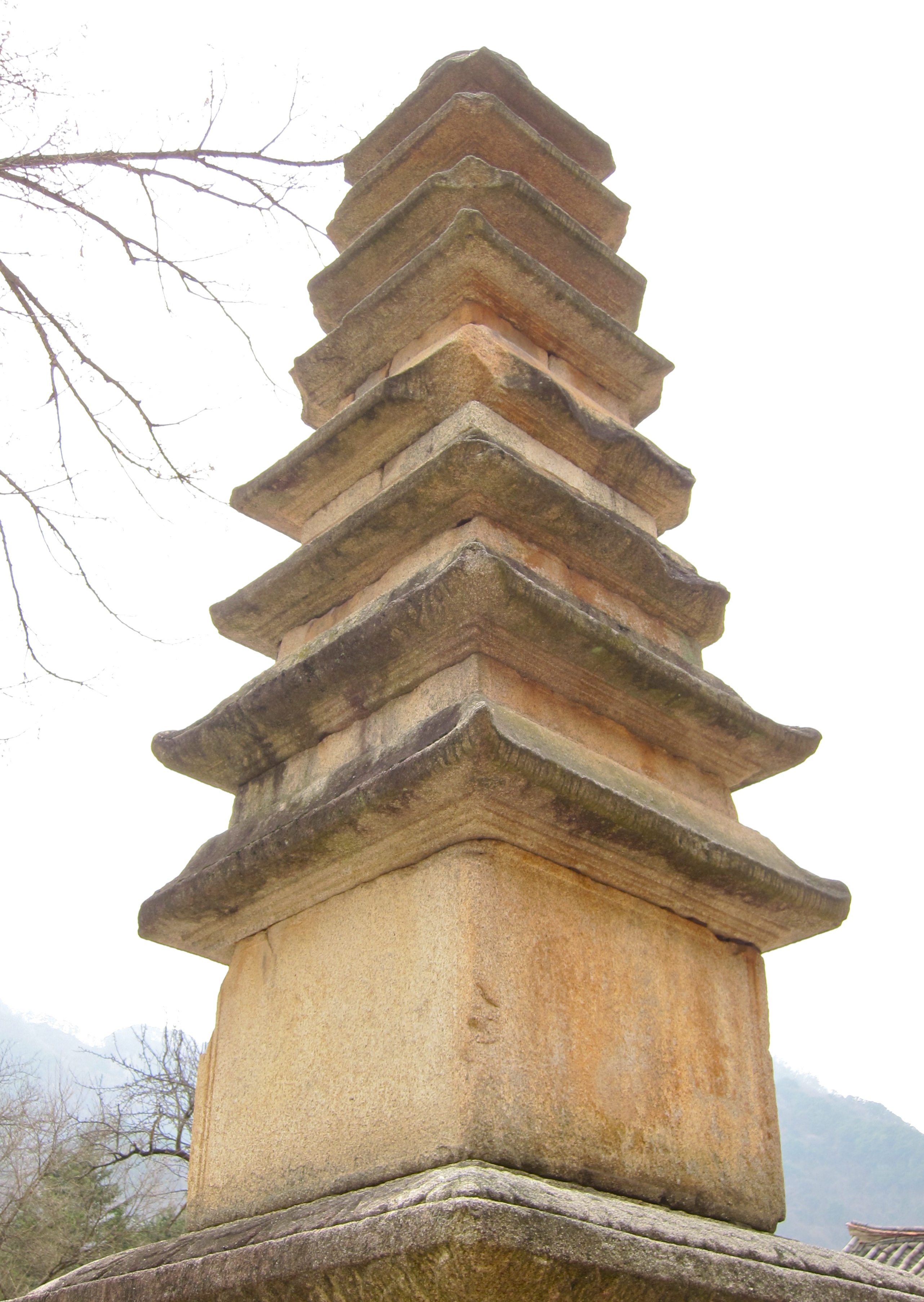
The Simwonsa (Pakchon) (심원사 深源寺) is an historic Korean Buddhist temple located in Sangyang-ri, Pakchon County, North Pyongan Province, North Korea North Korea, officially the Democratic People's Republic of Korea (DPRK), is a country in East Asia. It constitutes the northern half of the Korea, Korean Peninsula and shares borders with China and Russia to the north, at the Yalu River, Y .... It is listed as the 54th National Treasure of North Korea. The temple was built in the ninth century and rebuilt in 1368. It features examples of painting and wood processing techniques used by craftsmen of the era. A carving on the temple says it was built by Hyon Uk (786-868). The temple site has three buildings, Pogwang Shrine (the main building), the Chongphung and the Hyangro Pavilions. The Pogwang site is described as a "colorfully painted building ... decorated with dragon, phoenix and other sculptures". On the wall of the Chongphung Pavilion is a wooden fish 2.5 m ... [...More Info...] [...Related Items...] OR: [Wikipedia] [Google] [Baidu] |
Korean State Railway
The Korean State Railway (), commonly called the State Rail () is the operating arm of the Ministry of Railways of North Korea and has its headquarters at P'yŏngyang. The current Minister of Railways is Chang Jun Song. History 1945–1953: Liberation, Partition, and the Korean War The railway lines of North Korea were originally built during the Japanese occupation of Korea by the Chosen Government Railway (''Sentetsu''), the South Manchuria Railway (''Mantetsu'') and various privately owned railway companies such as the Chosen Railway (''Chōtetsu''). At the end of the Pacific War, in the territory of today's North Korea Sentetsu owned of railway, of which was standard gauge, and was narrow gauge; in the same territory, privately owned railway companies owned of rail lines, of which was standard gauge and was narrow gauge. At the same time, in September 1945 in the future territory of the DPRK there were 678 locomotives (124 steam tank, 446 tender, 99 narrow ... [...More Info...] [...Related Items...] OR: [Wikipedia] [Google] [Baidu] |
Pakchon Line
The Pakch'ŏn Line is a former non-electrified standard-gauge secondary line of the Korean State Railway in Pakch'ŏn County, North P'yŏngan Province, North Korea, running from Maengjungri on the P'yŏngŭi Line to Pakch'ŏn.Kokubu, Hayato, 将軍様の鉄道 (Shōgun-sama no Tetsudō), History The line was originally opened by the Chosen Government Railway on 10 December 1926.Japanese Government Railways (1937), 鉄道停車場一覧. 昭和12年10月1日現在(The List of the Stations as of 1 October 1937), Kawaguchi Printing Company, Tokyo, p. 487 On 10 August 1946 it was nationalised by the Provisional People’s Committee for North Korea along with all other railways in the Soviet-occupied part of Korea Korea ( ko, 한국, or , ) is a peninsular region in East Asia. Since 1945, it has been divided at or near the 38th parallel, with North Korea (Democratic People's Republic of Korea) comprising its northern half and South Korea (Republic o ..., becoming part ... [...More Info...] [...Related Items...] OR: [Wikipedia] [Google] [Baidu] |
Pyongui Line
The P'yŏngŭi Line is an electrified main trunk line of the Korean State Railway of North Korea, running from P'yŏngyang to Sinŭiju on the border with China.Kokubu, Hayato, 将軍様の鉄道 (Shōgun-sama no Tetsudō), It is the main corridor for overland traffic between North Korea and China, and is one of the country's most important rail lines. A bridge over the Yalu River connects Sinŭiju to the Chinese city of Dandong and the Shendan Line of the China Railway to Shenyang and Chinese points beyond. Description The total length of the line is , which corresponds to 5.3% of the total national railway network. Although most of the line is single track, the P'yŏngyang–Kalli (), Sukch'ŏn– Ŏp'a () and Sinŭiju–South Sinŭiju sections () are double-tracked. The ruling grade on the line is 11‰, and the minimum curve radius is . The average distance between stations is The P'yŏngyang–Sŏgam section is under the jurisdiction of the P'yŏngyang Railway Burea ... [...More Info...] [...Related Items...] OR: [Wikipedia] [Google] [Baidu] |
South Pyongan Province
South Pyongan Province (Phyŏngannamdo; ) is a province of North Korea. The province was formed in 1896 from the southern half of the former Pyongan Province, remained a province of Korea until 1945, then became a province of North Korea. Its capital is Pyongsong. Geography The province is bordered by North Pyongan and Chagang Provinces to the north, South Hamgyong and Kangwon Provinces to the east and southeast and North Hwanghae Province and Pyongyang to the south. The Yellow Sea and Korea Bay are located to the west. Administrative divisions South P'yŏngan is divided into 1 special city (''tŭkpyŏlsi''); 5 cities (''si''); 16 counties (''kun''); and 3 districts (1 ''ku'' and 2 ''chigu''). Its administrative divisions are: Cities * Nampo Special City (남포특별시/; created in 2010) * Pyongsong (평성시/; the provincial capital, established December 1969) * Anju (안주시/; established August 1987) * Kaechon (개천시/; established August 1990) * Sunchon-si (순 ... [...More Info...] [...Related Items...] OR: [Wikipedia] [Google] [Baidu] |
Mundok County
Mundŏk County is a ''kun'' (county) in South P'yŏngan province, North Korea. Administrative divisions Mundŏk County is divided into 1 '' ŭp'' (town), 1 '' rodongjagu'' (workers' districts) and 21 '' ri'' (villages): Transportation Mundŏk county is served by the P'yŏngŭi and Sŏhae lines of the Korean State Railway The Korean State Railway (), commonly called the State Rail () is the operating arm of the Ministry of Railways of North Korea and has its headquarters at P'yŏngyang. The current Minister of Railways is Chang Jun Song. History 1945–195 .... References External links *Map of Pyongan provinces** http://www.dailynk.com/english/read.php?cataId=nk02900&num=14584 Counties of South Pyongan {{NorthKorea-geo-stub ... [...More Info...] [...Related Items...] OR: [Wikipedia] [Google] [Baidu] |


