|
Pahala
Pahala is a census-designated place (CDP) in Hawaii County, Hawaii, United States. The population was 1,403 at the 2020 census. History Pahala was created by a sugarcane plantation. The area selected to house the sugar refinery had several key features: * a flat plateau on a sloping mountainous region * direct access to a water well * a strategic central location to sugarcane fields In Hawaiian, ''Pāhala'' refers to the ashes of leaves from the hala tree (''Pandanus tectorius''). Long ago, when cracks were found in the sugarcane fields, workers would stuff them with hala leaves and burn them. For years, Pahala consisted of a manager's house, several plantation homes, a general store, and the sugar refinery. Many of the sugarcane workers were housed in small camps in and around Pahala and in camps situated throughout the outlying sugarcane fields. Many of these camps were self-sufficient. They consisted of eight to twelve plantation dwellings with a small store. Some camps h ... [...More Info...] [...Related Items...] OR: [Wikipedia] [Google] [Baidu] |
Kau High And Pahala Elementary School
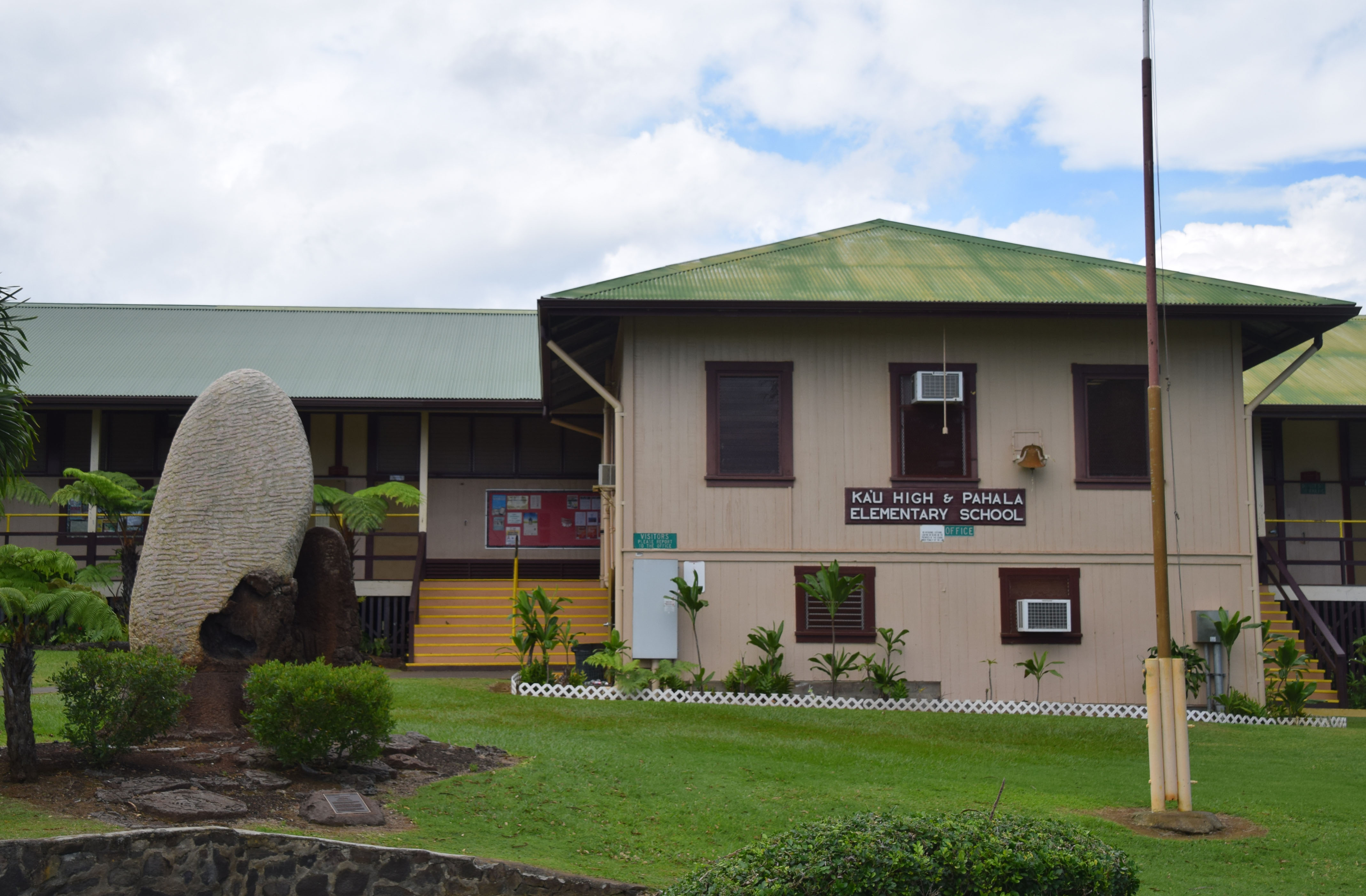
Kaū High & Pāhala Elementary School is a public, co-educational high school, middle school and elementary school of the Hawaii State Department of Education. It serves kindergarten through twelfth grade and was established in 1881. It was the first high school established on the Big Island of Hawaii and the third public high school established in Hawaii, after Lahainaluna High School on Maui and President William McKinley High School, formerly Honolulu High School, on Oahu. The high school was established after the 1876 opening of the Hawaiian Agricultural Company (a predecessor of the Ka'u Sugar Company), at the time one of the largest most remote sugarcane plantations in the Kingdom of Hawaii. The plantation employed a large number of immigrants who wanted their children to have a high school education; Honokaa High & Intermediate School was established on the north end of the island eight years later for similar reasons. General information Kaū High and Pāhala E ... [...More Info...] [...Related Items...] OR: [Wikipedia] [Google] [Baidu] |
Hawaii County, Hawaii
Hawaii County ( haw, Kalana o Hawaiʻi) (officially known as the County of Hawaii) is a county in the U.S. state of Hawaii in the Hawaiian Islands. It is coextensive with the Island of Hawaii, often called the "Big Island" to distinguish it from the state as a whole. The 2020 Census population was 200,629. The county seat is Hilo. There are no incorporated cities in Hawaii County (see Hawaii Counties). The Hilo Micropolitan Statistical Area includes all of Hawaii County. Hawaii County has a mayor–council form of government. Hawaii County is the largest county in the state in terms of geography. The mayor of Hawaii County is Mitch Roth, who took office in 2020. Legislative authority is vested in a nine-member Hawaii County Council. Hawaii County is one of seven counties in the United States to share the same name as the state they are in (the other six are Arkansas County, Idaho County, Iowa County, New York County, Oklahoma County, and Utah County, Utah, Utah County). ... [...More Info...] [...Related Items...] OR: [Wikipedia] [Google] [Baidu] |
Hawaii
Hawaii ( ; haw, Hawaii or ) is a state in the Western United States, located in the Pacific Ocean about from the U.S. mainland. It is the only U.S. state outside North America, the only state that is an archipelago, and the only state geographically located within the tropics. Hawaii comprises nearly the entire Hawaiian archipelago, 137 volcanic islands spanning that are physiographically and ethnologically part of the Polynesian subregion of Oceania. The state's ocean coastline is consequently the fourth-longest in the U.S., at about . The eight main islands, from northwest to southeast, are Niihau, Kauai, Oahu, Molokai, Lānai, Kahoolawe, Maui, and Hawaii—the last of these, after which the state is named, is often called the "Big Island" or "Hawaii Island" to avoid confusion with the state or archipelago. The uninhabited Northwestern Hawaiian Islands make up most of the Papahānaumokuākea Marine National Monument, the United States' largest protected ... [...More Info...] [...Related Items...] OR: [Wikipedia] [Google] [Baidu] |
Census-designated Place
A census-designated place (CDP) is a concentration of population defined by the United States Census Bureau for statistical purposes only. CDPs have been used in each decennial census since 1980 as the counterparts of incorporated places, such as self-governing cities, towns, and villages, for the purposes of gathering and correlating statistical data. CDPs are populated areas that generally include one officially designated but currently unincorporated community, for which the CDP is named, plus surrounding inhabited countryside of varying dimensions and, occasionally, other, smaller unincorporated communities as well. CDPs include small rural communities, edge cities, colonias located along the Mexico–United States border, and unincorporated resort and retirement communities and their environs. The boundaries of any CDP may change from decade to decade, and the Census Bureau may de-establish a CDP after a period of study, then re-establish it some decades later. Most unin ... [...More Info...] [...Related Items...] OR: [Wikipedia] [Google] [Baidu] |
Kohala, Hawaii
The districts of the Big Island. From Northernmost, clockwise; North Kohala (highlighted), Hilo,_ Hilo,_South_Hilo,_Hawaii">Hilo,_Puna,_Hawaii">Puna,_ Hilo,_South_Hilo,_Hawaii">Hilo,_Puna,_Hawaii">Puna,_Kau,_Hawaii">Kaū,_South_ Hilo,_South_Hilo,_Hawaii">Hilo,_Puna,_Hawaii">Puna,_Kau,_Hawaii">Kaū,_South_Kona_District,_Hawaii">Kona,_North_Kona_District,_Hawaii.html" ;"title="Kona_District,_Hawaii.html" ;"title="Kau,_Hawaii.html" ;"title="Puna,_Hawaii.html" ;"title="Hilo,_Hawaii.html" "title="Hilo,_Hawaii.html" "title="Hāmākua, North Hilo, Hawaii">Hilo, South Hilo, Hawaii">Hilo, Puna, Hawaii">Puna, Kau, Hawaii">Kaū, South Kona District, Hawaii">Kona, North Kona District, Hawaii">Kona, and South Kohala image:HawaiiIslandDistrict-SouthKohala.svg, The districts of the Hawaii (island), Big Island. From Northernmost, clockwise; North Kohala, Hāmākua, North Hilo, South Hilo, Puna, Kaū, South Kona, North Kona, and South Kohala (highlighted) Kohala () is the name of the northw ... [...More Info...] [...Related Items...] OR: [Wikipedia] [Google] [Baidu] |
Minimum Wage
A minimum wage is the lowest remuneration that employers can legally pay their employees—the price floor below which employees may not sell their labor. Most countries had introduced minimum wage legislation by the end of the 20th century. Because minimum wages increase the cost of labor, companies often try to avoid minimum wage laws by using gig workers, by moving labor to locations with lower or nonexistent minimum wages, or by automating job functions. The movement for minimum wages was first motivated as a way to stop the exploitation of workers in sweatshops, by employers who were thought to have unfair bargaining power over them. Over time, minimum wages came to be seen as a way to help lower-income families. Modern national laws enforcing compulsory union membership which prescribed minimum wages for their members were first passed in New Zealand in 1894. Although minimum wage laws are now in effect in many jurisdictions, differences of opinion exist about the benefit ... [...More Info...] [...Related Items...] OR: [Wikipedia] [Google] [Baidu] |
Tariff
A tariff is a tax imposed by the government of a country or by a supranational union on imports or exports of goods. Besides being a source of revenue for the government, import duties can also be a form of regulation of foreign trade and policy that taxes foreign products to encourage or safeguard domestic industry. ''Protective tariffs'' are among the most widely used instruments of protectionism, along with import quotas and export quotas and other non-tariff barriers to trade. Tariffs can be fixed (a constant sum per unit of imported goods or a percentage of the price) or variable (the amount varies according to the price). Taxing imports means people are less likely to buy them as they become more expensive. The intention is that they buy local products instead, boosting their country's economy. Tariffs therefore provide an incentive to develop production and replace imports with domestic products. Tariffs are meant to reduce pressure from foreign competition and reduce th ... [...More Info...] [...Related Items...] OR: [Wikipedia] [Google] [Baidu] |
United States Congress
The United States Congress is the legislature of the federal government of the United States. It is bicameral, composed of a lower body, the House of Representatives, and an upper body, the Senate. It meets in the U.S. Capitol in Washington, D.C. Senators and representatives are chosen through direct election, though vacancies in the Senate may be filled by a governor's appointment. Congress has 535 voting members: 100 senators and 435 representatives. The U.S. vice president has a vote in the Senate only when senators are evenly divided. The House of Representatives has six non-voting members. The sitting of a Congress is for a two-year term, at present, beginning every other January. Elections are held every even-numbered year on Election Day. The members of the House of Representatives are elected for the two-year term of a Congress. The Reapportionment Act of 1929 establishes that there be 435 representatives and the Uniform Congressional Redistricting Act requires ... [...More Info...] [...Related Items...] OR: [Wikipedia] [Google] [Baidu] |


.png)
