|
PROBA-1
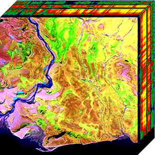
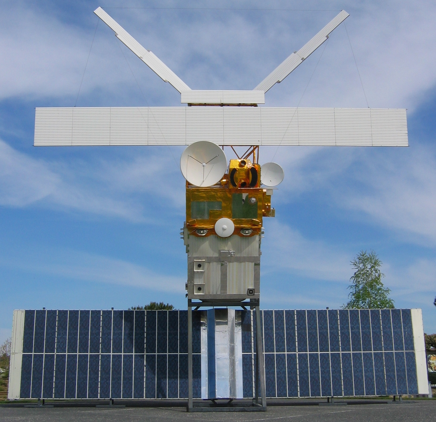
PROBA is minisatellite technology demonstration mission in ESA's General Study Program with the objective to address issues of on-board operational autonomy of a generic platform. PROBA (Project for On-Board Autonomy), renamed PROBA-1, is a Belgian satellite launched atop an Indian Polar Satellite Launch Vehicle by ISRO on 22 October 2001. The satellite was funded through the ESA's MicroSat program. This small (60×60×80 cm; 95 kg) boxlike system, with solar panel collectors on its surface, has remarkable image-making qualities. It hosts two Earth Observation instruments dubbed CHRIS and HRC. CHRIS is a hyperspectral system (200 narrow bands) that images at 17 m resolution, while HRC is a monochromatic camera that images visible light at 5 m resolution. With an initial lifetime of one to two years, the satellite celebrated its 20th year of operations in 2021. On 9 March 2018, it surpassed ERS-2 as ESA's longest operated Earth observation mission of all time. Series of ... [...More Info...] [...Related Items...] OR: [Wikipedia] [Google] [Baidu] |
PROBA-3
Proba-3 is a technological demonstration mission by the European Space Agency devoted to high precision formation flying to achieve scientific coronagraphy. It is part of the series of PROBA satellites that are being used to validate new spacecraft technologies and concepts while also carrying scientific instruments. History The mission concept dates back to 2005 when a study was performed in the ESA CDF. After several phase A studies and a change of industrial organisation at the beginning of the phase B, the mission's implementation phase (Phases C/D/E1) eventually began in July 2014. The system CDR has been closed in 2018. Mission concept Proba-3 consists of two independent, three-axis stabilized spacecraft: the Coronagraph Spacecraft (CSC) and the Occulter Spacecraft (OSC). Both spacecraft will fly close to each other on a highly elliptical orbit around the Earth, with an apogee at 60,500 km altitude. Along the apogee arc, when the gravity gradient is significantly sma ... [...More Info...] [...Related Items...] OR: [Wikipedia] [Google] [Baidu] |
Earth Observation
Earth observation (EO) is the gathering of information about the physical, chemical, and biological systems of the planet Earth. It can be performed via remote-sensing technologies (Earth observation satellites) or through direct-contact sensors in ground-based or airborne platforms (such as weather stations and weather balloons, for example). According to the Group on Earth Observations (GEO), the concept encompasses both " space-based or remotely-sensed data, as well as ground-based or in situ data". Earth observation is used to monitor and assess the status of and changes in natural and built environments. Terminology In Europe, ''Earth observation'' has often been used to refer to satellite-based remote sensing, but the term is also used to refer to any form of observations of the Earth system, including in situ and airborne observations, for example. The GEO, which has over 100 member countries and over 100 participating organizations, uses EO in this broader sense. In t ... [...More Info...] [...Related Items...] OR: [Wikipedia] [Google] [Baidu] |
Hyperspectral
Hyperspectral imaging collects and processes information from across the electromagnetic spectrum. The goal of hyperspectral imaging is to obtain the spectrum for each pixel in the image of a scene, with the purpose of finding objects, identifying materials, or detecting processes. There are three general branches of spectral imagers. There are push broom scanners and the related whisk broom scanners (spatial scanning), which read images over time, band sequential scanners (spectral scanning), which acquire images of an area at different wavelengths, and snapshot hyperspectral imaging, which uses a staring array to generate an image in an instant. Whereas the human eye sees color of visible light in mostly three bands (long wavelengths - perceived as red, medium wavelengths - perceived as green, and short wavelengths - perceived as blue), spectral imaging divides the spectrum into many more bands. This technique of dividing images into bands can be extended beyond the visible. ... [...More Info...] [...Related Items...] OR: [Wikipedia] [Google] [Baidu] |
Spacecraft Launched In 2001
A spacecraft is a vehicle or machine designed to fly in outer space. A type of artificial satellite, spacecraft are used for a variety of purposes, including communications, Earth observation, meteorology, navigation, space colonization, planetary exploration, and transportation of humans and cargo. All spacecraft except single-stage-to-orbit vehicles cannot get into space on their own, and require a launch vehicle (carrier rocket). On a sub-orbital spaceflight, a space vehicle enters space and then returns to the surface without having gained sufficient energy or velocity to make a full Earth orbit. For orbital spaceflights, spacecraft enter closed orbits around the Earth or around other celestial bodies. Spacecraft used for human spaceflight carry people on board as crew or passengers from start or on orbit (space stations) only, whereas those used for robotic space missions operate either autonomously or telerobotically. Robotic spacecraft used to support scientific re ... [...More Info...] [...Related Items...] OR: [Wikipedia] [Google] [Baidu] |
Earth Observation Satellites Of The European Space Agency
Earth is the third planet from the Sun and the only astronomical object known to harbor life. While large volumes of water can be found throughout the Solar System, only Earth sustains liquid surface water. About 71% of Earth's surface is made up of the ocean, dwarfing Earth's polar ice, lakes, and rivers. The remaining 29% of Earth's surface is land, consisting of continents and islands. Earth's surface layer is formed of several slowly moving tectonic plates, which interact to produce mountain ranges, volcanoes, and earthquakes. Earth's liquid outer core generates the magnetic field that shapes the magnetosphere of the Earth, deflecting destructive solar winds. The atmosphere of the Earth consists mostly of nitrogen and oxygen. Greenhouse gases in the atmosphere like carbon dioxide (CO2) trap a part of the energy from the Sun close to the surface. Water vapor is widely present in the atmosphere and forms clouds that cover most of the planet. More solar energy is re ... [...More Info...] [...Related Items...] OR: [Wikipedia] [Google] [Baidu] |
ALTIUS
ALTIUS (Atmospheric Limb Tracker for Investigation of the Upcoming Stratosphere) is a satellite mission proposed by the Belgian Institute for Space Aeronomy and currently under development by the European Space Agency. Its main objective is to monitor the distribution and evolution of stratospheric ozone in the Earth's atmosphere. The industrial consortium is led by QinetiQ Space, acting as mission prime. The satellite design is based on the PROBA small satellite bus. The payload, developed by OIP Sensor Systems, is an innovative UV, visible and NIR instrument. The mission is scheduled for launch in 2025 from the Guiana Space Centre. See also *List of European Space Agency programs and missions *PROBA PROBA is minisatellite technology demonstration mission in ESA's General Study Program with the objective to address issues of on-board operational autonomy of a generic platform. PROBA (Project for On-Board Autonomy), renamed PROBA-1, is a Belgia ... External links * * * * ... [...More Info...] [...Related Items...] OR: [Wikipedia] [Google] [Baidu] |
PROBA-V
PROBA-V, or PROBA-Vegetation (the ''V'' standing for ''vegetation'' and not the Roman numeral for ''5''), is a satellite in the European Space Agency's PROBA series. It was launched in 2013 with a predicted usable lifetime between 2.5 and 5 years. Satellite ''PROBA-V'' is a small satellite, assuring the succession of the Vegetation instruments on board the French SPOT-4 and SPOT-5 Earth observation missions. PROBA-V was initiated by the Space and Aeronautics department of the BELgian Science Policy Office. It is built by QinetiQ Space N.V. and operated by ESA and uses a PROBA platform. PROBA-V will support applications such as land use, worldwide vegetation classification, crop monitoring, famine prediction, food security, disaster monitoring and biosphere studies. The mission was originally conceived as a "gap filler" between the SPOT-5 end-of-life (foreseen mid-2014) and the launch of the constellation of the Sentinel-3A and -3B satellites. Due to delays of the Sentinel p ... [...More Info...] [...Related Items...] OR: [Wikipedia] [Google] [Baidu] |
Soil Moisture And Ocean Salinity Satellite
Soil Moisture and Ocean Salinity (SMOS) is a satellite which forms part of ESA's Living Planet Programme. It is intended to provide new insights into Earth's water cycle and climate. In addition, it is intended to provide improved weather forecasting and monitoring of snow and ice accumulation.ESA's water mission SMOS European Space AgencySMOS Project Team The Soil Moisture and Ocean Salinity (SMOS) Mission European Space AgencySMOS Special Issue of ESA Bulleti [...More Info...] [...Related Items...] OR: [Wikipedia] [Google] [Baidu] |
Earth Observation
Earth observation (EO) is the gathering of information about the physical, chemical, and biological systems of the planet Earth. It can be performed via remote-sensing technologies (Earth observation satellites) or through direct-contact sensors in ground-based or airborne platforms (such as weather stations and weather balloons, for example). According to the Group on Earth Observations (GEO), the concept encompasses both " space-based or remotely-sensed data, as well as ground-based or in situ data". Earth observation is used to monitor and assess the status of and changes in natural and built environments. Terminology In Europe, ''Earth observation'' has often been used to refer to satellite-based remote sensing, but the term is also used to refer to any form of observations of the Earth system, including in situ and airborne observations, for example. The GEO, which has over 100 member countries and over 100 participating organizations, uses EO in this broader sense. In t ... [...More Info...] [...Related Items...] OR: [Wikipedia] [Google] [Baidu] |
ERS-2
European Remote Sensing satellite (ERS) was the European Space Agency's first Earth-observing satellite programme using a polar orbit. It consisted of 2 satellites, ERS-1 and ERS-2. ERS-1 ERS-1 launched 17 July 1991 from Guiana Space Centre aboard an Ariane 4 rocket. The satellite was put into a Sun-synchronous polar orbit at an altitude of 782–785 km. ERS-1 failed on 10 March 2000 after nine years in orbit. Instruments ERS-1 carried an array of Earth-observation instruments that gathered information about the Earth (land, water, ice and atmosphere) using a variety of measurement principles. These included: * RA (Radar Altimeter) is a single frequency nadir-pointing radar altimeter operating in the Ku band. * ATSR-1 ( Along-Track Scanning Radiometer) is a 4 channel infrared radiometer and microwave sounder for measuring temperatures at the sea-surface and the top of clouds. * SAR (synthetic-aperture radar) operating in C band can detect changes in surface height ... [...More Info...] [...Related Items...] OR: [Wikipedia] [Google] [Baidu] |
Visible Light
Light or visible light is electromagnetic radiation that can be perceived by the human eye. Visible light is usually defined as having wavelengths in the range of 400–700 nanometres (nm), corresponding to frequencies of 750–420 terahertz, between the infrared (with longer wavelengths) and the ultraviolet (with shorter wavelengths). In physics, the term "light" may refer more broadly to electromagnetic radiation of any wavelength, whether visible or not. In this sense, gamma rays, X-rays, microwaves and radio waves are also light. The primary properties of light are intensity, propagation direction, frequency or wavelength spectrum and polarization. Its speed in a vacuum, 299 792 458 metres a second (m/s), is one of the fundamental constants of nature. Like all types of electromagnetic radiation, visible light propagates by massless elementary particles called photons that represents the quanta of electromagnetic field, and can be analyzed as both waves and ... [...More Info...] [...Related Items...] OR: [Wikipedia] [Google] [Baidu] |


.jpg)