|
Pueblo Pottery
Pueblo pottery are ceramic objects made by the indigenous Pueblo people and their antecedents, the Ancestral Puebloans and Mogollon cultures in the Southwestern United States and Northern Mexico. For centuries, pottery has been central to pueblo life as a feature of ceremonial and utilitarian usage. The clay is locally sourced, most frequently handmade (not thrown on a potters wheel nor cast in a mold), and fired traditionally in an earthen pit. These items take the form of storage jars, canteens, serving bowls, seed jars, and ladles, serving the needs of daily life. Some utility wares were undecorated except from simple corrugations or marks made with a stick or fingernail, however many examples for centuries were painted with abstract or representational motifs. Some pueblos made effigy vessels, fetishes or figurines such as Cochiti Pueblo. During modern times, pueblo pottery was produced specifically as an art form to serve an economic function. This role is not dissimilar t ... [...More Info...] [...Related Items...] OR: [Wikipedia] [Google] [Baidu] |
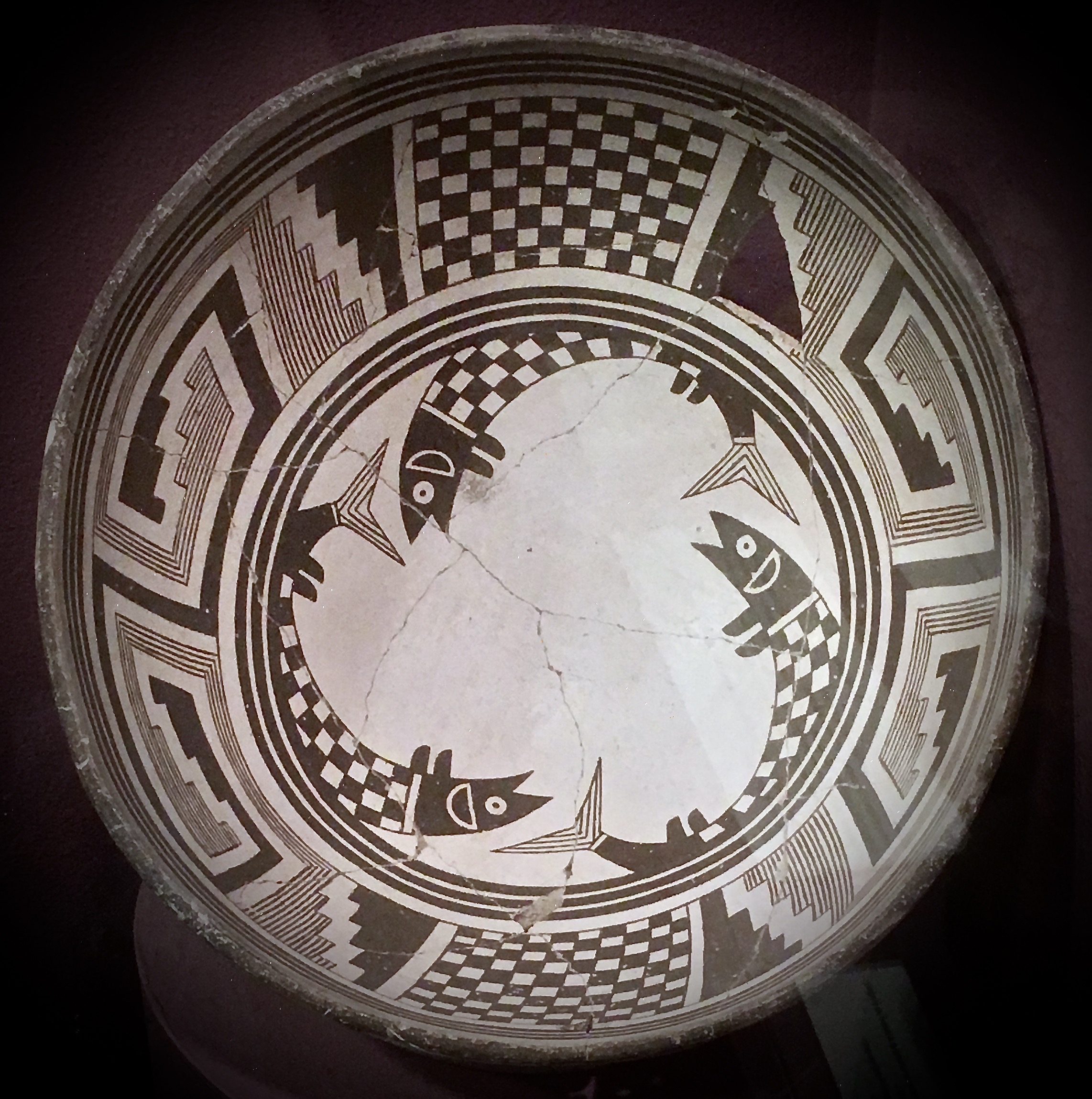
Mimbres Fish Pot, MRM
Mimbres may refer to: * Mimbres culture (c. 1100–1150 CE), a subdivision of Mogollon culture * Mimbres pottery, a particular style of pottery decoration from the Mimbres culture * Mimbres Valley AVA, an American Viticultural Area in southwestern New Mexico * Mimbres River, a river in New Mexico * Mimbres Mountains, the southernmost part of the Black Range * Chiricahua#Bands , Mlimbres Apaches, a band of the Chiricahua Apaches of the Southwestern US. {{disambiguation ... [...More Info...] [...Related Items...] OR: [Wikipedia] [Google] [Baidu] |
Antiquities Act Of 1906
The Antiquities Act of 1906 (, , ), is an act that was passed by the United States Congress and signed into law by Theodore Roosevelt on June 8, 1906. This law gives the President of the United States the authority to, by presidential proclamation, create national monuments from federal lands to protect significant natural, cultural, or scientific features. The Act has been used more than a hundred times since its passage. History The Antiquities Act was signed into law by President Theodore Roosevelt during his second term in office. The act resulted from concerns about protecting mostly prehistoric Native American ruins and artifacts -- collectively termed "antiquities" -- on federal lands in the West, such as at Chaco Canyon, New Mexico. Removal of artifacts from these lands by private collectors, "pot hunters," had become a serious problem by the end of the 19th century. In 1902, Iowa Congressman John F. Lacey, who chaired the House Committee on the Public Lands, trave ... [...More Info...] [...Related Items...] OR: [Wikipedia] [Google] [Baidu] |
Third Mesa
Hotevilla-Bacavi (Hopi: Hotvela-Paaqavi; also known as Third Mesa) is a census-designated place (CDP) in Navajo County, Arizona, United States, on the Hopi Reservation. The population was 957 at the 2010 census. History Hotevilla was first settled by the "hostiles", a group of Hopi residents who were forced out of nearby Oraibi in the 1906 Oraibi Split due to ideological differences over European cultural influences by recently arrived settlers, soldiers and missionaries, influences against which the hostiles were opposed. Later attempts to reintegrate displaced residents resulted in another split to the settlement of Bacavi, which later joined with Hotevilla to create a unified settlement. Hotevilla is mentioned by D. H. Lawrence in his Mornings in Mexico travel memoir. The English author visited Hotevilla and Hopi country in 1924. Geography Hotevilla-Bacavi is located at (35.922929, -110.665621). According to the United States Census Bureau, the CDP has a total area of , ... [...More Info...] [...Related Items...] OR: [Wikipedia] [Google] [Baidu] |
Oraibi
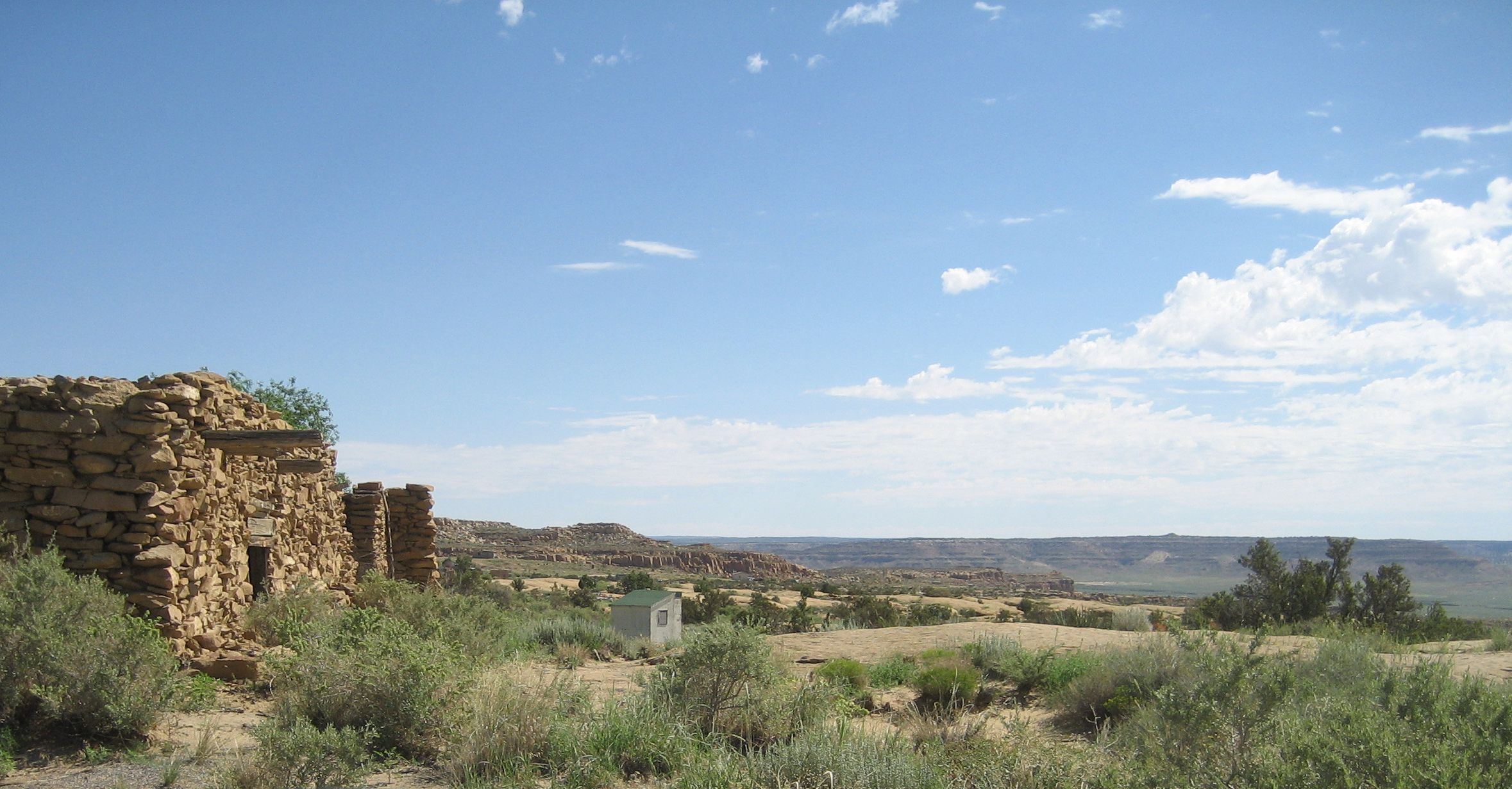
Oraibi, also referred to as Old Oraibi, is a Hopi village in Navajo County, Arizona, United States, in the northeastern part of the state. Known as Orayvi by the native inhabitants, it is on Third Mesa on the Hopi Reservation near Kykotsmovi Village. There are no accurate census counts or estimates for the village population. History Oraibi was founded sometime before the year 1100 AD, making it possibly the oldest continuously inhabited settlement in the United States. Archeologists speculate that a series of severe droughts in the late 13th century forced the Hopi to abandon several smaller villages in the region and consolidate within a few population centers. As Oraibi was one of these surviving settlements its population grew considerably, and became populous and the most influential of the Hopi settlements. By 1890 the village was estimated to have a population of 905, about half of the 1,824 estimated to be living in all of the Hopi settlements at the time. Oraibi r ... [...More Info...] [...Related Items...] OR: [Wikipedia] [Google] [Baidu] |
Pinch Pot
A pinch pot is a simple form of hand-made pottery produced from ancient times to the present. The pinching method is to create pottery that can be ornamental or functional, and has been widely employed across culture. The method used is to simply have a lob of clay, then pinch it to the shape desired. Pinch pots are the simplest and fastest way of making pottery,3 Ways to Make Pinch Pots - Pottery Tips by the Pottery Wheel thepotterywheel.com, accessed 12 July 2021 simply by pinching the clay into shape by using thumb and fingers. Simple vessels such as bowls and cups of various sizes can be formed and shaped by hand using a methodical pinching process in which the clay walls ... [...More Info...] [...Related Items...] OR: [Wikipedia] [Google] [Baidu] |
Pueblo Of Zuni
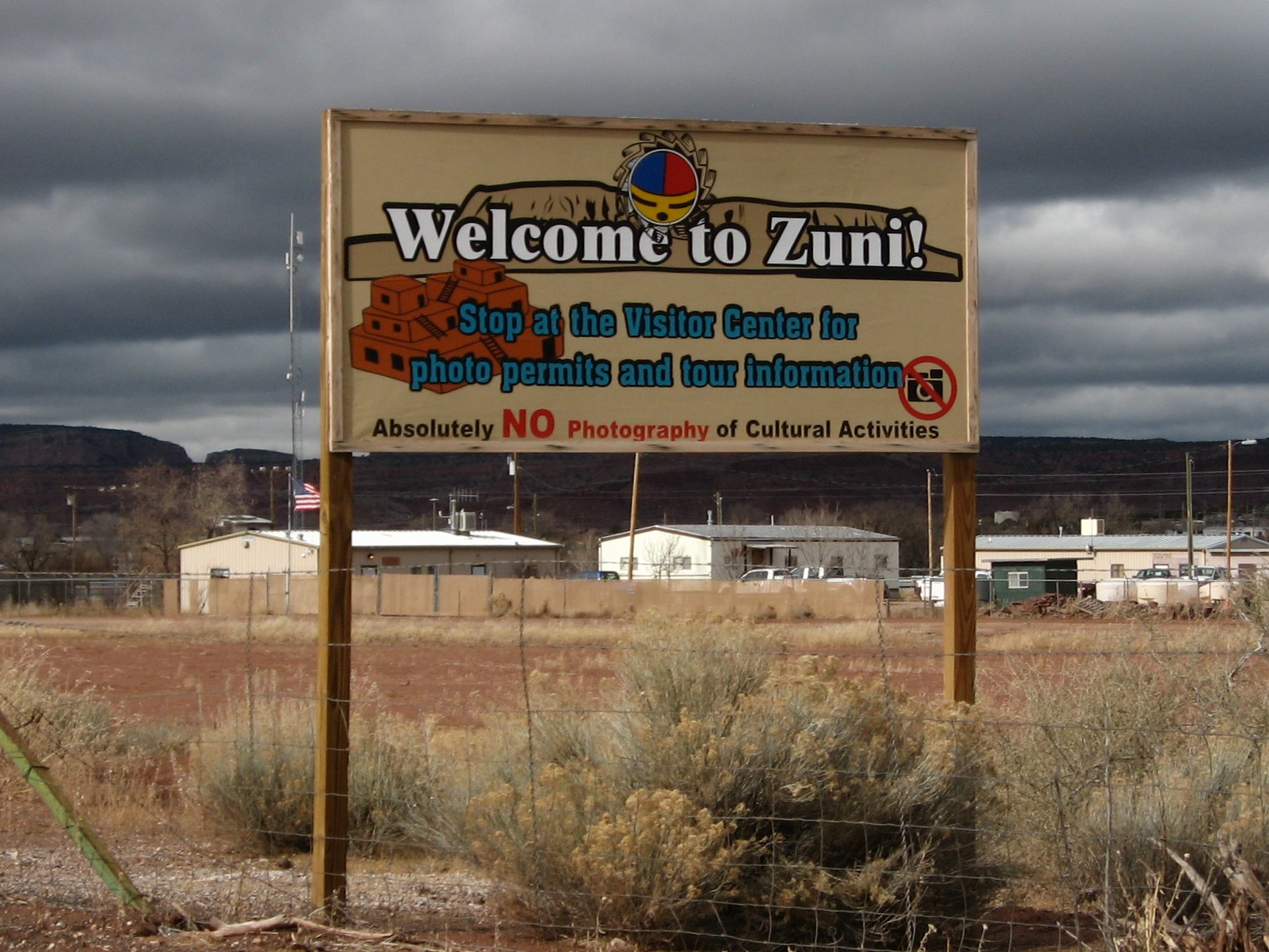
The Zuni Indian Reservation, also known as Pueblo of Zuni, is the homeland of the Zuni tribe of Native Americans. In Zuni language, the Zuni Pueblo people are referred to as A:shiwi, and the Zuni homeland is referred to as Halona Idiwan’a meaning Middle Place. Location The reservation lies in the Zuni River valley and is located primarily in McKinley and Cibola counties in western New Mexico, about west of Albuquerque. There are also several smaller non-contiguous sections in Apache County, Arizona, northwest of the city of St. Johns. The main part of the reservation borders the state of Arizona to the west and the Ramah Navajo Reservation to the east. The main reservation is surrounded by the Painted Cliffs, the Zuni Mountains, and the Cibola National Forest. The reservation's total land area is 723.343 sq mi (1,873.45 km²). As noted above, the Zuni Tribe also has land holdings in Apache County, Arizona, and Catron County, New Mexico, that do not border the m ... [...More Info...] [...Related Items...] OR: [Wikipedia] [Google] [Baidu] |
Zuni Language
Zuni (also formerly Zuñi, endonym ''Shiwiʼma'') is a language of the Zuni people, indigenous to western New Mexico and eastern Arizona in the United States. It is spoken by around 9,500 people, especially in the vicinity of Zuni Pueblo, New Mexico, and much smaller numbers in parts of Arizona Arizona ( ; nv, Hoozdo Hahoodzo ; ood, Alĭ ṣonak ) is a state in the Southwestern United States. It is the 6th largest and the 14th most populous of the 50 states. Its capital and largest city is Phoenix. Arizona is part of the Fou .... Unlike most indigenous languages in the US, Zuni is still spoken by a significant number of children and, thus, is comparatively less threatened with language endangerment. Edmund Ladd reported in 1994 that Zuni is still the main language of communication in the pueblo and is used in the home (Newman 1996). The Zuni name for their own language, ' (''shiwi'' "Zuni" + ''-ʼma'' "vernacular"; pronounced ) can be translated as "Zuni way", ... [...More Info...] [...Related Items...] OR: [Wikipedia] [Google] [Baidu] |
Acoma Pueblo
Acoma Pueblo (, kjq, Áakʼu) is a Native American pueblo approximately west of Albuquerque, New Mexico, in the United States. Four communities make up the village of Acoma Pueblo: Sky City (Old Acoma), Acomita, Anzac, and McCartys. These communities are located near the expansive Albuquerque metropolitan area, which includes several large cities and towns, including neighboring Laguna Pueblo. The Acoma Pueblo tribe is a federally recognized tribal entity, whose historic land of Acoma Pueblo totaled roughly . Today, much of the Acoma community is primarily within the Acoma Indian Reservation. Acoma Pueblo is a National Historic Landmark. According to the 2010 United States Census, 4,989 people identified as Acoma.U.S. Census Bureau, Census 2000 Census 2000 American Indian and Alaska Native Summary File (AIANSF) - Sample Data, Acoma alone, H38 The Acoma have continuously occupied the area for over 2000 years, making this one of the oldest continuously inhabited communities in t ... [...More Info...] [...Related Items...] OR: [Wikipedia] [Google] [Baidu] |
Keres Language
Keres (), also Keresan (), is a Native American language, spoken by the Keres Pueblo people in New Mexico. Depending on the analysis, Keres is considered a small language family or a language isolate with several dialects. The varieties of each of the seven Keres pueblos are mutually intelligible with its closest neighbors. There are significant differences between the Western and Eastern groups, which are sometimes counted as separate languages. Family division In 2007, there was an estimate total of 10,670 speakers. * Eastern Keres: total of 4,580 speakers (1990 census) ** Cochiti Pueblo ''Kotyit dialect'': 600 speakers (2007) ** San Felipe Pueblo ''Katishtya dialect'': 2,340 speakers (2007) **Kewa Pueblo (formally Santo Domingo Pueblo) ''Kewa dialect'': 2,850 speakers (2007) ** Zia Pueblo ''Ts'ia dialect'': 500 speakers (2007) ** Santa Ana Pueblo ''Tamaiya dialect'': 390 speakers (2007) * Western Keres: total of 3,391 speakers (1990 census) ** Acoma Pueblo ''Áakʼu dialect' ... [...More Info...] [...Related Items...] OR: [Wikipedia] [Google] [Baidu] |
San Ildefonso Pueblo
San Ildefonso Pueblo (Tewa: Pʼohwhogeh Ówîngeh ’òhxʷógè ʔówîŋgè"where the water cuts through" ) is a census-designated place (CDP) in Santa Fe County, New Mexico, United States, and a federally recognized tribe, established c. 1300 C.E. The Pueblo is self-governing and is part of the Santa Fe, New Mexico Metropolitan Statistical Area. The population was 524 as of the 2010 census, reported by the State of New Mexico as 1,524 in 2012, and there were 628 enrolled tribal members reported as of 2012 according to the Department of the Interior. San Ildefonso Pueblo is a member of the Eight Northern Pueblos, and the pueblo people are from the Tewa ethnic group of Native Americans, who speak the Tewa language. Geography San Ildefonso is located at (35.897902, -106.121834). According to the United States Census Bureau, the pueblo has a total area of , of which is land and (5.54%) is water. San Ildefonso Pueblo is located at the foot of Black Mesa. Demographics As ... [...More Info...] [...Related Items...] OR: [Wikipedia] [Google] [Baidu] |
Santa Clara Pueblo
Santa Clara Pueblo (in Tewa: Khaʼpʼoe Ówîngeh ɑ̀ʔp’òː ʔówîŋgè ″Singing Water Village″, also known as ″Village of Wild Roses″ is a census-designated place (CDP) in Rio Arriba County, New Mexico, United States and a federally recognized tribe of Native American Pueblo people. The pueblo is a member of the Eight Northern Pueblos, and the people are from the Tewa ethnic group of Native Americans who speak the Rio Grande Tewa language. The pueblo is on the Rio Grande, between Ohkay Owingeh (formerly San Juan Pueblo) to the north and San Ildefonso Pueblo (P'ohwhóge Owingeh) to the south. Santa Clara Pueblo is famous for producing hand-crafted pottery, specifically blackware and redware with deep engravings. The pueblo is listed on the National Register of Historic Places. Geography Santa Clara Pueblo is located at (35.971124, -106.089111), approximately 1.5 miles south of Española on NM 30. According to the United States Census Bureau, the CDP has a ... [...More Info...] [...Related Items...] OR: [Wikipedia] [Google] [Baidu] |
Tewa People
The Tewa are a linguistic group of Pueblo Native Americans who speak the Tewa language and share the Pueblo culture. Their homelands are on or near the Rio Grande in New Mexico north of Santa Fe. They comprise the following communities: * Nambé Pueblo * Pojoaque Pueblo * San Ildefonso Pueblo * Ohkay Owingeh * Santa Clara Pueblo. * Tesuque Pueblo The Hopi Tewa, descendants of those who fled the Second Pueblo Revolt of 1680–1692, live on the Hopi Reservation in Arizona, mostly in Tewa Village and Polacca on the First Mesa. Other Hopi clans are known to be descendants of Tewa people.J. Walter Fewkes, The Butterfly in Hopi Myth and Ritual. ''American Anthropologist'', New Series, Vol. 12, No. 4 (Oct. - Dec., 1910), pp. 576–594 Tewa is one of five Tanoan languages spoken by the Pueblo people of New Mexico. Though these five languages are closely related, speakers of one cannot fully understand speakers of another (similar to German and Dutch speakers). The six Tewa-spe ... [...More Info...] [...Related Items...] OR: [Wikipedia] [Google] [Baidu] |


