|
Protected Areas Of New South Wales (Australia)
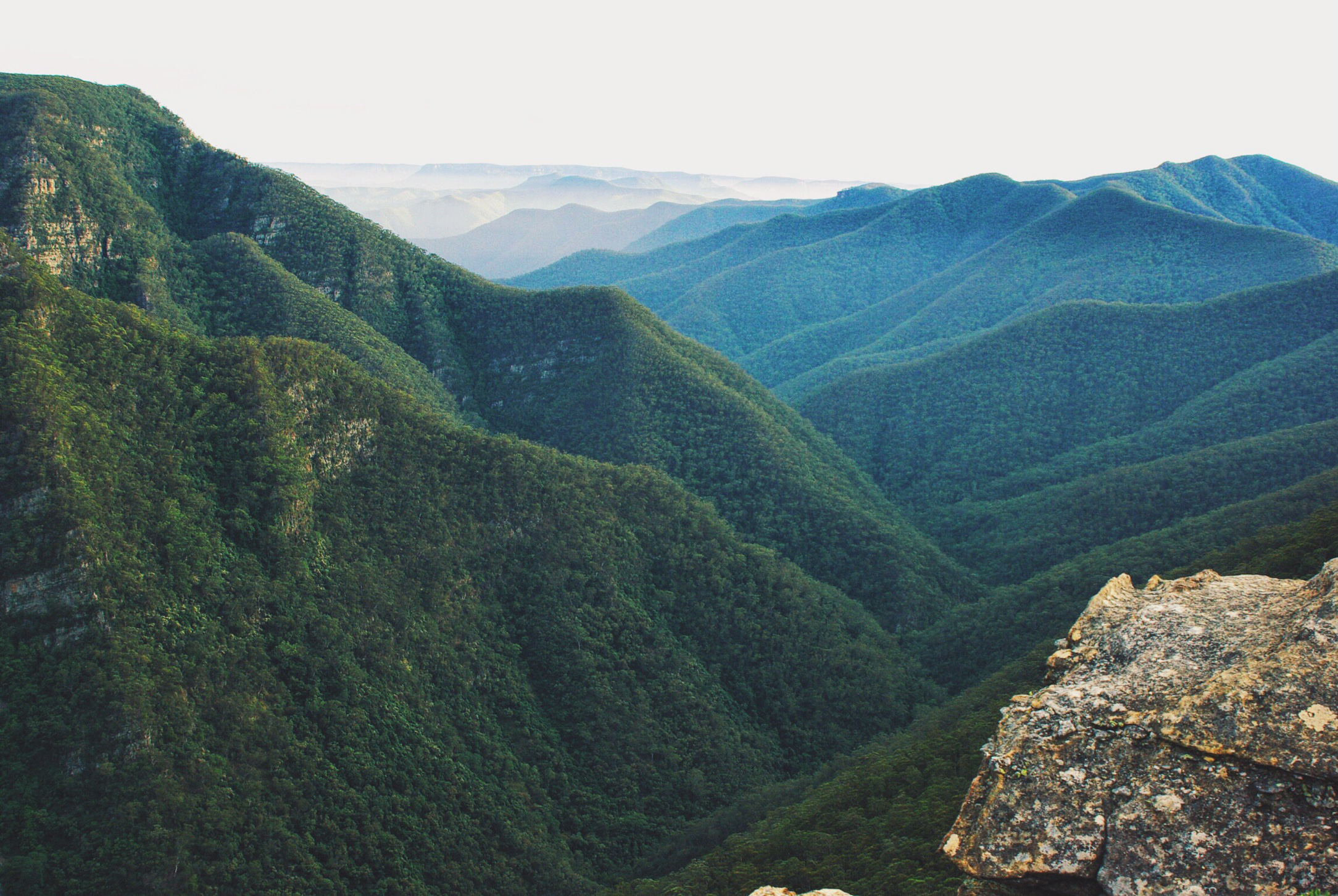
The Protected areas of New South Wales include both protected area, terrestrial and marine protected areas. there are 225 national parks in New South Wales. A number established since the late 1970s followed campaigns by local residents and environmentalists. Based on the Collaborative Australian Protected Area Database (CAPAD) 2020 data there are 2136 separate terrestrial protected areas with a total land area of (9.61% of the state's area). CAPAD data also shows 18 marine protected areas with a total area of , covering 39.63% of NSW waters. History New South Wales established the first known protected area in Australia, Royal National Park in 1879. The formation of the National Parks and Wildlife Service (New South Wales), NSW National Parks and Wildlife Service in 1967 saw a bid in the conservation of the state's diversity of natural ecosystems and cultural heritage. Today New South Wales contains more than 16.4 million acres within 870 protected areas, as well as 225 di ... [...More Info...] [...Related Items...] OR: [Wikipedia] [Google] [Baidu] |
Abercrombie River National Park
The Abercrombie River National Park is a protected national park that is located in the Central Tablelands region of New South Wales, in eastern Australia. The national park is situated approximately west of Sydney and south of . Features The park includes the catchments of Silent Creek and the Retreat River, as well as a section of the Abercrombie River. The Abercrombie River National Park protects an important area of remnant bushland within the south-western Central Tablelands. It contains a diversity of vegetation communities characteristic of montane and tableland species as well as of the western slopes of New South Wales New South Wales (commonly abbreviated as NSW) is a States and territories of Australia, state on the Eastern states of Australia, east coast of :Australia. It borders Queensland to the north, Victoria (state), Victoria to the south, and South .... The park makes an important contribution to nature conservation in the Central West by providi ... [...More Info...] [...Related Items...] OR: [Wikipedia] [Google] [Baidu] |
Nangar National Park
Nangar is a national park in located New South Wales, Australia, west of Sydney. The park is located in the Nangar-Murga Range between Eugowra and Canowindra. It features Nangar Mountain, which rises to . Trees consist of eucalyptus, blackpine, scribbly gum and ironbark. Shrubs include spider flowers, thyme spurge, nodding blue lily and waxlip orchids. Birds recorded include wrens, thornbills, falcons, hawks, peregrine falcon The peregrine falcon (''Falco peregrinus''), also known simply as the peregrine, is a Cosmopolitan distribution, cosmopolitan bird of prey (raptor) in the family (biology), family Falconidae renowned for its speed. A large, Corvus (genus), cro ...s and glossy black cockatoos. Eastern grey kangaroos and grey, redneck and swamp wallabies are common. The park was originally established in 1983 when 1,550 hectares of bushland were declared a national park. "Dripping Rock" was added to the park in 1988 and, in 1994, the Nangar State Forest was add ... [...More Info...] [...Related Items...] OR: [Wikipedia] [Google] [Baidu] |
Marrangaroo National Park
Marrangaroo is a village in the Central West of New South Wales, Australia in the City of Lithgow. The name is also applied to the surrounding area, for postal and statistical purposes. Overview Marrangaroo is located a few kilometres west of Lithgow. It is accessible from the Great Western Highway, and has no railway station and little bus services. Lithgow Buslines, run buses between Lithgow and Bathurst, which makes limited stops at Marrangaroo on the Great Western Highway. A main feature of Marrangaroo was the Trout Farm which was opposite the Lithgow Correctional Centre. At the 2016 census, Marrangaroo had a population of 909. The area in the north-east of the Marrangaroo bounded locality is now a part of the Gardens of Stone State Conservation Area. Military Marrangaroo Army Camp situated at the end of Reserve Road used to be a major ammunition depot from 1941 to the late 1980s. It was served by a three kilometres siding that branched off from the Main Wester ... [...More Info...] [...Related Items...] OR: [Wikipedia] [Google] [Baidu] |
Lachlan Valley National Park
Lachlan may refer to: People * Lachlan (name), masculine name. Places * Several places in New South Wales, Australia, named for Lachlan Macquarie. For a more complete list, see Places named after Macquarie ** Electoral district of Lachlan, an electoral district of the Legislative Assembly in New South Wales, Australia ** Electoral district of Lachlan and Lower Darling, an electoral district of the Legislative Assembly in New South Wales, Australia ** Lachlan River The Lachlan River (Wiradjuri: ''Kalari'', ''Galiyarr'') is an intermittent river that is part of the Murrumbidgee catchment within the Murray–Darling basin, located in the Southern Tablelands, Central West, and Riverina regions of New Sou ..., a river in central New South Wales, Australia ** Lachlan Shire, a local government area in the central west of New South Wales, Australia ** Lachlan Valley Railway, a rail preservation society based at Cowra, New South Wales, Australia ** Lachlan Valley Way, a sta ... [...More Info...] [...Related Items...] OR: [Wikipedia] [Google] [Baidu] |
Kanangra-Boyd National Park
The Kanangra-Boyd National Park is a state park, protected national park that is located in the Central Tablelands region, west of the Southern Highlands (New South Wales), Southern Highlands and Macarthur (New South Wales), Macarthur regions, in New South Wales, in eastern Australia. The national park is situated approximately South-western Sydney, south-west of Sydney and is contiguous with the Blue Mountains National Park and the Nattai National Park. The park was established in 1969. The Kanangra-Boyd National Park is one of the eight protected areas that, in 2000, was inscribed to form part of the UNESCO World Heritage Site, World Heritagelisted Greater Blue Mountains Area. The Kanangra-Boyd National Park is the most southwesterly of the eight protected areas within the World Heritage Site. The national park forms part of the Great Dividing Range. Notable features of the national park include the Thurat Spires, Kanangra Walls, Mount Colong, and three waterfall systems – ... [...More Info...] [...Related Items...] OR: [Wikipedia] [Google] [Baidu] |
Goulburn River National Park
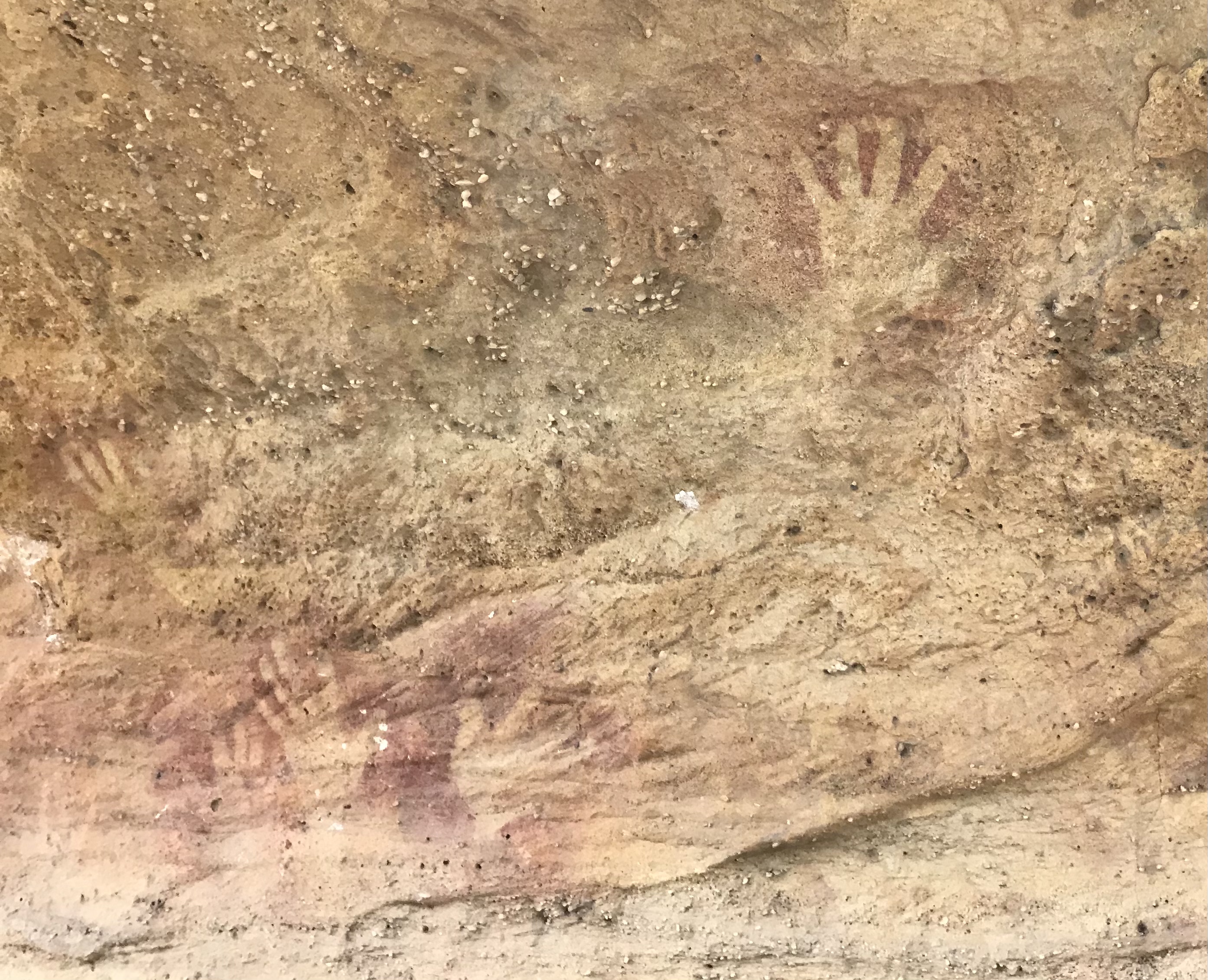
The Goulburn River National Park is a national park located in New South Wales, Australia, northwest of Sydney and it is south-west of Merriwa. The Goulburn River National Park is located in the Hunter Valley region and covers approximately of the Goulburn River. It is near the towns of Sandy Hollow, Denman, Merriwa, and Mudgee. The park with its beautiful surroundings, forest and river offers many opportunities for recreation, such as fishing, hiking, kayaking, swimming and camping. Animals The park is a sanctuary for kangaroos, wombats, emus, goannas, platypus, and a wide variety of birds. It lies within the Mudgee-Wollar Important Bird Area, so identified by BirdLife International because of its importance for the endangered regent honeyeater. Aboriginal heritage The park contains some 300 or more aboriginal site (mostly along the river). The Wiradjuri, Gamileroi and Wonnarua Clans peoples have traditionally lived in this area since ancient times. See also * Prot ... [...More Info...] [...Related Items...] OR: [Wikipedia] [Google] [Baidu] |
Goobang National Park
Goobang is a national park located in New South Wales, Australia, northwest of Sydney. It protects the largest remnant forest and woodland in the central west region of the state, where interior and coastal New South Wales flora and fauna species overlap. Originally named Herveys Range by John Oxley in 1817, the area was reserved in 1897 as state forest because of its importance as a timber resource, and was designated a national park in 1995. The park contains a camping ground and a hiking trail, Burrabadine Peak Walking Track, a 3.6 km round trip moderate hike. Climate Goobang National Park is in a temperate to semi-arid zone experiencing hot summers and cool winters with temperatures ranging from in winter and in summer. The heaviest rain fall is in the summer and can range from on the east side of the ranges to west of the ranges. Flora There are 459 species recorded in the park, several that are threatened. ''Tylophora linearis'' is listed as vulnerable accor ... [...More Info...] [...Related Items...] OR: [Wikipedia] [Google] [Baidu] |
Garrawilla National Park
Garrawilla National Park was created in December 2005. It covers an area of 937 hectares. This park is located on the northern side of the Oxley Highway Oxley Highway is a rural highway in New South Wales, Australia, linking Nevertire, Gilgandra, Coonabarabran, Tamworth, and Walcha to Port Macquarie, on the coast of the Tasman Sea. It was named to commemorate John Oxley, the first European t ... approximately halfway between Coonabarabran and Mullaley, New South Wales, Mullaley in New South Wales, Australia. Retrieved on 2009-6-2 See also * Protected areas of New South WalesReferences {{authority control National parks of New South Wales Protected areas established in 2005 2005 establishments in Australia ...[...More Info...] [...Related Items...] OR: [Wikipedia] [Google] [Baidu] |
Gardens Of Stone National Park
The Gardens of Stone National Park is a protected national park that is located in the Central Tablelands region of New South Wales in eastern Australia. The national park is situated northwest of Sydney, and northwest of . The national park draws its name from the natural stone pagodas within its boundaries. The Gardens of Stone National Park is one of the eight protected areas that, in 2000, was inscribed to form part of the UNESCO World Heritage-listed Greater Blue Mountains Area. The national park forms part of the Great Dividing Range. Features and location The most prominent features of the park are the sandstone pagoda landscapes and cliffs and canyons. Limestone outcrops, karsts and elevated swamps are other unusual features. The park is bounded on the west by the Castlereagh Highway; to the north by the Glen Davis Road; to the east by the Wollemi National Park; and to the south by the Newnes State Forest, the Wolgan Valley, and the Wolgan State Forest. The rural lo ... [...More Info...] [...Related Items...] OR: [Wikipedia] [Google] [Baidu] |
Drillwarrina National Park
Ewenmar County is one of the 141 cadastral divisions of New South Wales. It is located between the Macquarie River on the west and the Castlereagh River on the east, between Warren and Gilgandra. The name derives from a local Aboriginal word. Parishes A full list of parishes in this county, their current LGA LaGuardia Airport ( ) – colloquially known as LaGuardia or simply LGA – is a civil airport in East Elmhurst, Queens, New York City, situated on the northwestern shore of Long Island, bordering Flushing Bay. Covering , the facility wa ... and approximately central mapping coordinates follow: References {{reflist Counties of New South Wales ... [...More Info...] [...Related Items...] OR: [Wikipedia] [Google] [Baidu] |
Coolah Tops National Park
Coolah Tops is a national park located in New South Wales, Australia, northwest of Sydney, established on 5 July 1996. It is managed by the New South Wales National Parks and Wildlife Service. Its World Conservation Union category is II. It is situated east of Coolah in the Liverpool Range, on the Coolah Creek Road. The park features waterfalls that plunge from the plateau. Giant grass trees and open forest with stands of snow gums shelter gliders, wallabies, eagles and owls. It is home to one of the largest populations of greater gliders in Australia. Camping and walking are the main recreational activities performed here. Views from the tops are possible over the Liverpool Plains. The sources of the Talbragar River and the Coolaburragundy River lie in the park. The park is managed consistent with a statutory plan of managementhttps://www.environment.nsw.gov.au/-/media/OEH/Corporate-Site/Documents/Parks-reserves-and-protected-areas/Parks-plans-of-management/coolah-to ... [...More Info...] [...Related Items...] OR: [Wikipedia] [Google] [Baidu] |


