|
Ponta Do Sinó
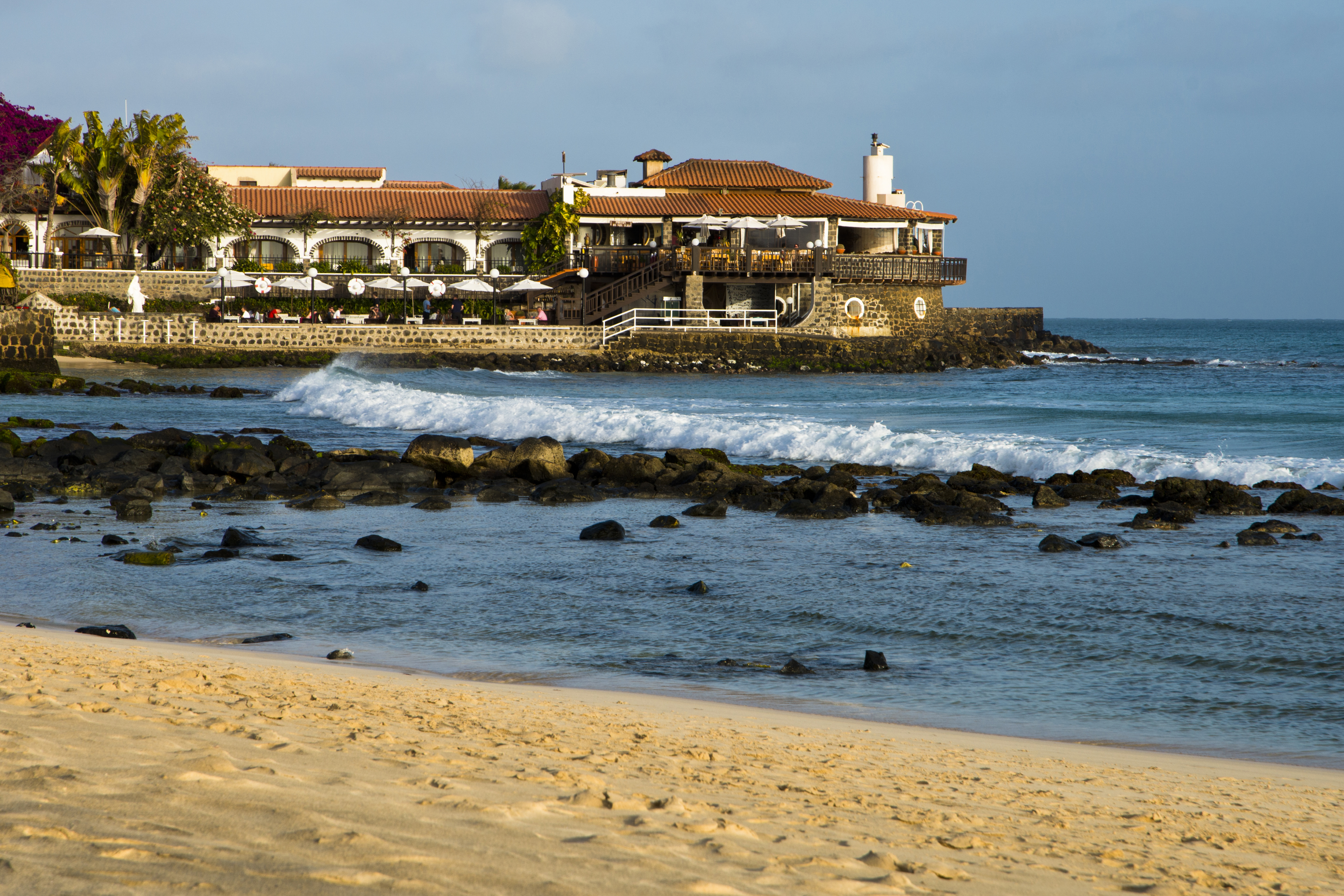
Ponta do Sinó is the southernmost point of the island of Sal in Cape Verde.Cabo Verde, Statistical Yearbook 2015 Instituto Nacional de Estatística, p. 26 It lies 2 km southwest of Santa Maria city centre. The area north of the headland is a : nature reserve ''Ponta do Sinó'', at the edge of a large tourism development zone. [...More Info...] [...Related Items...] OR: [Wikipedia] [Google] [Baidu] |
Sal, Cape Verde
Sal (Portuguese for "salt") is an island in Cape Verde. Sal is a tourist destination with white sandy beaches and over 350 days of sunshine a year. It is one of the three sandy eastern islands of the Cape Verde archipelago in the central Atlantic Ocean, off the west coast of Africa. Cabo Verde is known for year-round kiteboarding, for the large reserve of Caretta turtles which hatch from July to September, and the music of Cesaria Evora. History For Europeans , the island was discovered on 3 December 1460 and named ''Llana'' ("flat"). This name was changed into the current "Sal" when the two large salt ponds (Pedra de Lume and Santa Maria) were discovered. The first three centuries after its discovery, the island was only sparsely inhabited; in 1720 there was a small fishing village near present Palmeira. This changed when the salt industry was developed at the end of the 18th century, starting in Pedra de Lume. Santa Maria was founded in the south of the island in 1830 by ... [...More Info...] [...Related Items...] OR: [Wikipedia] [Google] [Baidu] |
Santa Maria, Cape Verde
Santa Maria (Portuguese for Saint Mary) is a cityCabo Verde, Statistical Yearbook 2015 Instituto Nacional de Estatística, p. 32-33 in the southern part of the island municipality of Sal, . It is located on the south coast, about 16 km south of the |
Atlantic Ocean
The Atlantic Ocean is the second-largest of the world's five oceans, with an area of about . It covers approximately 20% of Earth's surface and about 29% of its water surface area. It is known to separate the " Old World" of Africa, Europe and Asia from the "New World" of the Americas in the European perception of the World. The Atlantic Ocean occupies an elongated, S-shaped basin extending longitudinally between Europe and Africa to the east, and North and South America to the west. As one component of the interconnected World Ocean, it is connected in the north to the Arctic Ocean, to the Pacific Ocean in the southwest, the Indian Ocean in the southeast, and the Southern Ocean in the south (other definitions describe the Atlantic as extending southward to Antarctica). The Atlantic Ocean is divided in two parts, by the Equatorial Counter Current, with the North(ern) Atlantic Ocean and the South(ern) Atlantic Ocean split at about 8°N. Scientific explorations of the A ... [...More Info...] [...Related Items...] OR: [Wikipedia] [Google] [Baidu] |
Cape Verde
, national_anthem = () , official_languages = Portuguese , national_languages = Cape Verdean Creole , capital = Praia , coordinates = , largest_city = capital , demonym = Cape Verdean or Cabo Verdean , ethnic_groups_year = 2017 , government_type = Unitary semi-presidential republic , leader_title1 = President , leader_name1 = José Maria Neves , leader_title2 = Prime Minister , leader_name2 = Ulisses Correia e Silva , legislature = National Assembly , area_rank = 166th , area_km2 = 4033 , area_sq_mi = 1,557 , percent_water = negligible , population_census = 561,901 , population_census_rank = 172nd , population_census_year = 2021 , population_density_km2 = 123.7 , population_density_sq_mi = 325.0 , population_density_rank = 89th , GDP_PPP ... [...More Info...] [...Related Items...] OR: [Wikipedia] [Google] [Baidu] |
Instituto Nacional De Estatística (Cape Verde)
The Instituto Nacional de Estatística (Portuguese for the ''National Statistics Institute'', abbreviated as INE) is the public statistics institute of Cape Verde. Its current president is Osvaldo Rui Monteiro dos Reis Borges. The population censuses are held every first year of a decade; the most recent was in 2010. Its main office is on 18 Rua da Caixa Económica in the capital city of Praia. History Until 1975, under Portuguese rule, statistics were done by the Provincial Statistics Bureau (''Repartição Provincial de Estatística''), part of the Instituto Nacional de Estatística of Portugal. When Cape Verde became independent, the ''Serviço Nacional de Estatística'' (SNE, Portuguese for the National Statistics Service) was established, part of the Ministry of Economy. Its first president was Edgard Chrysostome Pinto. At the end of 1985, the Directorate-General of Statistics was created. In 1996, the new law of the National Statistics System was approved, and the ''Istituto ... [...More Info...] [...Related Items...] OR: [Wikipedia] [Google] [Baidu] |
List Of Protected Areas In Cape Verde
This is a list of protected areas in Cape Verde:Resolução nº 36/2016 Estratégia e Plano Nacional de Negócios das Áreas Protegidas Áreas protegidas Cabo Verde 
[...More Info...] [...Related Items...] OR: [Wikipedia] [Google] [Baidu] |
Farol Da Ponta Do Sinó
Farol is a municipality in the state of Paraná in the Southern Region of Brazil. See also *List of municipalities in Paraná This is a list of the municipalities in the state of Paraná (PR), located in the South Region of Brazil. Paraná is divided into 399 municipalities, which are grouped into 39 microregions, which are grouped into 10 mesoregions. See also * ... References Municipalities in Paraná {{ParanáBR-geo-stub ... [...More Info...] [...Related Items...] OR: [Wikipedia] [Google] [Baidu] |
Hotel Riu 1 (Sal, Cabo Verde)
A hotel is an establishment that provides paid lodging on a short-term basis. Facilities provided inside a hotel room may range from a modest-quality mattress in a small room to large suites with bigger, higher-quality beds, a dresser, a refrigerator and other kitchen facilities, upholstered chairs, a flat screen television, and en-suite bathrooms. Small, lower-priced hotels may offer only the most basic guest services and facilities. Larger, higher-priced hotels may provide additional guest facilities such as a swimming pool, business centre (with computers, printers, and other office equipment), childcare, conference and event facilities, tennis or basketball courts, gymnasium, restaurants, day spa, and social function services. Hotel rooms are usually numbered (or named in some smaller hotels and B&Bs) to allow guests to identify their room. Some boutique, high-end hotels have custom decorated rooms. Some hotels offer meals as part of a room and board arrangement. In Jap ... [...More Info...] [...Related Items...] OR: [Wikipedia] [Google] [Baidu] |
Tourism In Cape Verde
Tourism in Cape Verde, a group of islands off the coast of Senegal, West Africa, started in the 1970s on the island of Sal and increased slowly in the 1980s and 1990s. Overview Tourism contributed US$41 million to the country's economy in the year 2000. The hotel industry contributed 2.0% to GDP in 1997, which increased to 6.8% in 2001. The number of tourists increased from approximately 45,000 in 1997 to more than 115,000 in 2001 and to over 765,000 in 2018 according to the Cape Verdean statistics bureau. Most of these international arrivals came from the United Kingdom (23.6%), Germany (11.2%), the Low Countries (i.e., The Netherlands and Belgium), France, Portugal, Italy, and other countries. Less than one percent of tourists came from the United States. The vast majority of tourists visit the comparatively flat and less populated islands of Sal, Boa Vista, and Maio with their white sandy beaches. The islands of Cape Verde have a pleasant climate during most of the year w ... [...More Info...] [...Related Items...] OR: [Wikipedia] [Google] [Baidu] |
Headlands Of Cape Verde
A headland, also known as a head, is a coastal landform, a point of land usually high and often with a sheer drop, that extends into a body of water. It is a type of promontory. A headland of considerable size often is called a cape.Whittow, John (1984). ''Dictionary of Physical Geography''. London: Penguin, 1984, pp. 80, 246. . Headlands are characterised by high, breaking waves, rocky shores, intense erosion, and steep sea cliff. Headlands and bays are often found on the same coastline. A bay is flanked by land on three sides, whereas a headland is flanked by water on three sides. Headlands and bays form on discordant coastlines, where bands of rock of alternating resistance run perpendicular to the coast. Bays form when weak (less resistant) rocks (such as sands and clays) are eroded, leaving bands of stronger (more resistant) rocks (such as chalk, limestone, and granite) forming a headland, or peninsula. Through the deposition of sediment within the bay and the erosion of the ... [...More Info...] [...Related Items...] OR: [Wikipedia] [Google] [Baidu] |
Geography Of Sal, Cape Verde
Geography (from Greek: , ''geographia''. Combination of Greek words ‘Geo’ (The Earth) and ‘Graphien’ (to describe), literally "earth description") is a field of science devoted to the study of the lands, features, inhabitants, and phenomena of Earth. The first recorded use of the word γεωγραφία was as a title of a book by Greek scholar Eratosthenes (276–194 BC). Geography is an all-encompassing discipline that seeks an understanding of Earth and its human and natural complexities—not merely where objects are, but also how they have changed and come to be. While geography is specific to Earth, many concepts can be applied more broadly to other celestial bodies in the field of planetary science. One such concept, the first law of geography, proposed by Waldo Tobler, is "everything is related to everything else, but near things are more related than distant things." Geography has been called "the world discipline" and "the bridge between the human and ... [...More Info...] [...Related Items...] OR: [Wikipedia] [Google] [Baidu] |
Protected Areas Of Cape Verde
This is a list of protected areas in Cape Verde:Resolução nº 36/2016 Estratégia e Plano Nacional de Negócios das Áreas Protegidas Áreas protegidas Cabo Verde 
[...More Info...] [...Related Items...] OR: [Wikipedia] [Google] [Baidu] |


