|
Parley's Trail
Parley's Trail is an east-west cycling and pedestrian multi-use pathway in eastern Salt Lake County, Utah, United States. Description Parley's trail serves as a east-west multi-use pathway between the Bonneville Shoreline Trail and the Jordan River Parkway. The trail parallels the S Line streetcar though the neighborhoods of South Salt Lake and Sugar House before running along Interstate 80. The trail is 8 miles long, 1.5 miles of which are on roads. of separation including bridge and tunnel work is actively being conducted by the Utah Department of Transportation with an expected finish of summer of 2017. In gaps where the path isn't fully separated from cars, the trail has been temporarily routed on sidewalks and on-street bike lanes. Maps and updates on the project can be found on the Parley's Trail Alliance website. See also * Parley's Canyon * Cycling infrastructure * Sugar House Park Sugar House Park, also known as Sugarhouse Park, is located between I-80, 2100 So ... [...More Info...] [...Related Items...] OR: [Wikipedia] [Google] [Baidu] |
Bonneville Shoreline Trail
The Bonneville Shoreline Trail is a mixed use (biking/hiking) recreation trail in Utah that roughly follows the shoreline of the ancient Lake Bonneville, a prehistoric pluvial lake which existed in northern Utah before naturally draining about 14,000 years ago. Some sections of the trail are complete while other parts are still being developed. The Bonneville Shoreline Trail hopes to one day stretch from the Idaho border (north of Logan, Utah) and run southward all the way to Nephi, Utah. While the planned termini are apart, the trail will weave in and out of many canyons of the Wasatch Mountains, totaling 305+ miles of dirt and paved trails. Passing near the large population centers of the Wasatch Front, the planned trail is located within of 80% of the population of Utah. Although conceptual plans for the Bonneville Shoreline Trail date from 1990 as a way to connect and preserve existing trails in the Wasatch Front, construction has been spurred on by the trail's recogniti ... [...More Info...] [...Related Items...] OR: [Wikipedia] [Google] [Baidu] |
South Salt Lake, Utah
South Salt Lake is a city in Salt Lake County, Utah, United States and is part of the Salt Lake City Metropolitan Statistical Area. The population was 23,617 at the 2010 census. History Jesse Fox Jr. developed the area South Salt Lake referred to as Central Park around 1890. Mr. Fox chose the name after visiting New York and seeing Central Park there. He was impressed by the park and its design within an urban environment. Despite South Salt Lake being rural at the time, he decided to name the area Central Park. In 1925 the LDS Central Park Ward was created and named after the development. In 1936, an attempted annexation by Salt Lake City failed due to concerns over funding and implementation of a sewer system. On August 14, 1936 a resolution creating the Town of Central Park was approved by the Board of County Commissioners - however, this did not last long, as voters then decided to disincorporate the town in 1937. In a close vote, voters then approved incorporation of So ... [...More Info...] [...Related Items...] OR: [Wikipedia] [Google] [Baidu] |
Transportation In Salt Lake City
Transportation in Salt Lake City consists of a wide network of roads, an extensive bus system, a light rail system, and a commuter rail line. Although Salt Lake City, Utah, is a traditionally car-oriented city (as are most other cities in the western United States), the rapidly growing public transit system has a high number of riders for a city of its size, and public transit is widely supported by its residents and businesses. Nearly all public transit in the city is operated by the Utah Transit Authority. In addition to operating the bus system, it also operates the TRAX light rail system, which contains three lines, the first of which runs from downtown south to Draper, the second runs from University of Utah southwest to South Jordan, and the third from the Salt Lake City International Airport east through downtown and then southwest to West Valley City. A commuter rail line, called the ''FrontRunner'', runs north through Davis County to Ogden in central Weber County and so ... [...More Info...] [...Related Items...] OR: [Wikipedia] [Google] [Baidu] |
Greenways
Greenway or Greenways may refer to: * Greenway (landscape), a linear park focused on a trail or bike path * Another term for bicycle boulevards in some jurisdictions People * Greenway (surname) Places Australia * Electoral Division of Greenway, NSW, Australia * Greenway, Australian Capital Territory *Greenways, South Australia, a town Canada * Greenway, Manitoba * Greenway Sound and Greenway Point, British Columbia * Greenway, Ontario Ireland *Boyne Greenway, cycle and walkway, Co. Meath *Dublin-Galway Greenway, cycle and walkway *Great Western Greenway, cycle and walkway, Co. Mayo * Waterford Greenway, cycle and walkway between Waterford and Dungarvan United Kingdom * Greenway, several places in England * Greenway footpath, London * Greenway, Pembrokeshire, a hamlet in the Preseli Hills * Greenway Estate, Devon, former house of Agatha Christie * Greenway Halt railway station (Devon) United States * Greenway (Washington, D.C.), a neighborhood * Central Florida GreeneWay ... [...More Info...] [...Related Items...] OR: [Wikipedia] [Google] [Baidu] |
Sugar House Park
Sugar House Park, also known as Sugarhouse Park, is located between I-80, 2100 South, 1300 East, and 1700 East in the Sugar House neighborhood of Salt Lake City, Utah, United States. The park is at the heart of the Sugar House neighborhood. It was the site of a fireworks show and concert every Independence Day (July 4), but the event was discontinued in 2018 due to environmental, logistical, and financial reasons. It is a popular sledding location in the winter. The park was the location of Sugar House Prison, Utah's first state prison, until 1951 when the current prison was opened in Draper Draper was originally a term for a retailer or wholesaler of cloth that was mainly for clothing. A draper may additionally operate as a cloth merchant or a haberdasher. History Drapers were an important trade guild during the medieval peri .... Features * 10 pavilions for public use, available for reservation * Popular sledding hills during the snowy months * scenic pond ... [...More Info...] [...Related Items...] OR: [Wikipedia] [Google] [Baidu] |
Parley's Canyon
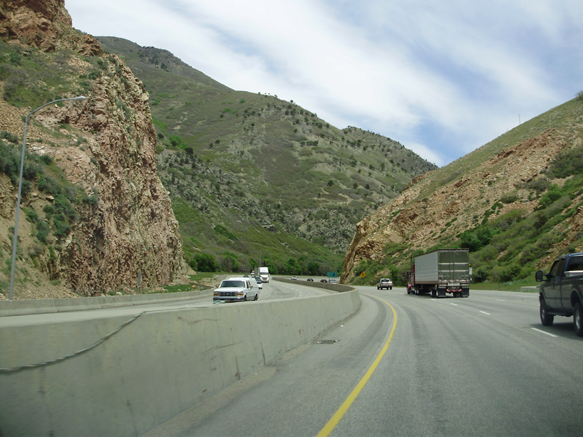
Parleys Canyon is a canyon located in the U.S. state of Utah. The canyon provides the route of Interstate 80 (I-80) (and previously the Lincoln Highway, U.S. Route 40, and a railroad) up the western slope of the Wasatch Mountains and is a relatively wide, straight canyon other than near its mouth. The mountain pass at the top of the canyon is known as Parleys Summit. With an elevation of , the pass is the highest point along I-80 in the state of Utah. Both features are named for Parley P. Pratt, an early settler of the Salt Lake Valley and leader of the Church of Jesus Christ of Latter-day Saints who surveyed the area to find a better transportation route through the Wasatch Mountains than the previous route which traversed Emigration Canyon. Description Parleys Canyon begins where I-215 merges into I-80 in Salt Lake City and ends at Parleys Summit. The lower part of the canyon is relatively twisty and narrow and had to be dynamited to make way for I-80. Despite this, the ... [...More Info...] [...Related Items...] OR: [Wikipedia] [Google] [Baidu] |
Utah Department Of Transportation
The Utah Department of Transportation (UDOT) is an agency of the state government of Utah, United States; it is usually referred to by its initials UDOT (pronounced "you-dot"). UDOT is charged with maintaining the more than of roadway that constitute the network of state highways in Utah. The agency is headquartered in the Calvin L. Rampton state office complex in Taylorsville, Utah. The executive director is Carlos Braceras with Lisa Wilson and Teri Newell as Deputy Directors. Project priorities are set forth by the independent Utah Transportation Commission, which coordinates directly with the UDOT. Structure UDOT maintains over of highways. The department is divided into four geographically defined regions and 10 functional groups: project development; operations; program development; technology and innovation; employee development; communications; policy and legislative services; audit; and finance. While the agency has maintenance stations throughout the state, for ... [...More Info...] [...Related Items...] OR: [Wikipedia] [Google] [Baidu] |
Interstate 80 In Utah
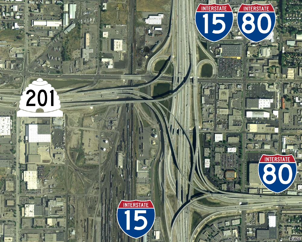
Interstate 80 (I-80) is a part of the Interstate Highway System that runs from San Francisco, California, to Teaneck, New Jersey. The portion of the highway in the US state of Utah is long through the northern part of the state. From west to east, I-80 crosses the state line from Nevada in Tooele County and traverses the Bonneville Salt Flats—which are a part of the larger Great Salt Lake Desert. It continues alongside the Wendover Cut-off—the corridor of the former Victory Highway— US Route 40 (US-40) and the Western Pacific Railroad Feather River Route. After passing the Oquirrh Mountains, I-80 enters the Salt Lake Valley and Salt Lake County. A short portion of the freeway is concurrent with I-15 through Downtown Salt Lake City. At the Spaghetti Bowl, I-80 turns east again into the mouth of Parleys Canyon and Summit County, travels through the mountain range, and intersects the eastern end of I-84 near Echo Reservoir before turning northeast toward ... [...More Info...] [...Related Items...] OR: [Wikipedia] [Google] [Baidu] |
Sugar House, Salt Lake City
Sugar House is a neighborhood in Salt Lake City, Utah. The name is officially two words, although it is often colloquially written as "Sugarhouse." As a primary commercial and residential hub of the region, it is often referred to as Salt Lake's "Second Downtown." Once a primarily residential area with a suburban-style retail hub, the neighborhood has transformed in recent years as mid-rise offices, residential blocks, and hotels have been constructed in the vicinity of Sugar House Park. Sugar House is the site of Westminster College. Overview Sugar House is home to two shopping centers that collectively feature various retailers such as clothing retailer Nordstrom Rack, bookseller Barnes & Noble, clothing retailer Old Navy, Whole Foods Market, Bed Bath & Beyond, Petco, Big 5 Sporting Goods, several fast food and family restaurants, and a luxury seating Cinemark cinema. A strip mall is located on the corner of 2100 South and 700 East. The corner of 2100 South and 1300 East f ... [...More Info...] [...Related Items...] OR: [Wikipedia] [Google] [Baidu] |
Tram
A tram (called a streetcar or trolley in North America) is a rail vehicle that travels on tramway tracks on public urban streets; some include segments on segregated right-of-way. The tramlines or networks operated as public transport are called tramways or simply trams/streetcars. Many recently built tramways use the contemporary term light rail. The vehicles are called streetcars or trolleys (not to be confused with trolleybus) in North America and trams or tramcars elsewhere. The first two terms are often used interchangeably in the United States, with ''trolley'' being the preferred term in the eastern US and ''streetcar'' in the western US. ''Streetcar'' or ''tramway'' are preferred in Canada. In parts of the United States, internally powered buses made to resemble a streetcar are often referred to as "trolleys". To avoid further confusion with trolley buses, the American Public Transportation Association (APTA) refers to them as " trolley-replica buses". In the ... [...More Info...] [...Related Items...] OR: [Wikipedia] [Google] [Baidu] |
Jordan River Parkway
The Jordan River Parkway is an approximately urban park that runs along the Jordan River within the U.S. state of Utah. The parkway follows along the river from Utah Lake in Utah County, through Salt Lake County and onto the Great Salt Lake in Davis County. The majority of a mixed-use trail has been completed with a shared-use path for cyclists, skaters, and joggers. A separate equestrian path runs on the southern portion of the trail. Many trail-heads, city and county parks and golf courses are also located along the parkway. History The parkway was conceived in 1971 primarily as a flood-control measure, but restoration of the floodplain, cleanup of pollution, adding trails and other recreational opportunities were also to be included. Requests for a river master plan included two reservoirs, the Lampton in South Jordan and the Riverton in Riverton and Draper, but plans for the reservoirs were dropped by the State Legislature in 1980. The Utah Legislature approved a bill ... [...More Info...] [...Related Items...] OR: [Wikipedia] [Google] [Baidu] |
S Line (Utah Transit Authority)
The S Line, or S-Line (formerly known as Sugar House Streetcar), is a public transit streetcar line in northeastern Salt Lake County, Utah, in the United States, that connects the business district of the Sugar House neighborhood of Salt Lake City with the neighboring city of South Salt Lake, as well as the Utah Transit Authority's (UTA) TRAX light rail system. It is a joint project between UTA, Salt Lake City, and South Salt Lake. It opened for service on December 8, 2013. It is operated by UTA and is UTA's first streetcar line. Description While fairly similar to UTA's TRAX light rail the S Line operates at a substantially slower speed, with a top speed of . The S Line also differs from TRAX in that, for the most part, it only has a single track (with passing tracks) and it operates with more frequent stops for easy pedestrian access. Other differences are that the S Line operates with a single vehicle, rather than a "train" of vehicle. Because of its slower sp ... [...More Info...] [...Related Items...] OR: [Wikipedia] [Google] [Baidu] |


