|
Otoyol 21
Otoyol 21 ( en, Motorway 21), abbreviated as O-21, a.k.a. Ankara-Tarsus Otoyolu ( en, Ankara-Tarsus Motorway), is a completed toll motorway in the Central Anatolia and Mediterranean regions in Turkey. Currently, it is connecting Otoyol 20 from Gölbaşı, Ankara with the Adana-Mersin Motorway O-51 at Tarsus in Mersin Province. On its full length, it is part of the European E90. The last part of the highway opened on 16 December 2020. Exit list See also * List of highways in Turkey The three types of intercity roads in Turkey • Motorways are controlled-access highways that are officially named '' Otoyol''. But it isn't uncommon that people in Turkey call them ''Otoban'' (referring to Autobahn) as this types of roads ent ... References External links Exit list of O-21 [...More Info...] [...Related Items...] OR: [Wikipedia] [Google] [Baidu] |
Gölbaşı, Ankara
Gölbaşı is a town and district of the Ankara Province in the Central Anatolia region of Turkey, south of the city of Ankara. According to a 2010 census, the population of the district is 95,109, 93,852 of whom live in the town of Gölbaşı. The district covers an area of , and the average elevation is . The district includes the Mogan and Eymir lakes. Although the lakes are polluted and infested with mosquitoes, the picnic areas and lakeside restaurants of Gölbaşı serve as a popular retreat from the city for the people of Ankara. A number of government departments have accommodations here, and the town is slowly but surely joining up with the city as the green space between the two disappears. Türk Telekom have their satellite ground control in the area. History Archaeological research in the area has revealed occupation since 3000 BC by a succession of civilısations including Early Bronze Age, Hittites, Phrygians, Romans, and Byzantines. Excavated sites include Sela ... [...More Info...] [...Related Items...] OR: [Wikipedia] [Google] [Baidu] |
European Route E90
European route E 90 is an A-Class West–East European route, extending from Lisbon in Portugal in the west to the Turkish– Iraqi border in the east. It is connected to the M5 of the Arab Mashreq International Road Network Itinerary The E 90 routes through five European countries, and includes four sea-crossings: Barcelona, Spain - Mazara del Vallo, Italy; Messina, Italy to Reggio Calabria, Italy; Brindisi, Italy, to Igoumenitsa, Greece, and Eceabat, Turkey, to Çanakkale, Turkey. *: Lisbon - Setúbal (Start of concurrency with ) - Landeira (End of concurrency with ) *: Landeira () - Évora (Start of concurrency with ) - Estremoz (End of concurrency with ) - Elvas *: Badajoz - Mérida () () - Madrid *: Madrid () *: Zaragoza () *: Zaragoza - Lleida - El Vendrell () *: El Vendrell (Start of concurrency with ) - Rubí (End of concurrency with ) *: Rubí () - Barcelona *: Barcelona *: Barcelona *: Barcelona Gap * Barcelona - Mazara del Val ... [...More Info...] [...Related Items...] OR: [Wikipedia] [Google] [Baidu] |
Kemerhisar
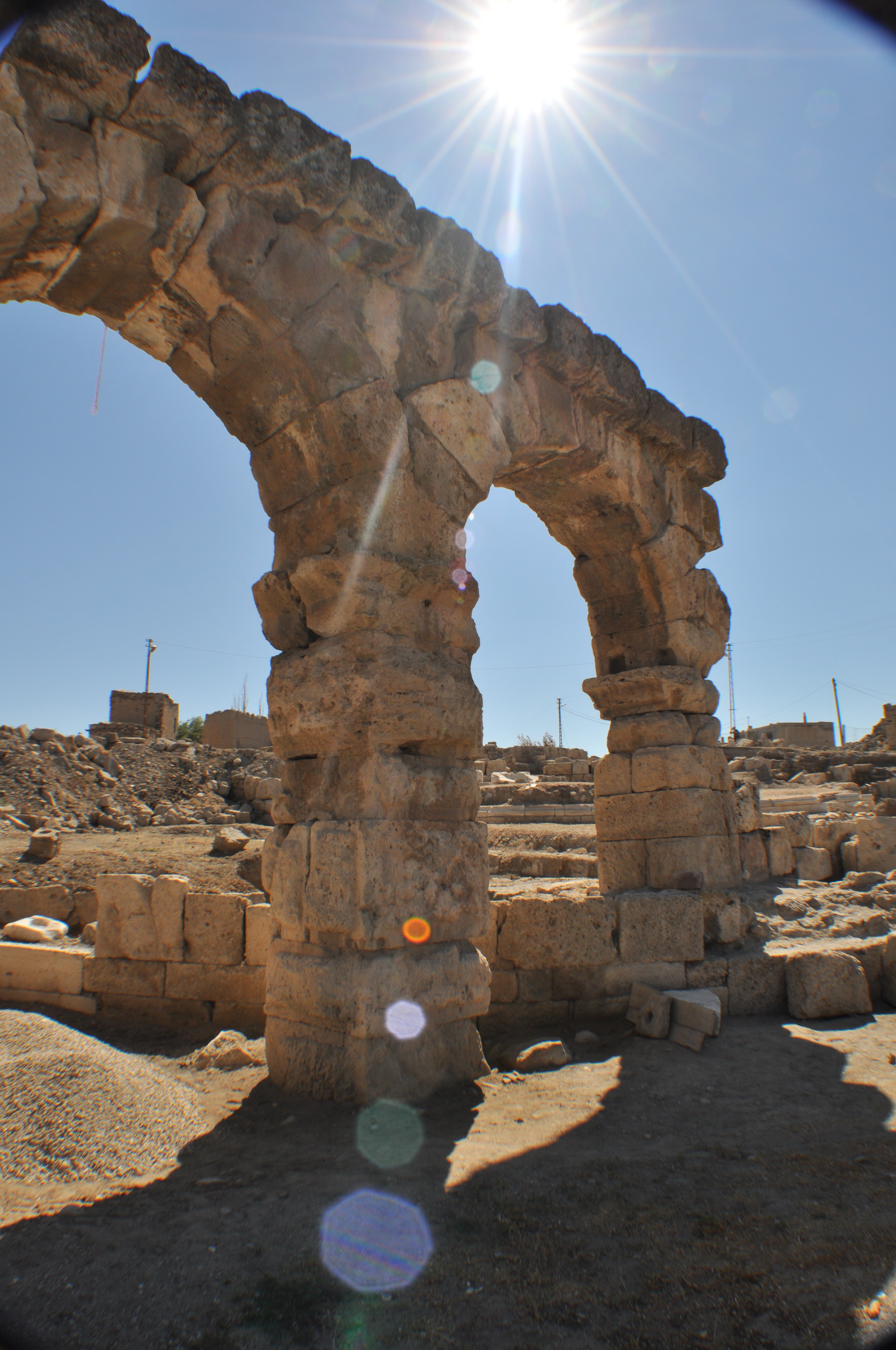
Kemerhisar is a belde (town) in Niğde Province, Turkey Geography Kemerhisar at is a part of Bor district of Niğde Province. Distance to Bor is and to Niğde is . It is only west of Bahçeli another town of Niğde. The population is 5,348 as of 2011. History The earliest name of Kemerhisar was ''Tuwanuwa''. It was an important Hitite city on the way to Cicilian Gates in Toros Mountains. During the Hellenistic age, the name was Tyana. It was briefly the capital of Cappadocia, the vassal of Roman Empire. Apollonius of Tyana, a contemporary of Christ, was born in Tyana. The town was an important settlement during Roman Empire domination and the aqueduct, which is the symbol of the town, had been constructed by the emperors Trajan and Hadrian. After the town was incorporated into the Seljuk Empire in the 11th century, the Turks Turk or Turks may refer to: Communities and ethnic groups * Turkic peoples, a collection of ethnic groups who speak Turkic languages * Tu ... [...More Info...] [...Related Items...] OR: [Wikipedia] [Google] [Baidu] |
Kayseri
Kayseri (; el, Καισάρεια) is a large industrialised city in Central Anatolia, Turkey, and the capital of Kayseri province. The Kayseri Metropolitan Municipality area is composed of five districts: the two central districts of Kocasinan and Melikgazi, and since 2004, also outlying Hacılar, İncesu and Talas. As of 31 December 2021, the province had a population of 1,434,357 of whom 1,175,886 live in the four urban districts, excluding İncesu which is not conurbated (i.e. not contiguous, having a largely non-protected buffer zone). Kayseri sits at the foot of Mount Erciyes ( Turkish: Erciyes Dağı), a dormant volcano that reaches an altitude of , more than 1,500 metres above the city's mean altitude. It contains a number of historic monuments, particularly from the Seljuk period. Tourists often pass through Kayseri en route to the attractions of Cappadocia to the west. Kayseri is served by Erkilet International Airport and is home to Erciyes Universit ... [...More Info...] [...Related Items...] OR: [Wikipedia] [Google] [Baidu] |
Nevşehir
Nevşehir (from the Persian compound ''Now-shahr'' meaning "new city"), formerly Neapolis (Ancient Greek: Νεάπολις) and Muşkara, is a largely modern city and the capital district of Nevşehir Province in the Central Anatolia Region of Turkey. According to the 2020 census, the population of the city is 82,110. It is from the capital Ankara and lies within the historical region of Cappadocia. The town lies at an elevation of and has a continental climate, with heavy snow in winter and great heat in summer. Although Nevşehir is close to the underground cities, fairy chimneys, monasteries, caravanserais and rock-hewn churches of Cappadocia, and has a few hotels, the modern town is not itself a tourist centre. In 2015 a huge underground city was discovered underneath its centre following demolition works intended to clear the central hillside of ramshackle modern housing. Founded in 2007, Nevşehir University was renamed Nevşehir Hacı Bektaş Veli University in 2013. ... [...More Info...] [...Related Items...] OR: [Wikipedia] [Google] [Baidu] |
Aksaray
Aksaray (, Koine Greek: Ἀρχελαΐς ''Arhelays'', Medieval Greek: Κολώνεια ''Koloneya'', Ancient Greek: Γαρσάουρα ''Garsaura'') is a city in the Central Anatolia region of Turkey and the capital of Aksaray Province. In 2020 the province had an estimated population of 423,011 distributed over about . The average elevation is , with the highest point being Mt. Hasan ( Turkish: ''Hasan Dağı'') at . The city of Aksaray has a long history and was an important stopover point on the Silk Road that transited Anatolia for centuries. It is a pleasant small city with the Melendiz river running through it and several monuments dating back to the pre-Ottoman era as well as some impressive examples of government buildings from the early Turkish Republic that are gathered around the main square. The nearest airport is Kapadokya Nevşehir Airport (NAV) which is 62.1 km away from the city. Etymology In antiquity the area was named ''Archelais Garsaura'', which was ... [...More Info...] [...Related Items...] OR: [Wikipedia] [Google] [Baidu] |
Ortaköy, Aksaray
Ortaköy is a town and district of Aksaray Province in the Central Anatolia region of Turkey, located north of the city of Aksaray. According to 2000 census, population of the district is 58,873 of which 26,961 live in the town of Ortaköy. The district covers an area of , and the average elevation is . This is a rural district centred on the small, quiet town of Ortaköy. History Prehistoric In Ortaköy and its surroundings, no comprehensive historical and archaeological research has been carried out on pre- and post-historical periods. It is claimed that some existing documents were destroyed by treasure hunters. Documents obtained during the excavations in Aksaray and the surrounding provinces (Acemhöyük, Alişar, Boğazköy) have also revealed the history of the region and its surroundings dating back to the Early Bronze Age. Archaeological excavations and researches to be carried out in settlements with more than one cultural level, such as Kalehöyük, Koçhasan Mound ... [...More Info...] [...Related Items...] OR: [Wikipedia] [Google] [Baidu] |
Kırşehir
Kırşehir, formerly Mocissus ( grc, Μωκισσός) and Justinianopolis (Ἰουστινιανούπολις), is a city in Turkey. It is the capital district of the Kırşehir Province. According to the 2000 census, the population of the district is 121,947 of which 105,826 live in the city of Kırşehir. The Mayor of Kırşehir is Selehattin Ekicioğlu. History The history of Kırşehir dates back to the Hittites. During the period of the Hittites, the basin of Kırşehir was known as the country of "Ahiyuva", meaning "the Land of the Achaeans", as the Greeks were known to the Hittites. This basin also took the name Cappadocia at the time of the Romans and Byzantines. Kırşehir was once known as Aquae Saravenae. The Seljuks took the city in the 1070's and bestowed the current name. In Turkish, "''Kır Şehri''" means "''steppe city''" or "''prairie city''". It became the chief town of a sanjak in the Ottoman vilayet of Angora, which possessed, 1912, 8000 inhabitan ... [...More Info...] [...Related Items...] OR: [Wikipedia] [Google] [Baidu] |
Sarıyahşi
Sarıyahşi is a town and district of Aksaray Province in the Central Anatolia region of Turkey, at a distance of from the province seat of Aksaray. According to 2000 census, population of the district is 12,120 of which 7,751 live in the town of Sarıyahşi, and the remainder in surrounding villages. The district covers an area of , and lies at an average elevation of . The district is good agricultural land watered by Hirfanlı Dam reservoir, and used for growing grain and other crops. There is a uranium Uranium is a chemical element with the symbol U and atomic number 92. It is a silvery-grey metal in the actinide series of the periodic table. A uranium atom has 92 protons and 92 electrons, of which 6 are valence electrons. Uranium is weak ... mine in the village of Bekdik and various stone quarries. The town of Sarıyahşi is a small rural centre providing schools and other basic amenities to the surrounding countryside. Notes References * * External links Gala ... [...More Info...] [...Related Items...] OR: [Wikipedia] [Google] [Baidu] |
Kulu, Konya
Kulu is a town and district of Konya Province in the Central Anatolia region of Turkey. According to the 2011 census, the population of the district is 55,573 and 22,844 of that number live in the town of Kulu. Kulu is situated approximately 110 km from Ankara and 150 km from the city of Konya. With a substantial Swedish-Turkish community, not few of whom are from this region, Swedish Prime Minister Fredrik Reinfeldt visited the city once. Climate Kulu has a semi-arid climate A semi-arid climate, semi-desert climate, or steppe climate is a dry climate sub-type. It is located on regions that receive precipitation below potential evapotranspiration, but not as low as a desert climate. There are different kinds of sem ... with hot and dry summers and cold and snowy winters. Notes References * External links District governor's official website District municipality's official website Best Private Site of Kulu KuluRadyo Tv , Kulu , Konya https://web.archiv ... [...More Info...] [...Related Items...] OR: [Wikipedia] [Google] [Baidu] |


