|
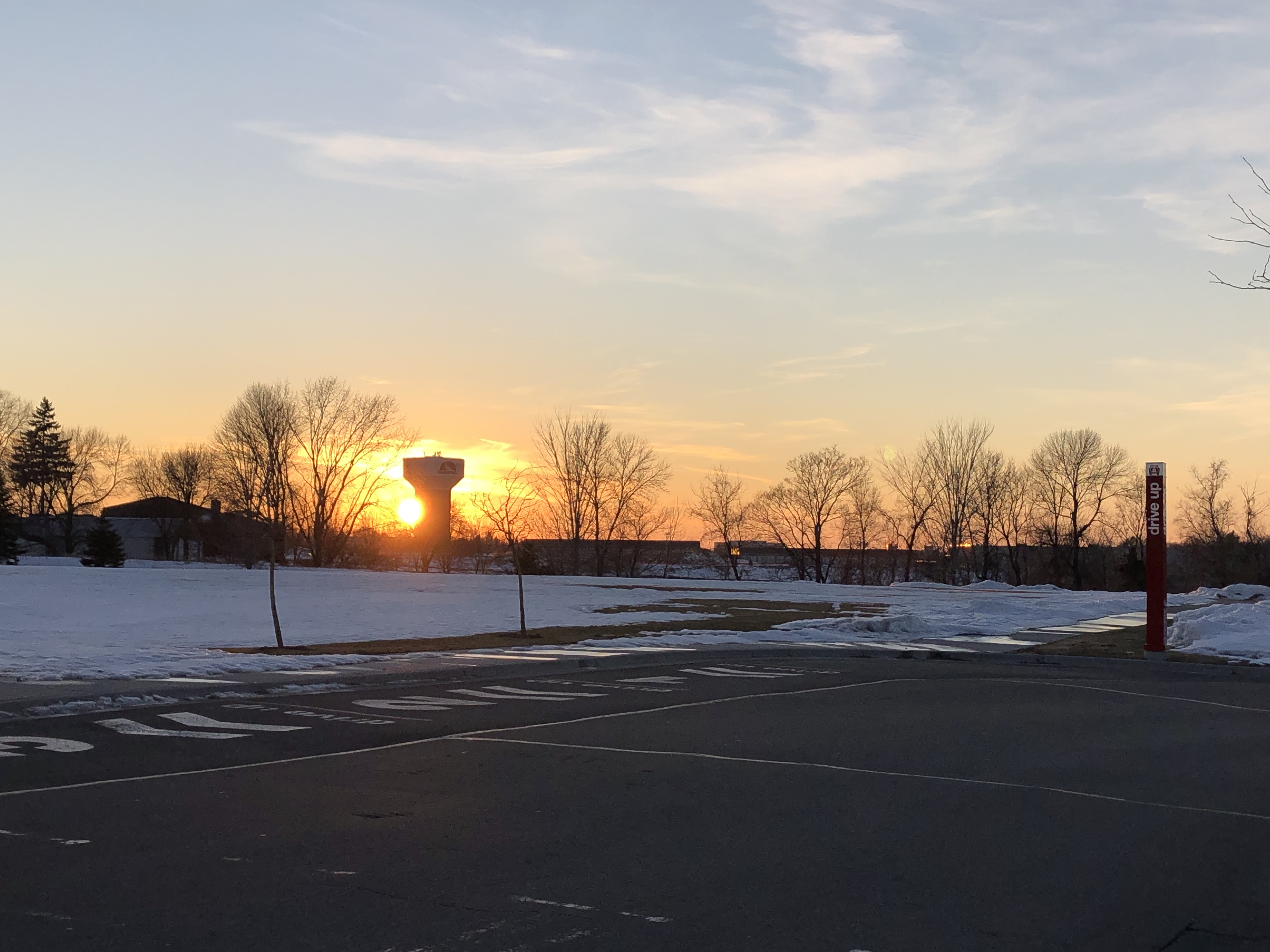
Osseo Water Tower
The Osseo Water Tower in Osseo, Minnesota, is an historic water tower listed in the National Register of Historic Places in June 5, 2017. It was listed for its historical significance to community planning and development in Osseo, because it promoted better fire fighting, provided fresh water to homes and businesses, and supported the growth of the community. It is also architecturally significant because hemispherical-bottom water towers, built from about the 1890s to about 1940, are rapidly being replaced by larger-capacity towers. Osseo residents and the Village Council had been discussing the establishment of a water works since about 1900. At that time, fire protection was only available with a bucket brigade, or with hand-pumped wells that each required six men to pump enough water to produce a strong stream. In 1914, the Osseo Commercial Club actively organized to bring water and electrical service to the village. They promoted the significant savings on fire insurance, ... [...More Info...] [...Related Items...] OR: [Wikipedia] [Google] [Baidu] |
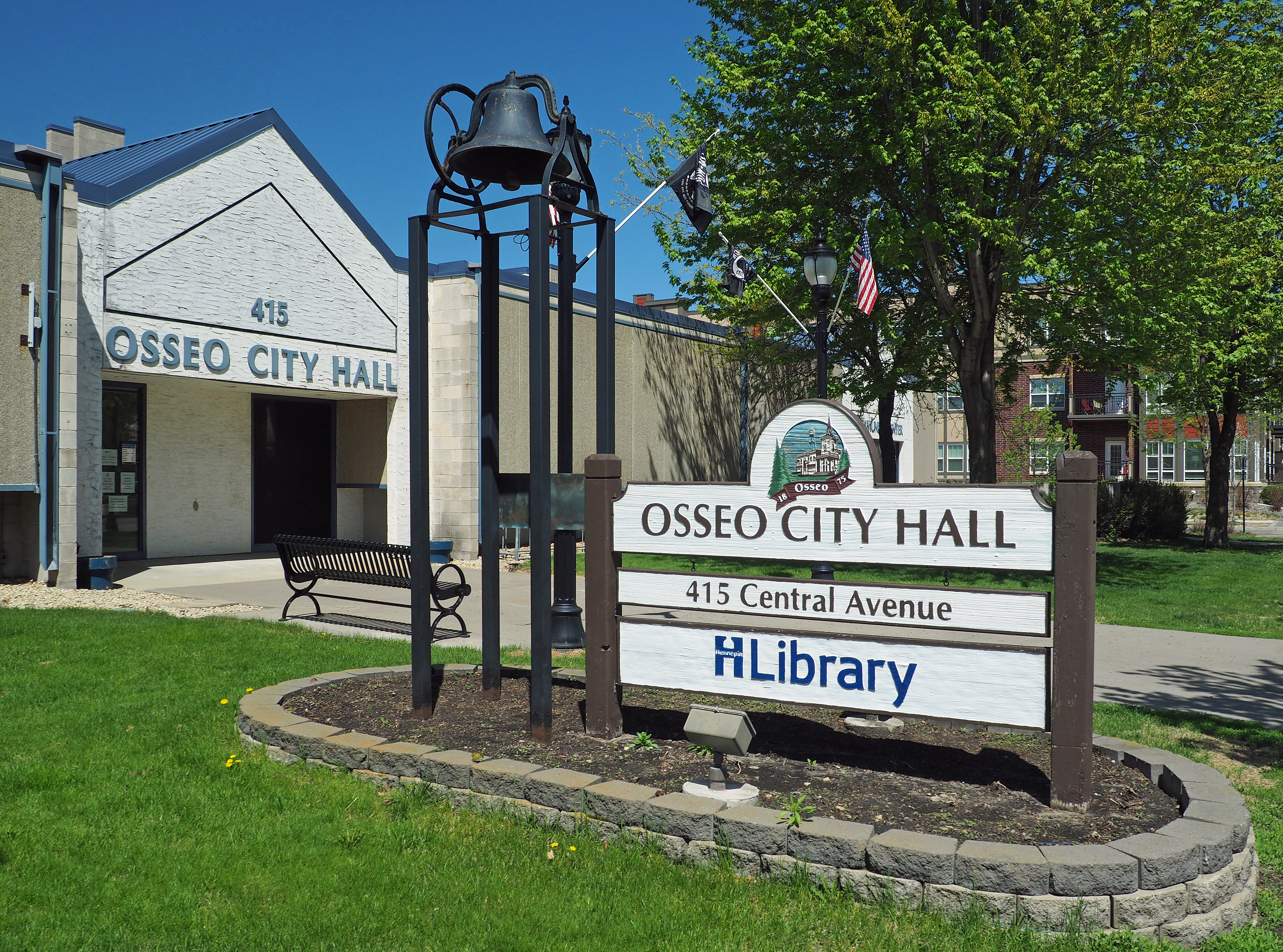
Osseo, Minnesota
Osseo is a small city in Hennepin County, Minnesota, United States. As of the 2020 census it had a population of 2,688. It is said that "Osseo" derives from the Ojibwe name ''waaseyaa'' meaning "there is light" (more commonly translated as "Son of the Evening Star"). Henry Wadsworth Longfellow mentions Osseo in his poem ''The Song of Hiawatha''. Geography Osseo is in northeastern Hennepin County, bordered by Brooklyn Park to the east and Maple Grove to the west. It has an area of , all land. There are three main transportation routes in the city. Jefferson Highway runs straight north/south through the city; the business stretch is Central Avenue. U.S. Highway 169 follows the eastern boundary. Bottineau Boulevard ( County Road 81) runs northwest through the city. History The area that is now Osseo was settled before organized local government. It was on what Pierre Bottineau named Bottineau Prairie in 1852; the community was called Palestine. In 1856 part of the town was ... [...More Info...] [...Related Items...] OR: [Wikipedia] [Google] [Baidu] |
Milaca, Minnesota
Milaca ( ) is a city and the county seat of Mille Lacs County, Minnesota. The population was 2,946 at the time of the 2010 census. It is situated on the Rum River. History A post office has been in operation at Milaca since 1883. The name Milaca is derived from shortening and alteration of Mille Lacs Lake. Geography According to the United States Census Bureau, the city has a total area of , of which is land and is water. U.S. Highway 169 and Minnesota Highway 23 are two of the main routes in the city. Demographics 2010 census As of the census of 2010, there were 2,946 people, 1,308 households, and 691 families living in the city. The population density was . There were 1,449 housing units at an average density of . The racial makeup of the city was 96.1% White, 0.4% African American, 1.4% Native American, 0.3% Asian, 0.1% from other races, and 1.6% from two or more races. Hispanic or Latino of any race were 0.6% of the population. There were 1,308 households, of w ... [...More Info...] [...Related Items...] OR: [Wikipedia] [Google] [Baidu] |
National Register Of Historic Places In Hennepin County, Minnesota
This list is of the properties and historic districts which are designated on the National Register of Historic Places or that were formerly so designated, in Hennepin County, Minnesota; there are 186 entries as of October 2021. A significant number of these properties are a result of the establishment of Fort Snelling, the development of water power at Saint Anthony Falls, and the thriving city of Minneapolis that developed around the falls. Many historic sites outside the Minneapolis city limits are associated with pioneers who established missions, farms, and schools in areas that are now suburbs in that metropolitan area. Historical background Father Louis Hennepin was the first European explorer to visit and name Saint Anthony Falls, the tallest waterfall on the Mississippi River, in 1680. While the falls were familiar to the Ojibwe and Sioux Indians who lived in the area, Father Hennepin spread word of the falls when he returned to France in 1683. The land east of the Missi ... [...More Info...] [...Related Items...] OR: [Wikipedia] [Google] [Baidu] |
Buildings And Structures In Hennepin County, Minnesota
A building, or edifice, is an enclosed structure with a roof and walls standing more or less permanently in one place, such as a house or factory (although there's also portable buildings). Buildings come in a variety of sizes, shapes, and functions, and have been adapted throughout history for a wide number of factors, from building materials available, to weather conditions, land prices, ground conditions, specific uses, prestige, and aesthetic reasons. To better understand the term ''building'' compare the list of nonbuilding structures. Buildings serve several societal needs – primarily as shelter from weather, security, living space, privacy, to store belongings, and to comfortably live and work. A building as a shelter represents a physical division of the human habitat (a place of comfort and safety) and the ''outside'' (a place that at times may be harsh and harmful). Ever since the first cave paintings, buildings have also become objects or canvasses of much artistic ... [...More Info...] [...Related Items...] OR: [Wikipedia] [Google] [Baidu] |
1915 Establishments In Minnesota
Events Below, the events of World War I have the "WWI" prefix. January *January – British physicist Sir Joseph Larmor publishes his observations on "The Influence of Local Atmospheric Cooling on Astronomical Refraction". *January 1 ** WWI: British Royal Navy battleship HMS ''Formidable'' is sunk off Lyme Regis, Dorset, England, by an Imperial German Navy U-boat, with the loss of 547 crew. **Battle of Broken Hill: A train ambush near Broken Hill, New South Wales, Australia, is carried out by two men (claiming to be in support of the Ottoman Empire) who are killed, together with 4 civilians. * January 5 – Joseph E. Carberry sets an altitude record of , carrying Capt. Benjamin Delahauf Foulois as a passenger, in a fixed-wing aircraft. * January 12 ** The United States House of Representatives rejects a proposal to give women the right to vote. ** ''A Fool There Was'' premières in the United States, starring Theda Bara as a ''femme fatale''; she quickly becomes one of ... [...More Info...] [...Related Items...] OR: [Wikipedia] [Google] [Baidu] |
Waconia, Minnesota
Waconia ( ) is a city in Carver County, Minnesota, United States. Waconia attracts visitors to nearby Lake Waconia, a lake locally renowned for its fishing and recreation opportunities. The city's population was 13,033 at the 2020 census. Geography According to the United States Census Bureau, the city has a total area of , of which is land and is water. Minnesota State Highways 5 and 284; and Carver County Highway 10 are the main routes in Waconia. Demographics 2000 census As of the census of 2000, there were 6,814 people, 2,568 households, and 1,848 families living in the city. The population density was . There were 2,646 housing units at an average density of . The racial makeup of the city was 97.06% White, 0.34% African American, 0.12% Native American, 0.65% Asian, 0.01% Pacific Islander, 1.00% from other races, and 0.82% from two or more races. Hispanic or Latino of any race were 1.28% of the population. There were 2,568 households, out of which 40.7% had ... [...More Info...] [...Related Items...] OR: [Wikipedia] [Google] [Baidu] |
Minnetonka Beach, Minnesota
Minnetonka Beach is a community in Hennepin County, Minnesota, United States. The population was 539 at the 2010 census. History Minnetonka Beach is located on the shores of Lake Minnetonka. Originally part of Excelsior Township, Minnetonka Beach was the site of the Hotel Lafayette, which was built by the Minneapolis, Saint Paul, & Manitoba Railway (later part of the Great Northern Railway) in 1882. In 1884, Minnetonka Beach was annexed by Medina Township. The community was incorporated as an independent village in 1894. After the Hotel Lafayette burned in 1897, a portion of the property became home to the Lafayette Club. The original clubhouse of the Lafayette Club was built in 1900 and burned in 1922. The current clubhouse was constructed in 1924. Geography According to the United States Census Bureau, the city has a total area of , of which is land and is water. County 15 serves as a main route. Demographics 2010 census As of the census of 2010, there were 539 peop ... [...More Info...] [...Related Items...] OR: [Wikipedia] [Google] [Baidu] |
Robbinsdale, Minnesota
Robbinsdale is a city in Hennepin County, Minnesota,. The population was 13,953 at the time of the 2010 census. Geography According to the United States Census Bureau, the city has a total area of , of which is land and is water. Minnesota State Highway 100 and County Road 81 are two of the main routes in the city. History Shortly after the Minnesota Territorial Legislative Assembly created Hennepin County in 1852, John C. Bohanon filed the first claim in the Township of Crystal Lake. Railroads didn't reach the area until 1880. A flag station was established near the farm of Alfred Parker and six years later he donated land for a depot. The community that grew around it came to be known as Parker's Station. In 1887 Minneapolis made an effort to secure more taxable property by annexing neighboring townships. In response, Crystal Lake farmers incorporated the Village of Crystal. Later that year, entrepreneur and real estate developer, Andrew B. Robbins came to Parker's Stati ... [...More Info...] [...Related Items...] OR: [Wikipedia] [Google] [Baidu] |
Hampton, Minnesota
Hampton is a city in Dakota County, Minnesota, United States. The population was 689 at the 2010 census. History A post office called Hampton has been in operation since 1856. The city took its name from Hampton Township. Geography According to the United States Census Bureau, the city has a total area of , of which is land and is water. Main routes in the community include U.S. Highway 52; State Highways 50 and 56; County Road 47 and County Road 78. The city of Hampton is within Hampton Township geographically but is a separate entity. Demographics 2010 census As of the census of 2010, there were 689 people, 245 households, and 175 families living in the city. The population density was . There were 268 housing units at an average density of . The racial makeup of the city was 95.6% White, 1.0% African American, 0.3% Native American, 0.6% Asian, 0.4% from other races, and 2.0% from two or more races. Hispanic or Latino of any race were 2.3% of the population. The ... [...More Info...] [...Related Items...] OR: [Wikipedia] [Google] [Baidu] |
National Register Of Historic Places
The National Register of Historic Places (NRHP) is the United States federal government's official list of districts, sites, buildings, structures and objects deemed worthy of preservation for their historical significance or "great artistic value". A property listed in the National Register, or located within a National Register Historic District, may qualify for tax incentives derived from the total value of expenses incurred in preserving the property. The passage of the National Historic Preservation Act (NHPA) in 1966 established the National Register and the process for adding properties to it. Of the more than one and a half million properties on the National Register, 95,000 are listed individually. The remainder are contributing resources within historic districts. For most of its history, the National Register has been administered by the National Park Service (NPS), an agency within the U.S. Department of the Interior. Its goals are to help property owners and inte ... [...More Info...] [...Related Items...] OR: [Wikipedia] [Google] [Baidu] |
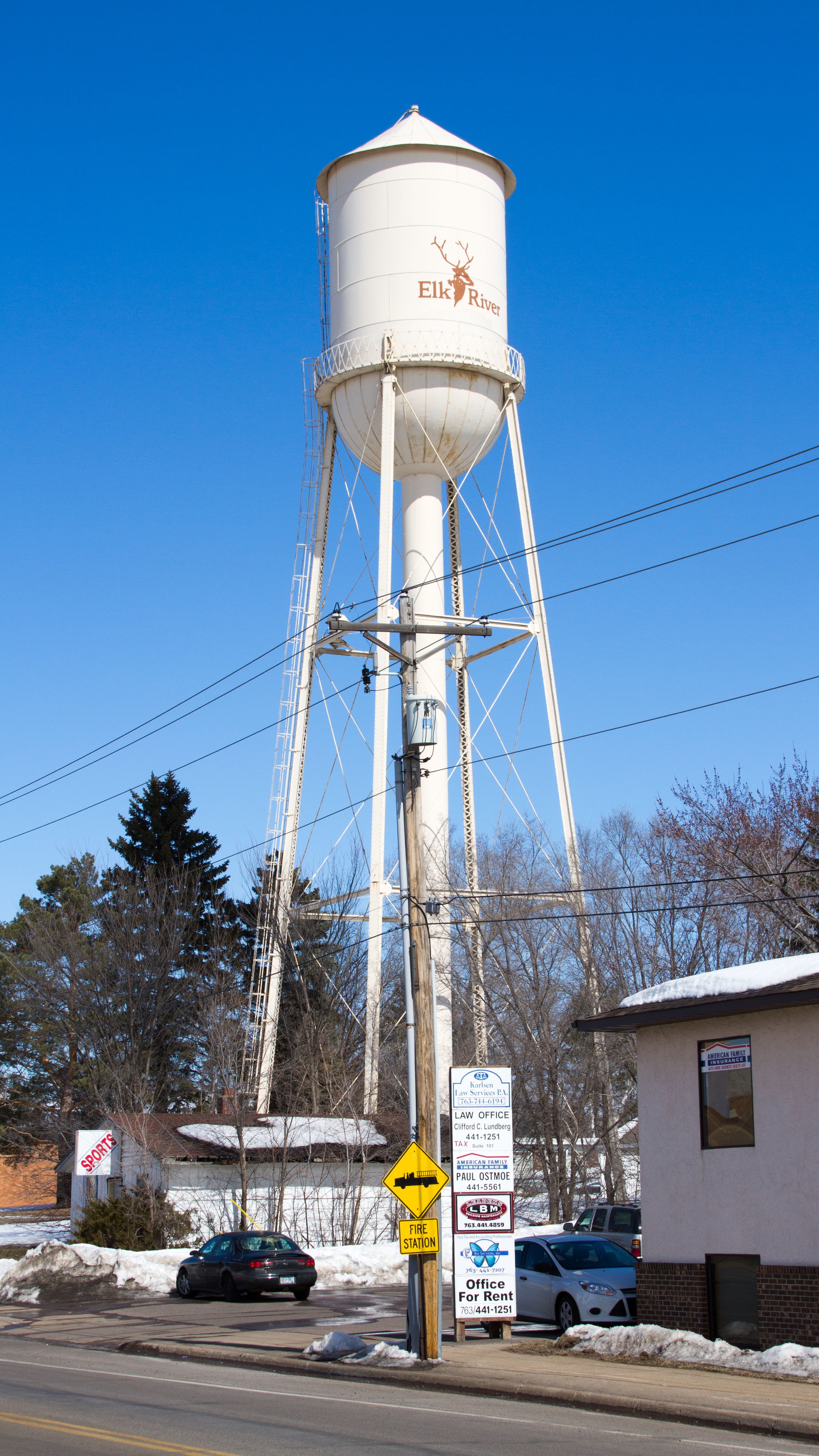
Elk River Water Tower
The Elk River Water Tower is a historic water tower in Elk River, Minnesota, United States. It was built in 1920 to improve the city's firefighting infrastructure, and uses a design popular from 1890 to 1940. It was listed on the National Register of Historic Places The National Register of Historic Places (NRHP) is the United States federal government's official list of districts, sites, buildings, structures and objects deemed worthy of preservation for their historical significance or "great artistic v ... in 2012 for its significance in the themes of "community planning and development" and "engineering". It was nominated for its impact on community development and as a representative of a once-common but vanishing design. In 2021, Elk River was able to restore the water tower using Minnesota Historical and Cultural Heritage Grants. The tower was returned to its original color scheme of silver with a red top, with black block lettering of the city's name. See also ... [...More Info...] [...Related Items...] OR: [Wikipedia] [Google] [Baidu] |
Elk River, Minnesota
Elk River is a city in Sherburne County, Minnesota, United States, approximately 34 miles northwest of Minneapolis. It is situated at the confluence of the Mississippi and Elk Rivers. The population was 25,835 at the 2020 census, making Elk River the second largest city in the Central Minnesota region after St. Cloud. It is the county seat. U.S. Highways 10 and 169 and State Highway 101 are three of the main routes in Elk River, and a station on the Northstar Commuter Rail line to downtown Minneapolis is located in the city. Elk River is located 33.2 miles northwest of Minneapolis and 37.4 miles southeast of St. Cloud. History The hardwood-forested hills in which Elk River is situated was pushed up by the last glacier that advanced across Minnesota. These hills are made up of coarse materials which is the reason gravel mining is so prevalent in Elk River, and also the reason much of the area is not considered good farmland for culture and agriculture use. To the south of ... [...More Info...] [...Related Items...] OR: [Wikipedia] [Google] [Baidu] |


