|
Osismii
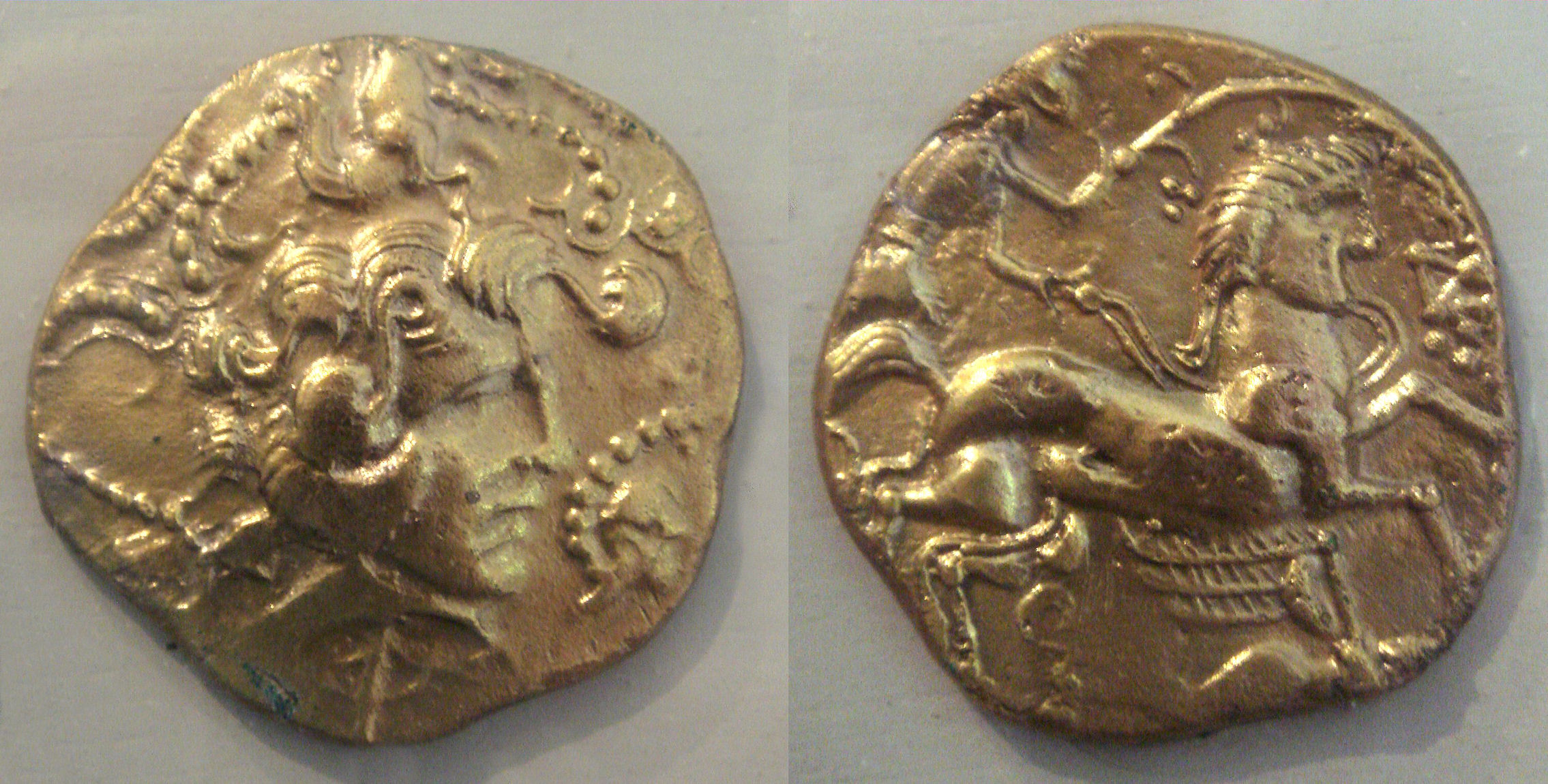
The Osismii, Ossismii, or Ostimii (also Ossismi, Osismi) were a Gallic tribe dwelling in the western part of the Armorican Peninsula (modern Brittany) during the Iron Age and the Roman period. Etymology They are mentioned as ''Osismos'' and ''Osismi'' (var. ''ossismi'') by Caesar (mid-1st c. BC), ''O̓sísmioi'' (Ὀσίσμιοι) by Strabo (early 1st c. AD), ''Ossismos'' by Pliny (1st c. AD), ''O̓sismíous'' (Ὀσισμίους; var. Ὀσίσμιοι, Ὀσισμαίους) by Ptolemy (2nd c. AD), and as ''Osismis'' in the ''Notitia Dignitatum'' (5th c. AD)., s.v. ''Osismii''. According to Strabo, the Massaliote explorer Pytheas, who travelled to northwestern Europe in the late 4th century BC, reported the variant ''Ōstimíous'' (Ὠστιμίους), which seems to be the earliest attested form of the name, documented before the Gaulish sound shift -''st''- > -''ss''- occurred. The Gaulish ethnonym ''Ostim(i)i'' (sing. ''Ostim(i)os'') literally means 'the ultimate', ... [...More Info...] [...Related Items...] OR: [Wikipedia] [Google] [Baidu] |
Veneti (Gaul)
The Venetī (, Gaulish language, Gaulish: ''Uenetoi'') were a Gauls, Gallic tribe dwelling in Armorica, in the northern part of the Brittany Peninsula, during the La Tène culture, Iron Age and the Roman period. A seafaring people, the Veneti strongly influenced southwestern Celtic Britons, Brittonic culture through trading relations with Great Britain. After they were defeated by Decimus Junius Brutus Albinus, Junius Brutus Albinus in a naval battle in 56 BC, their maritime commerce eventually declined under the Roman Empire, but a prosperous agricultural life is indicated by archaeological evidence. Name They are mentioned as ''Venetos'' by Julius Caesar, Caesar (mid-1st c. BC), Livy (late 1st c. BC) and Pliny the Elder, Pliny (1st c. AD), ''Ouénetoi'' (Οὐένετοι) by Strabo (early 1st c. AD) and Ptolemy (2nd c. AD), ''Veneti'' on the ''Tabula Peutingeriana'' (5th c. AD), and as ''Benetis'' in the ''Notitia Dignitatum'' (5th c. AD). The ethnonym ''Venetī'' is a la ... [...More Info...] [...Related Items...] OR: [Wikipedia] [Google] [Baidu] |
Brittany
Brittany (; french: link=no, Bretagne ; br, Breizh, or ; Gallo language, Gallo: ''Bertaèyn'' ) is a peninsula, Historical region, historical country and cultural area in the west of modern France, covering the western part of what was known as Armorica during the period of Roman occupation. It became an Kingdom of Brittany, independent kingdom and then a Duchy of Brittany, duchy before being Union of Brittany and France, united with the Kingdom of France in 1532 as a provinces of France, province governed as a separate nation under the crown. Brittany has also been referred to as Little Britain (as opposed to Great Britain, with which it shares an etymology). It is bordered by the English Channel to the north, Normandy to the northeast, eastern Pays de la Loire to the southeast, the Bay of Biscay to the south, and the Celtic Sea and the Atlantic Ocean to the west. Its land area is 34,023 km2 . Brittany is the site of some of the world's oldest standing architecture, ho ... [...More Info...] [...Related Items...] OR: [Wikipedia] [Google] [Baidu] |
Brittany Peninsula
Brittany (; french: link=no, Bretagne ; br, Breizh, or ; Gallo: ''Bertaèyn'' ) is a peninsula, historical country and cultural area in the west of modern France, covering the western part of what was known as Armorica during the period of Roman occupation. It became an independent kingdom and then a duchy before being united with the Kingdom of France in 1532 as a province governed as a separate nation under the crown. Brittany has also been referred to as Little Britain (as opposed to Great Britain, with which it shares an etymology). It is bordered by the English Channel to the north, Normandy to the northeast, eastern Pays de la Loire to the southeast, the Bay of Biscay to the south, and the Celtic Sea and the Atlantic Ocean to the west. Its land area is 34,023 km2 . Brittany is the site of some of the world's oldest standing architecture, home to the Barnenez, the Tumulus Saint-Michel and others, which date to the early 5th millennium BC. Today, the historical p ... [...More Info...] [...Related Items...] OR: [Wikipedia] [Google] [Baidu] |
Carhaix-Plouguer
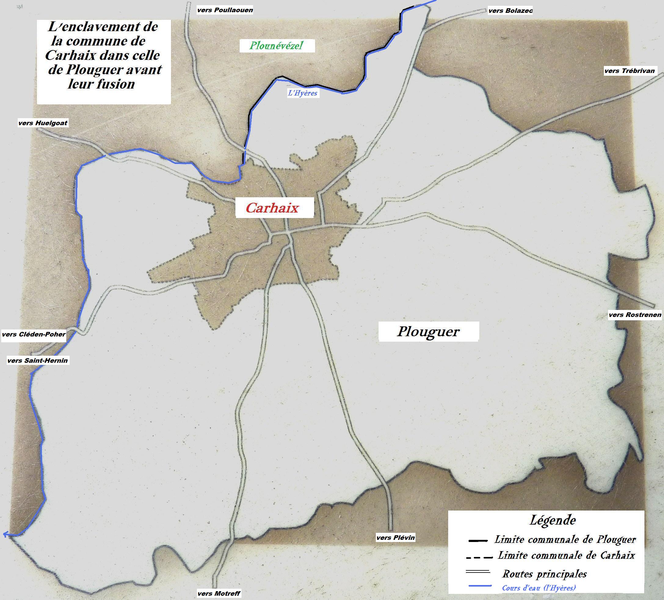
Carhaix-Plouguer (; br, Karaez-Plougêr ), commonly known as just Carhaix (), is a commune in the French department of Finistère, region of Brittany, France.Commune de Carhaix-Plouguer (29024) INSEE The commune was created in 1957 by the merger of the former communes Carhaix and Plouguer. Geography  Carhaix is located in the Poher, an important territory of Brittany, sandwiched between the Arrée Mountains to th ...
[...More Info...] [...Related Items...] OR: [Wikipedia] [Google] [Baidu] |
Gauls
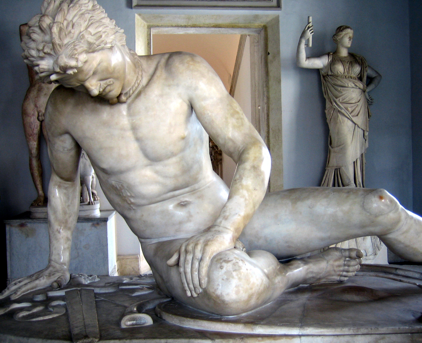
The Gauls ( la, Galli; grc, Γαλάται, ''Galátai'') were a group of Celtic peoples of mainland Europe in the Iron Age and the Roman period (roughly 5th century BC to 5th century AD). Their homeland was known as Gaul (''Gallia''). They spoke Gaulish, a continental Celtic language. The Gauls emerged around the 5th century BC as bearers of La Tène culture north and west of the Alps. By the 4th century BC, they were spread over much of what is now France, Belgium, Switzerland, Southern Germany, Austria, and the Czech Republic, by virtue of controlling the trade routes along the river systems of the Rhône, Seine, Rhine, and Danube. They reached the peak of their power in the 3rd century BC. During the 4th and 3rd centuries BC, the Gauls expanded into Northern Italy ( Cisalpine Gaul), leading to the Roman–Gallic wars, and into the Balkans, leading to war with the Greeks. These latter Gauls eventually settled in Anatolia, becoming known as Galatians. After the ... [...More Info...] [...Related Items...] OR: [Wikipedia] [Google] [Baidu] |
Armorica
Armorica or Aremorica (Gaulish: ; br, Arvorig, ) is the name given in ancient times to the part of Gaul between the Seine and the Loire that includes the Brittany Peninsula, extending inland to an indeterminate point and down the Atlantic Coast. Name The name ''Armorica'' is a Latinized form of the Gaulish toponym , which literally means 'place in front of the sea'. It is formed with the prefix ''are''- ('in front of') attached to -''mori''- ('sea') and the feminine suffix ''-(i)cā'', denoting the localization (or provenance). The inhabitants of the region were called ''Aremorici'' (sing. ''Aremoricos''), formed with the stem ''are-mori''- extended by the determinative suffix -''cos''. It is glossed by the Latin ''antemarini'' in Endlicher's Glossary. The Slavs use a similar formation, ''Po-mor-jane'' ('those in front of the sea'), to designate the inhabitants of Pomerania. The Latin adjective ''Armoricani'' was an administrative term designating in particular a sector of the ... [...More Info...] [...Related Items...] OR: [Wikipedia] [Google] [Baidu] |
Audierne
Audierne (; br, Gwaien) is a commune in the Finistère department of Brittany in northwestern France. On 1 January 2016 the former commune of Esquibien merged into Audierne. 16 October 2015 The town lies on a at the mouth of the Goyen river and for centuries was a fishing village, with a wide sandy beach. Visitors can take a boat from Audierne's port of Esquibien to the . The harbour, formerly important to the local fishing industry, is now essentially a |
Douarnenez
Douarnenez (, ; meaning ''douar'' (land) ''an enez'' (the island) or land of the island), is a commune in the French department of Finistère, region of Brittany, northwestern France. It is located at the mouth of the Pouldavid River, an estuary on the southern shore of Douarnenez Bay in the Atlantic Ocean, north-west of Quimper. The population in 2008 was 15,066. It has declined since the mid-20th century because of jobs lost from declines in the fishing industry. But it still has fish canning facilities (sardines and mackerel) although sardine fishing, for which the town became famous, has fallen off in recent years. Douarnenez has a growing tourist industry, with numerous visitors attracted annually to its pleasant location and warm climate, and also because of its marinas, maritime museum, regattas and sandy beaches. The island of Tristan off Douarnenez can be reached by foot at low tide. It is linked to the legend of Tristan and Iseult from the times of King Arthur. Hist ... [...More Info...] [...Related Items...] OR: [Wikipedia] [Google] [Baidu] |
Cap-Sizun
The Cap Sizun (; br, Ar C'hab) is a headland forming the western extremity of the Cornouaille, in the French département of Finistère in Brittany, corresponding to the former canton of Pont-Croix. The best known sites in this region are the pointe du Raz, the pointe du Van, and, between these two points, the baie des Trépassés. The Cap Sizun reaches out into the Atlantic Ocean, bordered to the north by the baie de Douarnenez, and to the south by the baie d'Audierne. The territory of Cap Sizun is formed by the communes of Pont-Croix, Audierne, Plouhinec, Confort-Meilars, Mahalon, Esquibien, Beuzec-Cap-Sizun, Goulien, Cléden-Cap-Sizun, Primelin, Plogoff Plogoff (; br, Plougoñ) is a commune in the Finistère department of Brittany in north-western France. It contains three small ports suitable for small vessels: Pors-Loubous, Feunten-Aod and Bestrée. Local industries include tourism, tradition ... and the Île-de-Sein. This territory is covered by a commonality of ... [...More Info...] [...Related Items...] OR: [Wikipedia] [Google] [Baidu] |
Pointe Du Raz
The Pointe du Raz is a promontory that extends into the Atlantic from western Brittany, in France. The local Breton name is ''Beg ar Raz''. It is the western point of the ''commune'' of Plogoff, Finistère. It is named after the ''Raz de Sein'', the dangerous stretch of water between it and the island of Sein (''Enez Sun'' in Breton). It is a dramatic place of crashing waves and strong winds. The word ''raz'' was borrowed from Norman by the Bretons and shares the same etymology as the English word race, "strong current of water"; both are from Old Norse ''rás''. It also marks the western end of the 3,200 km E5 European long distance path to Venice in Italy. The "La Vieille" lighthouse can be clearly seen from the headland. Although it is not quite the westernmost extent of France—that would be Pointe de Corsen, just to the north—its rocky isolation makes it a popular tourist destination, comparable in some ways to Land's End Land's End ( kw, Penn an Wlas or ''Ped ... [...More Info...] [...Related Items...] OR: [Wikipedia] [Google] [Baidu] |
Crozon
Crozon (, ; br, Kraozon, , ) is a commune in the department of Finistère and the administrative region of Brittany, northwestern France. As well as the town of Crozon, the village of Morgat is part of the commune. Crozon is located on the Crozon peninsula on the west coast of Finistère. It is bordered by the communes of Camaret-sur-Mer to the west, Roscanvel to the northwest, Lanvéoc to the north, Landévennec to the north-east and Telgruc-sur-Mer to the east. Crozon is the chef-lieu of the arrondissement of Châteaulin. Louis Jouvet, a French actor, was born in Crozon in 1887. Crozon harbours Île Longue, the base of the French strategic nuclear submarines. Tourism In common with many other French towns, Crozon has a number of fêtes and festivals at various times of year. Probably the best known festival held in Crozon is the ''Festival du Bout du Monde'' ("World's End Festival"), a live music festival held on the first weekend in August. Crozon has various shops and a co ... [...More Info...] [...Related Items...] OR: [Wikipedia] [Google] [Baidu] |
Ploumoguer
Ploumoguer (; ) is a Communes of France, commune in the Finistère Departments of France, department of Brittany (administrative region), Brittany in north-western France. Population Inhabitants of Ploumoguer are called in French language, French ''Ploumoguérois''. Notable people * Jean Causeur - 1643–1771, butcher who was said to have lived to 131 years of age. Modern scrutiny of his birth records reveal that he was probably born in around 1665, making his age of death around 109 years, still an exceptional age for his time.L.-L. B. Petersen and B. Jeune, ISSN 0909-119X , Odense, 2003; http://www.demogr.mpg.de/books/odense/6/03.htm See also *Communes of the Finistère department References External links Official website *Mayors of Finistère Association Communes of Finistère {{Finistère-geo-stub ... [...More Info...] [...Related Items...] OR: [Wikipedia] [Google] [Baidu] |


