|
Osa Fjord
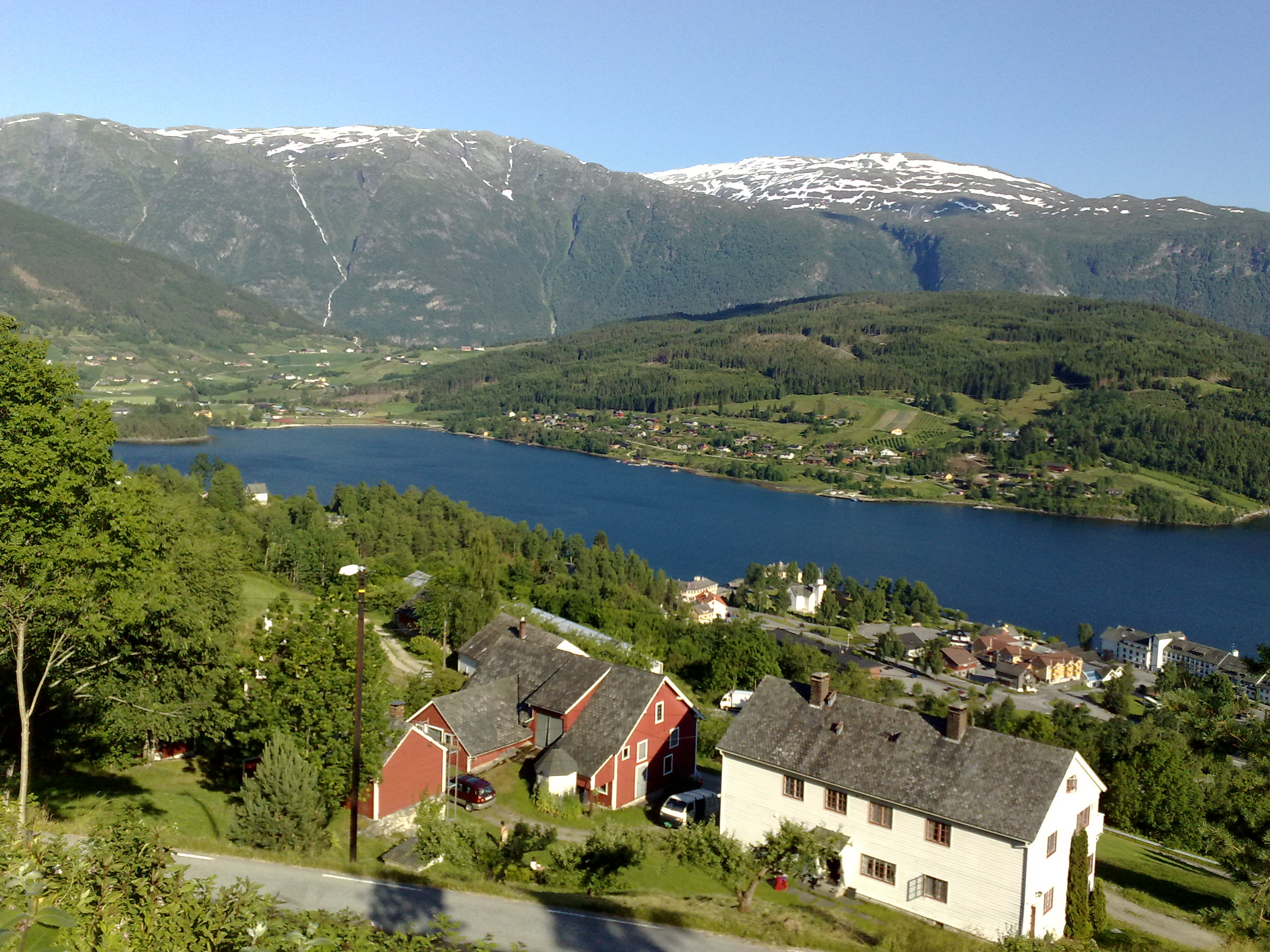
The Osa Fjord ( no, Osafjorden) is a branch of the Eid Fjord and the Hardanger Fjord fully located within the municipality of Ulvik in Vestland county, Norway. The fjord is long, with a maximum depth of at its mouth, and it runs northeast from its mouth between Bruravik and Bagnsnes to the head of the fjord at the small village of Osa. On the west side, the Ulvik Fjord extends to the north to the municipal center of Ulvik. The outermost part of the Osa Fjord is also known as the Bagns Fjord ( no, Bagnsfjorden), named after the headland where the fjord starts. At Bruravik there was formerly a ferry connection across the Eid Fjord to Brimnes in the municipality of Eidfjord Eidfjord is a municipality in Vestland county, Norway. The municipality is located in the traditional district of Hardanger. The administrative centre of the municipality is the village of Eidfjord, where the majority of the municipal popula .... Norwegian County Road 572 runs along the west side o ... [...More Info...] [...Related Items...] OR: [Wikipedia] [Google] [Baidu] |
Vestland
Vestland is a county in Norway established on 1 January 2020. The county is located in Western Norway and it is centred around the city of Bergen, Norway's second largest city. The administrative centre of the county is the city of Bergen, where the executive and political leadership is based, but the County Governor is based in Hermansverk. The county is one of two counties in Norway that have Nynorsk as their official written language form (the others are neutral as to which form people use). Vestland was created in 2020 when the former counties of Hordaland and Sogn og Fjordane (with the exception of Hornindal municipality, which became part of Volda municipality in Møre og Romsdal county) were merged. History Vestland county is a newly created county, but it has been inhabited for centuries. The area was made up of many petty kingdoms under the Gulating during the Middle Ages. The northern part was the known as ''Firdafylke'' (now the Fjordane region; Nordfjord-Sunnfjord), ... [...More Info...] [...Related Items...] OR: [Wikipedia] [Google] [Baidu] |
Ulvik (village)
Ulvik is a village in the municipality of Ulvik which is located in Vestland county, Norway. The village sits at the end of the Ulvikafjorden, a side arm off of the main Hardangerfjord. The village lies about north of the Hardanger Bridge and about east of the village of Vossevangen. The village has a population (2019) of 534 and a population density of . The centre of the village is called "Brakanes" and it is located at the mouth of the river Tysso. This is the downtown part of the village and it includes most of the commercial areas including a cinema as well as Ulvik Church, the only church in the municipality. Brakanes School is a primary and lower secondary school (and the only school in Ulvik). The school has about 150 students that attend there. History The village centre of Ulvik was burned by the Germans , native_name_lang = de , region1 = , pop1 = 72,650,269 , region2 = , pop2 = 534,000 , region3 ... [...More Info...] [...Related Items...] OR: [Wikipedia] [Google] [Baidu] |
List Of Norwegian Fjords ...
This list of Norwegian fjords shows many of the fjords in Norway. In total, there are about 1,190 fjords in Norway and the Svalbard islands. The sortable list includes the lengths and locations of those fjords. Fjords See also * List of glaciers in Norway * Geography of Norway {{Authority control Fjords Norway Fjords In physical geography, a fjord or fiord () is a long, narrow inlet with steep sides or cliffs, created by a glacier. Fjords exist on the coasts of Alaska, Antarctica, British Columbia, Chile, Denmark, Germany, Greenland, the Faroe Islands, Icela ... [...More Info...] [...Related Items...] OR: [Wikipedia] [Google] [Baidu] |
Norwegian County Road 300 (Hordaland)
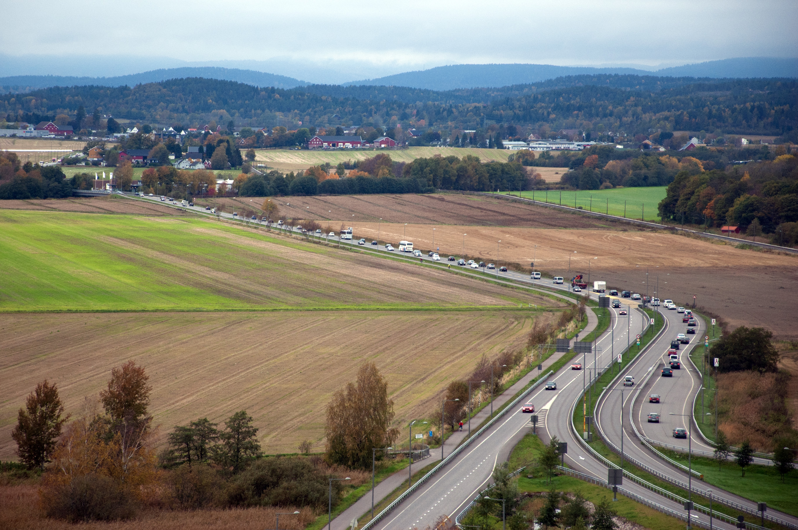
County Road 300 ( no, Fylkesvei 300) or Ringveg nord ( en, Ring Road North) is a bypass road running along the north side of the town of Tønsberg in Tønsberg Municipality in Vestfold county, Norway. The road is long and it connects the eastern part of Tønsberg, via the Frodeåsen Tunnel, to the European route E18 highway in the village of Sem. The road opened on 13 March 2008. References 300 300 __NOTOC__ Year 300 (Roman numerals, CCC) was a leap year starting on Monday (link will display the full calendar) of the Julian calendar. At the time, it was known as the Year of the Consulship of Constantius and Valerius (or, less frequently, ... Tønsberg {{Norway-road-stub ... [...More Info...] [...Related Items...] OR: [Wikipedia] [Google] [Baidu] |
Norwegian County Road 572
Norwegian, Norwayan, or Norsk may refer to: *Something of, from, or related to Norway, a country in northwestern Europe *Norwegians, both a nation and an ethnic group native to Norway *Demographics of Norway *The Norwegian language, including the two official written forms: **Bokmål, literally "book language", used by 85–90% of the population of Norway **Nynorsk, literally "New Norwegian", used by 10–15% of the population of Norway *The Norwegian Sea Norwegian or may also refer to: Norwegian *Norwegian Air Shuttle, an airline, trading as Norwegian **Norwegian Long Haul, a defunct subsidiary of Norwegian Air Shuttle, flying long-haul flights *Norwegian Air Lines, a former airline, merged with Scandinavian Airlines in 1951 *Norwegian coupling, used for narrow-gauge railways *Norwegian Cruise Line, a cruise line *Norwegian Elkhound, a canine breed. *Norwegian Forest cat, a domestic feline breed *Norwegian Red, a breed of dairy cattle *Norwegian Township, Schuylkill County, ... [...More Info...] [...Related Items...] OR: [Wikipedia] [Google] [Baidu] |
Eidfjord
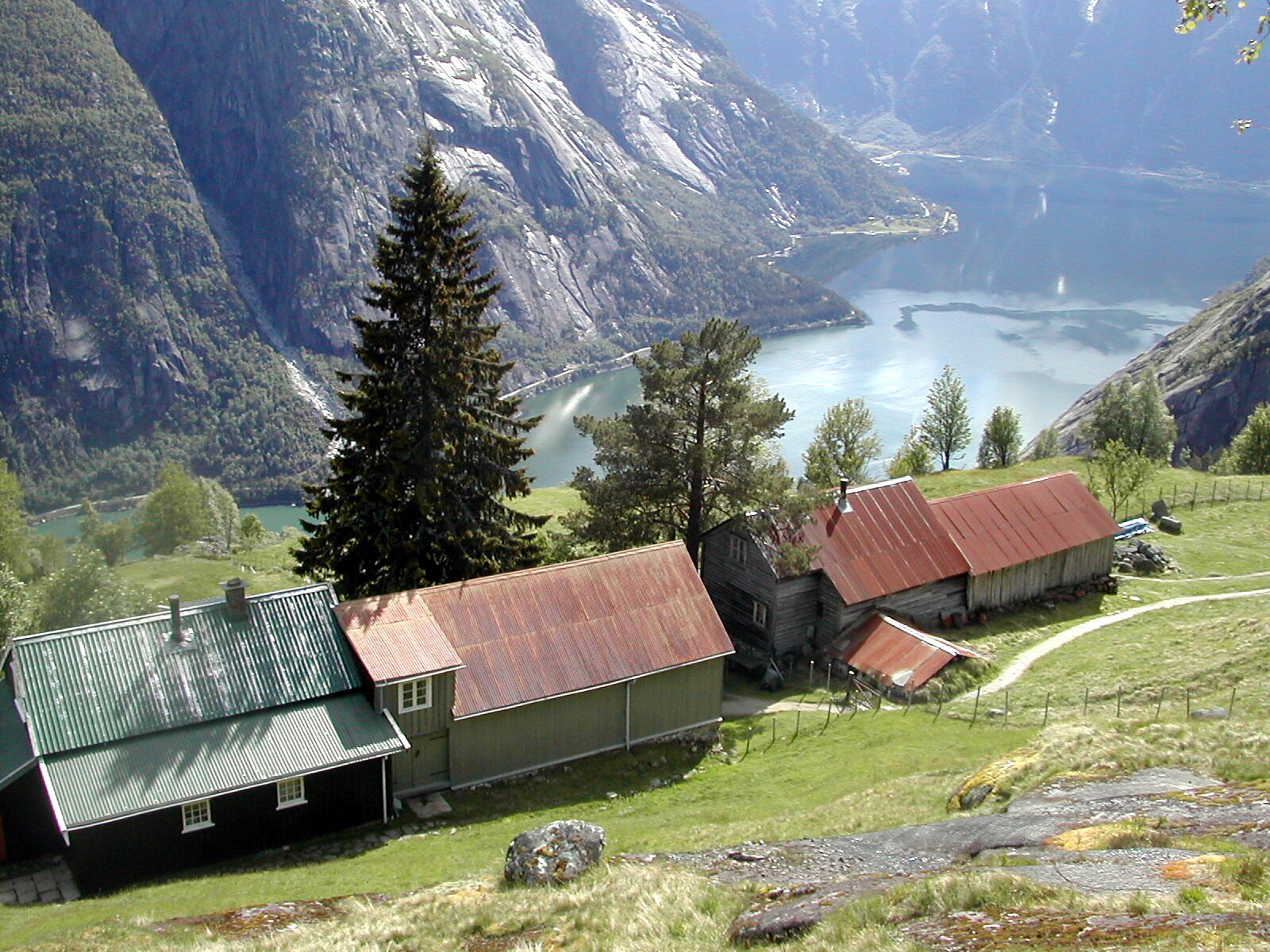
Eidfjord is a municipality in Vestland county, Norway. The municipality is located in the traditional district of Hardanger. The administrative centre of the municipality is the village of Eidfjord, where the majority of the municipal population lives. The other major population centre in the municipality is the village of Øvre Eidfjord. Eidfjord is situated at the end of the Eid Fjord, an inner branch of the large Hardangerfjorden. The village of Eidfjord is a major cruise ship port of call. Eidfjord has several tourist sites, like the Sima Power Plant which is built into the mountain itself, the Måbødalen valley, and the Vøringsfossen waterfall which has a free fall of . Large parts of the Hardangervidda (Europe's largest mountain plateau) are located in Eidfjord. The Hardangervidda Natursenter, a visitors centre and museum for Hardangervidda National Park, is located in Øvre Eidfjord. The municipality is the 57th largest by area out of the 356 municipalities in Nor ... [...More Info...] [...Related Items...] OR: [Wikipedia] [Google] [Baidu] |
Brimnes
Brimnes is a small village in the municipality of Eidfjord in Vestland county, Norway. Geography The settlement lies on the south side of the Eid Fjord, an inner branch of the Hardanger Fjord. The ferry quay at Brimnes formerly served the ferry connection to Bruravik in the municipality of Ulvik. The ferry was part of the Fylkesbåtene company. The ferry service was discontinued after the construction of the Hardanger Bridge. Brimnes lies about from the village of Eidfjord and about from Kinsarvik in the municipality of Ullensvang Ullensvang is a municipality in Vestland county, Norway. It is located in the traditional district of Hardanger. The administrative centre is the town of Odda. Some of the notable villages in the municipality include Lofthus, Utne, Vikebygd .... Name The name of the village was standardized as ''Brimnes'' in 1990. The folklorist Halldor O. Opedal argued that the name ''Brimnes'' is incorrect, and that the correct form of the name should b ... [...More Info...] [...Related Items...] OR: [Wikipedia] [Google] [Baidu] |
Headland
A headland, also known as a head, is a coastal landform, a point of land usually high and often with a sheer drop, that extends into a body of water. It is a type of promontory. A headland of considerable size often is called a cape.Whittow, John (1984). ''Dictionary of Physical Geography''. London: Penguin, 1984, pp. 80, 246. . Headlands are characterised by high, breaking waves, rocky shores, intense erosion, and steep sea cliff. Headlands and bays are often found on the same coastline. A bay is flanked by land on three sides, whereas a headland is flanked by water on three sides. Headlands and bays form on discordant coastlines, where bands of rock of alternating resistance run perpendicular to the coast. Bays form when weak (less resistant) rocks (such as sands and clays) are eroded, leaving bands of stronger (more resistant) rocks (such as chalk, limestone, and granite) forming a headland, or peninsula. Through the deposition of sediment within the bay and the erosion of the ... [...More Info...] [...Related Items...] OR: [Wikipedia] [Google] [Baidu] |
Bruravik
Bruravik is a ferry quay in the municipality of Ulvik in Vestland county, Norway. There was formerly a ferry connection from Bruravik to Brimnes in the municipality of Eidfjord. The ferry quay was equipped with waiting rooms, benches, and restrooms. The ferry service was discontinued after the construction of the Hardanger Bridge. Bruravik lies about from the municipality's administrative center of Ulvik, and it is also about from Granvin Granvin is a former municipality in the old Hordaland county, Norway. The municipality existed from 1838 until its dissolution in 2020 when it merged with Voss Municipality. The municipality was located in the traditional district of Hardanger. ..., which lies to the northwest. References {{reflist Ferry quays in Vestland Ulvik ... [...More Info...] [...Related Items...] OR: [Wikipedia] [Google] [Baidu] |
Ulvik Fjord
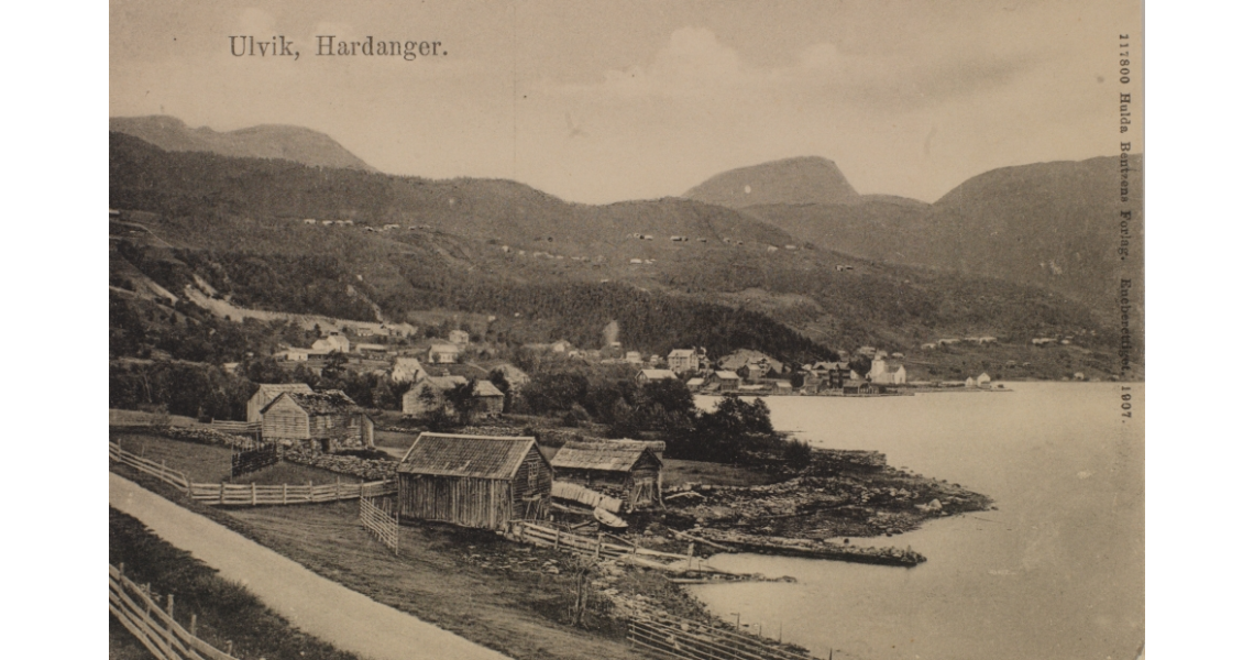
Ulvik is a municipality in Vestland county, Norway. The municipality stretches from the Hardangerfjord to the mountains that reach above sea level. The administrative centre of the municipality is the village of Ulvik. The villages of Osa and Finse are also located in Ulvik municipality. The municipality is the 158th largest by area out of the 356 municipalities in Norway. Ulvik is the 331st most populous municipality in Norway with a population of 1,051. The municipality's population density is and its population has decreased by 5.5% over the previous 10-year period. Of the municipality's total population, nearly half live in the village of Ulvik at the end of the Ulvikafjorden. The vast majority of those who do not live in the village of Ulvik live on the farms surrounding the village or at the end of the Osa Fjord in the village of Osa. In 2016, the chief of police for Vestlandet formally suggested a reconfiguration of police districts and stations. He proposed that the ... [...More Info...] [...Related Items...] OR: [Wikipedia] [Google] [Baidu] |
Ulvik
Ulvik is a municipality in Vestland county, Norway. The municipality stretches from the Hardangerfjord to the mountains that reach above sea level. The administrative centre of the municipality is the village of Ulvik. The villages of Osa and Finse are also located in Ulvik municipality. The municipality is the 158th largest by area out of the 356 municipalities in Norway. Ulvik is the 331st most populous municipality in Norway with a population of 1,051. The municipality's population density is and its population has decreased by 5.5% over the previous 10-year period. Of the municipality's total population, nearly half live in the village of Ulvik at the end of the Ulvikafjorden. The vast majority of those who do not live in the village of Ulvik live on the farms surrounding the village or at the end of the Osa Fjord in the village of Osa. In 2016, the chief of police for Vestlandet formally suggested a reconfiguration of police districts and stations. He proposed that the ... [...More Info...] [...Related Items...] OR: [Wikipedia] [Google] [Baidu] |
Hardangerfjord
The Hardangerfjord ( en, Hardanger Fjord) is the fifth longest fjord in the world, and the second longest fjord in Norway. It is located in Vestland county in the Hardanger region. The fjord stretches from the Atlantic Ocean into the mountainous interior of Norway along the Hardangervidda plateau. The innermost point of the fjord reaches the town of Odda. Location The Hardangerfjord starts at the Atlantic Ocean about south of the city of Bergen. Here the fjord heads in a northeasterly direction between the island of Bømlo and the mainland. It passes by the larger islands of Stord, Tysnesøya, and Varaldsøy on the north/west side and the Folgefonna peninsula on the south/east side. Once it is surrounded by the mainland, it begins to branch off into smaller fjords that reach inwards towards the grand Hardangervidda mountain plateau. The longest branch of the Hardangerfjord is Sørfjorden which cuts south about from the main fjord. Its maximum depth is more than just o ... [...More Info...] [...Related Items...] OR: [Wikipedia] [Google] [Baidu] |

