|
Oregon Badlands Wilderness
The Oregon Badlands Wilderness is a wilderness area located east of Bend, Oregon, Bend in Deschutes County, Oregon, Deschutes and Crook County, Oregon, Crook counties in the U.S. state of Oregon. The wilderness is managed by the Bureau of Land Management as part of the National Landscape Conservation System and was created by the Omnibus Public Land Management Act of 2009, which was signed into law by President of the United States, President Barack Obama on 30 March 2009. The area is known for igneous castle-like rock formations, harsh terrain, ancient Juniper trees, sagebrush, and extensive arid land. Desert wildflowers, dry river canyons, and Native American pictographs can be found. The blind iditarod racer Rachel Scdoris trained in the area, and the wilderness is home to the western terminus of the Oregon Desert Trail. Geology The wilderness is situated on high desert terrain and is associated with a volcanic rootless shield. This broad volcanic shield issued lava fro ... [...More Info...] [...Related Items...] OR: [Wikipedia] [Google] [Baidu] |
Deschutes County, Oregon
Deschutes County is one of the 36 counties in the U.S. state of Oregon. As of the 2020 census, the population was 198,253. The county seat is Bend. The county was created in 1916 out of part of Crook County and was named for the Deschutes River, which itself was named by French-Canadian trappers of the early 19th century. It is the political and economic hub of Central Oregon. Deschutes comprises the Bend, Oregon Metropolitan Statistical Area. Deschutes is Oregon’s fastest-growing and most recently-formed county. History French-Canadian fur trappers of the Hudson's Bay Company gave the name Rivière des Chutes (River of the Falls) to the Deschutes River, from which the county derived its name. On December 13, 1916, Deschutes County was created from the southern part of Crook County. Bend has been the county seat since the county's formation. It was the last county in Oregon to be established. The Shevlin-Hixon Lumber Company also operated within the Bend area proces ... [...More Info...] [...Related Items...] OR: [Wikipedia] [Google] [Baidu] |
Newberry Volcano
Newberry Volcano is a large active shield-shaped stratovolcano located about south of Bend, Oregon, United States, east of the major crest of the Cascade Range, within the Newberry National Volcanic Monument. Its highest point is Paulina Peak. The largest volcano in the Cascade Volcanic Arc, Newberry has an area of when its lava flows are taken into account. From north to south, the volcano has a length of , with a width of and a total volume of approximately . It was named for the geologist and surgeon John Strong Newberry, who explored central Oregon for the Pacific Railroad Surveys in 1855. The surrounding area has been inhabited by Native American populations for more than 10,000 years. The volcano contains a large caldera, in diameter, known as the Newberry Caldera. Within the caldera are two lakes: Paulina Lake and East Lake. The volcano and its vicinity include many pyroclastic cones, lava flows and lava domes; Newberry has more than 400 vents, the most of a ... [...More Info...] [...Related Items...] OR: [Wikipedia] [Google] [Baidu] |
Idaho Fescue
''Festuca idahoensis'' is a species of grass known by the common names Idaho fescue and blue bunchgrass. It is native to western North America, where it is widespread and common. It can be found in many ecosystems, from shady forests to open plains grasslands. Description This fescue is a densely clumping long-lived perennial bunch grass with stems from about 30 to 80 centimeters in height. The stiff, short, rolling leaves are mostly located near the base of the tuft. The inflorescence has hairy spikelets which produce large awned fruits. The root system is thick and penetrates deeply into the soil. The roots have symbiotic mycorrhizae. There are no rhizomes; the plant reproduces from seeds and from budding with tillers. It is similar to, but generally taller and larger than, ''Poa secunda''. Ecology The species can grow in well-soiled areas along with ponderosa pine. This is a nutritious and preferred forage grass for wild and domestic animals. Typical native grass associ ... [...More Info...] [...Related Items...] OR: [Wikipedia] [Google] [Baidu] |
Bunchgrasses
Tussock grasses or bunch grasses are a group of grass species in the family Poaceae. They usually grow as singular plants in clumps, tufts, hummocks, or bunches, rather than forming a sod or lawn, in meadows, grasslands, and prairies. As perennial plants, most species live more than one season. Tussock grasses are often found as forage in pastures and ornamental grasses in gardens. Many species have long roots that may reach or more into the soil, which can aid slope stabilization, erosion control, and soil porosity for precipitation absorption. Also, their roots can reach moisture more deeply than other grasses and annual plants during seasonal or climatic droughts. The plants provide habitat and food for insects (including Lepidoptera), birds, small animals and larger herbivores, and support beneficial soil mycorrhiza. The leaves supply material, such as for basket weaving, for indigenous peoples and contemporary artists. Tussock and bunch grasses occur in almost any hab ... [...More Info...] [...Related Items...] OR: [Wikipedia] [Google] [Baidu] |
Rabbitbrush
Rabbitbrush is a common name for shrubs, principally of the western United States, in three related genera of the family Asteraceae: * '' Chrysothamnus'' — about seven species in the United States, including Greene's rabbitbrush * ''Ericameria ''Ericameria'' is a genus of North American shrubs in the family Asteraceae. ''Ericameria'' is known by the common names goldenbush, rabbitbrush, turpentine bush, and rabbitbush. Most are shrubs but one species ''( E. parishii)'' can reach tree ...'' — about six species in the United States, including gray (or rubber) and Parry's rabbitbrush * '' Lorandersonia'' — about four species in the United States, including Bailey's rabbitbrush and spearleaf rabbitbrush Taxonomy for these genera has changed recently; previously, the rabbitbrushes in ''Ericameria'' and ''Lorandersonia'' were included in ''Chrysothamnus''. In each of these genera, not all species are called "rabbitbrush"; most ''Ericameria'', for instance, are cal ... [...More Info...] [...Related Items...] OR: [Wikipedia] [Google] [Baidu] |
Big Sagebrush
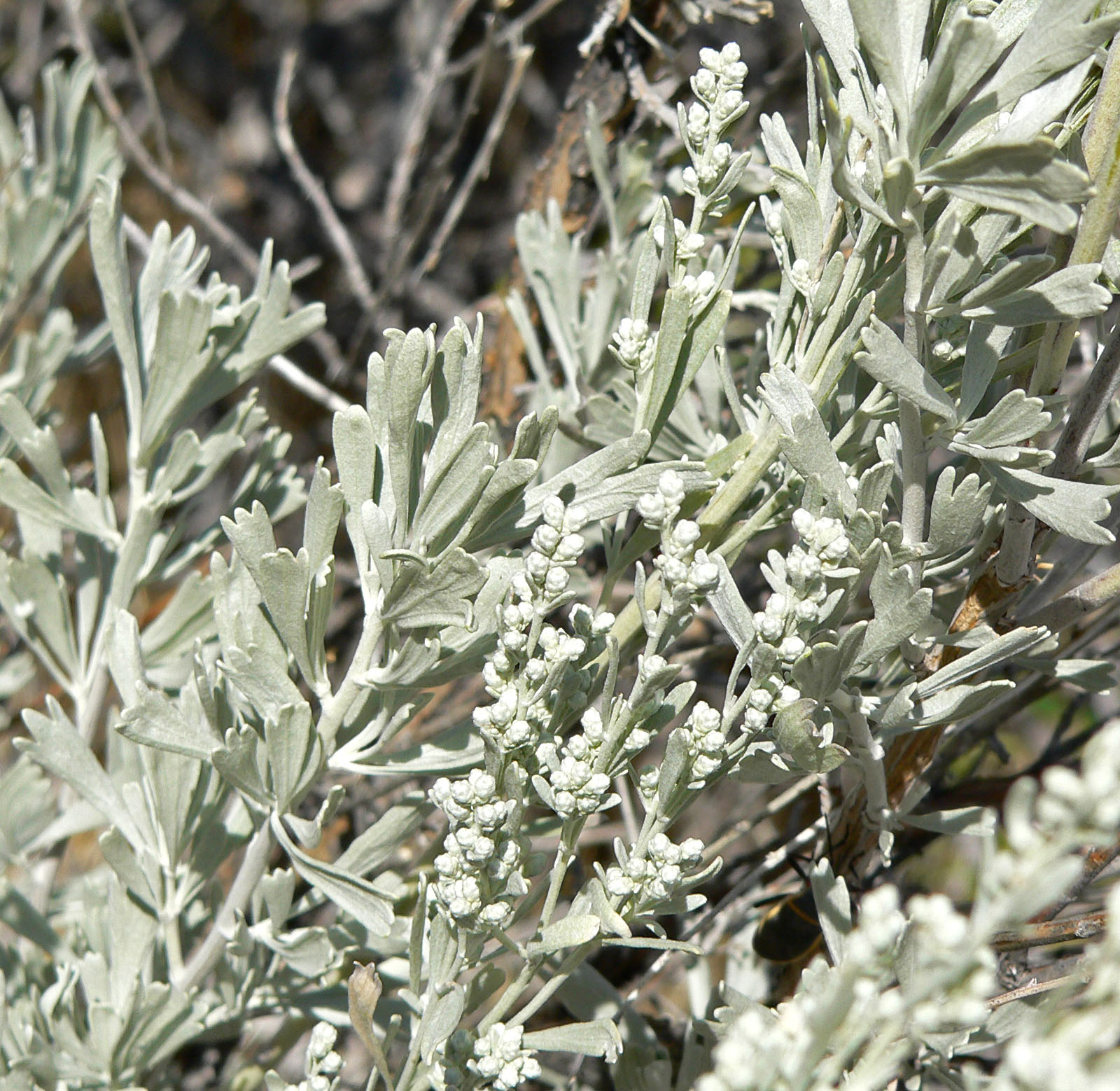
''Artemisia tridentata'', commonly called big sagebrush,MacKay, Pam (2013), ''Mojave Desert Wildflowers'', 2nd ed., , p. 264. Great Basin sagebrush or (locally) simply sagebrush, is an aromatic shrub from the family Asteraceae, which grows in arid and semi-arid conditions, throughout a range of cold desert, steppe, and mountain habitats in the Intermountain West of North America. The vernacular name "sagebrush" is also used for several related members of the genus ''Artemisia'', such as California sagebrush (''Artemisia californica''). Big sagebrush and other ''Artemisia'' shrubs are the dominant plant species across large portions of the Great Basin. The range extends northward through British Columbia's southern interior, south into Baja California, and east into the western Great Plains of New Mexico, Colorado, Nebraska, and the Dakotas. Several major threats exist to sagebrush ecosystems, including human settlements, conversion to agricultural land, livestock grazing, ... [...More Info...] [...Related Items...] OR: [Wikipedia] [Google] [Baidu] |
Western Juniper
''Juniperus occidentalis'', known as the western juniper, is a shrub or tree native to the Western United States, growing in mountains at altitudes of and rarely down to . It is listed as Least Concern on the IUCN Red List because it is a widespread species with an increasing population. Description ''Juniperus occidentalis'' is a shrub or small tree tall. Exceptionally tall specimens can be found in the John Day area of Oregon in excess of tall. The shoots are of moderate thickness among junipers, at diameter. The juvenile leaves (on young seedlings only) are needle-like and long. Arranged in opposite decussate pairs or whorls of three, the adult leaves are scale-like, 1–2 mm long (5 mm on lead shoots) and 1–1.5 mm broad. The cones are berry-like, 5–10 mm in diameter, blue-brown with a whitish waxy bloom, and mature in about 18 months. The male cones are 2–4 mm long and shed their pollen in early spring. The plants are about half monoeciou ... [...More Info...] [...Related Items...] OR: [Wikipedia] [Google] [Baidu] |
Chrysaetos La Cañada 20120114 1
The golden eagle (''Aquila chrysaetos'') is a bird of prey living in the Northern Hemisphere. It is the most widely distributed species of eagle. Like all eagles, it belongs to the family Accipitridae. They are one of the best-known birds of prey in the Northern Hemisphere. These birds are dark brown, with lighter golden-brown plumage on their napes. Immature eagles of this species typically have white on the tail and often have white markings on the wings. Golden eagles use their agility and speed combined with powerful feet and large, sharp talons to hunt a variety of prey, mainly hares, rabbits, and marmots and other ground squirrels. Golden eagles maintain home ranges or territories that may be as large as . They build large nests in cliffs and other high places to which they may return for several breeding years. Most breeding activities take place in the spring; they are monogamous and may remain together for several years or possibly for life. Females lay up to four e ... [...More Info...] [...Related Items...] OR: [Wikipedia] [Google] [Baidu] |
Great Basin
The Great Basin is the largest area of contiguous endorheic basin, endorheic watersheds, those with no outlets, in North America. It spans nearly all of Nevada, much of Utah, and portions of California, Idaho, Oregon, Wyoming, and Baja California. It is noted for both its arid climate and the basin and range topography that varies from the North American low point at Badwater Basin in Death Valley to the highest point of the contiguous United States, less than away at the summit of Mount Whitney. The region spans several physical geography, physiographic divisions, biomes, ecoregions, and deserts. Definition The term "Great Basin" is applied to hydrography, hydrographic, ecology, biological, floristic province, floristic, physiographic, topography, topographic, and Ethnography, ethnographic geographic areas. The name was originally coined by John C. Frémont, who, based on information gleaned from Joseph R. Walker as well as his own travels, recognized the hydrographic nature o ... [...More Info...] [...Related Items...] OR: [Wikipedia] [Google] [Baidu] |
Northern Basin And Range (ecoregion)
The Northern Basin and Range ecoregion is a Level III ecoregion designated by the United States Environmental Protection Agency (EPA) in the U.S. states of Oregon, Idaho, Nevada, Utah, and California. It contains dissected lava plains, rolling hills, alluvial fans, valleys, and scattered mountain ranges in the northern part of the Great Basin. Although arid, the ecoregion is higher and cooler than the Snake River Plain to the north and has more available moisture and a cooler climate than the Central Basin and Range to the south. Its southern boundary is determined by the highest shoreline of Pleistocene Lake Bonneville, which once inundated the Central Basin and Range. The western part of the region is internally drained; its eastern stream network drains to the Snake River system. The valleys support sagebrush steppe or saltbush vegetation. Mollisol soils are common, in contrast to the aridisols of the Central Basin. Juniper-dominated woodland occurs on rugged, stony uplands ... [...More Info...] [...Related Items...] OR: [Wikipedia] [Google] [Baidu] |
Mount Mazama
Mount Mazama (''Giiwas'' in the Native American language Klamath language, Klamath) is a complex volcano in the state of Oregon, United States, in a segment of the Cascade Volcanoes, Cascade Volcanic Arc and Cascade Range. Most of the mountain collapsed following a major eruption approximately 7,700 years ago. The volcano is in Klamath County, Oregon, Klamath County, in the southern Cascades, north of the Oregon–California border. Its collapse formed a caldera that holds Crater Lake. The mountain is in Crater Lake National Park. Mount Mazama originally had an elevation of , but following its climactic eruption this was reduced to . Crater Lake is deep, the deepest freshwater body in the US and the second deepest in North America after Great Slave Lake in Canada. Mount Mazama formed as a group of overlapping volcanic edifices such as shield volcanoes and small stratovolcano, composite cones, becoming active intermittently until its climactic eruption 7,700 years ago. This e ... [...More Info...] [...Related Items...] OR: [Wikipedia] [Google] [Baidu] |
Pressure Ridge (lava)
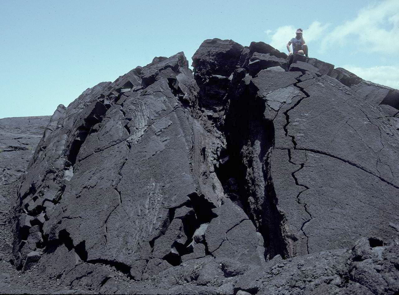
In volcanology, a pressure ridge or a tumulus (plural: tumuli), and rarely referred to as a schollendome, is sometimes created in an active lava flow. Formation occurs when the outer edges and surfaces of the lava flow begin to harden. If the advancing lava underneath becomes restricted it may push up on the hardened crust, tilting it outward. Inflation also takes place and is a process where the plastic layer of lava underneath expands as it cools and small crystals form. The end result is a raised mound of hardened lava rock, usually a relatively narrow but long ridge. Tension cracks form on the surface of pressure ridges and run along the axis An axis (plural ''axes'') is an imaginary line around which an object rotates or is symmetrical. Axis may also refer to: Mathematics * Axis of rotation: see rotation around a fixed axis * Axis (mathematics), a designator for a Cartesian-coordinat ... of elongated ridges, and at both edges of broader ridges, sometimes referred to as pre ... [...More Info...] [...Related Items...] OR: [Wikipedia] [Google] [Baidu] |


