|
Orca Bay, Alaska
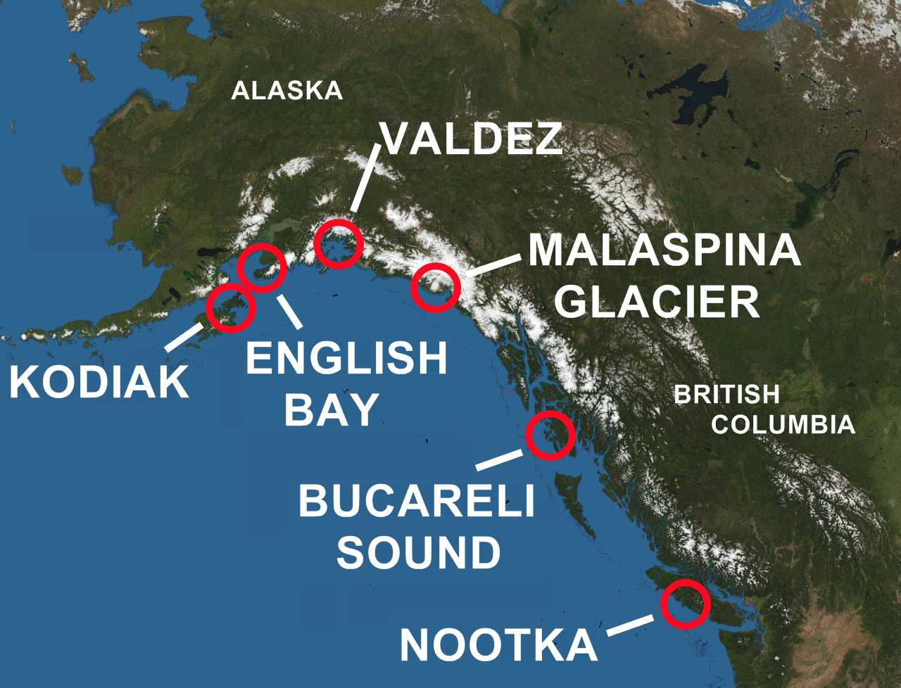
Orca Bay is a bay in Prince William Sound, Alaska. Orca Bay is on the north west and west sides of Hawkins Island, extending westward to Johnstone Point of Hinchenbrook Island. Its northwestern corner is demarcated by Knowles Head, between Port Gravina and Fidalgo Bay on the mainland. Its eastern end can be reached from the port of Cordova, Alaska on Orca Inlet. According to the US Board on Geographic Names, Orca Bay was named for the Orca salmon cannery of the Pacific Steam Whaling Company, which operated on the southeast shore of Orca Inlet and in turn was named for that company's ship ''Orca''. Ultimately the name is derived from the orca or killer whale. The bay was named ''Puerto Córdova'' by the Spanish explorer Salvador Fidalgo, in 1790, with the English name “Cordova Bay” marked on charts. It was renamed by the early twentieth century, to avoid confusion with Cordova Bay in Dixon Entrance, at the eastern extreme of the Gulf of Alaska. The United States Navy ... [...More Info...] [...Related Items...] OR: [Wikipedia] [Google] [Baidu] |
Cordova Bay
Cordova Bay is a bay in the Alexander Archipelago of southeast Alaska. It opens onto Dixon Entrance to the south, between Cape Muzon on Dall Island and Point Marsh (a group of small islets just off Prince of Wales Island). The name Puerto Cordova y Cordova was given by the Spanish explorer Lieutenant Don Jacinto Caamaño in 1792, in honor of Admiral Luis de Córdova y Córdova. The name was published by George Vancouver in 1798. Cordova Bay is bordered on the west by Dall Island, Long Island, Tlevak Strait, and Sukkwan Island, and on the east by Prince of Wales Island. Cordova Bay extends north and west from its mouth to Lime Point, where it connects with Hetta Inlet. The Coast Survey lists the length as about from a point between the SE corner of Long Island and Dewey Rocks to Lime Point and an average width of about from Ship Islands to Lime Point. Hetta Inlet extends a further north, and then turns east for about . Gould Island almost closes the inlet shortly after it tur ... [...More Info...] [...Related Items...] OR: [Wikipedia] [Google] [Baidu] |
USS Orca (AVP-49)
The second USS ''Orca'' (AVP-49) was a United States Navy seaplane tender in commission from 1944 to 1947 and from 1951 to 1960. She saw service during the latter stages of World War II and during the Cold War. In 1962 she was loaned to Ethiopia, where she served in the Ethiopian Navy as the training ship ''Ethiopia'' (A-01) until 1991. She was the Ethiopian Navys largest ship until she was sold for scrapping in 1993. Construction and commissioning ''Orca'' was laid down on 13 July 1942 at Houghton, Washington, by the Lake Washington Shipyard. She was launched on 4 October 1942, sponsored by Mrs. J. W. Reeves, Jr., and commissioned on 23 January 1944. United States Navy service World War II New Guinea campaign After shakedown off San Diego, California, ''Orca'' sailed for Pearl Harbor, Hawaii, escorting the escort aircraft carrier . Reporting to Commander, Naval Air Force, United States Seventh Fleet, she was ordered on to Hollandia, Dutch New Guinea, where she commenced ... [...More Info...] [...Related Items...] OR: [Wikipedia] [Google] [Baidu] |
Seaplane Tender
A seaplane tender is a boat or ship that supports the operation of seaplanes. Some of these vessels, known as seaplane carriers, could not only carry seaplanes but also provided all the facilities needed for their operation; these ships are regarded by some as the first aircraft carriers and appeared just before the First World War. Terminology In maritime parlance a tender is a vessel that is used to support the operation of other vessels. In British usage, the term tender was used for small craft, with the term depot ship being used for large seagoing vessels. Flying boats and float planes even when based at home in ports and harbour had a need for small support vessels to operate.p British tenders were small craft of launch to pinnace size. These were used to ferry crews, stores and supplies between shore and the aircraft, to maintain the buoys used to mark out "taxiways" and "runways" and to keep these clear of debris to prevent foreign object damage, and in the case of ... [...More Info...] [...Related Items...] OR: [Wikipedia] [Google] [Baidu] |
United States Navy
The United States Navy (USN) is the maritime service branch of the United States Armed Forces and one of the eight uniformed services of the United States. It is the largest and most powerful navy in the world, with the estimated tonnage of its active battle fleet alone exceeding the next 13 navies combined, including 11 allies or partner nations of the United States as of 2015. It has the highest combined battle fleet tonnage (4,635,628 tonnes as of 2019) and the world's largest aircraft carrier fleet, with eleven in service, two new carriers under construction, and five other carriers planned. With 336,978 personnel on active duty and 101,583 in the Ready Reserve, the United States Navy is the third largest of the United States military service branches in terms of personnel. It has 290 deployable combat vessels and more than 2,623 operational aircraft . The United States Navy traces its origins to the Continental Navy, which was established during the American Revo ... [...More Info...] [...Related Items...] OR: [Wikipedia] [Google] [Baidu] |
Geographic Names Information System
The Geographic Names Information System (GNIS) is a database of name and locative information about more than two million physical and cultural features throughout the United States and its territories, Antarctica, and the associated states of the Marshall Islands, Federated States of Micronesia, and Palau. It is a type of gazetteer. It was developed by the United States Geological Survey (USGS) in cooperation with the United States Board on Geographic Names (BGN) to promote the standardization of feature names. Data were collected in two phases. Although a third phase was considered, which would have handled name changes where local usages differed from maps, it was never begun. The database is part of a system that includes topographic map names and bibliographic references. The names of books and historic maps that confirm the feature or place name are cited. Variant names, alternatives to official federal names for a feature, are also recorded. Each feature receives a per ... [...More Info...] [...Related Items...] OR: [Wikipedia] [Google] [Baidu] |
United States Board On Geographic Names
The United States Board on Geographic Names (BGN) is a federal body operating under the United States Secretary of the Interior. The purpose of the board is to establish and maintain uniform usage of geographic names throughout the federal government of the United States. History On January 8, 1890, Thomas Corwin Mendenhall, superintendent of the US Coast and Geodetic Survey Office, wrote to 10 noted geographers "to suggest the organization of a Board made up of representatives from the different Government services interested, to which may be referred any disputed question of geographical orthography." President Benjamin Harrison signed executive order 28 on September 4, 1890, establishing the ''Board on Geographical Names''. "To this Board shall be referred all unsettled questions concerning geographic names. The decisions of the Board are to be accepted y federal departmentsas the standard authority for such matters." The board was given authority to resolve all unsettled ques ... [...More Info...] [...Related Items...] OR: [Wikipedia] [Google] [Baidu] |
Dixon Entrance
The Dixon Entrance (french: Entrée Dixon) is a strait about long and wide in the Pacific Ocean at the Canada–United States border, between the U.S. state of Alaska and the province of British Columbia in Canada. The Dixon Entrance is part of the Inside Passage shipping route. It forms part of the maritime boundary between the U.S. and Canada, although the location of that boundary here is disputed. Etymology The strait was named by Joseph Banks for Captain George Dixon, a Royal Navy officer, fur trader, and explorer, who surveyed the area in 1787. Geography The Dixon Entrance lies between Clarence Strait in the Alexander Archipelago in Alaska to the north, and Hecate Strait and the islands known as Haida Gwaii (the Queen Charlotte Islands) in British Columbia, to the south. Prince of Wales Island, Alaska, is the largest of the Alaskan islands on the north side of the entrance; the Kaigani Haida occupy this island. Members of the Haida nation maintain free access across the St ... [...More Info...] [...Related Items...] OR: [Wikipedia] [Google] [Baidu] |
Salvador Fidalgo
Salvador Fidalgo y Lopegarcía (6 August 1756 – 27 September 1803) was a Spanish explorer. He commanded an exploring expedition for Spain to Alaska and the Pacific Northwest during the late 18th century. Early career Fidalgo was born in La Seu d'Urgell in the province of Lérida, in the region of Catalonia, Spain, the heir of a noble Navarrese family. He entered joined the Spanish Navy as a guardiamarina (midshipman) at the Real Colegio de Guardiamarinas in Cádiz. He graduated in 1775 and given the rank of Alférez de Fragata (Frigate Ensign). He was chosen to be a member of Vicente Tofiño's team of cartographers working during the 1780s on the first atlas of Spain's ports and coastal waters. He served on various assignments in the Mediterranean and saw action against the British and Portuguese. In 1778 he was promoted to Teniente de Navío (Lieutenant) and assigned to the Spanish naval station at San Blas, Mexico. online aGoogle Books/ref> Spain and the Pacific Northwest ... [...More Info...] [...Related Items...] OR: [Wikipedia] [Google] [Baidu] |
Orca
The orca or killer whale (''Orcinus orca'') is a toothed whale belonging to the oceanic dolphin family, of which it is the largest member. It is the only Extant taxon, extant species in the genus ''Orcinus'' and is recognizable by its black-and-white patterned body. A cosmopolitan species, orcas can be found in all of the world's oceans in a variety of marine environments, from Arctic Ocean, Arctic and Southern Ocean, Antarctic regions to tropical seas. Orcas have a diverse diet, although individual populations often specialize in particular types of prey. Some feed exclusively on fish, while others hunt marine mammals such as Pinniped, seals and other species of dolphin. They have been known to attack baleen whale calves, and even adult whales. Orcas are apex predators, as they have no natural predators. They are highly Social animal, social; some populations are composed of very stable matrilineal family groups (pods) which are the most stable of any animal species. Their ... [...More Info...] [...Related Items...] OR: [Wikipedia] [Google] [Baidu] |
Pacific Steam Whaling Company
The Pacific Ocean is the largest and deepest of Earth's five oceanic divisions. It extends from the Arctic Ocean in the north to the Southern Ocean (or, depending on definition, to Antarctica) in the south, and is bounded by the continents of Asia and Oceania in the west and the Americas in the east. At in area (as defined with a southern Antarctic border), this largest division of the World Ocean—and, in turn, the hydrosphere—covers about 46% of Earth's water surface and about 32% of its total surface area, larger than Earth's entire land area combined .Pacific Ocean . '' Britannica Concise.'' 2008: Encyclopædia Britannica, Inc. The centers of both the |
_2.jpg)


.jpg)