|
Oophaga Sylvatica
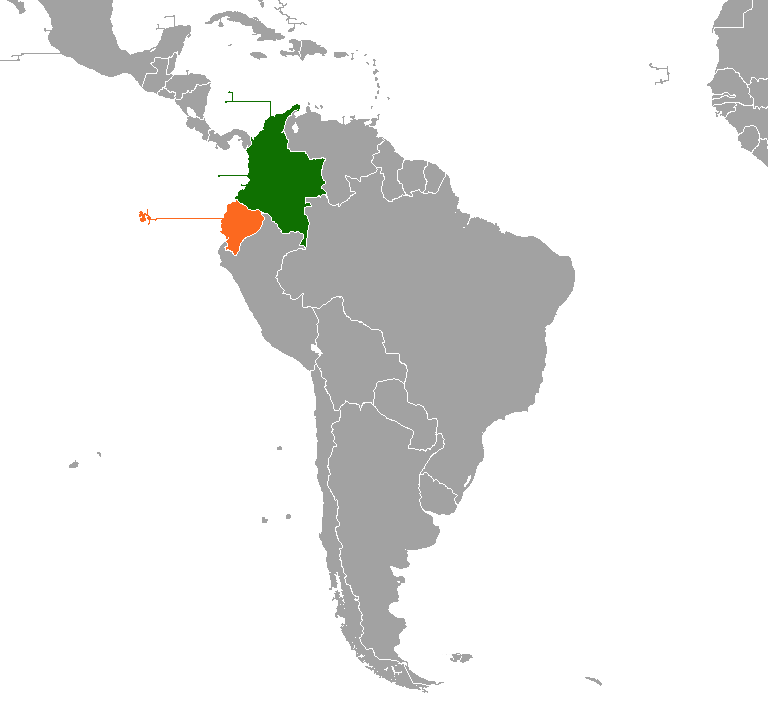
''Oophaga sylvatica'', sometimes known as its Spanish name diablito, is a species of frog in the family Dendrobatidae found in Southwestern Colombia and Northwestern Ecuador. Its natural habitat is lowland and submontane rainforest; it can, however, survive in moderately degraded areas, at least in the more humid parts of its range. It is a very common frog in Colombia, but has disappeared from much of its Ecuadorian range. It is threatened by habitat loss (deforestation) and agricultural pollution and sometimes seen in the international pet trade. This species occurs in several color morphs. For example, the Bilsa Biological Station (operated by the Jatun Sacha Foundation) boasts three color morphs—red, yellow, and orange—within their 3000-ha protected area located within Ecuador's Mache and Chindul coastal mountain ranges. Description ''Oophaga sylvatica'' only displays sexual dimorphism in body size, as both males and females typically have a snout-vent length of 26 ... [...More Info...] [...Related Items...] OR: [Wikipedia] [Google] [Baidu] |
Species
In biology, a species is the basic unit of classification and a taxonomic rank of an organism, as well as a unit of biodiversity. A species is often defined as the largest group of organisms in which any two individuals of the appropriate sexes or mating types can produce fertile offspring, typically by sexual reproduction. Other ways of defining species include their karyotype, DNA sequence, morphology, behaviour or ecological niche. In addition, paleontologists use the concept of the chronospecies since fossil reproduction cannot be examined. The most recent rigorous estimate for the total number of species of eukaryotes is between 8 and 8.7 million. However, only about 14% of these had been described by 2011. All species (except viruses) are given a two-part name, a "binomial". The first part of a binomial is the genus to which the species belongs. The second part is called the specific name or the specific epithet (in botanical nomenclature, also sometimes i ... [...More Info...] [...Related Items...] OR: [Wikipedia] [Google] [Baidu] |
Strawberry Poison-dart Frog
The strawberry poison frog, strawberry poison-dart frog or blue jeans poison frog (''Oophaga pumilio'', formerly ''Dendrobates pumilio'') is a species of small poison dart frog found in Central America. It is common throughout its range, which extends from eastern central Nicaragua through Costa Rica and northwestern Panama. The species is often found in humid lowlands and premontane forest, but large populations are also found in disturbed areas such as plantations.Savage, J. M. 2002. The Amphibians and Reptiles of Costa Rica. University of Chicago Press, Chicago and London. The strawberry poison frog is perhaps most famous for its widespread variation in coloration, comprising approximately 15–30 color morphs, most of which are presumed to be true-breeding. ''O. pumilio'', while not the most poisonous of the dendrobatids, is the most toxic member of its genus. Diet The diet of ''O. pumilio'' causes the skin of the amphibian to become toxic in nature when certain subspec ... [...More Info...] [...Related Items...] OR: [Wikipedia] [Google] [Baidu] |
International Union For Conservation Of Nature
The International Union for Conservation of Nature (IUCN; officially International Union for Conservation of Nature and Natural Resources) is an international organization working in the field of nature conservation and sustainable use of natural resources. It is involved in data gathering and analysis, research, field projects, advocacy, and education. IUCN's mission is to "influence, encourage and assist societies throughout the world to conserve nature and to ensure that any use of natural resources is equitable and ecologically sustainable". Over the past decades, IUCN has widened its focus beyond conservation ecology and now incorporates issues related to sustainable development in its projects. IUCN does not itself aim to mobilize the public in support of nature conservation. It tries to influence the actions of governments, business and other stakeholders by providing information and advice and through building partnerships. The organization is best known to the wider pu ... [...More Info...] [...Related Items...] OR: [Wikipedia] [Google] [Baidu] |
Bromeliaceae
The Bromeliaceae (the bromeliads) are a family of monocot Monocotyledons (), commonly referred to as monocots, (Lilianae ''sensu'' Chase & Reveal) are grass and grass-like flowering plants (angiosperms), the seeds of which typically contain only one Embryo#Plant embryos, embryonic leaf, or cotyledon. Th ... flowering plants of about 80 genera and 3700 known species, native mainly to the Tropics, tropical Americas, with several species found in the American subtropics and one in tropical west Africa, ''Pitcairnia feliciana''. It is among the basal (phylogenetics), basal families within the Poales and is the only family within the order that has Septal nectary, septal nectaries and Ovary (plants), inferior ovaries.Judd, Walter S. Plant systematics a phylogenetic approach. 3rd ed. Sunderland, MA: Sinauer Associates, Inc., 2007. These Ovary (plants), inferior ovaries characterize the Bromelioideae, a subfamily of the Bromeliaceae. The family includes both epiphytes, such as Spanis ... [...More Info...] [...Related Items...] OR: [Wikipedia] [Google] [Baidu] |
Plantation
A plantation is an agricultural estate, generally centered on a plantation house, meant for farming that specializes in cash crops, usually mainly planted with a single crop, with perhaps ancillary areas for vegetables for eating and so on. The crops that are grown include cotton, coffee, tea, cocoa, sugar cane, opium, sisal, oil seeds, oil palms, fruits, rubber trees and forest trees. Protectionist policies and natural comparative advantage have sometimes contributed to determining where plantations are located. In modern use the term is usually taken to refer only to large-scale estates, but in earlier periods, before about 1800, it was the usual term for a farm of any size in the southern parts of British North America, with, as Noah Webster noted, "farm" becoming the usual term from about Maryland northwards. It was used in most British colonies, but very rarely in the United Kingdom itself in this sense. There, as also in America, it was used mainly for tree plantations, a ... [...More Info...] [...Related Items...] OR: [Wikipedia] [Google] [Baidu] |
Riparian Zone
A riparian zone or riparian area is the interface between land and a river or stream. Riparian is also the proper nomenclature for one of the terrestrial biomes of the Earth. Plant habitats and communities along the river margins and banks are called riparian vegetation, characterized by hydrophilic plants. Riparian zones are important in ecology, environmental resource management, and civil engineering because of their role in soil conservation, their habitat biodiversity, and the influence they have on fauna and aquatic ecosystems, including grasslands, woodlands, wetlands, or even non-vegetative areas. In some regions, the terms riparian woodland, riparian forest, riparian buffer zone, riparian corridor, and riparian strip are used to characterize a riparian zone. The word ''riparian'' is derived from Latin '' ripa'', meaning " river bank". Characteristics Riparian zones may be natural or engineered for soil stabilization or restoration. These zones are important natural b ... [...More Info...] [...Related Items...] OR: [Wikipedia] [Google] [Baidu] |
Colombia Ecuador Locator
Colombia (, ; ), officially the Republic of Colombia, is a country in South America with insular regions in North America—near Nicaragua's Caribbean coast—as well as in the Pacific Ocean. The Colombian mainland is bordered by the Caribbean Sea to the north, Venezuela to the east and northeast, Brazil to the southeast, Ecuador and Peru to the south and southwest, the Pacific Ocean to the west, and Panama to the northwest. Colombia is divided into 32 departments and the Capital District of Bogotá, the country's largest city. It covers an area of 1,141,748 square kilometers (440,831 sq mi), and has a population of 52 million. Colombia's cultural heritage—including language, religion, cuisine, and art—reflects its history as a Spanish colony, fusing cultural elements brought by immigration from Europe and the Middle East, with those brought by enslaved Africans, as well as with those of the various Amerindian civilizations that predate colonization. Spanish is the of ... [...More Info...] [...Related Items...] OR: [Wikipedia] [Google] [Baidu] |
Late Pleistocene
The Late Pleistocene is an unofficial Age (geology), age in the international geologic timescale in chronostratigraphy, also known as Upper Pleistocene from a Stratigraphy, stratigraphic perspective. It is intended to be the fourth division of the Pleistocene Epoch within the ongoing Quaternary Period. It is currently defined as the time between c. 129,000 and c. 11,700 years ago. The Late Pleistocene equates to the proposed Tarantian Age of the geologic time scale, preceded by the officially ratified Chibanian (formerly known as Middle Pleistocene) and succeeded by the officially ratified Greenlandian. The estimated beginning of the Tarantian is the start of the Eemian interglacial period (Marine Isotope Stage 5). It is held to end with the termination of the Younger Dryas, some 10th millennium BC, 11,700 years ago when the Holocene Epoch began. The term Upper Pleistocene is currently in use as a provisional or "quasi-formal" designation by the International Union of Geological ... [...More Info...] [...Related Items...] OR: [Wikipedia] [Google] [Baidu] |
Günz Glaciation
Gunz, Günz or Gunz Complex is a timespan in the glacial history of the Alps. It started approximately one million years ago and ended about 370 000 years ago. Some sources put the end at 480 000 years ago. Deep sea core samples have identified approximately 5 glacial cycles of varying intensity during Gunz. History of the term The name Gunz glaciation, Gunzian glaciation or Günz glacial stage (german: Günz-Kaltzeit, also ''Günz-Glazial'', ''Günz-Komplex'' and ''Günz-Eiszeit'') goes back to Albrecht Penck and Eduard Brückner, who named this ice age after the River Günz in their multi-volume work, ''Die Alpen im Eiszeitalter'' ("The Alps in the Ice Age Period") which was published between 1901 and 1909. Its type region is the Iller-Lech Plateau. It is the oldest glaciation of the Pleistocene in the traditional, quadripartite glacial classification of the Alps. The Günz was thought to follow the Danube-Günz interglacial and was ended by the Günz-Haslach interglacial. The ... [...More Info...] [...Related Items...] OR: [Wikipedia] [Google] [Baidu] |
Mache-Chindul Ecological Reserve
The Mache-Chindul Ecological Reserve ( es, Reserva Ecológica Mache-Chindul) is an ecological reserve in the provinces of Esmeraldas and Manabí, Ecuador. It protects a mountainous area in the transition from tropical rain forest in the north to dry forest in the south. It contains the Cube Lagoon, which has been designated a Ramsar wetland of international importance. Location The Mache-Chindul Ecological Reserve protects the forests of the Mache Chindul mountain range on the coast of Ecuador. It has an area of . Elevations range from . The Mache Chindul range is a massif on the coastal plain west of the Andes. The massif is the northern extension of Ecuador's coastal range. It is isolated from the Andes, which are about to the east, The reserve is very near the coast a few kilometers south of Muisne. It holds the sources of the Coaque, Cojimies and Cheve rivers in Manabí, and Muisne, Atacames and Tiaone rivers in Esmeraldas. It contains the ''Laguna de Cube'' (Cube lag ... [...More Info...] [...Related Items...] OR: [Wikipedia] [Google] [Baidu] |
Santiago River (Puerto Rico)
Río Santiago is a short river of Puerto Rico. About long, it is spanned by historic Bridge No. 122 on the coastal road near barrio Duque, Naguabo, Puerto Rico, Duque in Naguabo, Puerto Rico. It discharges into the Caribbean Sea from Naguabo. See also * List of rivers of Puerto Rico References External links USGS Hydrologic Unit Map – Caribbean Region (1974) Rivers of Puerto Rico {{PuertoRico-river-stub ... [...More Info...] [...Related Items...] OR: [Wikipedia] [Google] [Baidu] |


.jpg)


